Naval History Homepage and Site Search
Naval History Homepage and Site Search
|
||||||||
|
||||||||
|
Fleet Minesweeping Sloop, Flower-class, Acacia-type Ordered 1.15, Acacia, Azalea and Arabis-types built on merchant ship lines, with similar warship-like appearance. ACACIA Pendant Nos M.26 (2.15), T.00 (9.15). Launched 15.4.15 Swan Hunter. 1200 tons, 262(oa), 250(pp)x33x11ft. TE 1800ihp, 16.5kts. Armament: 2-12pdr, 2-3pdr AA. Crew: 90. Acacia-types served in Grand Fleet, at Queenstown, and in Mediterranean. Sold 6.9.22 Dornom Bros. (British Warships 1914-1919/Conway's All the World's Fighting Ships 1906-21) |
||||||||
|
||||||||
|
Notes: 1. Latitude/longitude, including for days in port, show representative decimal positions for each day, as calculated by the Old Weather project's analysis program. As such, they differ by varying amounts from the positions recorded, usually at noon, in the log pages. In addition, some latitudes/longitudes have been amended in edited logs for errors in the logs, for errors in identifying locations by the analysis program, or simply for greater accuracy. In all cases, refer to the log-page scans for the positions as originally recorded. Not all log pages contain this information and the ships' positions have therefore often been estimated. 2. Full account of any day is available by clicking on the link above that day. Groups of links refer to log book covers and introductory information; some may be blank. Editor’s notes:
The latitude and longitude to 4 decimal of places (if available) is given in the gazetteer at the far end of the log.
|
||||||||
|
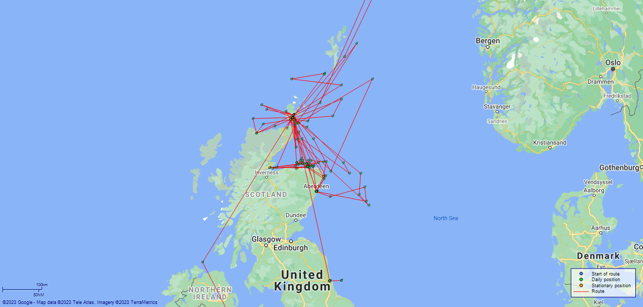
THE VOYAGES OF HMS ACACIA 1915-1916
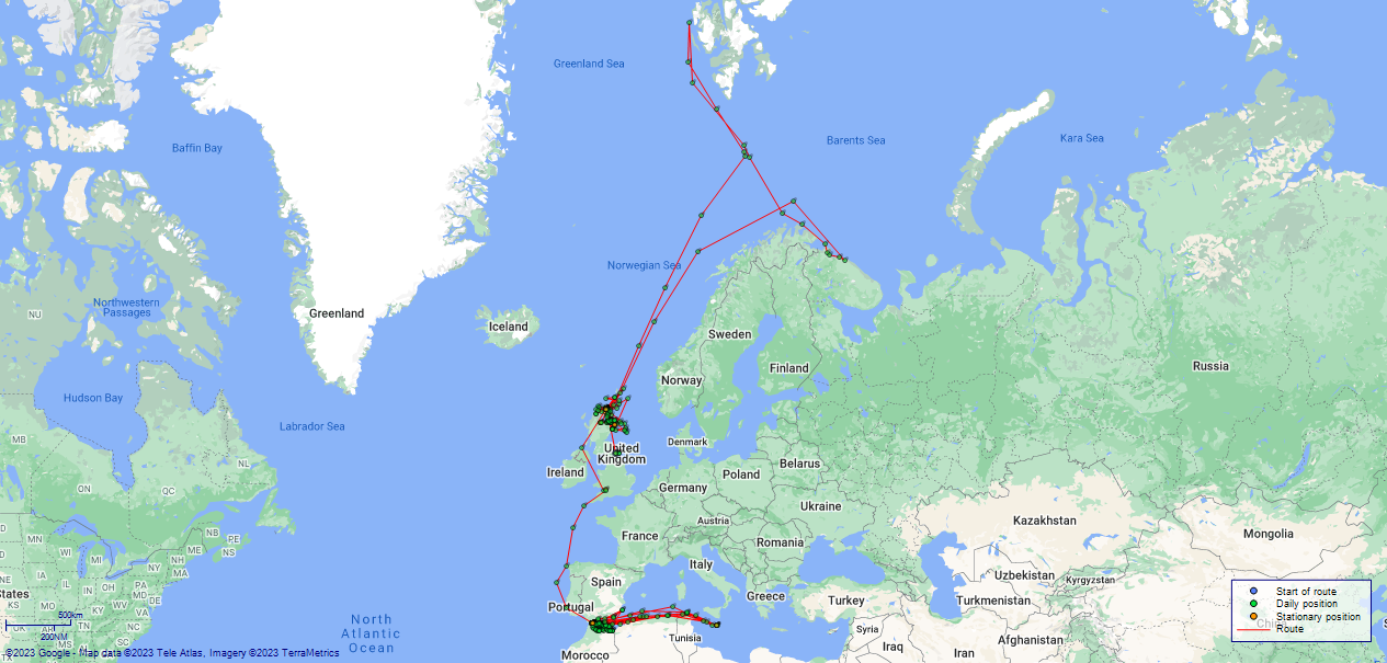
(Maps prepared using Journey Plotter, developed by Maikel. The Plots can only be approximate. They are made by joining-up positions on successive days, and sometimes positions are not given. There will therefore be occasions when the ship appears to have travelled overland) LOGS FOR MAY 1915 4caf8378cadfd34197000008: (http://oldweather.s3.amazonaws.com/ADM53-32581/0001_0.jpg) 4caf8378cadfd34197000009: (http://oldweather.s3.amazonaws.com/ADM53-32581/0001_1.jpg) 4caf8378cadfd3419700000a: (http://oldweather.s3.amazonaws.com/ADM53-32581/0002_0.jpg) 4caf8378cadfd3419700000b: (http://oldweather.s3.amazonaws.com/ADM53-32581/0002_1.jpg) 4caf8378cadfd3419700000c: (http://oldweather.s3.amazonaws.com/ADM53-32581/0003_0.jpg) [Above 5 pages: Book cover] 4caf8378cadfd3419700000d: (http://oldweather.s3.amazonaws.com/ADM53-32581/0003_1.jpg) HMS Acacia Copy of Log for Month of May 1915 Signed L Dickinson Sub Lieut RNR 4caf8378cadfd3419700000e: (http://oldweather.s3.amazonaws.com/ADM53-32581/0004_0.jpg) 4caf8378cadfd3419700000f: (http://oldweather.s3.amazonaws.com/ADM53-32581/0004_1.jpg) [Blank] 4caf8378cadfd34197000010: (http://oldweather.s3.amazonaws.com/ADM53-32581/0005_0.jpg) Barometer information: Aneroid Maker and number: J Hicks, London, No. 2222 Height of cistern above sea: 20 feet Thermometers for Air Temperature: Position: Upper deck Whether in screen: yes Maker and number: Negretta and Zambra, Nos 1206 and 1237, 11th May – 31st May Thermometer for Sea Temperature: Maker and number: Negretta and Zambra, No. 1554, 11th May – 31st May 4caf8378cadfd34197000011: (http://oldweather.s3.amazonaws.com/ADM53-32581/0005_1.jpg) [Blank]
THE VOYAGES OF HMS ACACIA
4caf8378cadfd34197000012: (http://oldweather.s3.amazonaws.com/ADM53-32581/0006_0.jpg) 11 May 1915 Walker-on-Tyne Lat 54.986, Long -1.525 Swan and Hunter Shipyard 9.00am: Commissioned. Complement: 77 men 10.00am: Hands taking in ammunition 1.30pm: Unmoored and proceeded pilot and 2 tugs 2.30pm: Moored to Herd Buoy forward, swung ship for adjustment of compasses 3.30pm: Cast off and returned to berth 4.45pm: Arrived off berth 5.00pm: Moored at Neptune Works, Walker-on-Tyne 7.00pm: Hands receiving and storing provisions 10.00pm: Hands billeted at Simpson's Hotel, Wallsend Provisions: fresh meat 90lb, vegetables 100lb, bread 140lb Fresh water: tanks not completed Thermometers: not in place on board Weather: winds SW force 4 to 1; no barometer yet; plenty of rain 4caf8378cadfd34197000013: (http://oldweather.s3.amazonaws.com/ADM53-32581/0006_1.jpg) 12 May 1915 Walker-on-Tyne [and at sea] Lat 55.00, Long -1.00 [Estimated] Swan and Hunter Shipyard 6.00am: Hands on board preparing ship for sea 7.20am: Unmoored and proceeded pilot and 2 tugs 8.20am: Passed breakwater 8.55am: Measured mile runs to 9.55 am 10.30am: Commenced 6 hours steaming trials Noon: Hands victualled on aboard 4.30pm: Steaming trials over 4.30pm: Measured Mile runs to 4.55pm 5.10pm: Entered River Tyne 6.00pm: Arrived off berth 6.10pm: Moored at Neptune Works 7.00pm: Leave for starboard watch to 7.00am Weather: winds SW/NE force 4; no barometer; rain in the morning, clearing later; NE swell 4caf8378cadfd34197000014: (http://oldweather.s3.amazonaws.com/ADM53-32581/0007_0.jpg) 13 May 1915 Walker-on-Tyne Lat 54.986, Long -1.525 Swan and Hunter Shipyard 5.30am: Lash up and stow 6.00am: Hands employed receiving and stowing stores 7.30am: Breakfast Noon: Dinner 1.15pm: Hands receiving and stowing stores 4.00pm: Tea 4.30pm: Liberty for Port Watch till 7.00am 7.30pm: Supper 10.00pm: Hands pipe down Provisions: fresh meat – lb, vegetables 100lb, bread 60lb Fresh water: tanks not yet completed Weather: winds NW force 2; dry in the fore noon, drizzle all after noon 4caf8378cadfd34197000015: (http://oldweather.s3.amazonaws.com/ADM53-32581/0007_1.jpg) 14 May 1915 Walker-on-Tyne Lat 54.986, Long -1.525 Swan and Hunter Shipyard Weather: winds N force 3; clear skies with some cloud 4caf8378cadfd34197000016: (http://oldweather.s3.amazonaws.com/ADM53-32581/0008_0.jpg) 15 May 1915 Walker-on-Tyne Lat 54.986, Long -1.525 Swan and Hunter Shipyard Fresh water: 22 tons. Tanks ready Weather: winds NE force 2; clear skies with some cloud 4caf8378cadfd34197000017: (http://oldweather.s3.amazonaws.com/ADM53-32581/0008_1.jpg) 16 May 1915 Walker-on-Tyne Lat 54.986, Long -1.525 Swan and Hunter Shipyard Fresh water: expended 1.5 tons Weather: winds SE force 2; mostly cloudy 4caf8378cadfd34197000018: (http://oldweather.s3.amazonaws.com/ADM53-32581/0009_0.jpg) 17 May 1915 Walker- on-Tyne Lat 54.986, Long -1.525 Swan and Hunter Shipyard 6.30am: Hands testing boats Weather: winds SE/SW force 2; mostly cloudy ending with drizzle 4caf8378cadfd34197000019: (http://oldweather.s3.amazonaws.com/ADM53-32581/0009_1.jpg) 18 May 1915 Walker-on-Tyne Lat 54.986, Long -1.525 Swan and Hunter Shipyard Weather: winds E force 2; clear skies with some cloud 4caf8378cadfd3419700001a: (http://oldweather.s3.amazonaws.com/ADM53-32581/0010_0.jpg) 19 May 1915 Walker-on-Tyne Lat 54.986, Long -1.525 Swan and Hunter Shipyard Distance through water nil miles. Fuel expended not shown, 251 tons remaining Weather: winds E/SSW force 3 to 4; clear skies changing to rain by afternoon 4caf8378cadfd3419700001b: (http://oldweather.s3.amazonaws.com/ADM53-32581/0010_1.jpg) 20 May 1915 Walker-on-Tyne Lat 54.986, Long -1.525 Swan and Hunter Shipyard Distance through water nil miles. Fuel expended 0.5 tons Weather: winds SE/E/NW force 3; cloud, ending day with rain 4caf8378cadfd3419700001c: (http://oldweather.s3.amazonaws.com/ADM53-32581/0011_0.jpg) 21 May 1915 Walker-on-Tyre Lat 54.986, Long -1.525 Swan and Hunter Shipyard Distance through water nil miles. Fuel expended 0.5 tons Weather: winds SW/E force 3; rain in the morning, cloud in the after noon 4caf8378cadfd3419700001d: (http://oldweather.s3.amazonaws.com/ADM53-32581/0011_1.jpg) 22 May 1915 Walker-on-Tyne Lat 54.986, Long -1.525 Swan and Hunter Shipyard Distance through water nil miles. Fuel expended 0.5 tons Weather: winds NE force 2; cloud, with some blue sky later 4caf8378cadfd3419700001e: (http://oldweather.s3.amazonaws.com/ADM53-32581/0012_0.jpg) 23 May 1915 Walker-on-Tyne Lat 54.986, Long -1.525 Swan and Hunter Shipyard Provisions: fresh meat 70lb; vegetables 200lb; bread 140lb Distance through water nil miles. Fuel expended 1.0 tons Weather: winds SE/E/NE force 2 to 3; clear skies with some cloud 4caf8378cadfd3419700001f: (http://oldweather.s3.amazonaws.com/ADM53-32581/0012_1.jpg) 24 May 1915 Walker-on-Tyne Lat 54.986, Long -1.525 Swan and Hunter Shipyard 4.00am: Barometer and thermometer recordings commence Distance through water nil miles. Fuel expended 1.5 tons Weather: winds NE force 1 to Calm; barometer readings commence, pressure high; temperature 50F; clear skies 4caf8378cadfd34197000020: (http://oldweather.s3.amazonaws.com/ADM53-32581/0013_0.jpg) 25 May 1915 Walker-on-Tyne Lat 54.986, Long -1.525 Swan and Hunter Shipyard Distance through water nil miles. Fuel expended 1.5 tons Weather: winds Calm force 0; barometer falling slowly; temperature 58F; misty all day 4caf8378cadfd34197000021: (http://oldweather.s3.amazonaws.com/ADM53-32581/0013_1.jpg) 26 May 1915 Walker-on-Tyne [and at sea] Lat 55.00, Long -1.00 [Estimated] 10.41am: Steaming on various courses and at various speeds for sweep trials 1.30pm: Gun crews on gun trials 1.30pm: Sweep trials continued to 4.00pm 5.00pm: Passed breakwater 6.00pm: Alongside Neptune Works 6.20pm: Moored at berth Provisions: fresh meat 30lb; vegetables 200lb; bread 140lb Distance through water [editor's note, not recorded] miles. Fuel expended 7.5 tons Weather: winds N/NE/E force 1; barometer steady; temperature 58F; cloudy and drizzly 4caf8378cadfd34197000022: (http://oldweather.s3.amazonaws.com/ADM53-32581/0014_0.jpg) 27 May 1915 Walker-on-Tyne Lat 54.986, Long -1.525 1.15pm: Unmoored and proceeded down river 2.15pm: Passed breakwater 2.40pm: St Mary Island Lighthouse abeam distance 1.6 miles 3.30pm: Exercised fire, collision and abandon ship stations 4.07pm: Coquet Island Lighthouse abeam distance 2 miles 5.40pm: Longstone Lighthouse abeam distance 1.5 miles 7.38pm: St Abb's Head Lighthouse abeam distance 1.5 miles Distance through water 126 miles. Fuel expended 11.5 tons Engine drinking: received 5 tons; expended 1.5 tons, 20.5 tons remaining of water Weather: winds E/NE/NW force 1 to 3; barometer rising slowly; temperature 53F; mostly blue skies; NE swell 4caf8378cadfd34197000023: (http://oldweather.s3.amazonaws.com/ADM53-32581/0014_1.jpg) 28 May 1915 Scapa Flow Lat 58.77, Long -3.04 [Estimated] Midnight: Zigzagging N9E - N43E 3.20am: Buchan Ness bearing N19W 4.00am: Buchan Ness Lighthouse abeam distance 3.5 miles 10.19am: Noss Head abeam distance1.8 miles 11.16am: Pentland Skerries abeam distance 2.2 miles Noon: Received orders from Exam Station, proceeded 1.00pm: Anchored in M1 berth 3.30pm: Hove up and proceeded to M2 berth Distance through water 268 miles. Fuel expended 14 tons Engine drinking: 1.5 tons, 19 tons remaining of water Weather: winds N force 4 to 2; barometer falling slowly [Editor's note: possible significant penning error at 8pm- shows rise of 27 points]; temperature 44F; mostly cloudy; NE swell, usual tidal currents observed 4caf8378cadfd34197000024: (http://oldweather.s3.amazonaws.com/ADM53-32581/0015_0.jpg) 29 May 1915 Scapa Flow Lat 58.90, Long -3.10 10.50pm: Grand Fleet left Distance through water 281 miles. Fuel expended 14 tons Weather: winds N/E force 4; barometer steady; temperature 48F; mostly cloudy; NE swell, usual tidal currents observed 4caf8379cadfd34197000025: (http://oldweather.s3.amazonaws.com/ADM53-32581/0015_1.jpg) 30 May 1915 Scapa Flow Lat 58.90, Long -3.10 6.15pm: Hoisted whaler Distance through water nil miles. Fuel expended 1.25 tons Weather: winds NE/NW/W force 2 to 4; barometer from 29.81 to 30.32 and back again in one day; temperature 44F; cloudy in the morning then overcast and into rain for the evening/night 4caf8379cadfd34197000026: (http://oldweather.s3.amazonaws.com/ADM53-32581/0016_0.jpg) 31 May 1915 Scapa Flow Lat 58.90, Long -3.10 7.50am: Drifter left ship with mails 8.00am: Grand Fleet left 1.35pm: HMS Iron Duke left Distance through water nil miles. Fuel expended 1.5 tons Weather: winds W/SW force 4; barometer falling fast; temperature 48F; rain first 4 hours, cloudy later LOGS FOR JUNE 1915 4caf8379cadfd34197000027: (http://oldweather.s3.amazonaws.com/ADM53-32581/0016_1.jpg) HMS Acacia Copy of Log for Month of June 1915 Signed L Dickinson Sub Lieut RNR 4caf8379cadfd34197000028: (http://oldweather.s3.amazonaws.com/ADM53-32581/0017_0.jpg) 4caf8379cadfd34197000029: (http://oldweather.s3.amazonaws.com/ADM53-32581/0017_1.jpg) [Blank] 4caf8379cadfd3419700002a: (http://oldweather.s3.amazonaws.com/ADM53-32581/0018_0.jpg) Barometer information: Aneroid Maker and number: J Hicks, London, No. 2222 Height of cistern above sea: 20 feet Error of Barometer: +.03 Thermometers for Air Temperature: Position: Upper deck Whether in screen: yes Maker and number: Negretta and Zambra, Nos 1236 and 1237, 1st June – 30th June Thermometer for Sea Temperature: Maker and number: Negretta and Zambra, No. 1554, 1st June – 30th June 4caf8379cadfd3419700002b: (http://oldweather.s3.amazonaws.com/ADM53-32581/0018_1.jpg) 1 June 1915 Scapa Flow Lat 58.90, Long -3.10 1 Able Seaman and 1 Stoker joined 1 Able Seaman and 1 Stoker left Distance through water nil miles. Fuel expended 0.25 tons Weather: winds NW force 4 to 1; barometer rising steadily; temperature 50F; cloudy 4caf8379cadfd3419700002c: (http://oldweather.s3.amazonaws.com/ADM53-32581/0019_0.jpg) 2 June 1915 Scapa Flow Lat 58.90, Long -3.10 3.55pm: Anchor aweigh. Proceeded to firing practice 6.40pm: Anchored in M2 berth 6.44pm: Anchor aweigh. Proceeded 7.40pm: Anchored in Cairston Roads, Hoy Sound Distance through water nil miles. Fuel expended 3.5 tons Weather: winds Calm/SE force 1; barometer steady; temperature 48F; some cloud then drizzling rain and overcast 4caf8379cadfd3419700002d: (http://oldweather.s3.amazonaws.com/ADM53-32581/0019_1.jpg) 3 June 1915 Scapa Flow Lat 58.98, Long -3.40 [Estimated] 8.30am: Anchor aweigh. Proceeded 9.30am: Commenced sweeping exercises 11.30am: Finished exercises 12.40pm: Passed Hoy Sound guard ship HMS Royal Arthur 1.30pm: Alongside collier in Long Hope 2.15pm: Commenced coaling 5.00pm: Coaling finished Midnight: Drifter alongside Provisions received: fresh meat 117lb; vegetables -lb; bread 192lb Distance through water nil miles. Fuel expended 5 tons, 250 tons remaining Weather: winds SE/SW force 1 to 2; barometer rising briskly, 29.78 to 30.00 over 12 hours; temperature 55F; some cloud 4caf8379cadfd3419700002e: (http://oldweather.s3.amazonaws.com/ADM53-32581/0020_0.jpg) 4 June 1915 Scapa Flow Lat 58.80, Long -3.20 9.00am: Motor boat put out 7.00pm: Preparing for sea 9.00pm: Hoisted motor boat Provisions received: fresh meat 92lb, vegetables 100lb, bread 192lb Distance through water nil miles. Fuel expended 2 tons Weather: winds SW force 1 to calm; barometer steady; temperature 55F; some cloud 4caf8379cadfd3419700002f: (http://oldweather.s3.amazonaws.com/ADM53-32581/0020_1.jpg) 5 June 1915 Scapa Flow Lat 58.88, Long -1.38 5.05am: Weighed anchor and proceeded 5.38am: Passed Switha Gateway 6.13am: Pentland Skerries Lighthouse abeam distance 1.5 miles 10.00am: Altered course 16 points to allow HMS Foxglove to take station 2.15pm: Passed quantities of wreckage barrels, etc. 7.40pm: Sited Sumburgh Head Lighthouse West Distance through water 68 miles. Fuel expended 22.5 tons Weather: winds SSE/NE/N/NxW/W/WSW force 2 increasing to 4 by end of day; barometer steady but rising at end of day; temperature 54F; some cloud 4caf8379cadfd34197000030: (http://oldweather.s3.amazonaws.com/ADM53-32581/0021_0.jpg) 6 June 1915 At sea Lat 59.25, Long -1.02 4.10am: Stopped. Took on board crew of 9 of Trawler Japonica of Aberdeen sunk by submarine 8pm: HMS Foxglove took station astern 8.35pm: Stopped for stearing gear defects to 8.45pm: 9.08pm: Pentland Skerries abeam South distance 2 miles 9.42pm: Passed Switha Gateway 9.49pm: Anchored in Long Hope Distance through water 255 miles. Fuel expended 23 tons Weather: winds W/SE hours force 3; barometer slowly falling; temperature 50F; some cloud; swell 2 4caf8379cadfd34197000031: (http://oldweather.s3.amazonaws.com/ADM53-32581/0021_1.jpg) 7 June 1915 Scapa Flow Lat 58.80, Long -3.20 5.20am: Thick fog 10.35am: Discharged crew of Trawler Japonica of Aberdeen to HMS Imperieuse 4.05pm: Anchor aweigh. Proceeded to collier 4.40pm: Moored alongside collier 5.00pm: Commenced coaling 6.00pm: Shore labour left 7.40pm: Coaling finished 7.50pm: Left collier 8.25pm: Anchored in M2 berth Distance through water nil miles. Fuel expended 0.25 tons Weather: winds SE veering to SW force 2; barometer falling during pm; temperature 50F; Fog all day long 4caf8379cadfd34197000032: (http://oldweather.s3.amazonaws.com/ADM53-32581/0022_0.jpg) 8 June 1915 Scapa Flow Lat 58.90, Long -3.10 3.30am: Drifter alongside 10.30am: HMS Skipjack left collier and anchored in berth 11.15am:
Fleet Surgeon of HMS Benbow visited and inspected ship Distance through water nil miles. Fuel expended 0.25 tons Weather: winds SE/SW force 1; barometer falling 29.88 to 29.68; temperature 55F; early rain clearing up to some cloud mid morning 4caf8379cadfd34197000033: (http://oldweather.s3.amazonaws.com/ADM53-32581/0022_1.jpg) 9 June 1915 Scapa Flow Lat 58.85, Long -3.13 4.15am: HMS Skipjack, HMS Gossamer, HMS Speedwell, and HMS Foxglove left harbour 6.40am: Weighed anchor and proceeded 7.25am: Moored alongside HMS Assistance for repair 5.00pm: Drifter alongside with stores Distance through water nil miles. Fuel expended 0.25 tons Weather: winds WSW/SSE/Calm force 2 to 0; barometer rising; temperature 55F; blue skies and some cloud 4caf8379cadfd34197000034: (http://oldweather.s3.amazonaws.com/ADM53-32581/0023_0.jpg) 10 June 1915 Scapa Flow Lat 58.85, Long -3.13 1.00pm: Hands overhauling boat gear, painting ship etc. 8.30pm: Hoisted whaler Distance through water nil miles. Fuel expended 0.25 tons Weather: winds SE/SW/SE force 1; barometer rising; temp 56F; clear skies with cloud 4caf8379cadfd34197000035: (http://oldweather.s3.amazonaws.com/ADM53-32581/0023_1.jpg) 11 June 1915 Scapa Flow Lat 58.85, Long -3.13 5.00am: Hands employed on wire sweeping gear 6.00am: Lost one 12 inch MacMahone spanner overboard 4.00pm: Drifter left for Kirkwall 11.15pm: Drifter alongside Distance through water nil miles. Fuel expended 0.25 tons Weather: winds SE/SW/SE force 1; barometer rising; temp hit a lovely 72F; blue skies, with clouds petering out in the pm 4caf8379cadfd34197000036: (http://oldweather.s3.amazonaws.com/ADM53-32581/0024_0.jpg) 12 June 1915 Scapa Flow Lat 58.85, Long -3.13 7.30pm: Lost overboard one Bosun's call Distance through water nil miles. Fuel expended 0.25 tons Weather: winds SW force 1; barometer rising; temperature 55F; blue skies some cloud, misty by midnight 4caf8379cadfd34197000037: (http://oldweather.s3.amazonaws.com/ADM53-32581/0024_1.jpg) 13 June 1915 Scapa Flow Lat 58.85, Long -3.13 2.40am: Destroyers enter sea harbour 9.30am: Unmoored and proceeded for engine trials in Scapa Flow 3.00pm: Rear Admiral F.S. (Francis Spurstow) Miller [Editor's note: see gazetteer at end of log for details] and S.O.M.S. visited re defects Distance through water nil miles. Fuel expended 0.25 tons Weather: winds SE force 1; barometer rising; temperature 50F; blue skies some cloud 4caf8379cadfd34197000038: (http://oldweather.s3.amazonaws.com/ADM53-32581/0025_0.jpg) 14 June 1915 Scapa Flow Lat 58.85, Long -3.13 2.00am: Deadlights opened. Ventilation attended to 4.40am: Minesweepers left harbour 11.00am: Left HMS Assistance for trials in Scapa Flow 2.50pm: Moored alongside HMS Assistance 7.00pm: Left HMS Assistance 7.20pm: Anchored in Long Hope 10.25pm: Weighed anchor and proceeded 11.26pm: Pentland Skerries distance 1.5 miles Distance through water nil miles. Fuel expended 0.25 tons Weather: winds SE/Calm force 1; barometer steady; temperature 63F; mostly blue skies 4caf8379cadfd34197000039: (http://oldweather.s3.amazonaws.com/ADM53-32581/0025_1.jpg) 15 June 1915 Aberdeen Lat 57.145, Long -2.083 4.00am: Rattray Head abeam distance 4 miles 5.35am: Buchan Ness abeam distance 2.5 miles 7.25am: Passed breakwaters 7.45am: Moored to quay 1.00pm: Left jetty for dry dock being towed by two tugs 1.40pm: Vessel dry docked 3.00pm: Vessel shored 6.00pm: Repair work proceeding as fast as possible Distance through water nil miles. Fuel expended 0.25 tons Weather: winds SE/Calm force 1; barometer steady; temperature 57F; blue skies 4caf8379cadfd3419700003a: (http://oldweather.s3.amazonaws.com/ADM53-32581/0026_0.jpg) 16 June 1915 Aberdeen Lat 57.1445, Long -2.0755 In dry dock 9.30pm: Unnecessary lights out Distance through water nil miles. Fuel expended 0.25 tons Weather: winds SE/SW Calm; barometer slowly falling; temperature 58F; mostly blue skies 4caf8379cadfd3419700003b: (http://oldweather.s3.amazonaws.com/ADM53-32581/0026_1.jpg) 17 June 1915 Aberdeen Lat 57.1445, Long -2.0755 In dry dock 11.00am: Senior Ranking Officer visited ship 9.30pm: Unnecessary lights out Distance through water nil miles. Fuel expended 0.25 tons Weather: winds SE/SW force 1; barometer steady and high 30.48; temperature 55F; blue skies 4caf8379cadfd3419700003c: (http://oldweather.s3.amazonaws.com/ADM53-32581/0027_0.jpg) 18 June 1915 Aberdeen Lat 57.1445, Long -2.0755 In dry dock 9.00am: Hands employed fitting buoys, collision mats, breakers, etc 1.00pm: Hands getting stores on board for HMS Hollyhock Provisions: fresh meat 130lb, vegetables 100lb, bread 160lb Distance through water nil miles. Fuel expended 0.25 tons Weather: winds SE/Calm force 1; barometer steady; temperature 55F; mostly blue skies 4caf8379cadfd3419700003d: (http://oldweather.s3.amazonaws.com/ADM53-32581/0027_1.jpg) 19 June 1915 Aberdeen Lat 57.1445, Long -2.0755 In dry dock Distance through water nil miles. Fuel expended 0.25 tons Weather: winds SE/Calm force 1; barometer falling slowly; temperature 55F; blue skies and some cloud 4caf8379cadfd3419700003e: (http://oldweather.s3.amazonaws.com/ADM53-32581/0028_0.jpg) 20 June 1915 Aberdeen Lat 57.1445, Long -2.0755 Ship in dry dock 1.00pm: Leave to Stokers to 11pm Distance through water nil miles. Fuel expended 0.25 tons Weather: winds Calm/S/Calm force 1; barometer falling to 29.96; temperature 55F; clear skies with clouds 4caf8379cadfd3419700003f: (http://oldweather.s3.amazonaws.com/ADM53-32581/0028_1.jpg) 21 June 1915 Aberdeen Lat 57.145, Long -2.083 4.00am: Flooding dry dock 5.00am: Dock flooded 6.30am: Left dry dock for wet dock towed by two tugs, no steam 7.15am: Moored alongside quay in Victoria Dock 1.00pm: A. Slater, Engine Room Artificer, discharged to Royal Infirmary Aberdeen [see gazetteer] Provisions: fresh meat 160lb, vegetables 500lb, bread 250lb Water: 20 tons Coal: 218.5 tons Distance through water nil miles. Fuel expended 0.25 tons Weather: winds SW/SE/Calm force 1; barometer rising slowly; temperature 55F; mostly blue skies 4caf8379cadfd34197000040: (http://oldweather.s3.amazonaws.com/ADM53-32581/0029_0.jpg) 22 June 1915 Aberdeen to Scapa Flow Lat 57.52, Long -1.70 9.00am: Unmoored and proceeded 9.10am: Passed through locks 9.23am: Passed Pierheads 11.00am: Buchan Ness Lighthouse abeam distance 1.8 miles 11.45am: Rattray Head abeam 3 miles 5.44pm: Pentland Skerries Lighthouse abeam distance 1.8 miles 6.45pm: Passed Switha Gateway Zigzagging 2 points 7.05pm: Moored to Collier Spilsby 8.20pm: Commenced coaling 11.10pm: Finished coaling Distance through water nil miles. Fuel expended 0.25 tons Weather: winds Calm/ENE force 0 to 3; barometer steady; temperature 56F; mostly blue skies distant objects unusually clear and distinct at midday 4caf8379cadfd34197000041: (http://oldweather.s3.amazonaws.com/ADM53-32581/0029_1.jpg) 23 June 1915 Scapa Flow M2 berth Lat 58.90, Long -3.10 3.35am: Minesweepers left 8.15am: Cast off from collier 8.55am: Anchored in M2 berth 1.00pm: Surgeon of HMS Skipjack inspected crew 2.00pm: Water boat alongside 6.00pm: One Stoker left for HMS Crescent for punishment 7.45pm: One Stoker joined from HMS Benbow 8.15pm: Three Ratings discharged to hospital ship HMHS Plassey 9.00pm: Weighed port anchor Distance through water nil miles. Fuel expended 0.25 tons Weather: winds E/SE force 1 to 2; barometer steady; temperature 50F; mostly blue skies 4caf8379cadfd34197000042: (http://oldweather.s3.amazonaws.com/ADM53-32581/0030_0.jpg) 24 June 1915 Scapa Flow, and at sea Lat 58.72, Long -2.95 2.00am: Opened all ventilation 5.30am: Reduced orders for steam 15 knots 9.18am: Weighed anchor and proceeded 9.50am: Passed Switha Gateway 10.00am: HMS Dahlia in company. Cruising awaiting HMS Foxglove 12.06pm: Pentland Skerries distance 1.5 miles. Zigzagging 4 points 7.25pm: Heavy Weather reduced to 12 knots 9.00pm: Reduced to 10 knots Distance through water nil miles. Fuel expended 0.25 tons Weather: winds E/ENE force 1; barometer steady; temperature 48F; overcast and cloudy; swell up to 5 4caf8379cadfd34197000043: (http://oldweather.s3.amazonaws.com/ADM53-32581/0030_1.jpg) 25 June 1915 At sea Lat 60.47, Long -0.35 12.45am: Observed Out Skerries Lighthouse bearing N6E 3.45am: Out Skerries Lighthouse abeam distance 8 miles 5.00am: HMS Foxglove distance 2 miles on port beam. HMS Dahlia distance 2 miles on starboard beam 1.20pm: HMS Dahlia ordered to examine two trawlers 2.00pm: HMS Dahlia took station astern 3 cables 4.00pm: Altered course N15W to close HMS Foxglove 4.20pm: Conveyed two Dutch trawlers to Lerwick 6.30pm: Off Lerwick 9.00pm: Cruising round watching HMS Dahlia (examining two Dutch trawlers) to 9.45pm 11.00pm: HMS Dahlia took station astern 3 cables Distance through water nil miles. Fuel expended 0.25 tons Weather: winds E/ESE force 5 to 6; barometer steady; temperature 50F; overcast in the fore noon, plus mist in the after noon; swell 5 to 4 4caf8379cadfd34197000044: (http://oldweather.s3.amazonaws.com/ADM53-32581/0031_0.jpg) 26 June 1915 At sea, and Scapa Flow Lat 58.77, Long -2.47 [Estimated] 6.25am: Observed Old Head ahead. Stopped for steering gear defect 6.39am: Proceeded. Foggy 6.50am: Too foggy to enter 8.00am: Dense fog Noon: Thick fog 3.00pm: Passed Pentland Skerries 1 mile 3.47pm: Passed Switha Gate 4.00pm: Moored alongside collier 4.20pm: Commenced coaling 6.40pm: Drifter alongside with mails 6.45pm: Finished coaling 6.45pm: Acting SPO [Stoker Petty Officer] discharged to HMS Plassey 8.25pm: Left collier 8.43pm: Anchored in Long Hope Sound Distance through water nil miles. Fuel expended 0.25 tons Weather: winds ESE force 2; barometer falling slowly; temperature 55F; some cloud plus thick fog 8am to midday 4caf8379cadfd34197000045: (http://oldweather.s3.amazonaws.com/ADM53-32581/0031_1.jpg) 27 June 1915 Scapa Flow Lat 58.80, Long -3.20 6.00pm: Hoisted motor boat 6.13pm: Weighed anchor and proceeded from Long Hope Sound 7.00pm: Anchored in M2 berth Scapa Flow Distance through water nil miles. Fuel expended 0.25 tons Weather: winds ESE/E force 2; barometer falling slowly; temperature 53F; overcast and cloudy, with drizzle for much of the day 4caf8379cadfd34197000046: (http://oldweather.s3.amazonaws.com/ADM53-32581/0032_0.jpg) 28 June 1915 Scapa Flow Lat 58.90, Long -3.10 2.00pm: Hands fitting modified sweep, and cleaning out boats Distance through water nil miles. Fuel expended 2.5 tons Weather: winds ESE/E/SE force 1; barometer falling; temperature 52F; overcast with early rain, with a break in the clouds mid-afternoon 4caf8379cadfd34197000047: (http://oldweather.s3.amazonaws.com/ADM53-32581/0032_1.jpg) 29 June 1915 Scapa Flow Lat 58.90, Long -3.10 Anchored in M2 Berth 8.15am: Mine Sweepers left 1.00pm: Hands refitting rails on boat deck, painting deck 3.45pm: Party for HMS Shannon Distance through water nil miles. Fuel expended 2.75 tons Weather: winds ESE/Calm force 1; barometer falling to low at 29.76; temperature 56F; mist, then overcast 4caf8379cadfd34197000048: (http://oldweather.s3.amazonaws.com/ADM53-32581/0033_0.jpg) 30 June 1915 Scapa Flow Lat 58.90, Long -3.10 9.30am: Drifter with mails 10.30am: Seaplane up from HMS Campania 4.30pm: Sent stores to HMS Hollyhock Distance through water nil miles. Fuel expended 0.25 tons Weather: winds SE/E force 1; barometer rising gently; temperature 52F; overcast all day long LOGS FOR JULY 1915 4caf8379cadfd34197000049: (http://oldweather.s3.amazonaws.com/ADM53-32581/0033_1.jpg) HMS Acacia Copy of Log for Month of July 1915 Signed L Dickinson Sub Lieut RNR 4caf8379cadfd3419700004a: (http://oldweather.s3.amazonaws.com/ADM53-32581/0034_0.jpg) 4caf8379cadfd3419700004b: (http://oldweather.s3.amazonaws.com/ADM53-32581/0034_1.jpg) [Blank] 4caf8379cadfd3419700004c: (http://oldweather.s3.amazonaws.com/ADM53-32581/0035_0.jpg) Barometer information: Aneroid Maker and number: J Hicks, London, No. 2222 Height of cistern above sea: 25 feet Error of mercurial barometer: +.10 Thermometers for Air Temperature: Position: amidships Whether in screen: yes Maker and number: J Hicks, London, Nos 1236 and 1237, 1st July – 31st July Thermometer for Sea Temperature: Maker and number: J Hicks, London, 1st July – 31st July 4caf8379cadfd3419700004d: (http://oldweather.s3.amazonaws.com/ADM53-32581/0035_1.jpg) 1 July 1915 Scapa Flow Lat 58.90, Long -3.10 1.20pm:
Up anchor and proceeded Distance through water nil miles. Fuel expended 0.25 tons Weather: winds NE/E/SSE force 1 to 2; barometer rising gently to 30.20; temperature 52F; overcast/drizzling rain 4caf8379cadfd3419700004e: (http://oldweather.s3.amazonaws.com/ADM53-32581/0036_0.jpg) 2 July 1915 Scapa Flow Lat 58.90, Long -3.10 2.45pm: McCleod, Able Seaman, Royal Naval Reserve, discharged to hospital ship HMHS Plassey Distance through water nil miles. Fuel expended 0.25 tons Weather: winds E/SSE/SW force 1; barometer falling; temperature 52F; overcast skies and drizzling rain 4caf8379cadfd3419700004f: (http://oldweather.s3.amazonaws.com/ADM53-32581/0036_1.jpg) 3 July 1915 Scapa Flow Lat 58.90, Long -3.10 1.00pm: Up anchor and proceeded to test bow defence gear and French Sweep [see gazetteer] in Scapa Flow 4.00pm: Gear tested 6.00pm: Finished tests 7.40pm: Proceeded to anchorage 8.00pm: Let go starboard anchor in L2 berth Distance through water nil miles. Fuel expended 0.25 tons Weather: winds Calm/SW/Calm force 0 to 1; barometer steady; temperature 58F; cloudy day 4caf8379cadfd34197000050: (http://oldweather.s3.amazonaws.com/ADM53-32581/0037_0.jpg) 4 July 1915 Scapa Flow Lat 58.85, Long -3.13 9.25am: Up anchor and proceeded to collier 10.10am: Moored alongside collier 12.30pm: Finished coaling 2.00pm: Left collier 2.28pm: Let go starboard anchor in L2 berth Provisions: fresh meat 57lb, vegetables 228lb, bread 128lb Distance through water nil miles. Fuel expended 0.25 tons Weather: winds S/SW force 1; barometer falling to steadily low 29.93; temperature 54F; overcast with drizzling rain, improving to cloudy 4caf8379cadfd34197000051: (http://oldweather.s3.amazonaws.com/ADM53-32581/0037_1.jpg) 5 July 1915 Scapa Flow and at sea Lat 58.90, Long -3.10 2.00pm: Hands taking in provisions 4.05pm: Weighed anchor and proceeded 4.40pm: Passed Switha Gate. HMS Dahlia, and HMS Foxglove in company 5.10pm: Rounded Louther Rock 5.25pm: Pentland Skerries abeam distance 1.75 miles 5.50pm: HMS Lilac joined set in dense fog 11.00pm: Lights airs and dense fog Distance through water nil miles. Fuel expended 0.25 tons Weather: winds Calm/SE force 0 to 2; barometer steadily low; temperature 68F at noon; overcast in the fore noon, dense fog later in the after noon 4caf8379cadfd34197000052: (http://oldweather.s3.amazonaws.com/ADM53-32581/0038_0.jpg) 6 July 1915 At sea Lat 59.57, Long -1.00 4.20am: Observed HMS Swift Noon: North end of Fair Isle. Bearing S87W distance18.2 miles 1.30pm: On patrol station 5.59pm: Altered course South (avoiding drift nets) Distance through water nil miles. Fuel expended 0.25 tons Weather: winds SE/Calm force 1 to 3; barometer steadily low; temperature 52F; dense fog in the morning, some blue sky later 4caf8379cadfd34197000054: (http://oldweather.s3.amazonaws.com/ADM53-32581/0039_0.jpg) 7 July 1915 At sea Lat 59.70, Long -3.17 6.30am: Reduced to 10 knots. Dense fog set in 10.00am: Exercised for Collision and abandon ship stations Noon: Sumburgh Head Lighthouse S51E distance 30 miles 3.15pm: Various courses to close HMS Lilac Distance through water nil miles. Fuel expended 0.25 tons Weather: winds E/NE force 3 to 5; barometer falling to 29.90; temperature 54F; foggy/overcast 4caf8379cadfd34197000053: (http://oldweather.s3.amazonaws.com/ADM53-32581/0038_1.jpg) 8 July 1915 At sea Lat 59.82, Long -1.73 Noon: Sumburgh Head Lighthouse N82E distance 14 miles 3.43pm: Passed Reindeer Buoy colour red, green, and white Distance through water nil miles. Fuel expended 0.25 tons Weather: winds E/SE/SW/N/NW force 4 to 6; barometer rising 29.89 to 30.01; temperature 52F; overcast skies; swell 1 to 2 4caf8379cadfd34197000055: (http://oldweather.s3.amazonaws.com/ADM53-32581/0039_1.jpg) 9 July 1915 At sea Lat 59.80, Long -1.75 8.00pm: Various courses to close HMS Lilac 8.40pm: Took Station 9.23pm: South End Fair Island abeam distance 4 miles 10.00pm: Flag pattern No. 625 lost overboard Distance through water nil miles. Fuel expended 0.25 tons Weather: winds NNW/WSW force 5 to 6; barometer steady; temperature 51F; overcast all day; swell 3 to 5 4caf8379cadfd34197000056: (http://oldweather.s3.amazonaws.com/ADM53-32581/0040_0.jpg) 10 July 1915 At sea and Long Hope Sound, Scapa Flow Lat 58.85, Long -3.13 1.45am: Single line ahead 2.00pm: Observed Pentland Skerries Lighthouse 2.30am: Passed Pentland Skerries Lighthouse distance 0.75 mile 3.10am: Passed Switha Gate 3.30am: Moored to Collier Mollie 10.00am: One Rating joined from HMS Imperieuse 2.00pm: Water boat and stores alongside 2.30pm: Finished coaling 3.20pm: Left collier 4.00pm: Fast alongside HMS Assistance 4.30pm: One Rating sent to hospital ship, accident to finger Distance through water nil miles. Fuel expended 0.25 tons Weather: winds NW force 2; barometer falling to 29.67; temperature 54F; overcast with drizzling rain 4caf8379cadfd34197000057: (http://oldweather.s3.amazonaws.com/ADM53-32581/0040_1.jpg) 11 July 1915 Scapa Flow, Moored to HMS Assistance in Long Hope Lat 58.80, Long -3.20 4.00am: HMS Assistance fitting deck over modified sweep 1.00pm: Pipe down Distance through water nil miles. Fuel expended 0.25 tons Weather: winds N/NW force 1; barometer falling to 29.54; temperature 61F; rain improving later 4caf8379cadfd34197000058: (http://oldweather.s3.amazonaws.com/ADM53-32581/0041_0.jpg) 12 July 1915 Scarpa Flow, Long Hope Sound Lat 58.80, Long -3.20 10.00am: One rating discharged to HMS Druid 7.00pm: Two Ratings joined from depot Distance through water nil miles. Fuel expended 0.25 tons Weather: winds NE/NW force 1; barometer steadily low; temperature 53F; cloudy 4caf8379cadfd34197000059: (http://oldweather.s3.amazonaws.com/ADM53-32581/0041_1.jpg) 13 July 1915 Scapa Flow, Long Hope, Moored to HMS Assistance Lat 58.80, Long -3.20 Distance through water nil miles. Fuel expended 0.25 tons Weather: winds WSW/SSE force 1; barometer steadily low; temperature 55F; cloudy 4caf8379cadfd3419700005a: (http://oldweather.s3.amazonaws.com/ADM53-32581/0042_0.jpg) 14 July 1915 Scapa Flow, Long Hope, Moored to HMS Assistance Lat 58.80, Long -3.20 5.30am: Lash up and stow 6.00am: Hands employed as required 8.30am: Divisions and prayers 9.20am: Hove ship off for HMS Assistance to lower boat 2.00pm: Hands cleaning and painting whalers 4.00pm: Quarters 5.05pm: Left HMS Assistance and proceeded 5.40pm: Senior Officer Medical Staff (SOMS) on board proceeded. In company with HMS Lilac, HMS Dahlia and HMS Lark to exercise sweeping 7.10pm: Evolution away seaboat 7.45pm: Proceeded to anchorage 8.05pm: Anchored (starboard) in L3 [berth] 8.10pm: SOMS disembarked Distance through water nil miles. Fuel expended 0.25 tons Weather: winds Calm/SE force 0 to 1; barometer steadily low; temperature 59F; cloudy 4caf8379cadfd3419700005b: (http://oldweather.s3.amazonaws.com/ADM53-32581/0042_1.jpg) 15 July 1915 Scapa Flow Lat 58.90, Long -3.10 5.30pm: Preparing sweeps 7.30pm: Gunboats and HMS Lilac left anchorage 8.55pm: Hove short 9.00pm: Weighed anchor and proceeded 9.30pm: Passed Switha Gate 10.00pm: Rounded Louther Rock 10.08pm: Pentland Skerries abeam distance 1.5 miles 10.20pm: Station starboard beam. HMS Hollyhock S27E 11.50pm: Increased to 15 knots Distance through water nil miles. Fuel expended 0.25 tons Weather: winds SE/Calm force 1 to 0; barometer steadily low; temperature 57F; cloudy 4caf8379cadfd3419700005c: (http://oldweather.s3.amazonaws.com/ADM53-32581/0043_0.jpg) 16 July 1915 At sea Lat 58.37, Long -2.23 4.05am: Line ahead 1 mile 10.00am: Form on bearing 85 from S.O. 10.30am: Noss Head Lighthouse abeam 11.00am: Altered course ENE. Reform Noon: In single port quarter line. Noss Head bearing N76W distance 26.5 miles 2.00pm: Various courses for changing station 4.00pm: Position checked by cross bearings 10.00pm: Took station on port beam of HMS Hollyhock Distance through water nil miles. Fuel expended 0.25 tons Weather: winds Calm/E force 0 to 3; barometer steadily low; temperature 65F; blue skies plus cloud 4caf8379cadfd3419700005d: (http://oldweather.s3.amazonaws.com/ADM53-32581/0043_1.jpg) 17 July 1915 At sea Lat 57.62, Long -1.48 6.20am: Noss Head abeam 6.40am: Reform Noon: Buchan Ness lighthouse bearing S46W distance 12½ miles 8.20pm: Close to 4 cables Distance through water nil miles. Fuel expended 0.25 tons Weather: winds Calm/N force 0/6; barometer rising rapidly; temperature 55F; blue skies plus cloud in the morning, cloud to passing squally rain and snow late after noon; swell 2 4caf8379cadfd3419700005e: (http://oldweather.s3.amazonaws.com/ADM53-32581/0044_0.jpg) 18 July 1915 At sea Lat 59.70, Long 0.33 4.30am: Gunboats joined and took station a [editorial note: scan cuts off page] 5.40am: Opened out to 7 cables 7.00am: Heavy rain squall Distance through water nil miles. Fuel expended 0.25 tons Weather: winds NW force 3; barometer steadily around 30.00; temperature 54F; blue skies plus cloud 4caf8379cadfd3419700005f: (http://oldweather.s3.amazonaws.com/ADM53-32581/0044_1.jpg) 19 July 1915 At sea Lat 58.72, Long -2.87 3.15am: Altered course N82W Reduced to 10 knots 3.54am: Altered course N60W 4.00am: Altered course S45W 4.00am: Course N80W zigzag 2 points 5.00am: Log taken in 9.00am: Divisions and prayers etc 11.10am: Altered course N8W zigzag 2 points 11.40am: Altered course W0.75S 11.50am: Single line ahead Noon: Pentland Skerries abeam distance 1.75 miles 1.04pm: Passed Switha Gate 1.30pm: Made fast to Collier Goukathra 2.40pm: Coaling. Two Ratings discharged to hospital ship 6.15pm: One Rating joined 8.30pm: Finished coaling 9.05pm: Left collier 9.30pm: Anchored in L line 10.00pm: Hands cleaning ship Distance through water nil miles. Fuel expended 0.25 tons Weather: winds S force 5 to 2; barometer falling 29.94 to 29.48; temperature 61F; clouds and late rain; swell up to 3 at noon 4caf8379cadfd34197000060: (http://oldweather.s3.amazonaws.com/ADM53-32581/0045_0.jpg) 20 July 1915 Scapa Flow Lat 58.90, Long -3.10 6.10am: Gunboats shifted berth 9.05am: Weighed anchor 9.30am: Anchored in L5 berth Distance through water nil miles. Fuel expended 0.25 tons Weather: winds S/SE/SW force 1 to 2; barometer falling slowly; temperature 56F; blue skies plus cloud flowed by rain later 4caf8379cadfd34197000061: (http://oldweather.s3.amazonaws.com/ADM53-32581/0045_1.jpg) 21 July 1915 Scapa Flow Lat 58.90, Long -3.10 6.30am: Up anchor and shifted berth 7.00am: Let go starboard anchor in L5 berth 9.30am: Hands painting Ward Room 11.00am: Getting in booms Noon: Cleaning boats 5.15pm: One Rating joined Distance through water nil miles. Fuel expended 0.25 tons Weather: winds NW/W force 2; barometer steadily low; temperature 55F; overcast skies plus cloud, ugly midmorning 4caf8379cadfd34197000062: (http://oldweather.s3.amazonaws.com/ADM53-32581/0046_0.jpg) 22 July 1915 Scapa Flow Lat 58.90, Long -3.10 11.00am: Hands stowing away bow defence gear Distance through water nil miles. Fuel expended 0.25 tons Weather: winds Calm force 0; barometer falling to new low 29.33; temperature 58F; blue skies plus cloud 4caf8379cadfd34197000063: (http://oldweather.s3.amazonaws.com/ADM53-32581/0046_1.jpg) 23 July 1915 Scapa Flow Lat 58.90, Long -3.10 9.00a.m. Captain's rounds and physical drill Distance through water nil miles. Fuel expended 0.25 tons Weather: winds Calm; barometer slowly rising from 29.32; temperature 61F; blue skies descending to gloomy with rain 4caf8379cadfd34197000064: (http://oldweather.s3.amazonaws.com/ADM53-32581/0047_0.jpg) 24 July 1915 At sea Lat 59.13, Long -4.47 4.00am: Anchor aweigh. Proceeded 4.50am: Passed HMS Royal Arthur 5.00am: Passed buoy 8.15am: Stack Skerry abeam distance 2 miles 9.35am: Passed sweep Noon: Sule Skerry Lighthouse 147° distance 4 miles 7.30pm: Slipped sweep up kite 7.45pm: In station 8.40pm: Passed through gate 9.40pm: Alongside Collier Mercedes 10.05pm: Commenced coaling Distance through water nil miles. Fuel expended 0.25 tons Weather: winds NW/W/Calm force 2 to 0; barometer rising steadily; temperature 63F; cloudy, clearing up a bit later 4caf8379cadfd34197000065: (http://oldweather.s3.amazonaws.com/ADM53-32581/0047_1.jpg) 25 July 1915 Scapa Flow Lat 58.85, Long -3.13 1.45am: HMS Foxglove moored alongside. Taking in stores and provisions from HMS Foxglove 3.00am: Coaling finished. 300 bags of coal on upper deck. Pipe down 6.00am: Lash up and stow 10.00am: 2 Ratings joined, 1 Rating discharged to HMS Assistance 1.30pm: Left Collier Mercedes 1.57pm: Anchored in Gutter Sound. Starboard anchor in 9 fathoms 4.00pm: One rating discharged to HMS Imperieuse Distance through water nil miles. Fuel expended 0.25 tons Weather: winds Calm force 0; barometer steady; temperature 57F; cloudy changing to rain in the afternoon 4caf8379cadfd34197000066: (http://oldweather.s3.amazonaws.com/ADM53-32581/0048_0.jpg) 26 July 1915 Scapa Flow, Gutter Sound Lat 58.86, Long -3.17 11.00am: Quarters clean guns 2.00pm: One Warrant Officer joined 6.00pm: Hands employed with modified sweep Provisions: fresh meat 245lb, vegetables 600lb, bread 448lb Distance through water nil miles. Fuel expended 0.25 tons Weather: winds NW/SE/Calm force 1 to 0; barometer steady; temperature 63F; cloud and ugly start clearing blue skies mid morning 4caf8379cadfd34197000067: (http://oldweather.s3.amazonaws.com/ADM53-32581/0048_1.jpg) 27 July 1915 Scapa Flow, Gutter Sound Lat 58.86, Long -3.17 11.30am: Monthly payment of hands 2.30pm: Leave to hands to 6.00pm 4.00pm: Petty Officer Hughes dives, Petty Officer H Baig attendant. One hours practice in 13 fathoms Distance through water nil miles. Fuel expended 0.25 tons Weather: winds Calm/ExN force 0 to 1; barometer steady; temperature 58F; blue skies plus cloud ending in rain 4caf8379cadfd34197000068: (http://oldweather.s3.amazonaws.com/ADM53-32581/0049_0.jpg) 28 July 1915 Scapa Flow, Gutter Sound Lat 58.86, Long -3.17 5.45pm: Shifted alongside collier 7.50pm: Commenced coaling 10.05pm: Coaling completed Distance through water nil miles. Fuel expended 0.25 tons Weather: winds NW/Calm/NE/Calm force 1 to 0; barometer rising to 29.94; temperature 57F; cloud and rain to passing showers mid afternoon, then blue skies with cloud 4caf8379cadfd34197000069: (http://oldweather.s3.amazonaws.com/ADM53-32581/0049_1.jpg) 29 July 1915 Scapa Flow to Bear Island Lat 59.18, Long -1.93 7.20am: Cast off from collier 7.40am: Let go and proceed 8.05am: Passed Switha Gate 8.30am: Took station astern HMS Columbella 8.46am: Pentland Skerries abeam 9.00am: Position S32W of Pentland Skerries distance 2.5 miles 1.32pm: Fair Isle North Lighthouse abeam distance 10.5 miles 3.30pm: Sumburgh Head abeam distance 10.75 miles 8.50pm: Positions by cross bearings obtained frequently Distance through water nil miles. Fuel expended 0.25 tons Weather: winds N/Calm/W/N force 1 to 5; barometer rising; temperature 56F; cloud and passing showers early morning, then blue skies with cloud; swell in the afternoon 4 to 5 4caf8379cadfd3419700006a: (http://oldweather.s3.amazonaws.com/ADM53-32581/0050_0.jpg) 30 July 1915 Scapa Flow to Bear Island Lat 63.68, Long 2.17 [Dead reckoning] 5.00am: Heavy head sea, vessel pitching and straining Noon: Shipping heavy seas Distance through water nil miles. Fuel expended 0.25 tons Weather: winds N/NE force 5 to 6; barometer falling slowly 30.00 to 29.79; temperature 53F; cloudy all day with rain in the morning; swell 5 4caf8379cadfd3419700006b: (http://oldweather.s3.amazonaws.com/ADM53-32581/0050_1.jpg) 31 July 1915 Scapa Flow to Bear Island Lat 67.52, Long 6.28 3.00am: Sea water thermometer broken (thrown overboard). Vessel pitching and straining 6.00am: Set in Dense fog 6.30am: HMS Columbella on port beam 10.00am: Landing parties exercised in rifle drill and marching orders 7.00pm: Served out extra gear to ship's company 10.00pm: Sunset Distance through water nil miles. Fuel expended 0.25 tons Weather: winds NE force 5 to 2; barometer steady; temperature 59F; cloudy and dew first thing, then fog, then noon forward blue skies some cloud; swell 5 moderating to 2 4caf8379cadfd3419700006c: (http://oldweather.s3.amazonaws.com/ADM53-32581/0051_0.jpg) [Blank] LOGS FOR AUGUST 1915 4caf8379cadfd3419700006d: (http://oldweather.s3.amazonaws.com/ADM53-32581/0051_1.jpg) HMS Acacia Copy of Log for Month of August 1915 Signed L Dickinson Lieut RNR 4caf8379cadfd3419700006e: (http://oldweather.s3.amazonaws.com/ADM53-32581/0052_0.jpg) [Blank] 4caf8379cadfd3419700006f: (http://oldweather.s3.amazonaws.com/ADM53-32581/0052_1.jpg) [Inserted Page] Care is to be taken that this Notice is not allowed to get into the hands of unauthorized persons. FLEET NOTICE TO MARINERS. [No. 289 of the year 1915] ENGLAND, EAST COAST. Yarmouth Road – Wreck marked by Buoy. (a) Wreck: Position. - At distance of 6 cables, 63° (N77E. Mag.) from Nelson Monument. Lat 52°35½'N, Long. 1°45'E. Description – Sunken wreck of SS Sir William Stephenson, with both masts and funnel standing, and the bridge showing 6 feet above Low water (b) Buoy: Position. – At a distance of 50 yards eastward from the wreck. Description – a green wreck-marking buoy. Variation. – 14°W. Note.- This Notice is to be acted upon in accordance with paragraphs (b), (d), (f) and (h) of Fleet Notice No. 2 of 1915 (Fleet Notice No. 289 of 1915) Charts temporarily affected. – No. 1543, Yarmouth and Lowestoft roads No. 1094, Outer Gabbard to Outer Dowsing. No. 1408, Orfordness and Scheveningen to Terschelling Zeegat. Authority. – Trinity House, London (H.4159/15) By Command of their Lordships. JF Parry Hydrographer. Hydrographic Department, Admiralty, London. 6th September 1915 4caf8379cadfd34197000070: (http://oldweather.s3.amazonaws.com/ADM53-32581/0053_0.jpg) 4caf8379cadfd34197000071: (http://oldweather.s3.amazonaws.com/ADM53-32581/0053_1.jpg) [Blank] 4caf8379cadfd34197000072: (http://oldweather.s3.amazonaws.com/ADM53-32581/0054_0.jpg) Barometer information: Aneroid Maker and number: J Hicks, London, No. 2222 Height of cistern above sea: 25 feet Error of mercurial barometer: +0.10 Thermometers for Air Temperature: Position: amidships Whether in screen: yes Maker and number: J Hicks, London, Nos 1236 and 1237, 1st August – 31st August Thermometer for Sea Temperature: Maker and number: J Hicks, London, 1st August – 31st August 4caf8379cadfd34197000073: (http://oldweather.s3.amazonaws.com/ADM53-32581/0054_1.jpg) 1 August 1915 Scapa Flow to Bear Island Lat 71.57, Long 12.18 4.00am: Engines stopped to repair steam pipe. Log hauled in 4.29am: Proceeded. Streamed log 9.30am: Landing parties drilled in rifle and cutlass exercise [see gazetteer] 11.30am: Press wireless news received from HMS Columbella 9.45pm: Made preparations for minesweeping with French Sweep Distance through water: 270 miles. Fuel expended: 14.75 tons, 224.25 tons remaining Weather: Wind NE/E force 3 to 5; barometer rising 29.96 to 30.10; temperature 55F; blue sky with some cloud all day; swell NE to force 4 4caf8379cadfd34197000074: (http://oldweather.s3.amazonaws.com/ADM53-32581/0055_0.jpg) 2 August 1915 Bear Island, South Haven Lat 74.36, Long 19.16 3.35am: Alter course SE 4.30am: Alter course N40E 5.20am: Alter course N38E 5.30am: Alter course N36E 5.35am: Observed ice bearing NNE and land ahead 6.30am: Single line ahead 7.00am: South Haven abeam, alter course S31W to search for trawlers. Log 736 8.00am: Breakfast. Passed several small growlers 9.00am: Divisions, prayers, etc 9.30am: Alter course 16 points N32E 10.30am: One fire bucket lost overboard 11.30am: Log in board Noon: Off Bear Island South Haven 12.10pm: Entered South Haven [Sorhamna], various speeds 12.25pm: Let go starboard anchor in South Haven, Bear Island, 3 shackles in 6 fathoms 1.30pm: Landing party landed Bear Island 5.15pm: Landing party returned 5.17pm: Weighed and proceeded 5.23pm: Cleared harbour and proceeded round Western side of Island various courses 7.07pm: Reduced speed, re-met HMS Columbella 7.13pm: Stopped 7.35pm: Proceeded. 12 knots round Island 10.00pm: Set course to take station 4 cables on port bow of HMS Columbella 10.10pm: Streamed Patent Log 10.25pm: Alter course S31W 11.30pm: Alter course S39W 10.40pm: Reduced 9 knots Distance through water 210+61=271 miles. Fuel expended 11.5 tons Weather: Wind NE/Calm/SE force 3 to 0; barometer rising slowly; temperature 43F; overcast with hail, then mist, then just cloudy; easterly swell; ice sighted [Editor's note: An average day in the Acacia ‘office'!] 4caf8379cadfd34197000075: (http://oldweather.s3.amazonaws.com/ADM53-32581/0055_1.jpg) 3 August 1915 North Harbour [Nordhamna], Bear Island Lat 74.54, Long 18.96 1.50am: Sighted Trawler Arley towing Trawler Mafeking 7.30am: Passed several growlers 8.00am: Passed large berg 9.20am: Hands employed painting Dan buoys as requisite 10.35am: Closed HMS Columbella 10.50am: Stopped 11.10am: Proceeded 8 knots to patrol distance 1.5 miles from anchorage Noon: North Harbour, Bear Island 2.45pm: Stopped and sent seaboat to HMS Columbella 4.00pm: Hoisted second whaler. Patrolling across North Harbour various courses 4.25pm: Slow 4.30pm: Stop. Alter course N19W. 8 knots. Station starboard bow HMS Columbella 4.43pm: Half speed 6 knots 4.50pm: Streamed Log 4 miles from North Haven. Set to zero 7.00pm: Replaced French Sweep 8.00pm: Fog 10.00pm: Log cleared. Sighted 3 bergs and sailing ketch Midnight: Foggy again Distance through water: 174 miles. Fuel expended 8.5 tons Weather: Wind NE/Calm/NNW force 0 to 2; barometer steady; temperature 43F; overcast with fog later on; ice sighted, large berg and growlers 4caf8379cadfd34197000076: (http://oldweather.s3.amazonaws.com/ADM53-32581/0056_0.jpg) 4 August 1915 Bear Island to Spitzbergen Lat 76.25, Long 14.55 2.00am: Fog lifted, entered field of drift ice 2.52am: Stopped 3.00am: Slow ahead 6 knots 3.20am: Stop 3.30am: 6 knots 3.50am: 8 knots 4.00am: West, steaming through large ice Noon: Streamed patent log 2.00pm: Dense fog. Reduced to 6 knots 3.18pm: Observed ice, stopped 3.20pm: Full astern 3.21pm: Stopped. Hauled in log 4.00pm: Steaming slow ahead through drift ice 7.20pm: Turned about to clear ice fields 8.30pm: Stopped engines clear of ice field 9.30pm: Station on port beam of HMS Columbella Distance through water: 179 miles. Fuel expended 7.5 tons Weather: Wind N/NW/Calm force 2 to 0; barometer rising steadily; temperature 34F; clear sky changing to cloudy, then clear with patchy fog, then fog later on; ice caused ship stoppage 4caf8379cadfd34197000077: (http://oldweather.s3.amazonaws.com/ADM53-32581/0056_1.jpg) 5 August 1915 Bear Island to Spitzbergen Lat 77.95, Long 10.10 3.10am: Took station on starboard bow of HMS Columbella 9.50am: Observed ice, apparently solid mass, ahead 10.50am: Stopped 11.00am: Proceeded, HMS Columbella left 5.50pm: Closed HMS Columbella 6.20pm: Stopped 7.00pm: 6 knots Distance through water: 135 miles. Fuel expended 7.25 tons Weather: Wind N/NW/Calm force 0 to 3; barometer steady; temperature 34F; clear sky with some cloud changing to overcast and cloudy; westerly swell; solid ice seen 4caf8379cadfd34197000078: (http://oldweather.s3.amazonaws.com/ADM53-32581/0057_0.jpg) 6 August 1915 Bear Island to Spitzbergen Lat 79.20, Long 10.13 4.00am: Stationed on HMS Columbella starboard bow about 5 cables 3.40am: Sighted ice field on port bow and ahead 4.00am: Light airs, some snow, sea smooth, overcast 4.23am: Stopped engines 4.40am: Half speed ahead 11.55am: Courses as requisite for clearing drift ice Noon: Reduced to slow and followed HMS Columbella 9.10pm: Altered course to avoid ice field 9.45pm: Altered course to close HMS Columbella, Passed sailing ketch steering South Midnight: Snow showers Distance through water: 141 miles. Fuel expended 7 tons Weather: Wind N/NW/Calm force 2 to 0; barometer rising steadily; temperature 34F; overcast and cloudy or misty, some blue sky, then back to overcast and misty then snow at end of day; field ice caused course alterations 4caf8379cadfd34197000079: (http://oldweather.s3.amazonaws.com/ADM53-32581/0057_1.jpg) 7 August 1915 Spitzbergen to Bear Island Lat 77.22, Long 10.67 3.04am: South to clear ice 11.00am: Altered course to close Sealer (Norwegian) 8.00pm: Moderate head wind and sea. Showery Distance through water: 185 miles. Fuel expended 8 tons Weather: Wind Calm/SE force 1 to 3; barometer falling slowly to 29.92; temperature 34F; overcast and cloudy with some snow and rain at end of the day; South to clear ice 4caf8379cadfd3419700007a: (http://oldweather.s3.amazonaws.com/ADM53-32581/0058_0.jpg) 8 August 1915 Spitzbergen to Bear Island Lat 74.83, Long 19.05 12.15am: Hauled in a cleaned and restreamed patent log 3.00am: Passed through drift ice 7.30am: Passed several large ice bergs to Port 2.30pm: Approaching North Harbour 3.30pm: Let go starboard anchor and secured, with staff bearing S3W, magnetic, distance 3 cables from shore Distance through water: 200 miles. Fuel expended 6 tons Weather: Wind E/SE force 1 to 3; barometer steady; temperature 38F; mixed blue sky and cloud in the morning, then overcast with snow and ending with rain; several icebergs on way to port 4caf8379cadfd3419700007b: (http://oldweather.s3.amazonaws.com/ADM53-32581/0058_1.jpg) 9 August 1915 Bear Island Lat 74.30, Long 19.80 5.00am: Called hands, prepare for coaling 5.50am: Weighed starboard anchor, proceeded alongside HMS Columbella 6.20am: Made fast 7.20am: Commenced coaling, Starboard Watch to breakfast 8.00am: Port Watch to breakfast 9.12am: Finished coaling 9.43am: Proceeded various courses and speeds 11.00am: Hands employed cleaning ship 1.00pm: Altered course to take station on port bow of HMS Columbella, distance 5 cables 3.30pm: HMS Columbella searching ketch Midnight: Moderate following wind, NW swell, rolling Distance through water: 36 miles. Fuel expended 7 tons Weather: Wind Calm/NW force 1 to 4; barometer dipped to 29.60 at start, 30.10 by end; temperature 36F; cloudy 4caf8379cadfd3419700007c: (http://oldweather.s3.amazonaws.com/ADM53-32581/0059_0.jpg) 10 August 1915 Spitzbergen to Bear Island and North Coast of Europe Lat 71.70, Long 25.08 5.40am: HMS Columbella left to board steamship 8.00am: Latitude 72°05'N, longitude 24°33'E 11.45am: Patrolling station 1 mile astern HMS Columbella 7.00pm: Patrolling off entrance to Ris Fiord [Risfjorden, Lat 70.1, Long 25.6] 8.30pm: Patrolling off entrance to Kamo Fiord [Kamoyfjorden, Lat 71.1, Long 25.9] 8.00pm: Latatitude 71°10'N, longitude 26°00'E 11.00pm: Entered Porsanger Fiord [Porsangen, Lat 70.83, Long 26.0] Distance through water: 188 miles. Fuel expended 7.5 tons Weather: Wind Calm/NW force 1 to 4; barometer dipped to 29.60 at start, 30.10 by end; temperature 36F; cloudy 4caf8379cadfd3419700007d: (http://oldweather.s3.amazonaws.com/ADM53-32581/0059_1.jpg) 11 August 1915 North Coast of Norway Lat 71.12, Long 28.35 2.30am: HMS Columbella rejoined. Reduced to Slow 2.50am: Took station on port bow of HMS Columbella 5 cables. Stopped 3.10am: Proceeded 8.05am: (By signal) Stopped 8.30am: Proceeded 1.30pm: Turned together to North 2.50pm: Entered Vestertana Fiord. HMS Columbella left to search Hops Fiord [Hopsfjorden] and Lang Fiord [Langfjorden] 7.10pm: Vestertana Fiord examined 8.00pm: Stopped to repair steam pipe joint 8.15pm: Proceeded 10.35pm: Took up station on starboard bow of HMS Columbella. Stopped 11.04pm: Proceeded N50E. Slow speed Distance through water: 204 miles. Fuel expended 8.25 tons Weather: Wind Calm/Variable force 0 to 2; barometer rising to 30.24; temperature 48F; blue sky with clouds 4caf8379cadfd3419700007e: (http://oldweather.s3.amazonaws.com/ADM53-32581/0060_0.jpg) 12 August 1915 Steaming along East coast of Norway and Lapland Lat 70.11, Long 31.95 10.23am: Stopped engines 10.30am: Proceeded 2.30pm: Coasting from Vaida Bay [Guba Vayda, Lat 69.9, Long 32.0] eastwards 4.00pm: Moderate wind, sea smooth, clear 6.50pm: Stopped to let trawlers overtake us 7.20pm: Proceeded 8.00pm: In Litza Bay [Malaya Litsa, Lat 69.47, Long 32.51] 11.20pm: Dropped anchor Midnight: Litza Bay Distance through water: 201 miles. Fuel expended: 8 tons Weather: Wind Calm/Variable force 0 to 2; barometer rising to 30.24; temperature 48F; blue sky with clouds 4caf8379cadfd3419700007f: (http://oldweather.s3.amazonaws.com/ADM53-32581/0060_1.jpg) 13 August 1915 Lat 69.57, Long 32.33 8.20am: Hove up anchor and proceeded 8.35am: Cleared harbour 10.30am: Aired night clothing and bedding lying to off Litza Bay 11.55am: Proceeded up gulf 2.10pm: Stopped engines, dropped port anchor, Zinigilen Zage [?], Litza Bay [Malaya Litsa, Lat 69.47, Long 32.51] 8.00pm: Stand by hammocks 9.30pm: Trawlers Arley and Mafeking anchored Distance through water: 98 miles. Fuel expended Weather: Wind Calm/E/Calm force 0 to 1; barometer rising slowly; temperature 60F; blue sky with clouds 4caf8379cadfd34197000080: (http://oldweather.s3.amazonaws.com/ADM53-32581/0061_0.jpg) 14 August 1915 Lat 69.483, Long 32.667 6.30am: Trawler Arley left 10.30am: Weighed and proceeded 11.55am: Blyudzo Island [Motovski Gulf, Russia: Ostrov Blyudtse: Lat 69.50, Long 32.6] abeam distance 0.5 miles 1.05pm: Took station on starboard bow of HMS Columbella, 5 cables 3.30pm: Courses various to follow HMS Columbella 4.30pm: Trawlers searched Fodinagai Bay [see gazetteer]. Proceeding towards Kildin Island 8.00pm: Off Kildin Island 11.30pm: Patrolling between Motovski Gulf and Kildin Island Distance through water: 27 miles. Fuel expended: 6 tons Weather: Wind Calm/E/Calm force 0 to 5; barometer rising steadily; temperature 59F; blue skies; swell up to 2-3 4caf8379cadfd34197000081: (http://oldweather.s3.amazonaws.com/ADM53-32581/0061_1.jpg) 15 August 1915 North Coast of Russia Lat 69.32, Long 34.30 4.30am: Patrolling between Kildin Island and mouth of Motovski Gulf 8.10am: Anchor in Monastery Bay [Bukhta Mogil'naya] Noon: Anchored in Monasteriski (Monastery) Bay 1.08pm: Hove up anchor and proceeded 6.30pm: Took station on port bow of HMS Columbella 5 cables Distance through water: 154 miles. Fuel expended 7.5 tons Weather: Wind Calm/E/Calm force 0 to 5; barometer rising steadily; temperature 59F; blue skies; swell up to 2-3 4caf8379cadfd34197000082: (http://oldweather.s3.amazonaws.com/ADM53-32581/0062_0.jpg) 16 August 1915 On North Coast of Russia Lat 69.18, Long 35.13 5.10am: Sighted HMS Columbella N by E 10 miles 6.05am: HMS Columbella joined up 6.30am: Took station on port bow of HMS Columbella 4 cables 10.24am: Let go port anchor Noon: Teriberisk Bay off Teriberka Town 1.30pm: Finished coaling 2.25pm: Hove up and proceeded 3.40pm: Stopped to take provisions from HMS Columbella 6.05pm: Proceeded 7.40pm: Kildin Island abeam 8.00pm: Latitude 69°35'N, longitude 34°29'E Distance through water: 180 miles. Fuel expended 11.5 tons Weather: Wind SE/NE/Variable force 2 to 5; barometer falling steadily; temperature 51F; blue skies and cloud; confused swell in early morning; morning steaming into the wind 4caf8379cadfd34197000083: (http://oldweather.s3.amazonaws.com/ADM53-32581/0062_1.jpg) 17 August 1915 North Coast of Russia to Scapa Flow Lat 72.27, Long 26.95 8.00am: Latitude 71°48'N, longitude 30°12'E 10.21am: Log hauled in, cleared and paid out again 1.15pm: Hands employed painting ship and scraping quarter deck hatches 8.00pm: Latitude 71°40'N, longitude 22°03'E 8.30pm: Tested gun circuits (correct) Distance through water: 264 miles. Fuel expended: 24.5 tons Weather: Wind S/W/Light Airs force 0 to 2; barometer steady around 30.00; temperature 48F; blue skies and cloud for the morning, cloud in the after noon; much of the day steaming into the wind 4caf8379cadfd34197000084: (http://oldweather.s3.amazonaws.com/ADM53-32581/0063_0.jpg) 18 August 1915 North Coast of Russia to Scapa Flow Lat 69.63, Long 11.67 4.00am: Light variable winds, fine clear weather 7.10am: Log foul hauled in 8.00am: Log cleared and restreamed 8.00am: Latitude 70°27'N, longitude 13°40'E 8.45am: Hands employed painting inside of ship and 1st skiff as requisite 10.53am: Zigzag 2 points each side of S54W every 15 minutes 1.00pm: Reset patent log 1.15pm: Make and mend clothes 4.00pm: Evening quarters. Zigzag every 15 minutes S76W and S32W. Initial course S54W 8.00pm: Latitude 68°18'N, longitude 8°36'E Midnight: Light variable wind, high westerly, swell, overcast Distance through water: 342 miles. Fuel expended: 23 tons Weather: Variable Light Airs/SW force 0 to 2; barometer steady; temperature 50F; overcast with cloud morning, cloudy afternoon; increasing swell to heavy westerly by end of day 4caf8379cadfd34197000085: (http://oldweather.s3.amazonaws.com/ADM53-32581/0063_1.jpg) 19 August 1915 North Coast of Russia to Scapa Flow Lat 65.35, Long 4.52 3.00am: Zigzagging. Initial course S41W, to S21W and S61W every 15 minutes 3.30am: Set in foggy 6.30am: Hands employed sweeping up decks and painting out waterways 11.00pm: Frequent heavy rain squalls Distance through water: 338 miles. Fuel expended: 25.25 tons, 87.75 tons remaining Weather: S/SW force 0 to 2; barometer falling slowly; temperature 56F; blue skies and cloud, fog, overcast, rain swell westerly to confused, 3 at end of day 4caf8379cadfd34197000086: (http://oldweather.s3.amazonaws.com/ADM53-32581/0064_0.jpg) 20 August 1915 North Coast of Russia to Scapa Flow Lat 60.18, Long -0.87 2.30am: Heavy rain squalls at intervals 8.00am: Latitude 61°04'N, longitude 0°03'W 8.30am: Continuous heavy rain 9.10am: Observed land on starboard bow 10.00am: Observed Outer Skerries bearing S36W 10.00am: Outer Skerries abeam distance 2.3 miles 1.37pm: Sumburgh Head lighthouse abeam distance 3 miles 2.10pm: Visibility reduced to 4000 yards 3.08pm: South lighthouse (Fair Isle) abeam 1.5 miles 5.00pm: Hands prepared for coaling 6.07pm: Auskerry Lighthouse abeam 7.20pm: Various courses in Pentland Skerries Channel 8.10pm: Passed entrance gates 8.27pm: Made fast alongside (Collier Mercedes) Distance through water: 351 miles. Fuel expended 22.75 tons, 65 tons remaining Weather: WSW/WbyN force 6 to 4; barometer rising slowly; temperature 55F; overcast with rain, overcast with more rain, broken clouds with squally rain. Yet another summer's day in the North Sea 4caf8379cadfd34197000087: (http://oldweather.s3.amazonaws.com/ADM53-32581/0064_1.jpg) 21 August 1915 Long Hope, Scapa Flow Lat 58.85, Long -3.13 4.30am: Commenced Coaling 9.15am: One Ordinary Telegraphist joined ship from RNB Chatham 9.30am: Water Tank Progress made fast alongside 10.30am: Water Tank cast off 11.30am: Discharged one Ordinary Telegraphist to HMS Hollyhock 2.00pm: Finished coaling 3.15pm: One Rating joined from HMS Warspite 4.00pm: Proceeded to anchorage 4.20pm: Let go port anchor, 3 shackles, 12 fathoms Distance through water: 126 miles. Fuel expended 2 tons, 198 tons remaining Weather: WbyN/NW force 4 to 2; barometer rising slowly; temperature 57F; overcast and ugly with rain later, clearing by end of day 4caf8379cadfd34197000088: (http://oldweather.s3.amazonaws.com/ADM53-32581/0065_0.jpg) 22 August 1915 Long Hope, Scapa Flow Lat 58.80, Long -3.20 6.00am: Called Hands 6.30am: Hands cleaning ship 8.00am: Breakfast 3.47pm: Weighed anchor 3.55pm: Passed entrance gates 4.42pm: Passed Pentland Skerries Lighthouse abeam Distance through water: 92 miles. Fuel expended 8 tons Weather: NW/SW force 2 to 5; barometer steady; temperature 59F; rain clearing early morning to overcast and cloudy all day 4caf8379cadfd34197000089: (http://oldweather.s3.amazonaws.com/ADM53-32581/0065_1.jpg) 23 August 1915 Aberdeen Lat 57.1445, Long -2.0755 4.40am: Observed Girdle Ness Lighthouse bearing S74W 6.15am: Passed pier, entered harbour 7.30am: Payment and Cooks. First watch to clean. Breakfast 8.50am: Libertymen fall in and Leave from 23rd August till 8.00am 28th August 11.35am: Tugs made fast alongside, proceeded into dock 1.00pm: Commenced to pump out dock. Hands employed removing ammunition also paint stores 4.00pm: Hands to tea Distance through water: 162 miles. Fuel expended 3.5 tons Weather: Calm; barometer steady; temperature 65F; blue skies and cloud all day 4caf8379cadfd3419700008a: (http://oldweather.s3.amazonaws.com/ADM53-32581/0066_0.jpg) 24 August 1915 Aberdeen, dry dock Lat 57.1445, Long -2.0755 6.15am: Called hands 6.45am: Hands fall in 8.00am: Breakfast and clean 9.00am: Hands employed as requisite Noon: Hands to dinner 1.30pm: Hands employed as requisite 4.00pm: Hands to tea 9.00pm: Rounds 10.00pm: Pipe down Distance through water: nil – dry dock miles. Fuel expended nil tons Weather: Calm; barometer steady; temperature 69F; blue skies and cloud all day 4caf8379cadfd3419700008b: (http://oldweather.s3.amazonaws.com/ADM53-32581/0066_1.jpg) 25 August 1915 Aberdeen Lat 57.1445, Long -2.0755 1.00pm: Hands employed striking down fore yard and painting ship's side Distance through water: nil – dry dock miles. Fuel expended nil tons Weather: NW/Calm force 1 to 0; barometer steady; temperature 76F; blue skies and cloud all day 4caf8379cadfd3419700008c: (http://oldweather.s3.amazonaws.com/ADM53-32581/0067_0.jpg) 26 August 1915 Aberdeen Lat 57.1445, Long -2.0755 2.15pm: Tugs alongside 3.30pm: Proceeded out of dock 3.35pm: Made fast Victoria Doc Distance through water: nil recorded miles. Fuel expended nil recorded tons Weather: WSW/Calm; barometer steady; temperature 60F; blue skies and cloud all day 4caf8379cadfd3419700008d: (http://oldweather.s3.amazonaws.com/ADM53-32581/0067_1.jpg) 27 August 1915 Aberdeen Lat 57.145, Long -2.083 8.00am: Breakfast Noon: Dinner 4.00pm: Tea Distance through water: nil recorded miles. Fuel expended nil recorded tons Weather: Calm, barometer steady, temperature 54F – possibly an autumnal nip in the air on a slack day at the Acacia Office 4caf8379cadfd3419700008e: (http://oldweather.s3.amazonaws.com/ADM53-32581/0068_0.jpg) 28 August 1915 Aberdeen Lat 57.145, Long -2.083 1.15pm: Make and mend clothes Distance through water: nil recorded miles. Fuel expended nil recorded tons Weather: Calm; barometer falling slowly; temperature 55F; blue skies and cloud all morning, overcast all afternoon 4caf8379cadfd3419700008f: (http://oldweather.s3.amazonaws.com/ADM53-32581/0068_1.jpg) 29 August 1915 Aberdeen Lat 57.145, Long -2.083 9.30am: Divisions and prayers Distance through water: nil recorded miles. Fuel expended nil recorded tons Weather: Calm; barometer steady; temperature 60F; blue skies and cloud all day 4caf8379cadfd34197000090: (http://oldweather.s3.amazonaws.com/ADM53-32581/0069_0.jpg) 30 August 1915 Aberdeen Lat 57.145, Long -2.083 9.00am: Hands employed painting ship Distance through water: nil recorded miles. Fuel expended nil recorded tons Weather: winds NW force 1; barometer steady; temperature 54F; blue skies and cloud all day 4caf8379cadfd34197000091: (http://oldweather.s3.amazonaws.com/ADM53-32581/0069_1.jpg) 31 August 1915 Aberdeen Lat 57.145, Long -2.083 Distance through water: nil recorded miles. Fuel expended 0.5 tons Weather: winds Calm; barometer steady; temperature 58F; blue skies and cloud all day 4caf8379cadfd34197000092: (http://oldweather.s3.amazonaws.com/ADM53-32581/0070_0.jpg) [Blank] LOGS FOR SEPTEMBER 1915 4caf8379cadfd34197000093: (http://oldweather.s3.amazonaws.com/ADM53-32581/0070_1.jpg) HMS Acacia Copy of Log for Month of September 1915 Signed L Dickinson Lieut RNR 4caf8379cadfd34197000094: (http://oldweather.s3.amazonaws.com/ADM53-32581/0071_0.jpg) 4caf8379cadfd34197000095: (http://oldweather.s3.amazonaws.com/ADM53-32581/0071_1.jpg) [Blank] 4caf8379cadfd34197000096: (http://oldweather.s3.amazonaws.com/ADM53-32581/0072_0.jpg) Barometer information: Aneroid Maker and number: J Hicks, London, No. 2222 Height of cistern above sea: 24 feet Thermometers for Air Temperature: Position: Amidships Whether in screen: yes Maker and number: wet No. 1236, dry No. 1237 4caf8379cadfd34197000097: (http://oldweather.s3.amazonaws.com/ADM53-32581/0072_1.jpg) 1 September 1915 Aberdeen Lat 57.145, Long -2.083 6.00am: Refitting proceeding Distance through water: nil recorded miles. Fuel expended 0.5 tons Weather: winds Calm; barometer falling slowly; temperature 54F; blue skies and cloud all day 4caf8379cadfd34197000098: (http://oldweather.s3.amazonaws.com/ADM53-32581/0073_0.jpg) 2 September 1915 Aberdeen Lat 57.145, Long -2.083 6.00am: Refitting proceeding Distance through water: nil recorded miles. Fuel expended 1 ton Weather: winds Calm; barometer falling slowly; temperature 47F; blue skies and cloud, overcast later 4caf8379cadfd34197000099: (http://oldweather.s3.amazonaws.com/ADM53-32581/0073_1.jpg) 3 September 1915 Aberdeen Lat 57.145, Long -2.083 9.00am: Hands employed on various work connected with refitting Distance through water: nil recorded miles. Fuel expended 1.5 tons Weather: winds Calm; barometer falling slowly; temperature 53F; blue skies and cloud 4caf8379cadfd3419700009a: (http://oldweather.s3.amazonaws.com/ADM53-32581/0074_0.jpg) 4 September 1915 Aberdeen Lat 57.145, Long -2.083 am: Hands employed on various work connected with refitting 6.00pm: Leave for Watch Distance through water: nil recorded miles. Fuel expended 1.5 tons Weather: winds Calm; barometer steady; temperature 53F; blue skies and cloud 4caf8379cadfd3419700009b: (http://oldweather.s3.amazonaws.com/ADM53-32581/0074_1.jpg) 5 September 1915 Aberdeen Lat 57.145, Long -2.083 9.00am: Hands preparing French sweep Distance through water: nil recorded miles. Fuel expended 1.25 tons Weather: winds Calm/NE; barometer rising to 30.28; temperature 60F; overcast and cloudy 4caf8379cadfd3419700009c: (http://oldweather.s3.amazonaws.com/ADM53-32581/0075_0.jpg) 6 September 1915 Aberdeen and at sea Lat 57.45, Long -1.75 6.00am: Lash up and stow 6.30am: Hands employed on French sweep 9.45am: Discharged prisoners 10.00am: Left dock 10.10am: Passed out of harbour 12.11pm: Buchan Ness Lighthouse abeam distance of 1 mile 1.40pm: Took station astern of HMS Hollyhock 2.30pm: Anchored off Frazerburgh 5.30pm: Up anchor and proceeded 7.15pm: Anchored off Banff Distance through water: 23 miles. Fuel expended 8 tons Weather: winds Calm/SW force 0 to 1; barometer steady; temperature 60F; blue skies with some cloud in the fore noon, cloudy after noon 4caf8379cadfd3419700009d: (http://oldweather.s3.amazonaws.com/ADM53-32581/0075_1.jpg) 7 September 1915 At sea Lat 57.73, Long -2.52 [Estimated] 7.15am: One rating joined 8.00am: Hands repairing French Sweep 10.45am: Up anchor and proceeded Noon: Testing French sweep off Banff 1.00pm: Hands employed on French Sweep 2.35pm: Anchored in 8 fathoms off Banff 5.30pm: Leave to Petty Officers till 8.00 pm 8.00pm: One leave breaker joined ship Distance through water: 54 miles. Fuel expended 3 tons Weather: winds SW/NE/Calm force 2 to 0; barometer steady; temperature 60F; blue skies with some cloud, pm cloudy with drizzle at end of day 4caf837acadfd3419700009e: (http://oldweather.s3.amazonaws.com/ADM53-32581/0076_0.jpg) 8 September 1915 At sea Lat 57.80, Long -2.50 [Estimated] 9.07am: Up anchor. Various speeds and courses testing French sweep 11.00am: Hove in sweep to repair Noon: Steaming off Banff 2.45pm: Secure proceeded to anchorage 3.15pm: Anchored in 6 fathoms off Banff, 2.5 shackles 6.00pm: Leave to Petty Officers till 8pm Distance through water: 19 miles. Fuel expended 4.5 tons Weather: winds SW force 2; barometer steady; temperature 68F; blue skies with some cloud all day long 4caf837acadfd3419700009f: (http://oldweather.s3.amazonaws.com/ADM53-32581/0076_1.jpg) 9 September 1915 At sea Lat 57.73, Long -2.25 [Estimated] Testing French Sweep off Banff 7.00am: One rating left for Banff hospital 8.00am: Hands employed in French sweep 10.30am: One hand left for attention 10.55am: Up anchor and proceeded with HMS Hollyhock and HMS Foxglove 1.00pm: Various speeds and courses testing sweep 4.00pm: Secure sweep 5.00pm: Anchored in Banff Bay in 7 fathoms, veered to 2.5 shackles Distance through water: 23 miles. Fuel expended 4 tons Weather: winds SW/E/SW force 2; barometer steady; temperature 67F; blue skies with some cloud 4caf837acadfd341970000a0: (http://oldweather.s3.amazonaws.com/ADM53-32581/0077_0.jpg) 10 September 1915 At sea Lat 57.75, Long -2.20 [Estimated] 11.00am: Up anchor and proceeded in company with HMS Foxglove 3.30pm: Secure sweep 5.00pm: Anchored in 6 fathoms, 2.5 shackles, off Banff Distance through water: 2 miles. Fuel expended 3 tons Weather: winds SW/S/SW force 2; barometer rising slowly to 30.40; temperature 70F; blue skies with some cloud, clearing completely later on 4caf837acadfd341970000a1: (http://oldweather.s3.amazonaws.com/ADM53-32581/0077_1.jpg) 11 September 1915 At sea Lat 57.75, Long -2.33 10.00am: Up anchor and proceeded 11.30am: Commenced sweeping 12.30pm: Slip sweep 1.18pm: Out sweep 2.26pm: Slip sweep 3.23pm: Out sweep 5.30pm: Secure sweep 6.50pm: Anchored in 9 fathoms, 3 shackles, off Banff Distance through water: 56 miles. Fuel expended 5.5 tons Weather: winds SW force 2 to 6; barometer falling; temperature 59F; blue skies with some cloud 4caf837acadfd341970000a2: (http://oldweather.s3.amazonaws.com/ADM53-32581/0078_0.jpg) 12 September 1915 At sea Lat 57.80, Long -2.42 6.00am: Hands preparing “A” sweep 10.40am: Up anchor, line ahead 11.30am: Out sweep 4.45pm: Secure Sweep 5.50pm: Anchored in 5 fathoms, 3 shackles, off Banff. Lost 10ft dinghy oar 9.00pm: Two ratings to Banff hospital Distance through water: 79 miles. Fuel expended 5.5 tons Weather: winds SW/Calm force 1 to 0; barometer falling to 29.92; temperature 63F; blue skies with some cloud 4caf837acadfd341970000a3: (http://oldweather.s3.amazonaws.com/ADM53-32581/0078_1.jpg) 13 September 1915 At sea Lat 57.73, Long -2.42 11.15am: Up anchor and proceeded 12.35pm: Out sweep 5.45pm: Secure sweep 6.50pm: Anchored in 5 fathoms, veered to 2½ shackles, off Banff Distance through water: 67 miles. Fuel expended 5.75 tons Weather: winds SW force 2; barometer falling to 29.78; temperature 61F; blue skies with some cloud 4caf837acadfd341970000a4: (http://oldweather.s3.amazonaws.com/ADM53-32581/0079_0.jpg) 14 September 1915 At sea Lat 57.82, Long -2.95 Midnight: Weather ‘black' 5.00am: Weighed and proceeded on sweeping operation 6.20am: Out sweep, down kite 7.20am: Finished sweeping. Proceeded to anchorage 7.25am: Anchored off Banff Bay 10.00am: Skiff's 8ft scull lost overboard (accident) 11.10am: Hove up and proceeded 1.22pm: Slipped sweep 1.40pm: Down kite and sweep 2.25pm: Slipped sweep 3.15pm: Out sweep 4.08pm: Slipped sweep 5.20pm: Out sweep 6.00pm: Slip sweep. Finished sweeping, proceeded to anchorage 7.50pm: Let go anchor off Banff Bay Distance through water: 98 miles. Fuel expended 7.5 tons Weather: winds NW/SSW force 1; barometer slight rise; temperature 52F; noted at start as ‘black', blue skies with some cloud 4caf837acadfd341970000a5: (http://oldweather.s3.amazonaws.com/ADM53-32581/0079_1.jpg) 15 September 1915 Buckie Lat 57.68, Long -2.97 5.00am: Shortened in and weighed port anchor 5.15am: Proceeded for sweeping operation (HMS Dahlia's position 57 45½N, 2 46W) 6.01am: Formed up for sweeping 6.10am: Passed down sweep. Slipped sweep (HMS Leda swept up mine) 8.00am: Breakfast 8.40am: Anchored in Buckie 12.30pm: Weighed anchor 1.30pm: Took up station for sweeping 1.33pm: Dropped dan buoy 1.34pm: Out sweep 2.25pm: Stopped sweep, 10 miles WNW (Mag) of Buckie Lighthouse 5.10pm: Dropped buoy 7 miles N (True) of Buckie Lighthouse 7.30pm: Anchored in Buckie Distance through water: 126 miles. Fuel expended 7 tons Weather: winds SW/WbyS/WNW/NE/Calm/WSW force 3 to 0; barometer steady; temperature 65F; blue skies with some cloud 4caf837acadfd341970000a6: (http://oldweather.s3.amazonaws.com/ADM53-32581/0080_0.jpg) 16 September 1915 At sea and at Buckie Bay Lat 57.68, Long -2.97 5.00am: Hove up and proceeded single line ahead 6.00am: Commenced sweeping. Finished sweeping 7.50am: Proceeded to anchorage 8.40am: Dropped anchor in Buckie Bay 11.25am: Shortened in, weighed and shifted berth 11.50am: Anchored 1.45pm: Weighed and proceeded single line ahead 3.00pm: Out sweep 4.05pm: Slipped sweep 4.10pm: Proceeded to anchorage 5.25pm: Anchored Lossiemouth 6.30pm: Metal boat hook lost overboard Distance through water: 106 miles. Fuel expended 5 tons Weather: winds NW force 2 to 6; barometer rising 29.93 to 30.26; temperature 63F; blue skies with some cloud, but ‘black' at midnight end of day 4caf837acadfd341970000a7: (http://oldweather.s3.amazonaws.com/ADM53-32581/0080_1.jpg) 17 September 1915 At sea and at Buckie Lat 57.68, Long -2.97 5.00am: Weighed anchor 5.05am: Single line ahead 6.00am: At Acacia's dan buoy (Covesea N80W, Buckie S10E) [Covesea: Moray, Scotland: Lat 57.7, Long -3.4] 6.35am: Passed through fishing lines 7.00am: Hove up kite. Single line ahead 8.00am: Down kite 10.15am: Anchored in Buckie 2.40pm: Weighed anchor. Proceeded single line ahead 4.00pm: Commenced sweeping 4.40pm: Slip sweep 4.55pm: Down kite 6.30pm: Finished sweeping. Proceeded into harbour line ahead 7.50pm: Let go starboard anchor 8.05pm: Weighed and anchored off Lossiemouth Distance through water: 91 miles. Fuel expended 7 tons, 114.5 tons remaining Weather: winds WSW/Calm/NE force 1; barometer steady until last 4 hours dropped 30.24 to 29.30 [Editor's note: possible penning error?]; temperature 54F; overcast with rain, ending overcast 4caf837acadfd341970000a8: (http://oldweather.s3.amazonaws.com/ADM53-32581/0081_0.jpg) 18 September 1915 At sea Lat 57.82, Long -2.00 5.15am: Weighed and proceeded 5.30am: Motor boat's metal rudder and litter lost overboard (accident) 6.35am: Commenced sweeping 3.10pm: Commenced sweeping 9.00pm: Let go anchor in Banff Bay 9.30pm: Two breakers drawn from HMS Foxglove Distance through water: 128 miles. Fuel expended 7 tons Weather: winds ESE force 3 to 1; barometer steady and started at 30.32; temperature 55F; overcast with rain, ending overcast 4caf837acadfd341970000a9: (http://oldweather.s3.amazonaws.com/ADM53-32581/0081_1.jpg) 19 September 1915 At sea Lat 57.80, Long -2.53 6.10am: Weighed anchor and proceeded in single line ahead 7.15am: Out sweep down kite 1.55pm: Slipped sweep, proceeded to anchorage single line ahead 2.45pm: Anchored in Buckie Bay 6.30pm: One breaker returned from HMS Foxglove after sweeping operations Distance through water: 128 miles. Fuel expended 6 tons Weather: winds SE force 2 to 5; barometer steady; temperature 53F; overcast with some rain and some breaks in the cloud 4caf837acadfd341970000aa: (http://oldweather.s3.amazonaws.com/ADM53-32581/0082_0.jpg) 20 September 1915 At sea Lat 57.82, Long -2.95 7.40am: Weighed starboard anchor 7.50am: Proceeded single line ahead 8.32am: Out sweep 11.35am: Slipped sweep, proceeded in Division, course NNW, speed 12 knots, columns 3 cables apart 1.15pm: Hands stowing gear and preparing for coaling 3.50pm: Noss Head Lighthouse abeam distance 3 miles 5.00pm: Pentland Skerries abeam distance 3½ miles 5.50pm: Passed through gateway to Scapa harbour 6.24pm: Made fast to Collier Collier Glenfruin. Prepare for coaling 7.20pm: Commenced coaling 10.45pm: Finished coaling 684 bags. Hands to cocoa and pipe down Draft before coaling: Fore 8ft 11in. Aft 11ft 7in Draft after coaling: Fore 9ft 6in. Aft 12ft 1in Distance through water: 79 miles. Fuel expended 8 tons, 162.5 tons remaining Weather: winds Calm/SE force 0 to 5; barometer steady; temperature 59F; overcast with some rain and some breaks in the cloud 4caf837acadfd341970000ab: (http://oldweather.s3.amazonaws.com/ADM53-32581/0082_1.jpg) 21 September 1915 Scapa Flow Lat 58.90, Long -3.10 10.50am: Cast off from collier and proceeded 11.47am: Made fast alongside HMS Benbow 1.40pm: Hands employed returning ammunition Distance through water: 74 miles. Fuel expended 2 tons Weather: winds SSE force 4; barometer steady; temperature 57F; overcast with cloud; all readings cease noon onwards 4caf837acadfd341970000ac: (http://oldweather.s3.amazonaws.com/ADM53-32581/0083_0.jpg) 22 September 1915 Scapa Flow Lat 58.90, Long -3.10 9.00am: Hands provision ship from drifter Maggie Lough empties returned by same 11.00am: Hands employed refitting sweeping gear 6.30pm: Cast off from HMS Benbow and proceeded 6.50pm: Passed through Switha Gate single line head, 12.5 knots, courses various 8.35pm: Passed Noss Head Lighthouse distance 3 miles, altered course S35W Distance through water: nil miles. Fuel expended 4 tons Weather: winds SW force 3 to 4; barometer steady; temperature 52F; overcast with bright spells and some cloud 4caf837acadfd341970000ad: (http://oldweather.s3.amazonaws.com/ADM53-32581/0083_1.jpg) 23 September 1915 At sea Lat 57.92, Long -2.75 12.40am: Anchored off Covesea 6.25am: Shortened in and weighed port anchor 8.00am: Let go port anchor 8.35am: Weighed and proceeded 9.30am: Commenced sweeping 4.25pm: In sweep 7.24pm: Anchored in Buckie Bay Distance through water 115 miles. Fuel expended 8.5 tons Weather: winds Calm/SE force 0 to 3; barometer falling 29.99 to 29.79; temperature 57F; mix of clear sky and cloud, but mid-afternoon a period of mist and drizzle 4caf837acadfd341970000ae: (http://oldweather.s3.amazonaws.com/ADM53-32581/0084_0.jpg) 24 September 1915 At sea Lat 57.77, Long -2.87 9.25am: Shortened and weighed port anchor 9.35am: Proceeded in a single line ahead 10.25am: Commenced sweeping 3.30pm: Finished sweeping 3.50pm: Anchored off Buckie, 2 shackles, 7 fathoms 4.00pm: Leave to Chief and 1st Class Petty Officers till 7 pm 4.30pm: One dan buoy returned from HMS Circe; one sinker returned from HMS Circe; 5 towing breakers returned from HMS Foxglove Distance through water 104 miles. Fuel expended 5.25 tons Weather: winds Calm; barometer steady 29.8; temperature 58F; mix of clear sky and cloud 4caf837acadfd341970000af: (http://oldweather.s3.amazonaws.com/ADM53-32581/0084_1.jpg) 25 September 1915 At sea Lat 57.74, Long -3.00 6.00am: Hands fall in and scrub decks 7.45am: Hands to breakfast 8.30am: Hands to scrub mess decks 10.05am: Weighed, Buckie lighthouse at distance 3 miles N28E 11.10am: Out sweep 11.40am: Slip sweep 11.50am: Slip, course North Noon: 4 miles North of Buckie lighthouse 12.30pm: Negative sweep, altered course West 3.33pm: Passed fairway buoy 4.10pm: Passed first gate 4.15pm: Passed second gate 4.50pm: Let go port anchor [Cromarty Firth: Lat 57.7, Long -4.0] Distance through water not recorded. Fuel expended 4.5 tons Weather: winds Calm/E/NE force 0 to 4/5; barometer falling to 29.39; temperature 52F; mix of clear sky and cloud at midnight, followed by rain, rain, rain, rain 4caf837acadfd341970000b0: (http://oldweather.s3.amazonaws.com/ADM53-32581/0085_0.jpg) 26 September 1915 At sea Lat 57.69, Long -3.98 9.00am: Weighed port anchor and proceeded to other anchorage 9.10am: Dropped port anchor 10.15am: Weighed port anchor 11.00am: Proceeded, single line ahead. Passed through gateway Noon: Passed through gate, let go starboard anchor 1.25pm: Hands unshipped bumpkins [see gazetteer] for bow defence and secured stern mat 4.35pm: Weighed starboard anchor, shifted berth 4.55pm: Let go starboard anchor Distance through water 64 miles. Fuel expended 3.5 tons Weather: winds NW/NE force 1 to 6/7; barometer rising back to 29.64; temperature 48F; rain, followed by rain, rain, rain, rain, rain 4caf837acadfd341970000b1: (http://oldweather.s3.amazonaws.com/ADM53-32581/0085_1.jpg) 27 September 1915 At sea Lat 57.73, Long -2.48 7.00am: Weighed port anchor. Proceeded in company with gunboats, line ahead 7.20am: Passed gates 9.20am: Covesea Lighthouse abeam 2 miles distant. Altered course S68E 10.00am: Hands employed reeving new boats falls and as requisite 10.00am: Heavy swell 1.15pm: Kinnaird Head abeam distance 3 miles, altered course S52E 1.53pm: Rattray Head abeam distance 2 miles, altered course S20E 2.35pm: Passed through breakwater 2.45pm: Let go starboard anchor, 8 fathoms, 2 shackles Distance through water 62 miles. Fuel expended 7.75 tons Weather: winds NE/NW force 5 to 1; barometer steady 29.7; temperature 50F; overcast morning, mix of blue sky and cloud afternoon; heavy swell midday 4caf837acadfd341970000b2: (http://oldweather.s3.amazonaws.com/ADM53-32581/0086_0.jpg) 28 September 1915 At Peterhead Lat 57.50, Long -1.78 6.00am: Hands lash up and stow hammocks. Hands employed as requisite 7.45am: Hands to breakfast and clean 8.00am: Hands employed refitting boats falls and sweep wires, scrubbing boats covers, and as requisite Distance through water 36 miles. Fuel expended 3.75 tons Weather: winds NW force 5; barometer steady; temperature 53F; day starts with passing hail showers, mix of blue sky and cloud midmorning onwards 4caf837acadfd341970000b3: (http://oldweather.s3.amazonaws.com/ADM53-32581/0086_1.jpg) 29 September 1915 At Peterhead Lat 57.50, Long -1.78 6.00am: HMS Gossamer weighed and proceeded to sea 7.00am: Whaler arrived 2.45pm: Hands employed lubricating, cleaning out boats, fitting, picking up pennant, and as requisite 7.00pm: HMS Boadicea and HMS Moon anchored. One trawler returned to HMS Boadicea for sounding machine Distance through water not recorded. Fuel expended 3.75 tons Weather: winds NE/N/NW force 4 to 6; barometer falling quickly then steady rise to 29.7; temperature 48F; day starts with passing showers, then rain with hail, by end of day mix of blue sky and cloud 4caf837acadfd341970000b4: (http://oldweather.s3.amazonaws.com/ADM53-32581/0087_0.jpg) 30 September 1915 Aberdeen Lat 57.145, Long -2.083 8.22am: Weighed starboard anchor. Passed through breakwater 8.40am: Buchan Ness abeam. Course SW 10.25am: Entered entrance harbour Aberdeen 10.40am: Secured to Provost Mearns Quay 7.00pm: Discharged two ratings to HMS Skipjack Distance through water 36 miles. Fuel expended 3.75 tons Weather: winds N/NW force 6 to 1; barometer rising gently; temperature 50F; mix of blue sky and cloud with passing showers around lunch LOGS FOR OCTOBER 1915 4caf837acadfd341970000b5: (http://oldweather.s3.amazonaws.com/ADM53-32581/0087_1.jpg) HMS Acacia Copy of Log for Month of October 1915 Signed L Dickinson Lieut RNR 4caf837acadfd341970000b6: (http://oldweather.s3.amazonaws.com/ADM53-32581/0088_0.jpg) 4caf837acadfd341970000b7: (http://oldweather.s3.amazonaws.com/ADM53-32581/0088_1.jpg) [Blank] 4caf837acadfd341970000b8: (http://oldweather.s3.amazonaws.com/ADM53-32581/0089_0.jpg) Barometer information: Aneroid Maker and number: J Hicks, London, No. 2222 Height of cistern above sea: 23 feet Thermometers for Air Temperature: Position: Amidships boat deck Whether in screen: yes Maker and number: J. Hicks, No. 1236 air dry, No. 1237 air wet Thermometer for Sea Temperature Maker and number: J. Hicks, London 4caf837acadfd341970000b9: (http://oldweather.s3.amazonaws.com/ADM53-32581/0089_1.jpg) 1 October 1915 At sea Lat 57.03, Long -1.50 9.20am: Cast off from Albert Quay 9.40am: Passed through breakwater 10.30am: Girdle Ness astern 2 miles, line abreast 12.10pm: Single line ahead, course North 3.05pm: Buchan Ness abeam. Ships head North 3.15pm: Entered breakwater 3.20pm: Let go starboard anchor[at Peterhead], 8 fathoms, 2 shackles. Hands to tea 6.45pm: Darken Ship. Supper Distance through water 28 miles. Fuel expended 5 tons Weather: winds NE/N/NW force 2; barometer steady at 30.00; temperature 44F; blue sky with clouds all day long; heavy swells noted midday 4caf837acadfd341970000ba: (http://oldweather.s3.amazonaws.com/ADM53-32581/0090_0.jpg) 2 October 1915 At sea Lat 57.25, Long 0.00 6.00am: Weighed anchor and proceeded 6.05am: Passed through breakwater 8.00am: Peterhead N74W 20 miles 10.30am: Out sweep 11.40am: Subs 8pts to starboard 11.47am: Subs 8pts to starboard 12.58pm: Subs 8pts to port 1.10pm: Subs 8 points to port 2.05pm: Subs 8 points to port 3.20pm: Subs 8 points to port 3.28pm: Subs 8 points to port 4.30pm: Subs 16 points to starboard 5.30pm: Subs 16 points to port 6.35pm: Line ahead N16E. Slip Sweep 6.55pm: Altered course N74W. Darken Ship 8.00pm: Latitude 57°10'N, long 0°00' 9.00pm: Rounds 9.30pm: Pipe down [Editor's note: Subs is possibly 'Subsequently altered course'] Distance through water 109 miles. Fuel expended 11 tons Weather: winds WNW/SE/Calm force 2; barometer rising to 30.20; temperature 53F; blue sky with clouds all day long; heavy swells noted midday again 4caf837acadfd341970000bb: (http://oldweather.s3.amazonaws.com/ADM53-32581/0090_1.jpg) 3 October 1915 At sea Lat 56.92, Long 0.07 12.45am: Altered course 8 points to port 3.45am: Altered course 8 points to port 4.50am: Altered course 8 points to port 5.50am: Down sweep out kite 6.45am: Altered course 8 points to starboard 6.55am: Altered course 8 points to starboard 7.30am: Hands to breakfast 8.00am: Altered course 8 points to port. Latitude 56°50'N, longitude 0°10'W 8.07am: Altered course 8 points to port 9.10am: Altered course 8 points to starboard 9.20am: Altered course 8 points to starboard 10.25am: Altered course 8 points to port 10.35am: Altered course 8 points to port 11.32am: Altered course 8 points to starboard 11.42am: Altered course 8 points to starboard Noon: Dinner 1.00pm: Altered course in succession 8 points to port 1.48pm: Altered course 8 points to starboard 2.58pm: Altered course 8 points to port 3.04pm: Altered course 8 points to port 4.07pm: Altered course 8 points to starboard 4.17pm: Altered course 8 points to starboard 5.20pm: Altered course 8 points to port 5.30pm: Altered course 8 points to port 5.55pm: Slip sweep. Single line ahead, course SSW 6.30pm: Darken ship 8.30pm: Rounds. Altered course 8 points to starboard (WNW) 9.30pm: Pipe down 11.30pm: Altered course 8 points to starboard (NNE) Distance through water 258 miles. Fuel expended 13.5 tons Weather: winds SE/Calm/SWS/ENE force 0 to 2; barometer rising still; temperature 54F; blue sky with clouds all day long again; sea flat [Editor's note: A really long day in the Acacia Office, 258 miles] 4caf837acadfd341970000bc: (http://oldweather.s3.amazonaws.com/ADM53-32581/0091_0.jpg) 4 October 1915 Aberdeen Lat 57.145, Long -2.083 5.40am: Girdle Ness abeam 5.55am: Entered breakwater 6.10am: Made fast alongside "Albert Quay" 7.30am: Commenced coaling 11.30am: Finished coaling 4.45pm: Shifted ship 5.40pm: Secured Distance through water 193 miles. Fuel expended 3.5 tons Weather: winds Calm; barometer rising to high of 30.46; temperature 55F; blue sky with clouds all day long yet again 4caf837acadfd341970000bd: (http://oldweather.s3.amazonaws.com/ADM53-32581/0091_1.jpg) 5 October 1915 At sea Lat 57.74, Long -2.24 [Estimated] 6.15am: Slipped from quay and proceeded 6.30am: Passed breakwater. Laying off harbour waiting gunboats 7.15am: Single line ahead, course NE 9.25am: Buchan Ness Lighthouse N5E distance 0.75 miles 10.15am: Rattray Lighthouse distance 1 mile 10.20am: Kinnaird Head abeam 11.30am: Stopped, sent whaler to HMS Skipjack for mails 10.45am: Proceeded 12.21pm: Out sweep 5.00pm: Finished sweeping 5.40pm: Anchored off Banff 6.45pm: Hands darken ship. Supper 9.00pm: Rounds 10.00pm: Pipe down Distance through water 57 miles. Fuel expended 9.25 tons Weather: winds Variable/SW force 1 to 2; barometer steady; temperature 55F; Fog early morning then blue sky with clouds 4caf837acadfd341970000be: (http://oldweather.s3.amazonaws.com/ADM53-32581/0092_0.jpg) 6 October 1915 At sea Lat 57.88, Long -2.43 6.15am: Weighed anchor and proceeded 12 knots 7.15am: Minesweeping 11.17am: Dropped dan buoy in latitude 57°45', longitude 2°26' 12.03pm: Slip sweep 12.52pm: Dropped dan buoy in latitude 57°48', longitude 2°24' 12.55pm: Out seep 4.30pm: Proceeded in line ahead 5.50pm: Dropped port anchor 9.5 fathoms, 2 shackles, in Banff Bay pm: One 8 inch spanner lost overboard (Gunners stores) Distance through water 132 miles. Fuel expended 9.5 tons Weather: winds SSW force 1 to 4; barometer steady; temperature 55F; clear sky with clouds 4caf837acadfd341970000bf: (http://oldweather.s3.amazonaws.com/ADM53-32581/0092_1.jpg) 7 October 1915 Banff Bay Lat 57.73, Long -2.47 6.00am: Weighed port anchor 6.18am: Proceeded, line ahead am: Mine sweeping pm: Mine sweeping 5.27pm: Anchored, 7 fathoms, 2 shackles, in Banff Bay Distance through water 129 miles. Fuel expended 8.5 tons Weather: winds SSW/SE force 3 to 4; barometer steady; temperature 55F; blue sky, later with clouds; getting up a swell of 3 at midday 4caf837acadfd341970000c0: (http://oldweather.s3.amazonaws.com/ADM53-32581/0093_0.jpg) 8 October 1915 Banff Bay Lat 57.70, Long -2.40 8.00am: Weighed, proceeded 8.15am: MacDuff Lighthouse distance 1.25 miles South am: Mine sweeping 11.54am: Slip sweep, single line ahead 12.15pm: Anchored off Banff 1.55pm: Weighed and proceeded. Joined up with sloops pm: Mine sweeping 5.05pm: Slip sweep, single line ahead 6.00pm: Dropped port anchor in 7½ fathoms, 3 shackles, in Banff Bay Distance through water 107 miles. Fuel expended 8 tons Weather: winds SE/S/SSW force 6 to 2; barometer falling, low for the day 29.79; temperature 53F; blue sky but with lunch time clouds; getting up a swell of 4 at midday 4caf837acadfd341970000c1: (http://oldweather.s3.amazonaws.com/ADM53-32581/0093_1.jpg) 9 October 1915 Cromarty Firth Lat 57.70, Long -4.10 5.30am: Weighed and proceeded, line ahead with sloops 5.50pm: Mine sweeping 6.50am: Covesea Lighthouse abeam distance 2.5 miles 8.20am: Passed through gateway 8.45 am: Made fast alongside Collier No. 247 at Cromarty 9.30am: Commenced coaling. Draft before coaling: forward 9ft 4in, aft 11ft 10in Noon: Finished coaling. Hands to dinner. Draft after coaling: forward 9ft 8in, aft 12ft 3in 1.15pm: Hands clean ship 4.00pm: Tea 5.30pm: Cast off from collier 5.45pm: Let go starboard anchor 5.55pm: Weighed and proceed. Draft on leaving: forward 9ft 9in, aft 12ft 5in 6.20pm: Passed though outer gate. Altered course East, single line ahead 7.50pm: Let go port anchor, 7 fathoms, 2 shackles, at Burghead Distance through water 87 miles. Fuel expended 6 tons Weather: winds SW/Calm/SE force 2 to 3; barometer slowly rising; temperature 56F; cloudy with mist later but finishing clear 4caf837acadfd341970000c2: (http://oldweather.s3.amazonaws.com/ADM53-32581/0094_0.jpg) 10 October 1915 At sea Lat 57.80, Long -2.80 5.30am: Weighed and proceeded 6.16am: Covesea Lighthouse abeam, ships lead East 7.20am: Buckie Lighthouse abeam 8.30am: Mine Sweeping Noon: Passed sweep down kite pm: Mine sweeping 5.25pm: Let go port anchor, 7 fathoms, 2 shackles, at Cullen 6.30pm: Darken Ship. Supper Distance through water 123 miles. Fuel expended 10 tons Weather: winds SE/E force 2 to 3; barometer steady; temperature 55F; clear at start of day, then cloudy, then rain all afternoon 4caf837acadfd341970000c3: (http://oldweather.s3.amazonaws.com/ADM53-32581/0094_1.jpg) 11 October 1915 At sea Lat 57.87, Long -2.67 4.00am: Hands lash up and stow 5.55am: Weighed port anchor 6.00am: Proceeded line ahead am and pm: Mine Sweeping 4.40pm: Anchored, 10 fathoms, 3 shackles, at Portsoy Distance through water 123 miles. Fuel expended 10 tons Weather: winds SE/S force 2 to 5; barometer falling 30.01 to 29.64; temperature 54F; mix of clear and cloudy all day 4caf837acadfd341970000c4: (http://oldweather.s3.amazonaws.com/ADM53-32581/0095_0.jpg) 12 October 1915 At sea Lat 57.80, Long -2.67 9.20am: Weighed port anchor 9.40am: Proceeded line ahead am and pm: Mine Sweeping 4.55pm: Finished sweeping line ahead 5.35pm: Anchored at Cullen pm: 4 Breakers returned to HMS Speedwell Distance through water 81 miles. Fuel expended 9.25 tons Weather: winds SE/S/SSW force 7/8 to 2; barometer rising to 29.82; temperature 56F; mix of clear and cloudy all day; heavy Easterly swell until 8pm 4caf837acadfd341970000c5: (http://oldweather.s3.amazonaws.com/ADM53-32581/0095_1.jpg) 13 October 1915 At sea Lat 57.87, Long -2.78 9.20am: Weighed starboard anchor, proceeded line ahead am and pm: Mine sweeping 5.05pm: Anchored at Cullen 10.00pm: Motor boat broke adrift and now on rocks. Engines and fittings removed. Hull of boat unable to salve. This is the subject of an enquiry. [Editor's note: it is the 13th!] Distance through water 81 miles. Fuel expended 9.25 tons Weather: winds S force 2 to 4; barometer steady; temperature 57F; mix of clear and cloudy all day; swell up to 2 4caf837acadfd341970000c6: (http://oldweather.s3.amazonaws.com/ADM53-32581/0096_0.jpg) 14 October 1915 At sea Lat 57.80, Long -2.62 6.00am: Hove up and proceed 6.15am: Single line ahead 7.30am: Out sweep 8.25am: Slip sweep 8.40am: Anchored, 10.5 fathoms, 2 shackles, off Portsoy 2 five cwt sinkers drawn from Steam Drifter Eileen Emma 11.10am: Weighed and proceeded pm: Mine sweeping 7.00pm: Anchored off Cullen Distance through water 90 miles. Fuel expended 9.5 tons Weather: winds Calm/S/SSW force 0 to 2; barometer from 29.87 to 30.13; temperature 60F; mix of clear and cloudy all day 4caf837acadfd341970000c7: (http://oldweather.s3.amazonaws.com/ADM53-32581/0096_1.jpg) 15 October 1915 Cromarty Firth Lat 57.70, Long -4.10 5.00am: Hove up and proceeded 5.10am: Single line ahead 6.44am: Covesea Lighthouse abeam distance 2 miles 8.35am: Passed through Cromarty outer gate 9.00am: Made fast alongside Collier Glenfruin 9.15am: Commenced coaling 11.30am: Ceased coaling cast off from collier Noon: Dinner 3.50pm: Left anchorage, made fast alongside Collier Wychwood at 4.20pm 4.03pm: Commenced coaling. Tea 6.30pm: Left collier. Darken ship 6.55pm: Anchored 7.00pm: Supper. Hands to bath Distance through water 127 miles. Fuel expended 6.5 tons Weather: winds S/SW/Calm force 3 to 0; barometer steady; temperature 60F; clear with some clouds 4caf837acadfd341970000c8: (http://oldweather.s3.amazonaws.com/ADM53-32581/0097_0.jpg) 16 October 1915 Cromarty Firth Lat 57.70, Long -4.10 9.30am: One absentee rejoined ship 12.30pm: Leave to watch till 7am 6.50pm: Darken ship Distance through water 7 miles. Fuel expended 1 ton Weather: winds Calm/Light airs; barometer steady at 30.21; temperature 53F; clear with some clouds 4caf837acadfd341970000c9: (http://oldweather.s3.amazonaws.com/ADM53-32581/0097_1.jpg) 17 October 1915 Cromarty Firth Lat 57.70, Long -4.10 6.00am: Hands fall in and clean in No. 2s 9.00am: Hands to divisions and prayers 1.00pm: One dinghy's crutch broken Distance through water nil miles. Fuel expended 1 tons Weather: winds W/Calm force 0 to 1; barometer small rise; temperature 55F; clear with some cloud ending in rain at end of day 4caf837acadfd341970000ca: (http://oldweather.s3.amazonaws.com/ADM53-32581/0098_0.jpg) 18 October 1915 Cromarty Firth Lat 57.70, Long -4.10 am: Hands fall in employed painting inboard Distance through water nil recorded miles. Fuel expended 1.25 tons Weather: winds Calm; barometer rising to high 30.57; temperature 52F; rain improving to clear with some clouds in the after noon 4caf837acadfd341970000cb: (http://oldweather.s3.amazonaws.com/ADM53-32581/0098_1.jpg) 19 October 1915 Cromarty Firth Lat 57.70, Long -4.10 am: Hands employed painting ship's side Distance through water nil recorded miles. Fuel expended 2 tons Weather: winds Calm/NE/SE force 0 to 4; barometer down then up; temperature 48F; started cloudy, cleared up, ended in rain 4caf837acadfd341970000cc: (http://oldweather.s3.amazonaws.com/ADM53-32581/0099_0.jpg) 20 October 1915 Cromarty Firth and at sea Lat 57.72, Long -3.80 10.15am: Weighed and proceeded line ahead 10.40am to 10.50pm: Passed through gates 11.25am: Out sweep 2.25pm: Sweep parted 3.30pm: Passed sweep 4.30pm: Slip sweep, line ahead 5.00pm: Anchored in 5 fathoms, 2 shackles, in Dornoch Firth. Darkened ship 5.00pm: Anchored in Dornoch Firth pm: Hands employed preparing new kite and sweep wire Distance through water 18 miles. Fuel expended 7.25 tons Weather: winds ESE force 5; barometer falling; temperature 55F; rain, cleared up, passing showers, cloudy; swell 5 4caf837acadfd341970000cd: (http://oldweather.s3.amazonaws.com/ADM53-32581/0099_1.jpg) 21 October 1915 At sea from Dornoch Firth to Scapa Flow Lat 58.68, Long -3.00 6.00am: Weighed anchor and proceeded, course NE by E 10.40am: Chart table lost overboard (i.e. lower woodwork part only) 10.52am: Noss Head Lighthouse abeam Noon: Pentland Skerries abeam distance 2.5 miles 12.40pm: Passed through gateway 1.15pm: Secured to Collier No. 189 at Long Hope 2.00pm: Commenced coaling 4.10pm: Finished coaling, cast off from collier 4.30pm: Anchored M3 berth Scapa Flow. Let go port and starboard anchor, 4 and 2 shackles respectively Distance through water 118 miles. Fuel expended 8 tons Weather: winds SW/S force 5; barometer steady; temperature 51F; clear with some clouds; heavy northerly swell 4caf837acadfd341970000ce: (http://oldweather.s3.amazonaws.com/ADM53-32581/0100_0.jpg) 22 October 1915 Scapa Flow Lat 58.90, Long -3.10 pm: Hands employed getting in mine sweeping stores: one 12ft kite; 2 sweep wires; 1 coil of grass Distance through water 13 miles. Fuel expended 3.5 tons Weather: winds S force 6; barometer steady; temperature 52F; cloudy with passing showers, improving later 4caf837acadfd341970000cf: (http://oldweather.s3.amazonaws.com/ADM53-32581/0100_1.jpg) 23 October 1915 Scapa Flow Lat 58.90, Long -3.10 6.00am: Hands lash and stow. Employed fitting new eyes in sweep wires etc. 9.00am: Two ratings joined ship form depot 4.40pm: Hands employed putting sweep wires on reels 6.00pm: Darken ship 7.00pm: Supper Distance through water 0 miles. Fuel expended 3.75 tons Weather: winds SE force 6; barometer falling; temperature 50F; clear but increasing cloud until rain in later after noon 4caf837acadfd341970000d0: (http://oldweather.s3.amazonaws.com/ADM53-32581/0101_0.jpg) 24 October 1915 Scapa Flow Lat 58.90, Long -3.10 6.15am: Hands employed scrubbing upper deck 7.00am: Breakfast 8.15am: Employed putting eyes in sweep wires and cleaning ship 9.00am: Divisions and prayers 1.00pm: Pipe down 4.00pm: Tea. Evening quarters. Hands employed preparing ship for sea 5.30pm: Darken ship 7.00pm: Dinner Distance through water nil miles. Fuel expended 3.5 tons Weather: winds SE force 6 to 2; barometer rise 30.11 to 30.50; temperature 52F; cloudy but clearing later 4caf837acadfd341970000d1: (http://oldweather.s3.amazonaws.com/ADM53-32581/0101_1.jpg) 25 October 1915 At sea Lat 59.03, Long -4.25 6.20am: Weighed and proceeded, line ahead 6.45am: Passed Cava Lighthouse 7.00am: Passed gateway am and pm: Mine sweeping 5.30pm: Passed through gateway 6.00pm: Anchored at Scapa Flow 8.00pm: One SSA (Senior Special Artificer) joined ship Distance through water 70 miles. Fuel expended 5 tons Weather: winds NW/N/NE force 3 to 1; barometer steady rise; temperature 49F; cloudy, clearing up but rain by midnight 4caf837acadfd341970000d2: (http://oldweather.s3.amazonaws.com/ADM53-32581/0102_0.jpg) 26 October 1915 Scapa Flow Lat 58.90, Long -3.10 7.00am: HMS Marigold left 8.30am: 1 rating rejoined ship from hospital in Banff 9.00am: SS Alisa alongside with stores 9.30am: Doctor's Inspection Distance through water 76 miles. Fuel expended 3.75 tons Weather: winds NE/Calm force 2 to 0; barometer falling from 30.50 to 30.30; temperature 51F; cloudy with some clear patches 4caf837acadfd341970000d3: (http://oldweather.s3.amazonaws.com/ADM53-32581/0102_1.jpg) 27 October 1915 Scapa Flow Lat 58.90, Long -3.10 6.40am: HMS Marigold weighed and proceeded 8.00am: Hands to breakfast. Clean in No. 5 8.40am: Night clothing aired. Up night clothing on forecastle lines am: Rigging main topsail 4.35pm: Weighed and proceeded, line ahead. 4.55pm: Passed through SE gate 7.25pm: Anchored in Sinclair Bay Distance through water 35 miles. Fuel expended 7.25 tons [Editor's note: ? A lot used in washing nightclothing] Weather: winds Calm/Light Airs/SE force 2 to 6 [Editor's note: not bad for Washing Day!]; barometer dropping like a stone from 30.23 to 29.62; temperature 44F; cloudy, even underlined cloudy mid-afternoon; sea swell rapidly from 1 to 5 and back to 3 in mid-afternoon 4caf837acadfd341970000d4: (http://oldweather.s3.amazonaws.com/ADM53-32581/0103_0.jpg) 28 October 1915 Sinclair Bay [and Dunnet Bay] Lat 58.61, Long -3.37 6.45am: Weighed anchor and proceeded, various courses 8.25am: Passed beacon 9.05am: Rounded Dunnet Head 9.45am: Anchored in Dunnet Bay. Hands employed replacing and securing kites boats etc. 10.00am: Barometer readings now taken hourly pm: At anchor Distance through water 67 miles. Fuel expended 6.5 tons Weather: winds SE force 7; barometer 29.50 rising slowly to 29.74; temperature 45F; cloudy then rain and mist and drizzle 4caf837acadfd341970000d5: (http://oldweather.s3.amazonaws.com/ADM53-32581/0103_1.jpg) 29 October 1915 Dunnet Bay Lat 58.61, Long -3.37 Jobs about the boat, jobs on sweep wires, 3 meals, and bed Distance through water nil miles. Fuel expended 5 tons Weather: winds SE force 7; barometer rising slowly; temperature 47F; overcast with rain/drizzle all after noon 4caf837acadfd341970000d6: (http://oldweather.s3.amazonaws.com/ADM53-32581/0104_0.jpg) 30 October 1915 At sea Lat 58.85, Long -3.13 7.35am: Rounded Dunnet Head distance 2 miles 8.48am: Passed through gate at Scapa Flow 9.00am: Made fast alongside Collier Horncastle 9.30am: Commenced coaling Noon: Competed coaling. Dinner Wind direction and force, and barometer and weather reports every hour for first 4 only 4.05pm: Cast off from collier 4.15pm: Let go port anchor 4.55pm: Weighed and proceeded 5.09pm: Passed through gateway 6.06pm: Duncansby Head abeam distance1 mile 8.55pm: Anchored in Dunnet Head Bay Distance through water 22 miles. Fuel expended 8.5 tons Weather: winds SE force 5 to 1; barometer steady around 29.84; temperature 52F; mixed clear and cloud, after passing rain showers; swell from 1 to 3 4caf837acadfd341970000d7: (http://oldweather.s3.amazonaws.com/ADM53-32581/0104_1.jpg) 31 October 1915 At sea Lat 58.35, Long -2.93 4.05am: Weighed and proceeded 4.40am: Rounded Dunnet Head 5.15am: Stroma Lighthouse abeam distance 1.5 miles 6.00am: Duncansby Head distance 1.5 miles 6.35am: Noss Head Lighthouse distance 1 mile am and pm: Mine sweeping Distance through water 138 miles. Fuel expended 15 tons Weather: winds SE/SW/NW/NE/SW force 2 to 3; barometer steady; temperature 49F; clear with cloud in the fore noon, cloudy ion the after noon; moderate swell force 3 4caf837acadfd341970000d8: (http://oldweather.s3.amazonaws.com/ADM53-32581/0105_0.jpg) [Blank] LOGS FOR NOVEMBER 1915 4caf837acadfd341970000d9: (http://oldweather.s3.amazonaws.com/ADM53-32581/0105_1.jpg) HMS Acacia Copy of Log for Month of November 1915 Signed L Croudace Sub Lieut RNR 4caf837acadfd341970000da: (http://oldweather.s3.amazonaws.com/ADM53-32581/0106_0.jpg) 4caf837acadfd341970000db: (http://oldweather.s3.amazonaws.com/ADM53-32581/0106_1.jpg) 4caf837acadfd341970000dc: (http://oldweather.s3.amazonaws.com/ADM53-32581/0107_0.jpg) [Blank] 4caf837acadfd341970000dd: (http://oldweather.s3.amazonaws.com/ADM53-32581/0107_1.jpg) 1 November 1915 At sea Lat 56.82, Long 0.18 1.35am: Kinnaird Head S52W, Rattray Head S32W 3.10am: Rattray Head abeam distance 5 miles 4.00am: High Southeasterly swell 8.00am: Line ahead 8.45am: Passed sweep subs altered course S72E 9.35am: Subs altered course 8 points to port 10.10am: Subs altered course 8 points to port 11.25am: Subs altered course 8 points to starboard 11.40am: Subs altered course 8 points to starboard 1.10pm: Subs altered course 8 points to port 1.20pm: Subs altered course 8 points to port 2.40pm: Subs altered course 8 points to starboard 2.50pm: Subs altered course 8 points to starboard 3.35pm: Subs altered course 8 points to port 4.05pm: Subs altered course 8 points to port 5.20pm: Slip sweep line ahead, 9 knots, course N72E 5.45pm: Altered course S65E 6.45pm: Altered course in succession 16 points to port (N64E) Midnight: Fresh head wind, sea moderate Distance through water 252 miles. Fuel expended 14 tons Weather: winds SE/ES/NW force 4 to 5 (not all entries noted); barometer steady; temperature 44F; clear with clouds until also passing showers and snow at end of day; swell up to force 6 mid morning 4caf837acadfd341970000de: (http://oldweather.s3.amazonaws.com/ADM53-32581/0108_0.jpg) 2 November 1915 At sea Lat 57.08, Long -0.25 12.40am: Girdle Ness Lighthouse bearing N60W (compass) 1.20am: Girdle Ness Lighthouse bearing N24W (compass) 2.45am: Girdle Ness light dipped bearing N64°W (compass) 20 miles distant 12.45pm: Stop engines, discharged signal rating to HMS Marigold 1.20pm: Proceeded pm: Mine sweeping Distance through water 234 miles. Fuel expended 16.5 tons Weather: winds NE/Various force 1 to 3; barometer steady; temperature 47F; clear with cloud and snow showers; moderate swell 4caf837acadfd341970000df: (http://oldweather.s3.amazonaws.com/ADM53-32581/0108_1.jpg) 3 November 1915 At sea Lat 57.58, Long -0.17 12.21am: Girdle Ness Lighthouse 4 points before beam (S85W) 1.07am: Girdle Ness Lighthouse abeam (N50W) 2.40am: Girdle Ness Lighthouse N68W 6.30am: Passed sweep 7.00am: Sweep parted 8.00am: Passed sweep 9.50am: Slip sweep, prepare to set fore and aft sails 10.00am: Line abreast, 14 knots, set fore and aft sails 1.30pm: Overhauling sweep gear and splicing new eye in kite wire 3.00pm: Furled sails 7.30pm: Land ahead 9.00pm: Pentland Skerries Lighthouse abeam distance 2 miles 9.45pm: Rounded Island 9.55pm: Passed gate 10.05pm: Anchored in Long Hope Distance through water 245 miles. Fuel expended 15.5 tons Weather: winds SE/N force 2; barometer rising to 30.07; temperature 48F; clear with cloud, then same with drizzle, and then snow showers to lunch time; slight swell in morning 4caf837acadfd341970000e0: (http://oldweather.s3.amazonaws.com/ADM53-32581/0109_0.jpg) 4 November 1915 Scapa Flow Lat 58.85, Long -3.13 7.00am: Weighed and proceeded alongside collier 7.30am: Secured to Collier Shakespeare No. 454 8.45am: Commenced coaling 11.00am: Finished coaling 3.50pm: Slipped from collier 4.30pm: Anchored in “M” line, Scapa Flow 6.00pm: Sweep wire received Distance through water 135 miles. Fuel expended 3 tons, remaining 172.75 Weather: winds N force 2 to 1; barometer steady; temperature 46F; overcast, gloomy at lunchtime, drizzly later 4caf837acadfd341970000e1: (http://oldweather.s3.amazonaws.com/ADM53-32581/0109_1.jpg) 5 November 1915 Scapa Flow Lat 58.90, Long -3.10 am: Employed on sweep wires, drawing stores etc. 11.00am: Engineer's, Bosun and Carpenter's stores received 11.30am: One entangled sweep wire returned 1.30pm: Football party landed 3.00pm: Weighed and proceeded with the assistance of two drifters 3.30pm: Anchored to await HMS Ajax anchoring 5.00pm: Tied up alongside HMS Ajax 5.00pm: Darken ship 6.55pm: Football party returned Distance through water 5 miles. Fuel expended 2.5 tons Weather: winds NNE/Calm/SW/W/WNW force 0 to 2; barometer steady; temperature 48F; clear with cloud until lunch, then clear but rain by end of day [Editor's note: The mention of the name 'Ajax' just as a football party is landed is amusing. Ajax football team in The Netherlands commenced in March 1900 so it may be possible that the party were aware of the irony] 4caf837acadfd341970000e2: (http://oldweather.s3.amazonaws.com/ADM53-32581/0110_0.jpg) 6 November 1915 Scapa Flow Lat 58.90, Long -3.10 am: Splicing sweep wires and cleaning ship pm: Make mend clothes Distance through water nil miles. Fuel expended 1.5 tons Weather: winds NNW force 2 to 6; barometer falling fast 30.12 to 20.83; temperature 52F; overcast and rain at end of day again 4caf837acadfd341970000e3: (http://oldweather.s3.amazonaws.com/ADM53-32581/0110_1.jpg) 7 November 1915 Scapa Flow Lat 58.90, Long -3.10 8.00am: Hands to breakfast. Clean in No. 2s 10.10am: Church party fall in, allowed divine service on board HMS Ajax Distance through water nil recorded miles. Fuel expended 4.5 tons Weather: winds WNW force5 to 7; barometer continues to fall to 29.56 at end of day; temperature 48F; overcast with passing showers including heavy hail at end of day; swell up to 2 4caf837acadfd341970000e4: (http://oldweather.s3.amazonaws.com/ADM53-32581/0111_0.jpg) 8 November 1915 Scapa Flow Lat 58.90, Long -3.10 6.00am: Hands lash up and stow Scrub upper deck 7.05am: Slipped from HMS Ajax and proceeded to anchorage M6 7.15am: Let go starboard anchor 7.50am: Weighed starboard anchor 8.20am: Let go starboard anchor am: Cleaning out boats 1.20pm: Hands fall in. Whaler away sailing. Hands employed refitting 3.45pm: Clear up decks for quarters. Evening quarters, tea 5.00pm: One rating joined ship from depot Distance through water 1.5 miles. Fuel expended 3 tons Weather: winds WNW/Calm force 7 to 0; barometer gentle dip to low of 29.42 mid afternoon; temperature 45F; clear but early morning to overcast with passing showers, hail and rain all day; swell of 2 all morning 4caf837acadfd341970000e5: (http://oldweather.s3.amazonaws.com/ADM53-32581/0111_1.jpg) 9 November 1915 Scapa Flow Lat 58.90, Long -3.10 am: Scrubbing decks pm: Painting ship 4.45pm: Darken ship Distance through water nil miles. Fuel expended 3 tons Weather: winds NE force 1 to 7; barometer still falling from 29.26 down to 28.98 [Editor's note, 28.98 inches = 736.1 millimetres]; temperature 44F; overcast with passing showers some of the day ending in very heavy rain; swell of 2 4caf837acadfd341970000e6: (http://oldweather.s3.amazonaws.com/ADM53-32581/0112_0.jpg) 10 November 1915 Scapa Flow Lat 58.90, Long -3.10 am: Cleaning mess decks pm: Painting wardroom lobby and cleaning ship. Stowing UD gear 10.00pm: Pipe down. Anchor watch kept Distance through water nil miles. Fuel expended 3.5 tons, remaining 154.5 Weather: winds NE force 7; barometer around 29.98, bar 29.18 at 4pm, and 29.28 at end of day; temperature 42F; rain, RAIN, hail, until mid-evening when clear plus cloud; swell of 2 all day 4caf837acadfd341970000e7: (http://oldweather.s3.amazonaws.com/ADM53-32581/0112_1.jpg) 11 November 1915 Scapa Flow Lat 58.85, Long -3.13 8.50am: Weighed port anchor 9.10am: Weighed starboard anchor and proceeded alongside Collier Mercedes 10.20am: Commenced coaling. Draft before coaling: forward 10ft 0in, aft 10ft 4in 3.20pm: Finished coaling. Took in 98 tons. Draft after coaling: forward 11ft 11in, aft 12ft 7in 4.00pm: Slipped collier. Scrubbed and washed upper decks 4.35pm: Anchored in M6 berth 5.30pm: Hands to bath. Darken ship Distance through water 5 miles. Fuel expended 4.25 tons, remaining 250.25 Weather: winds N/NE force 6 to 4; barometer 29.28 up to 29.38; temperature 48F; rain, hail passing showers clearing up to clear with clouds in the afternoon, but passing showers and hail by end of day; swell 1 4caf837acadfd341970000e8: (http://oldweather.s3.amazonaws.com/ADM53-32581/0113_0.jpg) 12 November 1915 Scapa Flow Lat 58.90, Long -3.10 4.15am: Let go starboard anchor 1.15pm: 1st whaler away sailing Distance through water 5 miles. Fuel expended 2 tons Weather: winds NE force 4 to 6; barometer steady; temperature 42F; patchy cloud with snow and hail midmorning, passing showers later in day 4caf837acadfd341970000e9: (http://oldweather.s3.amazonaws.com/ADM53-32581/0113_1.jpg) 13 November 1915 Scapa Flow Lat 58.90, Long -3.10 7.05am: Weighed starboard anchor 9.10am: Weighed port anchor and proceeded 9.15am: Accompanied HMS Carnation to test sweep and pick up buoy 11.30am: To M6 berth and anchored Noon: Dinner. Returned 4 breakers to HMS Daphne 1.00pm: Taking in and stowing away provisions 1.15pm: Let go second anchor Distance through water 19 miles. Fuel expended 5.0 tons Weather: winds NE/N force 6 to 5; barometer fallen to 29.31 and rising during day; temperature 45F; clear with cloud but soon squally with hail through much of the day 4caf837acadfd341970000ea: (http://oldweather.s3.amazonaws.com/ADM53-32581/0114_0.jpg) 14 November 1915 Scapa Flow Lat 58.90, Long -3.10 6.45am: Hands fall in and scrub decks 7.00am: Breakfast. Dress of the day No. 4 9.40am: Hands to divisions and prayers am: Took in stores Distance through water nil miles. Fuel expended 3.5 tons Weather: winds N/NW force 6 to 2; barometer slow rise to 29.73; temperature 43F; clear skies with some cloud and snow/hail during daylight 4caf837acadfd341970000eb: (http://oldweather.s3.amazonaws.com/ADM53-32581/0114_1.jpg) 15 November 1915 Scapa Flow Lat 58.90, Long -3.10 6.30am: Weighed port anchor 10.00am: Steam for 15 knots at 4pm 4.00pm: Stands to sea 10.32pm: Weighed and proceeded 10.53pm: Passed Weddle [?] Channel buoy 11.03pm: Passed main gate 11.15pm: Rounded island Distance through water 13.5 miles. Fuel expended 5.5 tons Weather: winds Calm/NE force 0 to 3; barometer slow rise to 30.04; temperature 38F; all morning cloud with snow, all afternoon/evening clear sky with cloud; moderate swell noted at day end 4caf837acadfd341970000ec: (http://oldweather.s3.amazonaws.com/ADM53-32581/0115_0.jpg) 16 November 1915 Loch Eriboll Lat 58.49, Long -4.68 2.00am: HMS Hollyhock turned searchlight on steamer 7.00am: Various courses 8.15am: Entered Loch Eriboll 9.03am: Anchored in Loch Eriboll 10.00am: Leave to part of ships company 1.20pm: Pipe down. 1st whaler away sailing 4.30pm: Darken ship Distance through water 88 miles. Fuel expended 6 tons Weather: winds NW force 2 to 5; barometer rising to 30.31; temperature 40F; mixed clear and cloud but also snow, ending in cloud and rain 4caf837acadfd341970000ed: (http://oldweather.s3.amazonaws.com/ADM53-32581/0115_1.jpg) 17 November 1915 Loch Eriboll and at sea Lat 58.83, Long -4.83 6.40am: Weighed and proceeded, single line ahead 7.30am: Cleared loch 8.10am: Out sweep, down kite 11.36am: Cape Wrath S24W Noon: Cape Wrath S44W 2.08pm: Slip sweep line abreast 4.00pm: Entered Loch Eriboll 4.29pm: Anchored at Loch Eriboll Distance through water 55 miles. Fuel expended 8.5 tons Weather: winds NW/Calm force 1 to 0; barometer slow rise; temperature 46F; overcast with rain early on clearing to clear plus clouds later; moderate to light swell 4caf837acadfd341970000ee: (http://oldweather.s3.amazonaws.com/ADM53-32581/0116_0.jpg) 18 November 1915 Loch Eriboll and at sea Lat 58.85, Long -3.13 6.30am: Weighed starboard anchor, proceeded, line ahead 8.20am: Sun bore S32E, ship's head E by S 8.45am: Sorting sweep wires and preparing for coaling 10.21am: Dunnet Head abeam distance 2 miles. Course as requisite for entering Scapa Flow 11.35am: Passed through gateway to Scapa Flow 11.50am: Made fast alongside Collier Mercedes 12.30pm: Commenced coaling. Draft before coaling: forward10ft 4in, aft 12ft 5in 1.15pm: Finished coaling, took 15 tons. Draft after coaling: forward 10ft 7in, aft 12ft 6in 1.50pm: Slipped collier 2.20pm: Secured to M2 buoy 2.30pm: Washing down decks 3.45pm: Wash and scrub coaling suits 4.15pm: Hands to sea 6.15pm: Hands fall in with scrubbed coaling suits 7.15pm: Supper Distance through water 47 miles. Fuel expended 7 tons Weather: winds Calm/SE force 0 to 1; barometer rising to 30.50; temperature 47F; clear with clouds all day 4caf837acadfd341970000ef: (http://oldweather.s3.amazonaws.com/ADM53-32581/0116_1.jpg) 19 November 1915 Scapa Flow and at sea Lat 58.52, Long -2.85 9.50am: Slipped ship buoy and proceeded to sea 10.10am: Passed through main gate 11.03am: Pentland Skerries Lighthouse abeam distance 3 miles 12.25am: Wick Harbour Lighthouse abeam distance 2.5 miles 1.00pm: Out sweep 3.50pm: Sun set S71W, ship's head NE by E. Slipped, line ahead. Darken ship 5.00pm: Rounded Noss Head distance 0.75 mile 5.20pm: Anchored in Sinclair Bay Distance through water 32 miles. Fuel expended 9 tons Weather: winds SW force 2 to 4; barometer still rising to 30.64; temperature 42F; clear with clouds all day again 4caf837acadfd341970000f0: (http://oldweather.s3.amazonaws.com/ADM53-32581/0117_0.jpg) 20 November 1915 At sea Lat 57.87, Long -2.32 6.35am: Weigh anchor. Swung ship to East 6.50am: Proceeded 7.00am: Noss Head Lighthouse bearing West (true) 1 mile 7.08am: Wick Breakwater Lighthouse abeam 8.40am: Splicing wires and fitting new sweeping roller 9.50am: Took up station astern of HMS Daphne 15 knots 10.30am: Stopped 10.35am: Proceeded 12 knots 2.45pm: Dropped dan buoy and picked up HMS Foxglove's dan buoy 4.15pm: Anchored at Fraserburgh. Tea. Darken ship 8.00pm: Supper 10.00pm: Rounds 11.00pm: Pipe down Distance through water 135 miles. Fuel expended 9.75 tons Weather: winds SSW/Calm force 5 to 0; barometer and still on the way up to 30.73; temperature 45F; mostly clear skies with cloud; swell 3 to 0 4caf837acadfd341970000f1: (http://oldweather.s3.amazonaws.com/ADM53-32581/0117_1.jpg) 21 November 1915 At sea Lat 57.85, Long -1.77 8.00am: Weighed anchor and proceeded at 12 knots course N50E 9.00am: Last hour run 12 miles 125.3 revs 9.15am: Down kite, pass sweep, course N18E 9.45am: Slip sweep 10.30am: Down kite, pass sweep 11.45am: Left line Noon: Dinner 12.10pm: Picked up dan buoy 12.20pm: Picked up dan buoy 12.30pm: Proceeded to Peterhead, course S19W 1.50pm: Altered course S20W 1.53pm: Rattray Head abeam distance 2.25 miles 2.35pm: Entered harbour 2.40pm: Anchored 7 fathoms, veered to 2 shackles, in Peterhead harbour 4.00pm: Weighed and proceeded to Fraserburgh 4.08pm: Passed breakwater 4.12pm: Course N18E 6.25pm: Let go port anchor in 6 fathoms veered to 2 shackles at Fraserburgh 7.00pm: Supper 9.00pm: Rounds 10.00pm: Pipe down Distance through water 89 miles. Fuel expended 8.25 tons Weather: winds SSW force 6 to 2; barometer falling to 30.6; temperature 43F; some clear sky in the morning, overcast and misty in the afternoon; swell from 0 to 4 at dinner, and back to 0 4caf837acadfd341970000f2: (http://oldweather.s3.amazonaws.com/ADM53-32581/0118_0.jpg) 22 November 1915 At sea Lat 57.85, Long -1.67 7.40am: Weighed anchor 8.00am: Proceeded to sea 9.00am: Altered course East and took up station astern of Eastern patrol [?] 9.40am: Dropped dan buoy altered course West to pick up 'Oice' [?] buoy 11.45am: Weighed 1st buoy, proceeded towards 2nd 12.40pm: Dropped buoy 1.00pm: Picked up buoy 1.50pm: Finished 2.00pm: Proceeded, line ahead, 12 knots 3.38pm: Rattray Head Lighthouse abeam distance 2.5 miles 4.00pm: Tea 4.30pm: Anchor in Peterhead harbour 5.30pm: One rating rejoined ship from hospital Distance through water 94 miles. Fuel expended 8.5 tons, 192.25 remaining Weather: winds SW/NW force 2 to 5 to 2; barometer steadily dropping; temperature 47F; overcast and cloudy till some clear sky later; slight swell midday 4caf837acadfd341970000f3: (http://oldweather.s3.amazonaws.com/ADM53-32581/0118_1.jpg) 23 November 1915 Peterhead Lat 57.50, Long -1.78 7.50am: Weighed starboard anchor 7.55am: Let go starboard anchor in Peterhead harbour 8.20am: Weighed starboard anchor 8.30am: Let go starboard anchor 8.45am: Let go port anchor 11.45am: Whalers crew to dinner and clean No. 3s Noon: Dinner Distance through water 51 miles. Fuel expended 5 tons Weather: winds NW/N force 2 to 6; barometer falling to 30.40; temperature 40F; overcast with rain then hail, just overcast and cloudy in the afternoon; light swell noted in the afternoon/evening 4caf837acadfd341970000f4: (http://oldweather.s3.amazonaws.com/ADM53-32581/0119_0.jpg) 24 November 1915 Peterhead Lat 57.50, Long -1.78 7.00am: One lead line lost overboard (accident) 4.00pm: Tea. Scrub and wash clothes 8.00pm: Stand by and sling clean hammocks Distance through water nil recorded miles. Fuel expended 4 tons Weather: winds NW force 7 to 5; barometer steady; temperature 40F; swell increasing from light in morning to moderate in the afternoon/evening 4caf837acadfd341970000f5: (http://oldweather.s3.amazonaws.com/ADM53-32581/0119_1.jpg) 25 November 1915 Peterhead Lat 57.50, Long -1.78 10.00am: Landing party. Dress No. 3s and gaiters 11.50am: Landing party returned 3.30pm: Hands employed preparing ship for sea 5.20pm: Let go starboard anchor Distance through water nil recorded miles. Fuel expended 4 tons Weather: winds N/NE force 5 to 3; barometer down to 30.24; temperature 43F; drizzle, rain, mist, cloud; light swell 4caf837acadfd341970000f6: (http://oldweather.s3.amazonaws.com/ADM53-32581/0120_0.jpg) 26 November 1915 Peterhead Lat 57.50, Long -1.78 1.00pm: Leave to Chief Petty Officers till 3.45pm 2.00pm: Pipe down 4.00pm: Prepare for sea 4.15pm: Weighed and proceeded 4.30pm: Passed breakwater 4.40pm: Single line ahead, 8 knots 10.00pm: Snow showers Distance through water nil recorded miles. Fuel expended 5.25 tons, remaining 174 tons Weather: winds N/NE force 2 to 1; barometer steady; temperature 42F; clear with clouds all morning, some snow in the afternoon; light swell, North Westerly swell 4caf837acadfd341970000f7: (http://oldweather.s3.amazonaws.com/ADM53-32581/0120_1.jpg) 27 November 1915 Peterhead to Scape Flow Lat 58.80, Long -3.20 3.50am: Increased to 11 knots 5.30am: Pentland Skerries bearing East abeam distance 0.5 mile 6.25am: Anchored in Long Hope 8.00am: Made fast to Collier Shakespeare 8.15am: Commenced coaling 11.00am: Completed coaling, received 60 tons. Hands sweep down upper deck 1.40pm: Slipped collier 2.00pm: Dropped port anchor 3.00pm: Let go starboard anchor 4.00pm: Taking in mine sweeping stores 6.30pm: Navigator discharged to hospital ship HMHS Garth Castle Distance through water 125 miles. Fuel expended 4 tons, remaining 236 tons Weather: winds NW/SW force 1 to 4; barometer dropping to 29.87; temperature 37F; light swell in early morning only 4caf837acadfd341970000f8: (http://oldweather.s3.amazonaws.com/ADM53-32581/0121_0.jpg) 28 November 1915 Scapa Flow Lat 58.80, Long -3.20 9.00am: Dress of the day No. 4s 10.00am: Divisions and prayers 1.30pm: Weighed port anchor 2.35pm: Weighed starboard anchor and proceeded to No. 1 buoy 3.00pm: Secured to No. 1 buoy. One stoker joined ship from HMS Hollyhock for HMS Jason Distance through water 2 miles. Fuel expended 4 tons Weather: winds SW force 2 to 4; barometer falling to 29.59; temperature 43F; rain then cloudy all day 4caf837acadfd341970000f9: (http://oldweather.s3.amazonaws.com/ADM53-32581/0121_1.jpg) 29 November 1915 Scapa Flow and at sea Lat 58.65, Long -3.88 [Estimated] 6.25am: Weighed and proceeded, line ahead, 10 knots 6.50am: Passed through gate am: Mine sweeping 4.30pm: Passed Whiten Head 4.52pm: Anchored in Loch Eriboll Distance through water not noted: Fuel expended 10 tons Weather: winds SW/SE force 5 to 7; barometer dropping to 29.15; temperature 42F; mostly cloudy with gloomy skies and rain later; heavy swell 4caf837acadfd341970000fa: (http://oldweather.s3.amazonaws.com/ADM53-32581/0122_0.jpg) 30 November 1915 Loch Eriboll Lat 58.49, Long -4.68 8.10am: Weighed and proceeded 8.45am: Turned 9.00am: Entered Lock Eriboll 9.40am: Let go port anchor 10.00am: Weighed and shifted billet 10.15am: Let go port anchor 1.00pm: Hands employed painting dan buoys and towing breakers, also fitting eyes in new sweep wire 5.00pm: Reeling up sweep wire Distance through water 121 miles. Fuel expended 7.25 tons Weather: winds SE force 7 to 1; barometer dipped to 28.97; temperature 42F; rain all morning, just overcast all pm LOGS FOR DECEMBER 1915 4caf837acadfd341970000fb: (http://oldweather.s3.amazonaws.com/ADM53-32581/0122_1.jpg) HMS Acacia Copy of Log for Month of December 1915 Signed L Croudace Sub Lieut RNR 4caf837acadfd341970000fc: (http://oldweather.s3.amazonaws.com/ADM53-32581/0123_0.jpg) 4caf837acadfd341970000fd: (http://oldweather.s3.amazonaws.com/ADM53-32581/0123_1.jpg) 4caf837acadfd341970000fe: (http://oldweather.s3.amazonaws.com/ADM53-32581/0124_0.jpg) [Blank] 4caf837acadfd341970000ff: (http://oldweather.s3.amazonaws.com/ADM53-32581/0124_1.jpg) 1 December 1915 At sea Lat 58.7, Long -4.40 [Estimated] 6.30am: Hands lash up and stow 7.30am: Fall in, prepare ship for sea 7.45am: Weighed 8.00am: Breakfast 8.20am: Passed Whiten Head 9.00am: Divisions and prayers 9.25am: Cape Wrath abeam 3 miles S45W 11.20am: Whiten Head bearing S34W 3.40pm: Form single line 4.15pm: Entered Dunnet Head Bay 4.30pm: Anchored Distance through water 38 miles. Fuel expended 9.75 tons, remaining 199 Weather: winds E/SE/NE force 0 to 5; barometer rising from 29.16 to 29.41; temperature 47F; some clear sky in the morning, overcast for remainder of the day; swell noted midday 4caf837acadfd34197000100: (http://oldweather.s3.amazonaws.com/ADM53-32581/0125_0.jpg) 2 December 1915 Dunnet Head Bay to Scapa Flow Lat 58.80, Long -3.20 12.30am: Let go starboard anchor, veered to 2 shackles 7.15am: Weighed anchor and proceeded, line ahead 9.10am: Passed through gate 9.20am: Let go starboard anchor 9.30am: Weighed 9.30am: Let go starboard anchor 9.45am: Weighed 9.50am: Secured alongside Collier Milly Longton 10.15am: Commenced coaling 11.45am: Finished coaling 1.05pm: Shoved off from collier 1.40pm: Secured to No1 buoy M line at Scapa 2.00pm: 1 skiffs crutch lost overboard (accident). Hands employed washing down decks 3.15pm: Hands to bath and scrub coaling suits 6.00pm: Victualling stores (72 cases by drifter Ardfern) 6.30pm: 1 SPO joined from HMS Hollyhock. 1 SPO discharged to HMS Hollyhock Distance through water 59 miles. Fuel expended 5.00 tons, remaining 234 Weather: winds NE force 6 to 0; barometer rising to 29.81; temperature 44F; cloudy most of the day plus snow early evening; heavy swell in the early hours 4caf837acadfd34197000101: (http://oldweather.s3.amazonaws.com/ADM53-32581/0125_1.jpg) 3 December 1915 At sea Lat 58.63, Long -2.50 7.15am: Drifter took 3 dan buoys to HMS Hollyhock 8.20am: Slipped buoy 8.40am: Passed through gate 9.30am: Old Head abeam S80/60E. Reduced 12 knots 9.50am: 8 knots 10.00am: 7 knots, course S20E 10.10am: 9 knots 10.20am: S26E 10.35am: Reduced 8 knots 10.45am: 9 knots. Turned 16 points 10.48am: Duncansby Head N71W, Old Head N25W 10.55am: Pentland Skerries N56W 11.30am: Altered course South Noon: Dinner 1.00pm: Altered course N52E 2.30pm: Altered course South 3.50pm: Slipped sweep, formed single line ahead 4.00pm: Altered course S53E, 11 knots 4.10pm: 12 knots 4.30pm: Darken ship 7.00pm: Supper 9.10pm: Altered course North. HMS Lilac, HMS Dahlia, HMS Acacia left flotilla. Proceeded on patrol, line ahead Midnight: Mod wind and fine Distance through water 33 miles. Fuel expended 9.5 tons Weather: winds NW/NE force 3 to 4; barometer steady and low; temperature 37F; clear skies, some cloud, and early morning snow 4caf837acadfd34197000102: (http://oldweather.s3.amazonaws.com/ADM53-32581/0126_0.jpg) 4 December 1915 At sea Lat 57.82, Long -0.92 Steaming line ahead 5.18am: Stopped for HMS Dahlia to examine schooner 10.00am: Formed line abreast and started zigzag courses 1.50pm: Examined steamer 2.35pm: Examined Norwegian Steamer "Olyg" 6.00pm: Steaming line ahead Distance through water 243 miles. Fuel expended 15.75 tons Weather: winds N force 2 to 4; barometer falling to 29.46; temperature F; clear with some clouds 4caf837acadfd34197000103: (http://oldweather.s3.amazonaws.com/ADM53-32581/0126_1.jpg) 5 December 1915 At sea Lat 57.57, Long -0.65 2.40am: HMS Dahlia examined steamer 8.00am: Took up position line abreast and started to zigzag 3.50pm: Hauled into line abreast 4.20pm: Altered course West to examine steamer 5.00pm: Sent away boat 5.30pm: Boat returned and secured 7.00pm: Rejoined 2nd Division [of Fleet] 11.10pm: Fired two rounds blanks and examined Norwegian Steamer "Helga" Distance through water 285 miles. Fuel expended tons 19.5 Weather: winds SE force 2; barometer steady but low at 29.60; temperature 41F; mixed clear and cloudy skies 4caf837acadfd34197000104: (http://oldweather.s3.amazonaws.com/ADM53-32581/0127_0.jpg) 6 December 1915 At sea Lat 58.37, Long -2.73 12.30am: Continued with 2nd Division 3.30am: Altered course to N78W, returning to base 4.00am: Moderate gale and big sea. Vessel labouring 8.00am: Fresh gale and big sea and swell Noon: High sea and heavy rain, big sea and swell 12.30pm: Fired blank to attract attention to signal 1.00pm: Sighted land, altered course East 3.20pm: Passed Duncansby Head 4.20pm: Passed through main gate 4.55pm: Let go port anchor in 13 fathoms and veered to 45 fathoms, in Long Hope anchorage 7.00pm: Supper Midnight: Light breeze and fine Distance through water 259 miles. Fuel expended tons 12 Weather: winds SE until midnight NNW force 7 to 2; barometer rising steadily 29.5 to 29.9; temperature 41F; overcast with rain all day until midnight when simply overcast; sea swell up to 6 at midday, down to 1 by midnight 4caf837acadfd34197000105: (http://oldweather.s3.amazonaws.com/ADM53-32581/0127_1.jpg) 7 December 1915 Scapa Flow Lat 58.80, Long -3.20 7.00am: Called hands, coaling required 9.00am: Weighed and proceeded to coaling hulk 9.40am: Made fast alongside SS Rhio and started coaling Noon: Hands to dinner 12.50pm: Hands fall in for coaling 2.55pm: Finished coaling 3.28pm: Left collier and proceeded to mooring buoy 3.50pm: Secured to No. 1 buoy 4.30pm: Darken Ship 7.00pm: Hands to Supper 10.00pm: Pipe down Distance through water 3.5 miles. Fuel expended 3.75 tons Weather: winds SE force 1 to 2; barometer steady; temperature 43F; overcast and cloudy, skies partly clear later on 4caf837acadfd34197000106: (http://oldweather.s3.amazonaws.com/ADM53-32581/0128_0.jpg) 8 December 1915 Scapa Flow Lat 58.80, Long -3.20 4.00am: Strong wind and rain 1.00pm: Hands fall in, in No. 3 dress, for HMS Iron Duke's concert party 1.10pm: Fall in for inspection 3.00pm: Medical Officer joined ship 6.30pm: Party returned 7.15pm: Supper 9.00pm: Rounds correct 10.00pm: Pipe down Distance through water nil miles. Fuel expended 3.5 tons Weather: winds NW force 3; barometer rising 28.94 to 29.64; temperature 38F; overcast with some rain in the morning, clearing to mixed clear and cloudy skies in the afternoon/evening; sea swell 3 4caf837acadfd34197000107: (http://oldweather.s3.amazonaws.com/ADM53-32581/0128_1.jpg) 9 December 1915 Scapa Flow Lat 58.80, Long -3.20 11.00am: Set sails to dry 1.15pm: Furled Sails Distance through water nil miles. Fuel expended 5 tons Weather: winds NW/W/WSW/NE/E force 6 to 3; barometer fallen to 29.55; temperature 39F; overcast and cloudy improving to clear sky with cloud; swell up to 2 [Editor's note: a good drying day!] 4caf837acadfd34197000108: (http://oldweather.s3.amazonaws.com/ADM53-32581/0129_0.jpg) 10 December 1915 Scapa Flow Lat 58.80, Long -3.20 3.00am: Parted bridle on moorings. Hands called and repaired same Distance through water nil miles. Fuel expended 3 tons Weather: winds E force 5; barometer dropping slowly; temperature 39F; overcast with rain and squalls, improved a little in the afternoon; sea swell to 2 4caf837acadfd34197000109: (http://oldweather.s3.amazonaws.com/ADM53-32581/0129_1.jpg) 11 December 1915 Scapa Flow Lat 58.80, Long -3.20 10.00am: Two ratings left ship for HMS Hollyhock Midnight: Fresh breeze and rain [Editor's note: No weather readings after midday] Distance through water nil miles. Fuel expended 4.5 tons Weather: winds SE force 5; barometer 29.36; temperature 39F; overcast with rain; swell to 2 4caf837acadfd3419700010a: (http://oldweather.s3.amazonaws.com/ADM53-32581/0130_0.jpg) 12 December 1915 Scapa Flow Lat 58.80, Long -3.20 6.45am: Hands fall in. Scrub decks 4.00pm: Quarters 4.05pm: Cooks 4.10pm: Tea. Darken ship Distance through water nil miles. Fuel expended 4.75 tons Weather: winds N force 7; barometer slowly rising; temperature 37F; overcast and cloudy, clearing a little but with squalls later 4caf837acadfd3419700010b: (http://oldweather.s3.amazonaws.com/ADM53-32581/0130_1.jpg) 13 December 1915 Scapa Flow Lat 58.80, Long -3.20 7.00am: Hands lash up and stow 7.15am: Breakfast 8.00am: Hands employed as requisite 10.30am: Stand easy 10.40am: Resume work 11.50am: Cooks Noon: Hands to dinner 2.00pm: Hands employed as requisite 4.00pm: Evening quarters 4.15pm: Hands to tea 7.15pm: Hands to supper 8.00pm: Stand by hammocks 10.00pm: Pipe down Distance through water nil miles. Fuel expended 5.5 tons Weather: winds NW/Calm force 5 to 0; barometer slowly rising to 30.20; temperature 37F; to midday squalls and hail, after overcast and cloudy; sea swell to 4 4caf837acadfd3419700010c: (http://oldweather.s3.amazonaws.com/ADM53-32581/0131_0.jpg) 14 December 1915 Scapa Flow Lat 58.80, Long -3.20 9.00am: Refitting gear 1.20pm: Pipe down 5.00pm: Darken ship Distance through water nil miles. Fuel expended 5.5 tons Weather: winds SW/NWxN force 3 to 1; barometer slowly falling; temperature 42F; mixed clear and cloud, but cloud only at end of day; sea swell to 2 4caf837acadfd3419700010d: (http://oldweather.s3.amazonaws.com/ADM53-32581/0131_1.jpg) 15 December 1915 Scapa Flow Lat 58.17, Long -2.97 [longitude 20°58'W in log] 7.15am: Unshackled both bridles 8.10am: Slipped and proceeded 8.30am: Passed through gate 9.30am: Duncansby Head abeam bearing West, 3.25 miles 10.30am: Noss Head abeam bearing N67W, 2 miles 2.30pm: Cullen abeam 3.20pm: MacDuff abeam 3.50pm: Troup Head abeam 4.50pm: Anchored in Fraserburgh Bay Distance through water 48.5 miles. Fuel expended (not given) tons Weather: winds Calm/SW/E force 0 to 2; barometer falling very slowly to 29.46; temperature 43F; mixed clear and cloud, but rain at end of day; sea swell to 3 4caf837acadfd3419700010e: (http://oldweather.s3.amazonaws.com/ADM53-32581/0132_0.jpg) 16 December 1915 At sea and at Scapa Flow, Long Hope Lat 58.80, Long -3.05 [No mention when she weighed and proceeded, probably at midnight] Noon: Passed through main gates 1.40pm: Weighed and proceeded for steaming trials in flow with Engineer Captain 3.30pm: Proceeded to buoy 4.10pm: Picked up No. 1 buoy and secured 8.00pm: Stand by hammocks Distance through water 139 miles. Fuel expended 11 tons, 178 tons remaining Weather: winds NE force 5 to 2 to 7; barometer 29.44; temperature 45F; overcast with rain all day long; sea swell to 3 4caf837acadfd3419700010f: (http://oldweather.s3.amazonaws.com/ADM53-32581/0132_1.jpg) 17 December 1915 Scapa Flow Lat 58.80, Long -3.20 11.55am: Cooks Noon: Dinner 4.30pm: Hands to Tea 7.05pm: Hands to Supper 8.00pm: Stand by Hammocks 9.00pm: Pounds Correct 10.00pm: Pipe down Distance through water nil miles. Fuel expended 3.5 tons Weather: winds NE force 5 to 3; barometer rising; temperature 40F; day starts with rain and clears a bit to end of day; sea swell to 3 4caf837acadfd34197000110: (http://oldweather.s3.amazonaws.com/ADM53-32581/0133_0.jpg) 18 December 1915 Scapa Flow Lat 58.80, Long -3.20 6.30am: Lash up and stow 7.15am: Breakfast and clean 8.00am: Hands employed cleaning ship 10.30am: Stand easy 10.40am: Resume work 11.55am: Cooks Noon: Dinner 1.15pm: Make and mend clothes 3.30pm: Hoisted 1st whaler and 2nd skiff 4.00pm: Hands to tea 5.00pm: Evening quarters 7.10pm: Supper 9.00pm: Rounds correct 10.00pm: Pipe down Distance through water nil miles. Fuel expended 3.75 tons Weather: winds N/NW force 2 to 3; barometer rising to 30.34; temperature 39F; mixed clear sky with clouds and rain later; swell to 2 4caf837acadfd34197000111: (http://oldweather.s3.amazonaws.com/ADM53-32581/0133_1.jpg) 19 December 1915 Scapa Flow Lat 58.80, Long -3.20 1.00pm: Leave from 1.00pm till 3.30pm Distance through water nil miles. Fuel expended 3 tons Weather: winds E/NW/N force 1 to 3; barometer steady; temperature 43F; overcast all day with patches of rain; swell to 2 [Editor's note: Clean decks, say prayers, 4 meals and back to bed.] 4caf837acadfd34197000112: (http://oldweather.s3.amazonaws.com/ADM53-32581/0134_0.jpg) 20 December 1915 Scapa Flow Lat 58.80, Long -3.20 3.15pm: Slipped buoy and proceeded 3.40pm: Passed through main gate 7.45pm: Sighted Cape Wrath Lighthouse bearing S66W 11.05pm: Sighted Tiumpan Head Lighthouse N80W 11.15pm: Tiumpan Head Lighthouse 4 points on bow N41W 11.37pm: Tiumpan Head Lighthouse abeam Distance through water 103 miles. Fuel expended 13 tons Weather: winds E/S force 2 to 3; barometer steady; temperature 40F; raining most of the day; swell to 2 4caf837acadfd34197000113: (http://oldweather.s3.amazonaws.com/ADM53-32581/0134_1.jpg) 21 December 1915 Scapa Flow to Cardiff Lat 55.45, Long -7.02 1.35am: Glas Island abeam S20E [N20W in log] distance 1.5 miles 3.22am: Neist Point abeam S52E distance 3 miles 6.45am: Barra Head abeam 8.05am: Skerryvore Lighthouse abeam distance 3 miles 10.00am: Sighted and challenged HMS Cochrane 1.52pm: Rue Point abeam N50E distance 1 mile 2.40pm: Tor Point [Torr Head, Northern Ireland] abeam S40W distance 1 mile 5.05pm: Copeland Island Lighthouse abeam distance 1 mile 5.47pm: Skullmartin Lighthouse abeam distance 3 miles 5.50pm: South Rock Lighthouse S28W 6.18pm: Altered course S16W log 367.5 7.10pm: St. John's Lighthouse abeam Distance through water 289 miles. Fuel expended 31 tons, 123.75 tons remaining Weather: winds West/Light airs force 3 to 0; barometer steady; temperature 49F; clear skies with cloud until last 4 hours when cloudy with rain and mist; swell to 3 4caf837acadfd34197000114: (http://oldweather.s3.amazonaws.com/ADM53-32581/0135_0.jpg) 22 December 1915 Scapa Flow to Cardiff Lat 51.36, Long -3.52 1.10am: Bardsey Island Lighthouse abeam distance 10 miles. Log 470.6 3.15am: Strumble Head Lighthouse abeam distance 14 miles 5.45am: Rounded [The] Smalls bearing N42E distance 3 miles 7.45am: Passed St Gowan Lightvessel [St Gover in log] distance 1 mile 9.24am: Helwick Lightvessel [Elswick in log] abeam distance 1 mile 12.08pm: Nash Point Lighthouse Head abeam distance 2 miles 1.07pm: Dropped anchor Barry Roads. Striking down ammunition. Patent log line carried away and was lost overboard 5.00pm: Weighed and proceeded to Cardiff 6.30pm: Made fast in Roath Basin [Editor's note: see Cardiff Bay] Distance through water 353 miles. Fuel expended 18 tons Weather: winds SW force 4 to 2; barometer drooped 29.92 to 29.44; temperature 49F; cloudy and misty, small sight of sun, then rain; swell to 4 4caf837acadfd34197000115: (http://oldweather.s3.amazonaws.com/ADM53-32581/0135_1.jpg) 23 December 1915 Cardiff Lat 51.463, Long -3.158 1.30pm: Four cases of charts received Distance through water nil miles. Fuel expended 3 tons Weather: winds SW force 2; barometer still falling; temperature 47F; mixed clear and cloud, with rain at midday and midnight 4caf837acadfd34197000116: (http://oldweather.s3.amazonaws.com/ADM53-32581/0136_0.jpg) 24 December 1915 Cardiff Lat 51.463, Long -3.158 7.00am: Lash up and Stow 7.15am: Hand to breakfast and clean 8.00am: Hands fall in scrub decks and clean ship in general 11.00am: Dinner, Leave to watch from noon till 7.00am Midnight: Liberty men fall in 1.30am: Watch clearing up decks 3.50pm: Hands to tea 7.00pm: Supper 9.00pm: Rounds correct 10.00pm: Pipe down Distance through water nil miles. Fuel expended 2.5 tons Weather: winds Calm; barometer steady; temperature 51F; cloudy all day and a lot of rain [Editor's note: Crew member Richard Haffenden died of drowning this day: see gazetteer] 4caf837acadfd34197000117: (http://oldweather.s3.amazonaws.com/ADM53-32581/0136_1.jpg) 25 December 1915 Cardiff Lat 51.463, Long -3.158 Noon: Dinner. Leave from noon till 7.00am Distance through water nil miles. Fuel expended 2.5 tons Weather: winds Calm; barometer steady; temperature 45F; a wet Christmas day 4caf837acadfd34197000118: (http://oldweather.s3.amazonaws.com/ADM53-32581/0137_0.jpg) 26 December 1915 Cardiff Lat 51.463, Long -3.158 Noon: Dinner. Leave from noon till 7.00am Distance through water nil miles. Fuel expended 2.5 tons Weather: winds NW force 4; barometer slowly rising; temperature 51F; Rain 4caf837acadfd34197000119: (http://oldweather.s3.amazonaws.com/ADM53-32581/0137_1.jpg) 27 December 1915 Cardiff Lat 51.463, Long -3.158 3.30am: Rating joined from Chatham Depot 1.00pm: Leave to watch till 10.00pm Distance through water nil miles. Fuel expended 2.5 tons, remaining 95.25 tons Weather: winds Calm/S/W force 0 to 7; barometer tiny rise; temperature 51F; rain on and off all day 4caf837acadfd3419700011a: (http://oldweather.s3.amazonaws.com/ADM53-32581/0138_0.jpg) 28 December 1915 Cardiff Lat 51.463, Long -3.158 10.30am: Shift ship for coaling under tip 11.15am: Commenced coaling. Draft before coaling: forward 9 feet 5 inches, aft 11 feet 5 inches 4.00pm: Completed coaling. Draft after coaling: forward 10 feet 11 inches, aft 12 feet 2 inches 5.30pm: Shifted ship from tip Distance through water nil miles. Fuel expended 2.5 tons, 232.25 tons remaining Weather: winds W/Calm force 2 to 0; barometer steady around 29.80; temperature 45F; mixed clear sky and cloud 4caf837acadfd3419700011b: (http://oldweather.s3.amazonaws.com/ADM53-32581/0138_1.jpg) 29 December 1915 Cardiff to Gibraltar Lat 51.45, Long -3.16 10.40am: Cast off and passed through Roath Basin Noon: Passed through locks 12.40pm: Dropped Pilot 2.00pm: 14 knots, 150.0 revolutions per minute 3.05pm: Bull Point abeam distance 3 miles 3.50pm: Altered course S78W to weather Lundy Island 4.15pm: Lundy Island Lighthouse abeam 6.15pm: Reduced to 10 knots 6.30pm: Reduced to 8 knots, 122.5 revolutions per minute 8.00pm: Reduced to 4 knots, 89.0 revolutions per minute 9.00pm: Fresh gales and high head sea, vessel labouring Distance through water 88 miles. Fuel expended 12 tons Weather: winds NE/E morning, then S, force 2 to 6; barometer steady [Editor's note: no readings after midday]; temperature 47F [Editor's note: no readings after midday]; overcast with cloud in morning, followed by mixed clear sky and cloud 4caf837acadfd3419700011c: (http://oldweather.s3.amazonaws.com/ADM53-32581/0139_0.jpg) 30 December 1915 Cardiff to Gibraltar Lat 49.87, Long -6.67 Midnight: Fresh gale. Big head sea 7.35am: Increase to 10 knots 8.05am: Increase to 11 knots 11.40am: Bishop Rock abeam S84E distance 7 miles 11.50am: Increased to 11.5 knots Noon: Dinner. Fresh wind and heavy head sea 1.25pm: Increased 14 knots 2.00pm: Increased 14.5 knots 2.15pm: Set main trysail 7.00pm: Eased to 13.5 knots 7.30pm: Reduced to 12.5 knots Distance through water 170 miles. Fuel expended 18 tons Weather: winds SW force 5 to 7; barometer steady around 29.58; temperature 51F; mostly overcast 4caf837acadfd3419700011d: (http://oldweather.s3.amazonaws.com/ADM53-32581/0139_1.jpg) 31 December 1915 Cardiff to Gibraltar Lat 47.50, Long -8.43 12.55am: Reduced to 10 knots 1.50am: Reduced to 8 knots 8.00am: Fresh gale, high head sea and swell 2.00pm: Fresh gale and heavy head sea Distance through water 150 miles. Fuel expended 16 tons Weather: winds SW force 7; barometer rising from low of 29.32; temperature 52F; cloud all day; swell to 7 4caf837acadfd3419700011e: (http://oldweather.s3.amazonaws.com/ADM53-32581/0140_0.jpg) [Blank]
THE VOYAGES OF HMS ACACIA
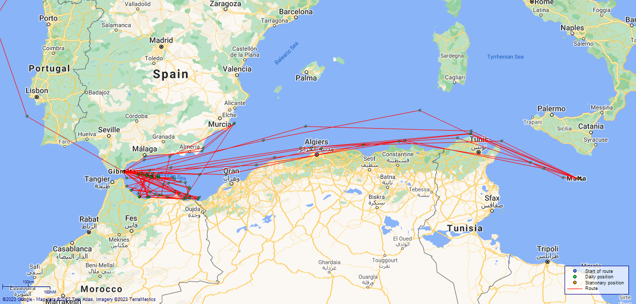
LOGS FOR JANUARY 1916 4caf837acadfd3419700011f: (http://oldweather.s3.amazonaws.com/ADM53-32581/0140_1.jpg) HMS Acacia Copy of Log for Month of January 1916 Signed L Croudace Sub Lieut RNR 4caf837acadfd34197000120: (http://oldweather.s3.amazonaws.com/ADM53-32581/0141_0.jpg) 4caf837acadfd34197000121: (http://oldweather.s3.amazonaws.com/ADM53-32581/0141_1.jpg) 4caf837acadfd34197000122: (http://oldweather.s3.amazonaws.com/ADM53-32581/0142_0.jpg) [Blank] 4caf837acadfd34197000123: (http://oldweather.s3.amazonaws.com/ADM53-32581/0142_1.jpg) 1 January 1916 Cardiff to Gibraltar Lat 43.17, Long -9.43 1.00am: Fresh gale, big head sea 5.00am: One 12lb tampion washed overboard 8.00am: Hands employed securing gear 2.00pm: Two coir fenders and one hazel rod fender washed overboard Distance through water 90 miles. Fuel expended 19.6 tons Weather: winds W/SW force 8 to 6; barometer rising rapidly; temperature 55F; overcast all day, plus mist at midday, plus rain at midnight; swell to 7 4caf837acadfd34197000124: (http://oldweather.s3.amazonaws.com/ADM53-32581/0143_0.jpg) 2 January 1916 Cardiff to Gibraltar Lat 41.30, Long -11.02 [latitude 43°18'N in log] 2.00am: Sea gradually abating 7.00am: Scrubbing decks 8.00am: Breakfast and clean 11.15am: Pipe down 1.00pm: Reduced to 6 knots. Altered course S13W. Set fore trysail 1.35pm: Increased to 14 knots 4.30pm: Reduced to 10 knots 9.00pm: Increased to 14 knots 9.30pm: Pipe down Distance through water 188 miles. Fuel expended 19.2 tons Weather: winds SW force 5 to 6; barometer 30.40; temperature 58F; mixed clear skies and cloud; swell 5 still at midday, down to 1 at midnight 4caf837acadfd34197000125: (http://oldweather.s3.amazonaws.com/ADM53-32581/0143_1.jpg) 3 January 1916 Cardiff to Gibraltar Lat 38.07, Long -9.58 1.00am: At 15 knots 7.00am: Smooth and fine 10.00am: Altered course to avoid steamer 5.09pm: Cape St Vincent abeam N70E distance 8 miles 5.30pm: Altered course S55E. Reduced 14 knots Distance through water 338 miles. Fuel expended 28.3 tons, 120 tons remaining Weather: winds S/E force 1 to 3; barometer rising slowly to 30.61; no temperatures in the morning, 60F at end of day; mixed clear and cloud; slight swell to swell force 2 4caf837acadfd34197000126: (http://oldweather.s3.amazonaws.com/ADM53-32581/0144_0.jpg) 4 January 1916 Cardiff to Gibraltar Lat 36.13, Long -5.36 6.35am: Cape Trafalgar abeam 9.30am: Passed Tarifa Point 10.15am: Let go starboard anchor in 20 fathoms 11.15am: Weighed anchor and proceeded through breakwater 12.10pm: Started coaling 5.00pm: Finished coaling Distance through water 275 miles. Fuel expended 15 tons, 107 tons remaining Weather: winds ENE force 5 to 2; barometer steady; temperature 58F; mostly clear skies; swell reducing 3 down to 1 4caf837acadfd34197000127: (http://oldweather.s3.amazonaws.com/ADM53-32581/0144_1.jpg) 5 January 1916 Gibraltar Lat 36.13, Long -5.36 4.30pm: Read 3 warrants Distance through water nil miles. Fuel expended 3.2 tons Weather: winds E force 2; barometer steady around 30.50; temperature 58F; mixed clear and cloud 4caf837acadfd34197000128: (http://oldweather.s3.amazonaws.com/ADM53-32581/0145_0.jpg) 6 January 1916 Gibraltar Lat 36.13, Long -5.36 8.00am: Stowing gear 1.20pm: Red leading ship Distance through water nil miles. Fuel expended 2.7 tons Weather: winds E force to 2; barometer steady; temperature 58F; mixed clear and cloud 4caf837acadfd34197000129: (http://oldweather.s3.amazonaws.com/ADM53-32581/0145_1.jpg) 7 January 1916 Gibraltar Lat 36.13, Long -5.36 8.00am: Scrapping and red leading ship Distance through water nil miles. Fuel expended 2.5 tons Weather: winds E/Calm force 2 to 0; barometer dropping slowly; temperature 59F; mixed clear and cloud 4caf837acadfd3419700012a: (http://oldweather.s3.amazonaws.com/ADM53-32581/0146_0.jpg) 8 January 1916 Gibraltar Lat 36.13, Long -5.36 8.00am: Scraping ship's side Distance through water nil miles. Fuel expended 3.5 tons Weather: winds NW/Calm force 2 to 0; barometer steady around 30.20; temperature 62F; mixed clear and cloud 4caf837acadfd3419700012b: (http://oldweather.s3.amazonaws.com/ADM53-32581/0146_1.jpg) 9 January 1916 Gibraltar Lat 36.13, Long -5.36 8.00am: Breakfast. And clean in No. 2 caps and covers and flannels 9.30am: Muster open lists and inspect History Sheets Distance through water nil miles. Fuel expended 2.5 tons Weather: winds NW/Calm force 2 to 0; barometer steady; temperature 63F; mixed clear and cloud 4caf837acadfd3419700012c: (http://oldweather.s3.amazonaws.com/ADM53-32581/0147_0.jpg) 10 January 1916 Gibraltar Lat 36.13, Long -5.36 Distance through water nil miles. Fuel expended 2.5 tons Weather: winds NW/S force 2 to 1; barometer rising slowly; temperature 68F; mixed clear and cloud with squalls late evening 4caf837acadfd3419700012d: (http://oldweather.s3.amazonaws.com/ADM53-32581/0147_1.jpg) 11 January 1916 Gibraltar Lat 36.13, Long -5.36 4.00pm: Cast off from South Mole and proceeded 4.40pm: Log streamed 4.49pm: Set log 11.20pm: Passed trawlers 2nd pair Distance through water nil miles. Fuel expended 3.5 tons Weather: winds W/ESE force 1 to 0; barometer steady; temperature 70F [Editor's note: no temperature readings show post noon]; mixed clear and cloud in the morning, clear skies afterwards 4caf837acadfd3419700012e: (http://oldweather.s3.amazonaws.com/ADM53-32581/0148_0.jpg) 12 January 1916 At sea Lat 35.22, Long -2.67 2.07am: Alboran abeam, log 107 6.25am: Zigzag 3 points each side initial course every 15 minutes 10.05am: Port Kelah abeam 10.12am: Cape Milonia abeam 11.15 am: Zafarin Lighthouse abeam distance 3 miles. Various courses (coasting) 4.30pm: Exercise fire stations and abandon ship 5.41pm: Alhucemas Lighthouse abeam distance 4 miles 7.05pm: Cape Baba abeam 4 miles. Log 324 11.26pm: Point Almina abeam 3 miles Distance through water nil miles. Fuel expended 21 tons Weather: winds SW/W/ESE force 2 to 1; barometer steady; temperature 58F; overcast all day long 4caf837acadfd3419700012f: (http://oldweather.s3.amazonaws.com/ADM53-32581/0148_1.jpg) 13 January 1916 At sea Lat 35.53, Long -2.47 6.20am: Zigzag 3 points each way every 20 minutes 7.24am: Sun rose bearing S52E, ship's head East 7.40am: Sighted Alboran Island Lighthouse 9.15am: Repairing fenders 1.30pm: Hands scrub and wash clothes 4.50pm: Zafarin Island Lighthouse abeam distance 1 mile Distance through water 310 miles. Fuel expended 20.5 tons Weather: winds Light airs/NW force 0 to 3; barometer steady; temperature 56F; clear skies 4caf837acadfd34197000130: (http://oldweather.s3.amazonaws.com/ADM53-32581/0149_0.jpg) 14 January 1916 At sea Lat 35.93, Long -4.10 2.33am: Sighted Almina Lighthouse on starboard bow 6.30am: Almina Lighthouse abeam 6.40am: Started zigzagging 1.30pm: Clear up desks, pipe down 3.50pm: Alboran Lighthouse abeam distance 3.5 miles 4.30pm: Set fore and aft sails 6.00pm: Darken ship 7.30pm: Slung clean hammocks 10.30pm: Exercised general quarters and abandon ship 11.25pm: Zafarin Island Lighthouse abeam 2 miles Distance through water 277 miles. Fuel expended 19.5 tons Weather: winds NW/W/SW force 4 to 1; barometer steady; temperature 59F; clear skies 4caf837acadfd34197000131: (http://oldweather.s3.amazonaws.com/ADM53-32581/0149_1.jpg) 15 January 1916 At sea Lat 35.47, Long -5.00 2.04am: Cape Tres Forcas abeam distance 4 miles 4.55am: Sighted Alhucemas Lighthouse 1 point on port bow 6.58am: Alhucemas Lighthouse abeam distance 5.8 miles 8.45am: Cape Baba Lighthouse abeam distance 1 mile 10.30am: Aired bedding 1.15pm: Forenoon watchmen air bedding 1.30pm: Make and mend clothes 3.30pm: Down all bedding Distance through water 285 miles. Fuel expended 19 tons Weather: winds W/E force 3 to 1; barometer steady; temperature 71F; mixed clear skies with cloud 4caf837acadfd34197000132: (http://oldweather.s3.amazonaws.com/ADM53-32581/0150_0.jpg) 16 January 1916 At sea Lat 35.40, Long -4.20 2.27am: Alhucemas Island Lighthouse abeam distance 4.5 miles 2.38am: Stopped. Spoke to TB 92 2.59am: Patrolling N83W and S83E at 12 knots 5.00am: Patrolling East and West, 7 miles off Alhucemas Lighthouse 6.45am: Proceeded to search Alhucemas Bay 11.15am: Altered course N41W returning to base 4.45pm: Passed through entrance 4.50pm: Picked up buoy No. 12 and secured Distance through water 289 miles. Fuel expended 20 tons, 118 tons remaining Weather: winds Calm force 0; barometer steady; temperature 63F; mixed clear skies with cloud 4caf837acadfd34197000133: (http://oldweather.s3.amazonaws.com/ADM53-32581/0150_1.jpg) 17 January 1916 Gibraltar Lat 36.137, Long -5.358 7.15am: Shifted to No. 7 shed for coal and water 9.15am: Commenced coaling 1.00am: Finished coaling 1.40pm: Hands clean ship 4.00pm: Tea, Leave to watch from 4.30pm till 7.00am Distance through water 72 miles. Fuel expended 9 tons, 109 tons remaining Weather: winds NW force 1; barometer steady around 30.40; temperature F; clear skies all day 4caf837acadfd34197000134: (http://oldweather.s3.amazonaws.com/ADM53-32581/0151_0.jpg) 18 January 1916 Gibraltar Lat 36.137, Long -5.358 8.00am: Painting aloft 1.20pm: Getting out ammunition Distance through water nil miles. Fuel expended 'coaling' tons, 254 tons Weather: winds SW/W/NW force to [Editor's note: force noted in swell column apparently]; barometer steady; temperature 59F; mixed clear skies with cloud 4caf837acadfd34197000135: (http://oldweather.s3.amazonaws.com/ADM53-32581/0151_1.jpg) 19 January 1916 Gibraltar Lat 36.127, Long -5.355 8.00am: Painting aloft 9.30am: Proceeded into dry dock 11.00am: Read warrant 1.20pm: Clearing store 1.30pm: One prisoner discharged to detention 4.45pm: Exercise fire stations Distance through water nil miles. Fuel expended nil tons Weather: winds NW/Calm force 2 to 0; barometer; temperature 57F; mixed clear skies with cloud 4caf837acadfd34197000136: (http://oldweather.s3.amazonaws.com/ADM53-32581/0152_0.jpg) 20 January 1916 Gibraltar Lat 36.127, Long -5.355 8.00am: Return boats falls 9.30am: Hands working about anchor and cables 5.00am: Exercised fire stations Distance through water nil miles. Fuel expended nil tons Weather: winds Calm force 0; barometer rising slightly to 30.56; temperature 58F; mixed clear skies with cloud 4caf837acadfd34197000137: (http://oldweather.s3.amazonaws.com/ADM53-32581/0152_1.jpg) 21 January 1916 Gibraltar Lat 36.127, Long -5.355 8.00am: Painting out boats 5.00pm: Exercised fire stations Distance through water nil miles. Fuel expended nil tons Weather: winds Calm/NW force 0 to 1; barometer steady; temperature 59F; mixed clear skies with cloud 4caf837acadfd34197000138: (http://oldweather.s3.amazonaws.com/ADM53-32581/0153_0.jpg) 22 January 1916 Gibraltar Lat 36.127, Long -5.355 1.15pm: Make and mend clothes 5.00pm: Exercised fire stations Distance through water nil miles. Fuel expended nil tons Weather: winds Various, force 0 to 2; barometer steady; temperature 61F; mixed clear skies with cloud 4caf837acadfd34197000139: (http://oldweather.s3.amazonaws.com/ADM53-32581/0153_1.jpg) 23 January 1916 Gibraltar Lat 36.127, Long -5.355 9.00am: Church parties landed 5.00pm: Exercised fire stations Distance through water nil miles. Fuel expended nil tons Weather: winds SW force 1; barometer steady; temperature 59F; mixed clear skies with cloud 4caf837acadfd3419700013a: (http://oldweather.s3.amazonaws.com/ADM53-32581/0154_0.jpg) 24 January 1916 Gibraltar Lat 36.127, Long -5.355 9.15am: Oiled down aloft 5.00pm: Exercised fire stations Distance through water nil miles. Fuel expended nil tons Weather: winds various, force 1 to 0; barometer steady; temperature 62F; mixed clear skies with cloud 4caf837acadfd3419700013b: (http://oldweather.s3.amazonaws.com/ADM53-32581/0154_1.jpg) 25 January 1916 Gibraltar Lat 36.127, Long -5.355 5.30pm: Exercised fire stations Distance through water nil miles. Fuel expended nil tons Weather: winds various, force 1; barometer steady; temperature 61F; mixed clear skies with cloud 4caf837acadfd3419700013c: (http://oldweather.s3.amazonaws.com/ADM53-32581/0155_0.jpg) 26 January 1916 Gibraltar Lat 36.127, Long -5.355 2.30pm: Three ratings discharged to hospital 5.30pm: Exercised fire stations Distance through water nil miles. Fuel expended nil tons Weather: winds various, force 1; barometer steady; temperature 62F; mixed clear skies with cloud 4caf837acadfd3419700013d: (http://oldweather.s3.amazonaws.com/ADM53-32581/0155_1.jpg) 27 January 1916 Gibraltar Lat 36.127, Long -5.355 1.15pm: Hands employed striking down cable 5.30pm: Exercised fire stations Distance through water nil miles. Fuel expended nil tons Weather: winds various, force 1; barometer steady; temperature 61F; mixed clear skies with cloud 4caf837bcadfd3419700013e: (http://oldweather.s3.amazonaws.com/ADM53-32581/0156_0.jpg) 28 January 1916 Gibraltar Lat 36.127, Long -5.355 7.45am: Painting ship 1.15pm: Painting ship 5.30pm: Exercised fire stations Distance through water nil miles. Fuel expended nil tons Weather: winds various, force 1; barometer steady around 30.30; temperature 56F; mixed clear skies with cloud but with rain midmorning 4caf837bcadfd3419700013f: (http://oldweather.s3.amazonaws.com/ADM53-32581/0156_1.jpg) 29 January 1916 Gibraltar Lat 36.127, Long -5.355 9.00am: Drawing stores 1.15pm: Make and mend clothes 5.00pm: Exercised fire stations Distance through water nil miles. Fuel expended nil tons Weather: winds Calm/W force 0 to 1; barometer steady; temperature 56F [Editor's note: no temperatures noted after midday]; mixed clear skies with cloud 4caf837bcadfd34197000140: (http://oldweather.s3.amazonaws.com/ADM53-32581/0157_0.jpg) 30 January 1916 Gibraltar Lat 36.127, Long -5.355 9.00am: Church parties landed 5.30pm: Exercised fire stations Distance through water nil miles. Fuel expended nil tons, 249 tons remaining Weather: winds Calm force 0; barometer steady; temperature 55F; clear skies, bit of cloud toward end of day 4caf837bcadfd34197000141: (http://oldweather.s3.amazonaws.com/ADM53-32581/0157_1.jpg) 31 January 1916 Gibraltar Lat 36.127, Long -5.355 9.15am: Painting ship 1.15pm: Drawing stores 5.30pm: Exercised fire stations Distance through water nil miles. Fuel expended nil tons Weather: winds SW force 1; barometer steady; temperature 57F; mixed clear skies with cloud 4caf837bcadfd34197000142: (http://oldweather.s3.amazonaws.com/ADM53-32581/0158_0.jpg) [Blank] LOGS FOR FEBRUARY 1916 4caf837bcadfd34197000143: (http://oldweather.s3.amazonaws.com/ADM53-32581/0158_1.jpg) HMS Acacia Copy of Log for Month of February 1916 Signed L Croudace Sub Lieut RNR 4caf837bcadfd34197000144: (http://oldweather.s3.amazonaws.com/ADM53-32581/0159_0.jpg) 4caf837bcadfd34197000145: (http://oldweather.s3.amazonaws.com/ADM53-32581/0159_1.jpg) 4caf837bcadfd34197000146: (http://oldweather.s3.amazonaws.com/ADM53-32581/0160_0.jpg) [Blank] 4caf837bcadfd34197000147: (http://oldweather.s3.amazonaws.com/ADM53-32581/0160_1.jpg) 1 February 1916 Gibraltar Lat 36.127, Long -5.355 7.45am: Employed painting boats 9.00am: Divisions, prayers, etc. 9.15am: Hands employed painting boats 10.15am: Discharged 1 rating to hospital 10.30am: Stand easy 10.40am: Resume work Noon: Dinner 1.15pm: Hands employed getting out bow defence and kites for storage in dockyard 2.25pm: One rating returned from detention 4.00pm: Evening quarters 4.10pm: Tea, usual leave to watch till 7.00 am 5.30pm: Exercised fire stations 7.00pm: Hands to supper 9.00pm: Rounds correct 10.00pm: Pipe down Distance through water nil miles. Fuel expended nil tons, remaining 259 tons coal Weather: winds Light Airs/Variable force 1; barometer steady around 30.4; temperature 59F; some clear sky, some cloud 4caf837bcadfd34197000148: (http://oldweather.s3.amazonaws.com/ADM53-32581/0161_0.jpg) 2 February 1916 Gibraltar Lat 36.127, Long -5.355 7.45am: Painting out boats 1.15pm: Painting out boats 5.30pm: Exercised fire stations Distance through water nil miles. Fuel expended nil tons, remaining 254 tons Weather: winds Calm; barometer steady around 30.40; temperature 58F; some clear sky, some cloud 4caf837bcadfd34197000149: (http://oldweather.s3.amazonaws.com/ADM53-32581/0161_1.jpg) 3 February 1916 Gibraltar Lat 36.131, Long -5.356 7.45am: Preparing to leave dock 9.50am: Left dry dock and made fast alongside wall at No. 2 steps 1.15pm: Hands employed in dockyard stowing sweeping gear Distance through water nil miles. Fuel expended nil tons, remaining 254 tons Weather: winds Calm; barometer slowly falling; temperature 56F; some clear sky, some cloud 4caf837bcadfd3419700014a: (http://oldweather.s3.amazonaws.com/ADM53-32581/0162_0.jpg) 4 February 1916 Gibraltar Lat 36.131, Long -5.356 7.45am: Scraping decks 9.15am: Drawing stores 1.15pm: Drawing stores 5.00pm: One rating joined from hospital Distance through water nil miles. Fuel expended 2 tons Weather: winds SW/NW force 2 to 5; barometer falling fast 30.14 to 29.80; temperature 57F; clear with cloud first 4 hours, then cloud with rain all day 4caf837bcadfd3419700014b: (http://oldweather.s3.amazonaws.com/ADM53-32581/0162_1.jpg) 5 February 1916 Gibraltar Lat 36.131, Long -5.356 7.45am: Painting ship 9.15am: Painting ship 1.15pm: Make and mend clothes Distance through water nil miles. Fuel expended 1 ton Weather: winds NW force 3 to 1; barometer quick dip 30.36 to 30.12 and back ; temperature 54F; clear with cloud 4caf837bcadfd3419700014c: (http://oldweather.s3.amazonaws.com/ADM53-32581/0163_0.jpg) 6 February 1916 Gibraltar Lat 36.131, Long -5.356 9.00am: Church parties fall in Distance through water nil miles. Fuel expended 2 tons Weather: winds NW/Calm force 2 to 0; barometer steady around 30.40; temperature 57F; clear with cloud 4caf837bcadfd3419700014d: (http://oldweather.s3.amazonaws.com/ADM53-32581/0163_1.jpg) 7 February 1916 Gibraltar Lat 36.131, Long -5.356 7.00am: Scraping decks 9.15am: Drawing stores 10.15am: One rating discharged to hospital 1.15am: Getting in ammunition Provisions received: fresh meat 60lbs, vegetables 100lbs, bread 100lbs Distance through water nil miles. Fuel expended 2 tons Weather: winds Variable force 1 to 0; barometer steady; temperature 57F; clear with occasional cloud 4caf837bcadfd3419700014e: (http://oldweather.s3.amazonaws.com/ADM53-32581/0164_0.jpg) 8 February 1916 Gibraltar Lat 36.131, Long -5.356 9.00am: Divisions and prayers 9.15am: Drawing stores 12.30pm: Sale of dead man's effects [Editor's note: No name noted, Rest in Peace] 1.15pm: Hands employed painting out boats 1.50pm: Two ratings joined ship from hospital Provisions received: fresh meat 120lbs, vegetables 200lbs, bread 100lbs Distance through water nil miles. Fuel expended 2.5 tons Weather: winds Calm/NW force 0 to 2; barometer steady; temperature 59F; bit clear, bit cloud, and train for lunch 4caf837bcadfd3419700014f: (http://oldweather.s3.amazonaws.com/ADM53-32581/0164_1.jpg) 9 February 1916 Gibraltar Lat 36.131, Long -5.356 7.00am: Refitting boats 9.15am: Employed working about boats 11.00am: Discharged three ratings to hospital 1.15pm: Hands employed bringing boats from boat shed 2.20pm: Slipped from mole and proceeded to buoy assisted by tug Distance through water nil miles. Fuel expended 3 tons Weather: winds NW force 3; barometer steady; temperature 53F; clear with some cloud and drizzle at the end of the day 4caf837bcadfd34197000150: (http://oldweather.s3.amazonaws.com/ADM53-32581/0165_0.jpg) 10 February 1916 Gibraltar Lat 36.03, Long -4.37 [latitude 35°02'N in log] 6.00am: Hands lash up and stow 6.30am: Unshackle and prepare slip rope 7.35am: Slipped buoy and proceeded, course S72E 8.00am: Hands to breakfast and clean 8.05am: Streamed patent log 9.00am: Divisions and prayers 9.15am: Hands employed scrubbing decks 10.30am: Stand easy 10.40am: Resume work 11.50am: Set both sails Noon: Dinner 2.00pm: Passed town class cruiser steering west 3.45pm: Sighted Alboran Island Lighthouse 4.00pm: Evening quarters and physical drill 4.30pm: Hands to tea 4.55pm: Alboran Island Lighthouse abeam distance 2 miles. Altered course S36E 6.30pm: Darken ship 7.00pm: Hands to supper 8.35pm: Altered course S23E 8.30pm: Rounds correct 9.30pm: Pipe down 10.50pm: Altered course N53W Distance through water 50 miles. Fuel expended 6 tons Weather: winds Variable force 3; barometer steady around 30.20; temperature 56F; clear with some cloud 4caf837bcadfd34197000151: (http://oldweather.s3.amazonaws.com/ADM53-32581/0165_1.jpg) 11 February 1916 At sea Lat 35.35, Long -4.72 [latitude 35°11'N in log] 12.58am: Zafarin Island Lighthouse abeam distance 7 miles 1.20am: Sighted Tres Forcas Lighthouse 3.25am: Tres Forcas Lighthouse abeam distance 3.4 miles 11.30am: Passed trawler and torpedo boat 2.35pm: Cape Negra abeam distance 3.5 miles 2.45pm: Wind freshened 3.35pm: Almina Point abeam 6.55pm: Passed 2 trawlers 9.45pm: Sighted Alboran Lighthouse ahead. Wind increased 11.05pm: Sighted Alboran Lighthouse abeam distance 2 miles Distance through water 291 miles. Fuel expended 18 tons Weather: winds NW force 3 to 5; barometer falling fast 30.30 to 30.12; temperature 64F; clear with clouds; swell increasing rapidly 1 to 4 afternoon and evening 4caf837bcadfd34197000152: (http://oldweather.s3.amazonaws.com/ADM53-32581/0166_0.jpg) 12 February 1916 At sea Lat 35.18, Long -2.63 4.00am: Altered course N53W. Reduced to 12 knots. Strong head wind. Rough sea 6.15am: Zafarin Lighthouse abeam distance 5 miles 7.00am: Scrub upper decks 8.50am: Scrubbing mess deck 10.45am: Melilla Lighthouse abeam distance 3miles 1.35pm: Reduced to 10 knots 4.05pm: Cape Tres Forcas abeam distance 2.5 miles 6.15pm: Darken ship 7.45pm: Sighted Alhucemas Lighthouse bearing S68W 10.05pm: Passed Alhucemas Lighthouse distance 6 miles Midnight: Cape Baba abeam distance 6 miles Distance through water 302 miles. Fuel expended 22.5 tons Weather: winds NW force 6 to 4; barometer rising rapidly 30.10 to 30.40; temperature 55F; yet again, clear skies with some clouds; swell reducing from 6 down to 2 4caf837bcadfd34197000153: (http://oldweather.s3.amazonaws.com/ADM53-32581/0166_1.jpg) 13 February 1916 At sea Lat 35.95, Long -3.83 2.00am: Moderate breeze, sea, and swell 4.36am: Almeria Point 4 points on bow 5.16am: Almina Point abeam distance 6.9 miles 5.25am: Almina Point S58W 8.50am: Clear up decks 9.00am: Passed yacht patrol 10.00am: Passed hospital and troop ship 11.00am: Moderate breeze and sea 12.30pm: Passed trawler patrol 3.00pm: Alboran Island abeam distance 3 miles 4.30pm: Sighted patrol yacht 11.00pm: Examined SS Tanisic of Oran 11.10pm: Proceeded 11.45pm: Zafarin Island abeam distance 3 miles Distance through water 236 miles. Fuel expended 15 tons, remaining 180 tons Weather: winds NW/SE/SW force 5 to 1; barometer steady around 30.50; temperature 56F; mostly clear skies all day 4caf837bcadfd34197000154: (http://oldweather.s3.amazonaws.com/ADM53-32581/0167_0.jpg) 14 February 1916 Lat 35.63, Long -5.23 12.05am: Sighted Tres Forcas Lighthouse bearing N62W 1.40am: Tres Forcas Lighthouse 4 points on bow 2.03am: Tres Forcas Lighthouse abeam distance 5 miles 6.21am: Passed Alhumecas Lighthouse distance 7 miles 8.00am: Cape Baba abeam distance 4 miles 8.30am: Light airs, smooth and fine 9.20am: Painting upper decks 1.30pm: Scrub and wash clothes 1.55pm: Almina Point abeam distance 2 miles 4.05pm: Passed trawler patrol 9.05pm: Sighted Alboran Lighthouse bearing S67E 10.19pm: Alboran Lighthouse 4 points on bow 10.30pm: Alboran Lighthouse abeam distance 3.2 miles 11.50pm: Altered course to avoid steamer Midnight: Sea smooth and fine Distance through water 283 miles. Fuel expended 17.2 tons, remaining 162.5 tons Weather: winds Light airs/NE force 1 to 2; barometer rising to 30.67; temperature 74F; clear skies 4caf837bcadfd34197000155: (http://oldweather.s3.amazonaws.com/ADM53-32581/0167_1.jpg) 15 February 1916 At sea Lat 35.23, Long -3.45 11.45am: Passed Spanish Cruiser 1.30pm: Hands scrub hammocks and wash clothes 3.46pm: Passed Cape Baba 4.45pm: Passed torpedo boat patrol 4.58pm: Cape Pescadores abeam distance 1.5 miles 7.15pm: Sighted Almina Lighthouse bearing N25W Distance through water 300 miles. Fuel expended 19.5 tons, remaining 143 tons Weather: winds SW/Light airs force 3 to 0; barometer steady about 30.54; temperature 64F; clear skies all day long 4caf837bcadfd34197000156: (http://oldweather.s3.amazonaws.com/ADM53-32581/0168_0.jpg) 16 February 1916 At sea Lat 35.15, Long -2.12 12.30am: Altered course to examine steamer by searchlight 12.45am: Steered course again 2.20am: Passed torpedo boat destroyer steering West 4.40am: Alboran Lighthouse 4 points on bow 4.50am: Alboran Lighthouse abeam distance 2 miles 8.50am: Air night clothing 3.35pm: Cape Tres Forcas abeam distance 2.5 miles 5.45pm: Course as requisite to close trawler patrol 8.20pm: Examined SS Vergen de Africa, Spain 9.04pm: Cape Baba Lighthouse abeam distance 4 miles 10.08pm: Reduced to 8 knots 11.15pm: Passed armed boarding steamer steering SE Distance through water 301 miles. Fuel expended 18 tons Weather: winds various, force 1; barometer steady; temperature 63F; clear skies 4caf837bcadfd34197000157: (http://oldweather.s3.amazonaws.com/ADM53-32581/0168_1.jpg) 17 February 1916 At sea and at Gibraltar Lat 36.137, Long -5.358 12.40am: Sighted Almina Point Lighthouse bearing N40W 9.50am: Secured alongside coaling shed No. 5 10.30am: Commenced coaling Distance through water 206 miles. Fuel expended 16 tons, remaining109 tons Weather: winds NW force 1; barometer steady; temperature 66F; mixed clear skies with cloud 4caf837bcadfd34197000158: (http://oldweather.s3.amazonaws.com/ADM53-32581/0169_0.jpg) 18 February 1916 Gibraltar Lat 36.140, Long -5.364 7.50am: Hands employed painting ship 9.05am: Left coaling shed, secured to No. 20 buoy 1.15pm: Hands employed painting ship Distance through water nil miles. Fuel expended 1.2 tons, 287 tons remaining Weather: winds Various/light airs force 1 to 0; barometer steady; temperature 60F; mixed clear skies with cloud 4caf837bcadfd34197000159: (http://oldweather.s3.amazonaws.com/ADM53-32581/0169_1.jpg) 19 February 1916 Gibraltar Lat 36.140, Long -5.364 7.45am: Hands employed painting ship 1.00pm: Make and mend clothes Distance through water nil miles. Fuel expended 1.2 tons, 287 tons remaining Weather: winds Calm; barometer steady; temperature 60F; mixed clear skies with cloud 4caf837bcadfd3419700015a: (http://oldweather.s3.amazonaws.com/ADM53-32581/0170_0.jpg) 20 February 1916 Gibraltar and at sea Lat 36.00, Long -3.92 7.50am: Slipped buoy and proceeded 2.50pm: Sighted Alboran Island Lighthouse 3.47pm: Alboran Island Lighthouse abeam distance 1.25 miles 3.50pm: Streamed patent log 7.03pm: Sighted Zafarin Island Lighthouse bearing S15W 7.45pm: Sighted Nemours Lighthouse right ahead 11.38pm: Zafarin Island Lighthouse abeam distance 1.5 miles Distance through water 57 miles. Fuel expended 6.5 tons Weather: winds Light airs force 1; barometer dropped to around 30.10; temperature 61F; mostly clear but some cloud 4caf837bcadfd3419700015b: (http://oldweather.s3.amazonaws.com/ADM53-32581/0170_1.jpg) 21 February 1916 At sea Lat 35.22, Long -4.65 4.19am: Cape Tres Forcas Lighthouse abeam distance 3.6 miles 4.38am: Cape Tres Forcas bearing S9E 7.10am: Stopped 7.45am: Proceeded 9.21am: Morro Neuvo abeam distance 1.5 miles 11.30am: Passed torpedo boat patrol 12.09pm: Cape Pescadores abeam distance 1 mile 4.38pm: Almina Point abeam distance 2.4 mile 5.30pm: Passed SS Saturnia of Glasgow 6.30pm: Darkened ship 6.35pm: Passed SS Andania of Liverpool Distance through water 279 miles. Fuel expended 19.4 tons, 211.5 remaining tons Weather: winds NW/Calm/ESE force 2 to 1; barometer falling slightly to 30.04; temperature 61F; mixed clear skies with cloud in the morning, afternoon overcast and cloudy 4caf837bcadfd3419700015c: (http://oldweather.s3.amazonaws.com/ADM53-32581/0171_0.jpg) 22 February 1916 At sea Lat 35.35, Long -2.92 12.50am: Alboran Lighthouse 4 points on bow 1.05am: Alboran Lighthouse abeam distance 3 miles 2.05am: Challenged HMS Mars, Westward bound 7.05am: 3 miles off Nemours 9.15am: Hands employed reeving motor boats falls. Course various patrolling coast 11.30am: Passed Mellila distance 3 miles 1.30pm: Scrub hammocks and clothes 2.47pm: Zafarin Island Lighthouse abeam distance 5.2 miles 5.00pm: Altered course N55W 2 miles off Nemours Lighthouse 9.15pm: Cape Tres Forcas Lighthouse on bow 9.40pm: Cape Tres Forcas Lighthouse abeam distance 5 miles. Altered course N61W Distance through water 294 miles. Fuel expended 17.4 tons, 194 tons remaining Weather: winds E/Calm force 3 to 1; barometer falling slowly to 29.90; temperature 62F; mixed clear skies with cloud 4caf837bcadfd3419700015d: (http://oldweather.s3.amazonaws.com/ADM53-32581/0171_1.jpg) 23 February 1916 At sea and Gibraltar Lat 36.140, Long -5.364 7.55am: Passed through entrance 8.15am: Secured to No. 17 buoy 11.00am: Secured coal lighter alongside. Commenced coaling (native labourers) 2.30pm: Finished coaling, washed down decks 3.45pm: Received new motor boat Distance through water 280 miles. Fuel expended 17 tons [distance through water looks to be over by 100 miles] Weather: winds NE/SW force 2 to 1; barometer slightly lower at 29.76 but steady; temperature 59F; clear skies with cloud until rain at midnight on SW breeze 4caf837bcadfd3419700015e: (http://oldweather.s3.amazonaws.com/ADM53-32581/0172_0.jpg) 24 February 1916 Gibraltar Lat 36.140, Long -5.364 7.35am: HMS Mars left 2.30pm: Secured another wire to buoy Distance through water nil miles. Fuel expended 1.5 tons Weather: winds SW force 2; barometer fast rise and fall; temperature 59F; rainy and overcast until very late clear skies 4caf837bcadfd3419700015f: (http://oldweather.s3.amazonaws.com/ADM53-32581/0172_1.jpg) 25 February 1916 Gibraltar Lat 36.140, Long -5.364 9.00am: Divisions and prayers 9.15am: Hands employed scrubbing boat covers 1.15pm: Hands employed drawing stores and getting in provisions Distance through water nil miles. Fuel expended 1.7 tons Weather: winds NW/SW force 1; barometer steady; temperature 58F; clear skies with clouds 4caf837bcadfd34197000160: (http://oldweather.s3.amazonaws.com/ADM53-32581/0173_0.jpg) 26 February 1916 Gibraltar Lat 36.140, Long -5.364 8.15am: HMS Asphodel arrives 1.15pm: Make and mend clothes. Leave to watch from 1.30pm till 7.30am Distance through water nil miles. Fuel expended 1.5 tons Weather: winds Calm force 0; barometer steady; temperature 54F; clear skies with cloud 4caf837bcadfd34197000161: (http://oldweather.s3.amazonaws.com/ADM53-32581/0173_1.jpg) 27 February 1916 Gibraltar Lat 36.140, Long -5.364 8.00am: Breakfast and clean in No. 2s 8.30am: Roman Catholics landed 9.00am: Clear up decks for divisions 10.00am: Divisions and prayers Distance through water nil miles. Fuel expended 2 tons Weather: winds Light airs/SW/WSW force 0 to 3; barometer steady/falling a little to end of day; temperature 56F; mostly clear skies all day 4caf837bcadfd34197000162: (http://oldweather.s3.amazonaws.com/ADM53-32581/0174_0.jpg) 28 February 1916 Gibraltar and at sea Lat 36.03, Long -4.30 6.00am: Unshackling and securing ship for sea 7.30am: Passed through entrance 1.15pm: Make and mend clothes 3.30pm: Sighted Alboran Island and passed trawler patrol 5.04pm: Passed Alboran Island distance 2.5 miles 6.40pm: Cape Tres Forcas Lighthouse abeam distance 3 miles 10.23pm: Off Nemours Midnight: Zafarin Island Lighthouse 4 points on bow Distance through water 54 miles. Fuel expended 6 tons, 249 tons remaining Weather: winds SW/SE force 4; barometer falling to 29.64; temperature 58F; mostly clear skies all day 4caf837bcadfd34197000163: (http://oldweather.s3.amazonaws.com/ADM53-32581/0174_1.jpg) 29 February 1916 At sea Lat 35.48, Long -5.03 12.15am: Passed Zafarin Island distance 2.5 miles 2.23am: Passed Cape Tres Forcas distance 6.5 miles 3.00am: Light variable winds and rain squalls 4.35am: Sighted Alhucemas Lighthouse 1 point on the port bow 6.05am: Alhucemas 4 points on bow 6.55am: Abeam 10 miles 7.00am: Courses as requisite to close land 8.34am: Penon de Velez de la Gomera abeam distance 2.5 miles 9.15am: Rigging lower boom 10.00am: Cape Pescadores abeam distance 1 mile 11.00am: Heavy squalls and rain 12.15pm: Sighted torpedo boat and trawler patrol 2.00pm: Passed 3 French torpedo boats 2.37pm: Altered course S79E off Almina Point 5.30pm: Heavy rain squalls 8.00pm: Heavy squalls, thunder, lightning and heavy rains 11.25pm: Passed Alboran Lighthouse distance 3 Miles Distance through water 292 miles. Fuel expended 20 tons Weather: winds Various Westerlies force 5 to 2; barometer small rise to 29.78; temperature 60F; rain clearing for midday, then back to rain rest of day [weather codes did not record the squalls, thunder and lightening]; swell to 2 4caf837bcadfd34197000164: (http://oldweather.s3.amazonaws.com/ADM53-32581/0175_0.jpg) [Blank] LOGS FOR MARCH 1916 4caf837bcadfd34197000165: (http://oldweather.s3.amazonaws.com/ADM53-32581/0175_1.jpg) HMS Acacia Copy of Log for Month of March 1916 Signed L Croudace Sub Lieut RNR 4caf837bcadfd34197000166: (http://oldweather.s3.amazonaws.com/ADM53-32581/0176_0.jpg) 4caf837bcadfd34197000167: (http://oldweather.s3.amazonaws.com/ADM53-32581/0176_1.jpg) 4caf837bcadfd34197000168: (http://oldweather.s3.amazonaws.com/ADM53-32581/0177_0.jpg) [Blank] 4caf837bcadfd34197000169: (http://oldweather.s3.amazonaws.com/ADM53-32581/0177_1.jpg) 1 March 1916 At sea Lat 35.43, Long -3.15 1.45am: Cape Tres Forcas Lighthouse abeam 3.10am: Sighted Zafarin Island Lighthouse bearing SSW 3.40am: Sighted Nemours Lighthouse ahead 5.40am: Altered course N66W off Nemours 7.43am: Zafarin Island Lighthouse abeam distance 2 miles 9.20am: Fitting gear 11.15am: Passed Tres Forcas distance 3 miles. Course various, patrolling coast 11.30am: Strong wind, rough seas and swell, rain squalls 3.50pm: Alhucemas Lighthouse abeam 5.35pm: Cape Baba Lighthouse abeam 10.04pm: Almina Lighthouse on port bow 10.32pm: Almina Lighthouse abeam distance 5 miles Distance through water 287 miles. Fuel expended 17 tons Weather: winds NW force 2 to 1; barometer rising to 29.98; temperature 55F; overcast with rain clearing to clear skies with clouds; swell to 3 4caf837bcadfd3419700016a: (http://oldweather.s3.amazonaws.com/ADM53-32581/0178_0.jpg) 2 March 1916 At sea Lat 35.23, Long -2.05 6.52am: Alboran abeam distance 2.5 miles 8.30am: Light winds, considerable sea and swell 9.20am: Rigging topping lift and guys for lower boom 12.45pm: Altered course N68W, 1.5 miles off Nemours Lighthouse 3.00pm: Altered course N434W, 1 mile off Zafarin Island Lighthouse 4.30pm: Increased to 15 knots 6.30pm: Strong wind and rough sea 11.30pm: Strong wind and rough sea Distance through water 289 miles. Fuel expended 19.5 tons, 173.7 tons remaining Weather: winds NW force 4; barometer steady; temperature 55F; overcast and cloudy for the bulk of the day, otherwise brighter patches; swell to 3 4caf837bcadfd3419700016b: (http://oldweather.s3.amazonaws.com/ADM53-32581/0178_1.jpg) 3 March 1916 At sea Lat 35.30, Long -3.83 12.30am: Patrolling off Alhucemas Bay 2.00am: Strong wind and rough sea 5.00am: Patrolling off Alhucemas Bay 1.00pm: Patrolling off Alhucemas Bay 3.00pm: Fresh wind and rough sea 7.10pm: Increased to 10 knots to intercept steamer 7.50pm: Stopped steamer SS Benigna Huelva and taking her to Gibraltar 11.30pm: Strong wind and heavy squalls Distance through water 269 miles. Fuel expended 12.5 tons, 161.2 tons remaining Weather: winds NW force 5 to 3; barometer steady; temperature 57F; mixed clear and cloudy skies; swell to 4 4caf837bcadfd3419700016c: (http://oldweather.s3.amazonaws.com/ADM53-32581/0179_0.jpg) 4 March 1916 At sea Lat 35.33, Long -3.97 8.15am: Signalled to steamer (proceed on your voyage) 11.50am: Set course N43W for Gibraltar 1.00pm: Make and mend clothes 5.45pm: Passed through entrance 6.15pm: Made fast to No. 9 shed Distance through water 187 miles. Fuel expended 11 tons, 265 tons remaining Weather: winds NW force 5 to 2; barometer steady; temperature 63F; swell 5 reducing to 2 4caf837bcadfd3419700016d: (http://oldweather.s3.amazonaws.com/ADM53-32581/0179_1.jpg) 5 March 1916 Gibraltar Lat 36.137, Long -5.358 7.45am: Commenced coaling 8.30am: Roman Catholics landed Distance through water 89 miles. Fuel expended 1.8 tons, 263 tons remaining Weather: winds WSW/NW force 1; barometer falling to 29.75, rising back to 29.85; temperature 61F; mixed clear skies with cloud all day after rain in the early hours 4caf837bcadfd3419700016e: (http://oldweather.s3.amazonaws.com/ADM53-32581/0180_0.jpg) 6 March 1916 Gibraltar Lat 36.140, Long -5.364 9.00am: Cleaning paintwork 11.50am: Left No. 9 shed and secured to No. 16 buoy Distance through water nil miles. Fuel expended 2 tons Weather: winds SW/ENE force 2 to 1; barometer falling; temperature 48F; rain early hours, then mixed clear skies with clouds 4caf837bcadfd3419700016f: (http://oldweather.s3.amazonaws.com/ADM53-32581/0180_1.jpg) 7 March 1916 Gibraltar Lat 36.140, Long -5.364 Cleaning, scrubbing and scraping decks Distance through water nil miles. Fuel expended 2.5 tons Weather: winds SE/NE force 2 to 1; barometer falling then rising; temperature 53F; mixed clear skies with clouds 4caf837bcadfd34197000170: (http://oldweather.s3.amazonaws.com/ADM53-32581/0181_0.jpg) 8 March 1916 Gibraltar Lat 36.140, Long -5.364 9.20am: Scrubbing boats covers and scraping decks 1.00pm: Cleaning boats Distance through water nil miles. Fuel expended 7.3 tons Weather: winds WNW force 2; barometer steady around 29.98; temperature 56F; mixed clear skies with clouds 4caf837bcadfd34197000171: (http://oldweather.s3.amazonaws.com/ADM53-32581/0181_1.jpg) 9 March 1916 Gibraltar and at sea Lat 36.54, Long -4.46 [Estimated] 7.00am: Slipped buoy and proceeded 9.20am: Fitting new boat ropes 10.20am: Marbella Pier (end) abeam distance 1.5 miles 11.20am: Callaburras Lighthouse abeam distance 1.5 miles 12.45pm: Set fore and aft sails 2.08pm: Torrox Point Lighthouse abeam distance 2.5 miles 3.41pm: Cape Sacratif Lighthouse abeam distance 2 miles 6.15pm: Darkened ship 6.40pm: Sighted Cape de Gata Lighthouse 8.00pm: Cape de Gata Lighthouse abeam. Altered course S14W 9.40pm: Turned 16 points N13E 11.40pm: Turned 16 points S14W Distance through water 202 miles. Fuel expended 28.25 tons Weather: winds NW force 2; barometer at 30.00; temperature 58F; mixed clear skies with clouds; little swell 4caf837bcadfd34197000172: (http://oldweather.s3.amazonaws.com/ADM53-32581/0182_0.jpg) 10 March 1916 At sea Lat 36.97, Long -1.88 4.00am: Patrolling of Almeria 10.15am: Cape de Gata abeam distance 2.3 miles 11.51am: Mesa de Roldan Lighthouse abeam distance 1.5 miles 2.00pm: Examined Aguilas 4.40pm: Cape Agua abeam distance 2.4 miles 5.10pm: Cape Palos abeam distance 5 miles 9.15pm: Off Alicante. Courses various Distance through water 313 miles. Fuel expended 20.5 tons Weather: winds W/SW force 2; barometer fell half an inch in the day; temperature 60F; mostly cloudy, only a few brighter spells, a gloomy sky mid-evening 4caf837bcadfd34197000173: (http://oldweather.s3.amazonaws.com/ADM53-32581/0182_1.jpg) 11 March 1916 At sea Lat 37.83, Long -0.52 2.00am: Patrolling off Alicante 4.30am: Tabarca Lighthouse abeam distance 6 miles 8.30am: Altered course for Alicante 9.20am: Examined Alicante harbour 10.08am: Tabarca abeam 12.15pm: Streamed patent log. Make and mend clothes 1.53pm: Cape Palos Lighthouse abeam distance 5.0 miles 6.30pm: Darkened ship. Fresh wind, considerable sea and swell Fresh wind, considerable sea and swell Distance through water 292 miles. Fuel expended 16 tons, 186.5 tons remaining Weather: winds SW force 4 to 6; barometer low at around 29.32; temperature 58F; overcast but some clear sky later; swell to 4 4caf837bcadfd34197000174: (http://oldweather.s3.amazonaws.com/ADM53-32581/0183_0.jpg) 12 March 1916 At sea Lat 35.32, Long -2.60 2.32am: Habibas Lighthouse abeam distance 1.7 miles 5.33am: Roshgun Lighthouse abeam distance 13.5 miles 7.30am: Off Nemours 10.30am: Zafarin Island abeam distance 2 miles. Altered course to close trawler 1.50pm: Tres Forcas abeam distance 2 miles 3.00pm: Moderate breeze, sea and swell 7.40pm: Cape Baba lighthouse abeam distance 2 miles 10.00pm: Passed patrol 11.55pm: Almina Lighthouse 4 points on bow Distance through water 235 miles. Fuel expended 22 tons Weather: winds W force 3; barometer rising slowly; temperature 64F; mixed clear sky and cloud 4caf837bcadfd34197000175: (http://oldweather.s3.amazonaws.com/ADM53-32581/0183_1.jpg) 13 March 1916 At sea Lat 35.58, Long -2.50 12.30am: Almina Point abeam distance 5 miles 3.00am: Light airs, continues to rain, smooth sea 8.47am: Alboran Island abeam distance 2 miles 9.20am: Refitting 3.00pm: Off Nemours 4.00am: Light airs and smooth 4.57pm: Zafarin Island Lighthouse abeam 7.40pm: Stopped boat, examined steamer 8.30pm: Proceeded. Rounds correct Distance through water 287 miles. Fuel expended 22 tons, 142 tons remaining Weather: winds NW/Light airs/NW force 1; barometer rising slowly; temperature 58F; day starts with a gloomy sky, changes to the usual mixed clear and cloudy skies 4caf837bcadfd34197000176: (http://oldweather.s3.amazonaws.com/ADM53-32581/0184_0.jpg) 14 March 1916 Gibraltar Lat 36.140, Long -5.364 12.15am: Alhucemas abeam distance 7.5 miles 3.45am: Sighted Europa Point and Alhucemas Lighthouses 6.00am: Almina Lighthouse abeam distance 6 miles 7.00am: Prepare for coaling 7.40am: Secured to No. 6 buoy 8.00am: Left No. 6 buoy and secured to No. 20 12.40pm: Slipped buoy and proceeded 3.00pm: TB 93 took station astern 4.30pm: Hands to sea 10.00pm: Callaburras Lighthouse abeam distance 7 miles Distance through water 242 miles. Fuel expended 25 tons, 117 tons remaining [Editor's note: Clearly no coal came onboard in Gibraltar and she had a very fast turn around] Weather: winds NW/SW force 3; barometer steady around 29.90; temperature 58F; mixed clear and cloudy skies with rain midmorning 4caf837bcadfd34197000177: (http://oldweather.s3.amazonaws.com/ADM53-32581/0184_1.jpg) 15 March 1916 At sea and Gibraltar Lat 36.13, Long -5.36 4.00am: Off Cape Baba 7.38am: Negra Point abeam 8.45am: Preparing for coaling 9.45am: Europa Point abeam distance 1 mile 10.03am: Passed through entrance 10.25am: Secured to South Mole 10.45am: Commenced Coaling 1.30pm: Two ratings despatched to hospital, one to detention 5.45pm: Finished Coaling Distance through water [Editor's note: mileage shows 276, but covered 120 miles according to knots list] miles. Fuel expended 2 tons [Editor's note, this figure of 2 tons used does not match the miles noted], 265 remaining Weather: winds SW force 4 to 1; barometer falling slightly; temperature 58F; overcast and cloudy with rain on and off all day 4caf837bcadfd34197000178: (http://oldweather.s3.amazonaws.com/ADM53-32581/0185_0.jpg) 16 March 1916 Gibraltar Lat 36.13, Long -5.36 9.15am: Refitting wires, etc. Distance through water nil miles. Fuel expended 1.7 tons Weather: winds SW/NW/Light airs force 2 to 0; barometer rising slightly; temperature 64F; rain until midmorning then mixed clear skies with clouds 4caf837bcadfd34197000179: (http://oldweather.s3.amazonaws.com/ADM53-32581/0185_1.jpg) 17 March 1916 Gibraltar Lat 36.13, Long -5.36 9.15am: Refitting boats falls Distance through water nil miles. Fuel expended 2.7 tons Weather: winds NE/Calm force 1 to 0; barometer steady at 30.01; temperature 60F; mixed clear skies with clouds for the morning, then clear skies for the remainder 4caf837bcadfd3419700017a: (http://oldweather.s3.amazonaws.com/ADM53-32581/0186_0.jpg) 18 March 1916 Gibraltar Lat 36.13, Long -5.36 8.45am: Cleaning paintwork and testing life floats Distance through water nil miles. Fuel expended 1.7 tons Weather: winds N/NE/SE force 1; barometer steady; temperature 60F; mixed clear skies with clouds, with rain at the end of the day 4caf837bcadfd3419700017b: (http://oldweather.s3.amazonaws.com/ADM53-32581/0186_1.jpg) 19 March 1916 Gibraltar Lat 36.13, Long -5.36 8.30am: Landed Roman Catholics Distance through water nil miles. Fuel expended 3 tons Weather: winds SW force 1; barometer falling to 29.82; temperature 61F; mostly rain, drying up mid afternoon 4caf837bcadfd3419700017c: (http://oldweather.s3.amazonaws.com/ADM53-32581/0187_0.jpg) 20 March 1916 At sea Lat 36.03, Long -4.37 7.40am: Slipped buoy and passed entrance 1.00pm: Sea smooth, slight Breeze 3.40pm: Sighted Alboran Island 7.56pm: Zafarin Island Lighthouse on bow (S13W) 10.26pm: 3 miles off Nemours Distance through water 53 miles. Fuel expended 20.5 tons, 235.5 tons remaining Weather: winds SW force 2; barometer steady; temperature 56F; starts with rain, then overcast, then rain, then finally a break in the clouds 4caf837bcadfd3419700017d: (http://oldweather.s3.amazonaws.com/ADM53-32581/0187_1.jpg) 21 March 1916 At sea Lat 35.25, Long -4.67 11.30am: Passed Spanish gunboat off Pescadores 1.15pm: Make and mend clothes 6.30pm: Passed SS Ilwen of Cardiff steering westerly Distance through water 290 miles. Fuel expended 20.7 tons Weather: winds NW force 2; barometer steady; temperature 62F; mixed clear and cloudy skies 4caf837bcadfd3419700017e: (http://oldweather.s3.amazonaws.com/ADM53-32581/0188_0.jpg) 22 March 1916 At sea Lat 35.15, Long -2.73 12.38am: Alboran Lighthouse abeam distance 2.2 miles 5.25am: Zafarin Island Lighthouse abeam distance 2 miles 7.10am: Off Nemours 8.45am: Aired night clothing 9.20am: Cleaning out boats 1.15pm: Down all night clothing 1.30pm: Scrub hammocks and wash clothes 3.00pm: Patrolling 3 miles off coast. Sea smooth and fine 5.05pm: Natives fired 2 rifle shots 6.00pm: Spanish gunboat entered Alhucemas Bay 6.30pm: Darkened ship 8.25pm: Cape Baba Lighthouse abeam 5 miles Distance through water 281 miles. Fuel expended 25 tons Weather: winds NW/W force 2 to 1; barometer steady; temperature 61F; close to clear skies all day 4caf837bcadfd3419700017f: (http://oldweather.s3.amazonaws.com/ADM53-32581/0188_1.jpg) 23 March 1916 At sea Lat 35.70, Long -3.62 1.00am: Almina Lighthouse abeam distance 5.5 miles 8.45am: Alboran Island bearing S70E 9.47am: Alboran Island abeam distance 2.4 miles 2.19pm: Zafarin Island abeam distance 1.7 miles 4.00pm: Altered course N63W 1 mile off Nemours 7.15pm: Sighted Tres Forcas Lighthouse (bearing N52W) 9.02pm: Cape Tres Forcas Lighthouse abeam distance 4.5 miles Distance through water 283 miles. Fuel expended 22 tons, 168 tons remaining Weather: winds W/NW force 2; barometer steady; temperature 59F; mixed clear skies with clouds 4caf837bcadfd34197000180: (http://oldweather.s3.amazonaws.com/ADM53-32581/0189_0.jpg) 24 March 1916 At sea Lat 35.98, Long -4.13 1.13am: Alhucemas abeam distance 7 miles 2.47am: Cape Baba abeam distance 5 miles 3.10am: Sighted Almina Lighthouse (bearing N39W) 7.40am: Almina abeam distance 5 miles 7.56pm: Tres Forcas abeam distance 11 mile Distance through water 288 miles. Fuel expended 22 tons, 274 tons remaining [Editor's note: a mysterious coaling whilst at sea? See tomorrow's log for correction] Weather: winds W/SW force 2; barometer steady; temperature 62F; sometimes clear, sometimes cloudy, sometimes mixed 4caf837bcadfd34197000181: (http://oldweather.s3.amazonaws.com/ADM53-32581/0189_1.jpg) 25 March 1916 At sea and Gibraltar Lat 36.137, Long -5.358 12.50am: Cape Baba on bow 1.12am: Cape Baba Lighthouse abeam distance 4.4 miles 3.30am: Sighted Almina Lighthouse (bearing N38W) 6.30am: Sighted Almina Lighthouse abeam distance 5 miles 7.45am: Passed through entrance. Secured No. 5 shed South Mole 9.00am: Commenced coaling 2.00pm: Two ratings from hospital, and one rating from HMS Cormorant, joined 2.19pm: Secured to No. 16 buoy Distance through water 240 miles [Editor's note, only went 84 miles, so 'tons used' look to be incorrect]: Fuel expended 2 tons, remaining Weather: winds NW/W force 1; barometer steady; temperature 62F; the usual clear skies with some clouds 4caf837bcadfd34197000182: (http://oldweather.s3.amazonaws.com/ADM53-32581/0190_0.jpg) 26 March 1916 Gibraltar Lat 36.140, Long -5.364 8.30am: Roman Catholics landed Distance through water nil miles. Fuel expended 1.7 tons Weather: winds NW/SW force 1; barometer steady; temperature 59F; the usual clear skies with some clouds [Editor's note: A slow Sunday] 4caf837bcadfd34197000183: (http://oldweather.s3.amazonaws.com/ADM53-32581/0190_1.jpg) 27 March 1916 Gibraltar Lat 36.140, Long -5.364 1.30pm: Refitting wires Distance through water nil miles. Fuel expended 2 tons Weather: winds Calm/SW force 0 to 1; barometer rising slightly; temperature 60F; the usual clear skies with some clouds 4caf837bcadfd34197000184: (http://oldweather.s3.amazonaws.com/ADM53-32581/0191_0.jpg) 28 March 1916 Gibraltar Lat 36.140, Long -5.364 9.30am: Canvassing boats' oars 1.30pm: Leave to watch till 7.00 am Distance through water nil miles. Fuel expended 2 tons Weather: winds W/NW force 1; barometer falling slightly; temperature 58F; the usual clear skies with some clouds 4caf837bcadfd34197000185: (http://oldweather.s3.amazonaws.com/ADM53-32581/0191_1.jpg) 29 March 1916 Gibraltar Lat 36.140, Long -5.364 8.50am: HMS Berberis left 9.20am: Drawing stores Distance through water nil miles. Fuel expended 8 tons Weather: winds NW force 3 to 0; barometer falling slightly; temperature 63F; the usual clear skies with some clouds 4caf837bcadfd34197000186: (http://oldweather.s3.amazonaws.com/ADM53-32581/0192_0.jpg) 30 March 1916 Gibraltar and at sea Lat 36.67, Long -4.42 7.00am: Slipped buoy and proceeded 9.20am: Refitting gear 12.10pm: Examined Malaga 2.30pm: Sea smooth, overcast 9.03pm: Cape De Gata abeam distance 4.5 miles Midnight: Heavy NE swell Distance through water 65 miles. Fuel expended 18 tons Weather: winds NW/SE/E force 3 to 1; barometer steady; temperature 61F; clear sky with clouds then overcast in the pm; Heavy NE swell 4caf837bcadfd34197000187: (http://oldweather.s3.amazonaws.com/ADM53-32581/0192_1.jpg) 31 March 1916 At sea Lat 36.87, Long -1.93 1.00am: Standing off and on Almeria 3.00am: Fresh breeze and considerable swell 9.02am: Examined Almeria. German SS Javonina, Hamburg, alongside 10.15am: Cape de Gata abeam distance 2 miles 12.15pm: Mesa de Roldan abeam distance 2.5 miles 3.15pm: Examined Agilas 5.19am: Cape Tinosa abeam distance 4.5 miles 7.06am: Cape Palos Lighthouse abeam 8.00am: Heavy swell and heavy rain 8.05pm: Hormigis Island 11.00pm: Moderate gale, heavy head sea and swell Distance through water 272 miles. Fuel expended 17 tons, 223 tons remaining Weather: winds E/N/NE force 3 to 5; barometer steady; temperature 59F; the usual clear skies with some clouds, but overcast with rain late in the day; NE swell 4caf837bcadfd34197000188: (http://oldweather.s3.amazonaws.com/ADM53-32581/0193_0.jpg) [Blank] LOGS FOR APRIL 1916 4caf837bcadfd34197000189: (http://oldweather.s3.amazonaws.com/ADM53-32581/0193_1.jpg) HMS Acacia Copy of Log for Month of April 1916 Signed L Croudace Lieut RNR 4caf837bcadfd3419700018a: (http://oldweather.s3.amazonaws.com/ADM53-32581/0194_0.jpg) 4caf837bcadfd3419700018b: (http://oldweather.s3.amazonaws.com/ADM53-32581/0194_1.jpg) 4caf837bcadfd3419700018c: (http://oldweather.s3.amazonaws.com/ADM53-32581/0195_0.jpg) [Blank] 4caf837bcadfd3419700018d: (http://oldweather.s3.amazonaws.com/ADM53-32581/0195_1.jpg) 1 April 1916 At sea Lat 37.80, Long -0.52 3.45am: Tabarca Lighthouse abeam distance 9 miles 8.02am: Altered course S66W off Villajoyosa 9.30am: Examined Alicante, nothing to report 11.00am: Light breeze, heavy NE swell 12.45pm: Cape Palos Lighthouse abeam 1.40pm: Chapa Lighthouse abeam 2.44pm: Cape Tinosa abeam distance 3.8 miles 4.35pm: Examined Aquilas 6.06pm: Altered course S27W off La Garrucha 9.30pm: Cape de Gata Lighthouse abeam Distance through water 196 miles. Fuel expended 17 tons, 223 tons remaining Weather: winds NE/NW/N force 1 to 3; barometer steady; temperature 58F; overcast with rain at start improving to clear sky with clouds at end of day; swell to 4 4caf837bcadfd3419700018e: (http://oldweather.s3.amazonaws.com/ADM53-32581/0196_0.jpg) 2 April 1916 At sea Lat 36.67, Long -3.35 1.50am: Altered course 16 points S14W 3.40am: Altered course 16 points N12E 7.30am: Examined Almeria. Light airs, slight swell and fine 9.00am: Sabinal Lighthouse abeam 10.43am: Adra Lighthouse distance 5.8 miles 2.21pm: Torrox Lighthouse abeam distance 2 miles 4.00pm: Examined Malaga 4.10pm: Altered course S34E for Alboran 6.45pm: Full speed ahead 6.53pm: Reduced to 12 knots 11.30pm: Altered course S30E, 3 miles off Alboran Island Distance through water 268 miles. Fuel expended 18 tons Weather: winds Light airs/SE force 1 to 2; barometer steady; temperature 62F; clear sky with clouds; swell to 1 4caf837bcadfd3419700018f: (http://oldweather.s3.amazonaws.com/ADM53-32581/0196_1.jpg) 3 April 1916 At sea Lat 35.30, Long -3.72 11.00am: Coasting round Betoya Bay 2.45pm: Passed Cape Baba distance 3 miles 4.15pm: Pescadores abeam distance 2.2 miles 5.55pm: Cotella Point 7.02pm: Altered course North off Cape Mazari 8.38pm: Altered corse off Almeria Point Distance through water 288 miles. Fuel expended 20.5 tons Weather: winds NE force 2; barometer steady; temperature 63F; sky sometimes clear, with clouds 4caf837bcadfd34197000190: (http://oldweather.s3.amazonaws.com/ADM53-32581/0197_0.jpg) 4 April 1916 Gibraltar Lat 36.140, Long -5.364 8.00am: Secured to No. 3 Buoy 8.45am: Coaling Ship 1.50pm: Finished Coaling Distance through water 84 miles. Fuel expended 20 tons, 164.5 remaining Weather: winds NE force 1 to 2; barometer steady around 29.90; temperature 65F; clear sky with clouds 4caf837bcadfd34197000191: (http://oldweather.s3.amazonaws.com/ADM53-32581/0197_1.jpg) 5 April 1916 Gibraltar Lat 36.140, Long -5.364 1.30pm: Unshipping davits and refitting gear Distance through water nil miles. Fuel expended 2 tons Weather: winds NE/Calm force 1 to 0; barometer steady; temperature 60F; clear sky with clouds 4caf837bcadfd34197000192: (http://oldweather.s3.amazonaws.com/ADM53-32581/0198_0.jpg) 6 April 1916 Gibraltar Lat 36.140, Long -5.364 9.20am: Scrubbing ship's sides and re-canvassing stanchions 10.30am: Exercised OD [Editor's note: Overboard Drill] and stewards at boat pulling 1.15pm: Make and mend clothes Distance through water nil miles. Fuel expended 2 tons Weather: winds NW force 2; barometer steady; temperature 66F; clear sky with clouds 4caf837bcadfd34197000193: (http://oldweather.s3.amazonaws.com/ADM53-32581/0198_1.jpg) 7 April 1916 Gibraltar Lat 36.140, Long -5.364 9.15am: Refitting wires Distance through water nil miles. Fuel expended 2 tons, 258.5 tons remaining Weather: winds NW force 1; barometer steady; temperature F; clear sky with clouds 4caf837bcadfd34197000194: (http://oldweather.s3.amazonaws.com/ADM53-32581/0199_0.jpg 8 April 1916 Gibraltar Lat 36.140, Long -5.364 Noon: Make and mend clothes Distance through water nil miles. Fuel expended 2 tons) Weather: winds NW/SW force 3 to 1; barometer steady around 29.97; temperature 58F; clear sky with clouds [Editor's note: A long day resulting in good clothes and clean decks] 4caf837bcadfd34197000195: (http://oldweather.s3.amazonaws.com/ADM53-32581/0199_1.jpg) 9 April 1916 At sea Lat 35.98, Long -4.33 7.00am: Slipped buoy and proceeded 2.00pm: Passed trawler patrol 4.00pm: Sighted Alboran Island on port bow 6.30pm: Darkened ship. Zigzagging 2 points to each side of initial course 7.45pm: Stopped zigzagging 11.12pm: Off Nemours Distance through water 52 miles. Fuel expended 7 tons Weather: winds SE force 2 to 4; barometer steady; temperature 56F; clear sky with clouds; swell to 2 4caf837bcadfd34197000196: (http://oldweather.s3.amazonaws.com/ADM53-32581/0200_0.jpg) 10 April 1916 At sea Lat 35.25, Long -4.67 12.50am: Passed Zafarin Island distance 9 miles 3.45am: Rounded Cape Tres Forcas distance 7 miles 4.30am: Heavy rain, moderate wind and sea 5.30am: Altered course to S70W to close land 9.15am: Refitting slip rope 10.20am: Cape Baba abeam distance 2.5 miles 11.51am: Cape Pescadores abeam distance 2 miles 12.50pm: Received signal to return to base. Increased speed to 15 knots 4.45pm: Passed through entrance. Secured to No. 20 buoy 6.15pm: Slipped and proceeded to sea 6.35pm: Off Europa Point Distance through water 284 miles. Fuel expended 25 tons Weather: winds SW/NW force 2 to 4; barometer steady; temperature 54 F; overcast with clouds and rain for most of the day; swell to 3 4caf837bcadfd34197000197: (http://oldweather.s3.amazonaws.com/ADM53-32581/0200_1.jpg) 11 April 1916 At sea Lat 35.72, Long -3.38 2.20am: Sighted Alboran Lighthouse 3.05am: Sighted Alboran Lighthouse abeam distance 6 miles 10.20am: Reduced to 6 knots. Signalled trawler patrol 1.15pm: Wash and scrub clothes 2.16pm: Alboran Island abeam distance 7 miles 4.40pm: Passed Yacht Atalanta 4.55pm: Passed torpedo boat patrol 6.00pm: Passed SS Monmouth (Liverpool) (RTBF) 7.40pm: Moderate breeze, heavy swell 11.30pm: Passed torpedo boat patrol 11.55pm: Altered course as requisite for examining steamer Distance through water 270 miles. Fuel expended 25 tons Weather: winds NW/W force 4 to 1; barometer steady; temperature 62F; overcast with rain till midday then clear sky with clouds on new westerly breeze; swell 4 to midday then 1 [Editor's note: A horrid morning weather-wise] 4caf837bcadfd34197000198: (http://oldweather.s3.amazonaws.com/ADM53-32581/0201_0.jpg) 12 April 1916 At sea Lat 35.78, Long -2.88 12.20am: Examined SS Ekaterinoslav of Libau 1.30am: Alboran Island abeam distance 5 miles 8.00am: Passed torpedo boat patrol 9.15am: Making covers 11.30am: Strong wind and sea 1.48pm: Reduced to 10 knots 2.28pm: Alboran Island abeam distance 3 miles 3.00pm: Strong wind and Sea 5.15pm: Passed HMY Iolanda Distance through water 262 miles. Fuel expended 20 tons Weather: winds NW/W force 6; barometer steady; temperature 61F; clear sky with clouds, then clear with mist, then clear; swell to 5 4caf837bcadfd34197000199: (http://oldweather.s3.amazonaws.com/ADM53-32581/0201_1.jpg) 13 April 1916 At sea Lat 35.92, Long -3.83 3.40am: Sighted Alboran Lighthouse 4.30am: Alboran Lighthouse abeam, altered course N19E 5.15am: Altered course N69W 5.18am: Alboran Lighthouse abeam distance 5 miles 5.30am: Altered course to avoid a sailing ship 11.06am: Passed torpedo boat patrol Noon:
Resumed zigzag 3 points each way 3.33pm: Alboran abeam distance 5 miles [Editor's
notes: The log keeper copied the morning events into the afternoon
lines – which were then corrected] Weather: winds NW/SW force 4 to 1; barometer steady around 30.05; temperature 65F; clear sky; swell to 3 4caf837bcadfd3419700019a: (http://oldweather.s3.amazonaws.com/ADM53-32581/0202_0.jpg) 14 April 1916 At sea Lat 35.92, Long -3.20 12.10am: Passed HM Yacht patrol 1.21am: Alboran Island abeam 5.5 miles altered course N69W 5.30am: Sighted trawler patrol, zigzag 3 points each side 6.00am: Hands lash up and stow 6.30am: Turned 16 points 6.30am: Hands employed scrubbing decks. Wind and weather freshening 8.00am: Breakfast and clean 9.00am: Divisions, prayers and physical drill 9.15am: Hands employed as requisite. Passed various shipping 10.30am: Stand easy 10.40am: Resume work 11.13am: Alboran abeam altered course to N69W 11.30am: Moderate breeze and fine 1.00pm: Passed trawler patrol 1.30pm: Passed torpedo boat patrol. Make and mend clothes. Zigzag 3 points each side of initial course N69W 3.00pm: Passed HM Yacht patrol 4.00pm: Evening Quarters 4.15pm: Hands to tea 4.38pm: Altered Course S77E, turned 16 points. Passed various shipping 7.00pm: Darkened ship 7.45pm: Set initial course. Light breeze and fine 8.37pm: Alboran Lighthouse abeam distance 8 miles. Altered course N13E 8.53pm: Altered course N69W 9.50pm: Passed TB 93 (challenged) Distance through water 277 miles. Fuel expended 18 tons Weather: winds SW/NW/W force 4 to 2; barometer steady; temperature 63F; sky with clouds; swell up to 4 [Editor's note: And that's everything that fills the average day] 4caf837bcadfd3419700019b: (http://oldweather.s3.amazonaws.com/ADM53-32581/0202_1.jpg) 15 April 1916 At sea Lat 35.91, Long -5.22 [Estimated] 5.15am: Started to zigzag 3 points each side of course 5.30am: Passed torpedo boat patrol 7.15am: Alboran Island abeam distance 5 miles 11.20am: Passed G-class destroyer (Eastbound) 2.00pm: Passed torpedo boat patrol 3.15pm: Sighted SS Zealandia of New York 5.00pm: Passed torpedo boat patrol 8.55pm: Alboran Island abeam distance 3.5 miles 11.20pm: HM Sloop Pentstemon passed steering easterly Distance through water 276 miles. Fuel expended 20 tons Weather: winds Various force 2 to 1; barometer steady around 30.16; temperature 64 F; clear sky, with clouds later 4caf837bcadfd3419700019c: (http://oldweather.s3.amazonaws.com/ADM53-32581/0203_0.jpg) 16 April 1916 At sea and Gibraltar Lat 36.140, Long -5.364 7.15am: Passed through entrance 7.26am: Secured to No. 16 buoy 9.00am: Commenced coaling 11.30am: Finished coaling Provisions: fresh meat 138lb, vegetables 300lb, bread 270lb Distance through water 232 miles. Fuel expended 18 tons Weather: winds Light airs force 1; barometer steady; temperature 60F; clear sky with clouds 4caf837bcadfd3419700019d: (http://oldweather.s3.amazonaws.com/ADM53-32581/0203_1.jpg) 17 April 1916 Gibraltar Lat 36.140, Long -5.364 9.15am: Cleaning ship Distance through water nil miles. Fuel expended 1.8 tons, 233 tons remaining Weather: winds ENE force 1; barometer steady; temperature 62F; clear sky with clouds 4caf837bcadfd3419700019e: (http://oldweather.s3.amazonaws.com/ADM53-32581/0204_0.jpg) 18 April 1916 Gibraltar Lat 36.140, Long -5.364 9.15am: Refitting gear 1.00pm: Make and mend clothes 7.00pm: One rating joined ship from Royal Naval Hospital Distance through water nil miles. Fuel expended 1.8 tons Weather: winds Calm; barometer small fall to 30.00; temperature 67F; clear sky with clouds 4caf837bcadfd3419700019f: (http://oldweather.s3.amazonaws.com/ADM53-32581/0204_1.jpg) 19 April 1916 Gibraltar Lat 36.140, Long -5.364 10.00am: Read warrant No. 19, discharged one rating to detention 11.50pm: Slipped buoy and proceeded Distance through water nil miles. Fuel expended 2 tons Weather: winds SW/Light airs/NW force 1 to 0; barometer falling to 29.67; temperature 66F; clear sky with clouds 4caf837bcadfd341970001a0: (http://oldweather.s3.amazonaws.com/ADM53-32581/0205_0.jpg) 20 April 1916 At sea Lat 35.97, Long -3.83 12.15am: Passed Europa Point distance 1 mile 7.20am: Turned 16 points off Alboran Island. Reduced to 12 knots 8.00am: Strong winds and considerable sea 8.10am: Reduced to 10 knots 9.00am: Divisions and prayers and physical drill. Hands employed splicing motorboats' falls 10.30am: Stand easy 10.40am: Return to work 1.00pm: Passed yacht patrol 7.30pm: Sighted Almina Lighthouse (N81W) 9.30pm: Altered course for Alboran Distance through water 148 miles. Fuel expended 20 tons, 240 tons remaining Weather: winds SW/NW force 6; barometer rising; temperature 64F; clear sky with clouds; swell to 5 4caf837bcadfd341970001a1: (http://oldweather.s3.amazonaws.com/ADM53-32581/0205_1.jpg) 21 April 1916 At sea Lat 35.95, Long -3.92 12.30am: Passed various shipping. Strong wind and rough sea 5.55am: Alboran Island Lighthouse abeam distance 3 miles 9.00am: Refitting gear 10.30am: Resumed zigzagging 12.15pm: Passed Yacht Atalanta 3.00am: Strong wind and rough sea 5.20am: Altered course S10E to examine vessel 9.45pm: Passed various shipping 11.00pm: Fresh wind and moderate sea Distance through water 211 miles. Fuel expended 17 tons Weather: winds NW force 6; barometer rising; temperature 62F; clear sky with clouds, though overcast with rain mid-evening; swell to 5 then down to 2 4caf837bcadfd341970001a2: (http://oldweather.s3.amazonaws.com/ADM53-32581/0206_0.jpg) 22 April 1916 At sea Lat 36.08, Long -4.60 2.20am: Sighted Alboran Lighthouse 3.50am: Alboran Lighthouse abeam distance 4 miles 8.00am: Commenced zigzagging 3 points each side 11.00am: Passed Yacht Narcissus II. Strong wind and rough sea 1.00pm: Make and mend clothes 3.40pm: Sea boats crew to tea 4.00pm: Hands to tea 5.00pm: Stopped. Away sea boats for provisions 5.50pm: Hoisted 2nd whaler and proceeded 7.30pm: Passed HMS Wistaria 7.40pm: Course S77E for Alboran. Moderate wind and sea 10.45pm: Passed trawler patrol Distance through water 256 miles. Fuel expended 20 tons Weather: winds NW/W force 6 to 4; barometer rising; temperature 57F; clear sky with clouds; swell 4 reducing to 2 4caf837bcadfd341970001a3: (http://oldweather.s3.amazonaws.com/ADM53-32581/0206_1.jpg) 23 April 1916 At sea Lat 35.23, Long -2.48 2.50am: Alboran abeam distance 4 miles 5.00am: Light breeze and moderate swell 9.15am: Nemours distance 2.0 miles 11.37am: Zafarin Island abeam distance 3.2 3.24pm: Cape Tres Forcas abeam distance 4 miles 6.45pm: Alhucemas Lighthouse abeam 4.6 miles 8.50pm: Cape Baba abeam distance 7 miles. Altered course N34W 10.00pm: Sea smooth and fine Distance through water 276 miles. Fuel expended 21 tons Weather: winds W/Calm force 5 to 0; barometer rise to 30.20 then back to 30.15; temperature 68F; clear sky with clouds 4caf837bcadfd341970001a4: (http://oldweather.s3.amazonaws.com/ADM53-32581/0207_0.jpg) 24 April 1916 At sea Lat 35.75, Long -2.65 1.19am: Almina Point abeam distance 8 miles 2.00am: Alltered course S77E for Alboran Island 2.45am: Passed HMS Gentian 3.00am: Light breeze and fine 7.00am: Lost overboard one hacksaw from stores 9.15am: Getting down yards 10.15am: Alboran Island abeam distance 3 miles 1.30pm: Unbending sails 3.00pm: Light breeze and fine 4.30pm: Stopped 4.45pm: Proceeded N64W 9.00pm: Cape Tres Forcas abeam distance 4.5 miles 11.00pm: Light breeze and fine Distance through water 292 miles. Fuel expended 21 tons Weather: winds SE/NW force 2; barometer steady; temperature 61F; clear sky with clouds 4caf837bcadfd341970001a5: (http://oldweather.s3.amazonaws.com/ADM53-32581/0207_1.jpg) 25 April 1916 At sea Lat 35.95, Long -4.15 12.40am: Alhucemas Lighthouse on bow 1.30am: Alhucemas Lighthouse abeam distance 10 miles 2.35am: Cape Baba Lighthouse on bow 3.10am: Cape Baba abeam distance 7 miles 7.50am: Almina Point abeam 8.30am: Passed HMY Iolanda 10.30am: Light; breeze smooth and fine 1.00pm: Passed trawler patrol 2.05pm: Passed SS Strathness (Westward bound) 3.00pm: Fix by cross bearings 4.25pm: Stopped 4.45pm: Proceeded 7.00pm: Tres Forcas abeam distance 3.5 miles 7.30pm: Light airs from East 10.35pm: Alhucemas Lighthouse abeam 10.5 miles 11.43pm: Cape Baba Lighthouse on bow Distance through water 291 miles. Fuel expended 20 tons, 141 tons remaining) Weather: winds Light airs; barometer steady; temperature 63F; clear sky with clouds, in the morning then clear skies 4caf837bcadfd341970001a6: (http://oldweather.s3.amazonaws.com/ADM53-32581/0208_0.jpg) 26 April 1916 At sea and Gibraltar Lat 36.140, Long -5.364 12.33am: Cape Baba abeam distance 10 miles 6.55am: Secured to No. 13 Buoy 8.30am: Commenced coaling 9.30am: Three ratings discharged to hospital 12.30pm: Finished coaling 4.00pm: Leave to watch till 7.00am Distance through water 230 miles. Fuel expended 17 tons, 274 tons remaining Weather: winds SE/NNE force 1; barometer steady; temperature 64F; clear sky with clouds 4caf837bcadfd341970001a7: (http://oldweather.s3.amazonaws.com/ADM53-32581/0208_1.jpg) 27 April 1916 Gibraltar Lat 36.140, Long -5.364 9.15am: Fitting ridge ropes 1.30pm: Leave to watch till 7.00am Provisions: 128lb vegetables, 100lb bread Distance through water nil miles. Fuel expended 1.7 tons Weather: winds ESES/W force 1; barometer steady; temperature 65F; clear sky with clouds 4caf837bcadfd341970001a8: (http://oldweather.s3.amazonaws.com/ADM53-32581/0209_0.jpg) 28 April 1916 Gibraltar Lat 36.140, Long -5.364 9.15am: Cleaning hawser reels 1.15pm: Refitting gear Distance through water nil miles. Fuel expended 1.7 tons Weather: winds NW force 1; barometer still steady; temperature 69F; clear sky with clouds 4caf837bcadfd341970001a9: (http://oldweather.s3.amazonaws.com/ADM53-32581/0209_1.jpg) 29 April 1916 Gibraltar Lat 36.140, Long -5.364 1.00pm: Leave to watch from 1.30pm till 7.00am Distance through water nil miles. Fuel expended 1.7 tons Weather: winds NW force 1; barometer still steady; temperature 66F; clear sky with clouds [Editor's note: Ship scrubbed, prayers given, leave taken, 4 square meals, and back to bed] 4caf837bcadfd341970001aa: (http://oldweather.s3.amazonaws.com/ADM53-32581/0210_0.jpg) 30 April 1916 Gibraltar Lat 36.140, Long -5.364 1.30pm: Leave to Chief and 1st Class Petty Officers till 10.00pm Distance through water nil miles. Fuel expended 1.7 tons Weather: winds NW force 1; barometer steady; temperature 65F; clear sky with clouds LOGS FOR MAY 1916 4caf837bcadfd341970001ab: (http://oldweather.s3.amazonaws.com/ADM53-32581/0210_1.jpg) HMS Acacia Copy of Log for Month of May 1916 Signed L Croudace Lieut RNR 4caf837bcadfd341970001ac: (http://oldweather.s3.amazonaws.com/ADM53-32581/0211_0.jpg) 4caf837bcadfd341970001ad: (http://oldweather.s3.amazonaws.com/ADM53-32581/0211_1.jpg) 4caf837bcadfd341970001ae: (http://oldweather.s3.amazonaws.com/ADM53-32581/0212_0.jpg) [Blank] 4caf837bcadfd341970001af: (http://oldweather.s3.amazonaws.com/ADM53-32581/0212_1.jpg) 1 May 1916 At sea Lat 35.95, Long -4.15 7.00am: Slipped buoy and proceeded 7.25am: Set course to S68E off Europa Point 9.30am: Passed HM Yacht patrol 1.30pm: Spreading bridge awnings 3.25pm: Passed Collier 731 SS Strathdon, Glasgow 3.42am: Alboran 4 points on bow 4.30pm: Stopped 4.45pm: Proceeded 5.00pm: Passed various shipping. Light breeze and fine 7.15pm: Darkened ship 7.30pm: Examined general quarters 9.00am: Stopped, hands to abandon ship stations 11.30pm: Passed steamer steering Easterly Distance through water 66 miles. Fuel expended 6 tons Weather: winds W force 3-4; barometer falling to 29.84; temperature 64F; clear sky with clouds 4caf837bcadfd341970001b0: (http://oldweather.s3.amazonaws.com/ADM53-32581/0213_0.jpg) 2 May 1916 At sea Lat 35.87, Long -3.12 3.50am: Altered course S86E, by cross bearings off Europa Point and Almina 4.00am: Light airs and fine 4.40am: Altered course to avoid steamship 7.35am: Passed trawler patrol 8.55am: Sighted sloop Wistaria 9.15am: Refitting gear 10.20am: Semaphored SS Glenshiel, Tyne dock to Port Said, cargo coal steering easterly 10.55am: Passed transport steering Westerly 12.15pm: Alboran abeam 8 miles 3.47pm: Zafarin Island abeam distance 10.5 miles 4.00am: Light breeze and fine 4.25pm: Stopped 4.42pm: Proceeded 4.50pm: Fix by cross bearings, altered course N75W 5.40pm: Zafarin Island Lighthouse on bow (4 points) 6.00pm: Zafarin Island Lighthouse abeam distance 4 miles 8.30pm: Tres Forcas abeam distance 5 miles 10.00pm: Light airs and fine Sick list: 1 Distance through water 292 miles. Fuel expended 20 tons Weather: winds Light airs force 1; barometer falling slowly; temperature 69F; clear sky all day 4caf837bcadfd341970001b1: (http://oldweather.s3.amazonaws.com/ADM53-32581/0213_1.jpg) 3 May 1916 At sea Lat 36.02, Long -4.52 2.00am: Light breeze and fine 6.40am: Passed SS Pierros de Espana 7.40am: Arrived in [Gibraltar] Straits 8.20am: Sent 2nd whaler to TB 91 for provisions 8.35am: Proceeded S70E 9.10am: Rigging stages and awnings 10.00am: Moderate wind and swell 1.15pm: Scrub hammocks and wash clothes 5.15pm: Passed trawler steering easterly 6.30pm: Alboran abeam 8.00pm: Light breeze and considerable swell 10.45pm: Passed yacht patrol 10.55pm: Altered course to avoid steamer 11.03pm: Steadied Provisions: 190lb meat, 200lb vegetables, 250lb bread Sick list: 1 Distance through water 284 miles. Fuel expended 22 tons Weather: winds ES force 3 to 1; barometer still falling; temperature 63F; clear sky with clouds in the forenoon, overcast with some rain in the after noon; swell to 4 4caf837bcadfd341970001b2: (http://oldweather.s3.amazonaws.com/ADM53-32581/0214_0.jpg) 4 May 1916 At sea Lat 35.23, Long -4.32 3.00am: Position by cross bearings off Almina and Europa Point 5.00am: Altered course off Almina Point. Courses various, coasting 8.00am: Light breeze and fine 10.30am: Pescadores abeam distance 1.5 miles 11.45am: Cape Baba Lighthouse 4 points on bow Noon: Cape Baba Lighthouse abeam 3 miles 1.32pm: Passed torpedo boat patrol 1.38pm: Alhucemas Lighthouse abeam 3.00pm: Coasting, courses as required 6.30pm: Tres Forcas Lighthouse abeam distance 3.2 miles 9.34pm: Zafarin Lighthouse abeam distance 3 miles 11.55pm: Nemours Lighthouse abeam distance 6 miles Sick list: 1 Distance through water 255 miles. Fuel expended 17 tons Weather: winds SW/Light airs force 3 to 1; barometer down to 29.62; temperature 70F; clear sky with clouds; swell to 3 4caf837bcadfd341970001b3: (http://oldweather.s3.amazonaws.com/ADM53-32581/0214_1.jpg) 5 May 1916 At sea Lat 35.97, Long -4.20 4.10am: Sighted Alboran Lighthouse 5.00am: Moderate sea and swell 6.23am: Alboran Lighthouse abeam 4.2 miles 6.40am: Passed HMS Wistaria 9.15am: Cleaning rifles 9.50am: Passed SS Wellington of Cardiff 10.18am: Passed Italian barque Reno of Genoa 12.30pm: Passed HM Yacht patrol 5.00pm: Fix by cross bearings, altered course S75E Distance through water 280 miles. Fuel expended 20 tons, 182 tons remaining Weather: winds NW force 4 to 2; barometer rising; temperature 66F; clear sky with clouds; swell to 2 4caf837bcadfd341970001b4: (http://oldweather.s3.amazonaws.com/ADM53-32581/0215_0.jpg) 6 May 1916 Gibraltar Lat 36.140, Long -5.364 3.15am: Passed SS Huntsman, Calcutta to London 6.54am: Passed through entrance 6.58am: Secured to No. 13 Buoy 8.30am: Started coaling Noon: Finished coaling Sick list: Distance through water 218 miles. Fuel expended 18 tons, 274 tons remaining Weather: winds Various force 1 to 5; barometer rising to 30.00; temperature 63F; clear sky with clouds as usual 4caf837bcadfd341970001b5: (http://oldweather.s3.amazonaws.com/ADM53-32581/0215_1.jpg) 7 May 1916 Gibraltar Lat 36.140, Long -5.364 9.00pm: Landed church parties 3.00pm: Landed funeral party Sick list: 1 Distance through water nil miles. Fuel expended no record tons Weather: winds SW/NW/Light airs force 2 to 1; barometer steady; temperature 62F; clear sky with clouds 4caf837bcadfd341970001b6: (http://oldweather.s3.amazonaws.com/ADM53-32581/0216_0.jpg) 8 May 1916 Gibraltar Lat 36.140, Long -5.364 9.20am: Painting ship's side 1.20pm: Painting ship Sick list: 1 Distance through water nil miles. Fuel expended no record, 274 tons remaining Weather: winds Light airs force 0; barometer steady; temperature 65F; clear sky with clouds 4caf837bcadfd341970001b7: (http://oldweather.s3.amazonaws.com/ADM53-32581/0216_1.jpg) 9 May 1916 Gibraltar Lat 36.140, Long -5.364 7.00am: Painting ship's side 9.20am: Painting down aloft 1.15pm: Painting down aloft Sick list: 1 Distance through water nil miles. Fuel expended none recorded Weather: winds NE force 2; barometer steady; temperature 64F; clear sky with clouds 4caf837bcadfd341970001b8: (http://oldweather.s3.amazonaws.com/ADM53-32581/0217_0.jpg) 10 May 1916 Gibraltar Lat 36.140, Long -5.364 9.20am: Painting ship 9.30am: Discharged one rating to Royal Naval Hospital 1.30pm: Painting ship Sick list: 1 Distance through water nil miles. Fuel expended no entry tons Weather: winds E/NE force 1; barometer steady; temperature 64F; sky with clouds; swell 4caf837bcadfd341970001b9: (http://oldweather.s3.amazonaws.com/ADM53-32581/0217_1.jpg) 11 May 1916 Gibraltar Lat 36.140, Long -5.364 9.20am: Drawing stores and painting ship 1.00pm: Make and mend clothes Provisions: fresh meat 120lb, vegetables 200lb, bread 100lb Distance through water I miles. Fuel expended no record tons Weather: winds NE force 3 to 1; barometer steady; temperature 62F; clear sky with clouds 4caf837bcadfd341970001ba: (http://oldweather.s3.amazonaws.com/ADM53-32581/0218_0.jpg) 12 May 1916 Gibraltar Lat 36.13, Long -5.36 6.30am: Reeved slip rope 7.00am: Slipped buoy and towed alongside wall 8.45am: Hands drawing stores 1.30pm: Hands drawing stores 6.10pm: Cast off from wall 6.30pm: Passed through entrance 9.00pm: Keeping station on port bow of transport Distance through water nil miles. Fuel expended no record Weather: winds E/SE/W force 1; barometer steady; temperature 67F; clear sky with clouds 4caf837bcadfd341970001bb: (http://oldweather.s3.amazonaws.com/ADM53-32581/0218_1.jpg) 13 May 1916 Gibraltar to Malta Lat 36.03, Long -0.88 1.50am: Sighted Alboran Lighthouse (bearing East) 3.05am: Alboran Lighthouse abeam 6 miles 5.00am: Moderate breeze and sea. Keeping station on port bow of transport 10.30am: Passed HM Yacht patrol 1.15pm: Scrub hammocks and wash clothes 2.00pm: Cape Ferrat abeam distance 5.5 miles 7.20pm: Sighted Cape Tenex Lighthouse 9.10pm: Cape Tenez Lighthouse abeam distance 8.2 miles Distance through water 222 miles. Fuel expended 20 tons Weather: winds NW/NE force 4 to 1; barometer still steady; temperature 68F; clear sky with clouds; swell 4caf837bcadfd341970001bc: (http://oldweather.s3.amazonaws.com/ADM53-32581/0219_0.jpg) 14 May 1916 Gibraltar to Malta Lat 37.08, Long 5.13 1.20am: Cape Shershel [Cape Shershal in log] abeam distance 13 miles 3.27am: Cape Caxine abeam distance 1.5 miles. Altered course S55E 4.00am: Light breeze and fine 5.20am: Small French cruiser steering West 7.06am: Cape Bengut abeam distance 7.5 miles. Altered course S79E 9.12am: Cape Corbelin Lighthouse abeam distance 8 miles 10.35am: Sigli Lighthouse abeam distance 10 miles. Altered course S88E 11.40am: Cape Carbon abeam 2.00pm: Heavy swell and moderate breeze 4.55pm: Cape Bougaroni abeam distance 9 miles 7.08pm: Cape de Fer Lighthouse 4 points on bow 7.40pm: Cape de Fer abeam distance 6.7miles. Altered course S78E 10.11pm: Cape de Garde abeam distance 13 miles 11.55pm: Cape Rosa abeam distance 1.2 miles Midnight: Heavy swell and moderate breeze Distance through water 305 miles. Fuel expended 25 tons Weather: winds Light airs/NE force 0 to 1; barometer still steady; temperature 66F; clear sky with clouds in the fore noon, overcast in the after noon; NE heavy swell in the after noon 4caf837bcadfd341970001bd: (http://oldweather.s3.amazonaws.com/ADM53-32581/0219_1.jpg) 15 May 1916 Gibraltar to Malta Lat 37.22, Long 11.17 3.52am: Cape Serrat bearing S9E. Altered course N88E 4.35am: Fix by cross bearings 6.08am: Ras Engela lighthouse abeam distance 7 miles 6.30am: Cape Blanc abeam 8 miles 7.32am: Cani Rock Lighthouse abeam 10 miles. Altered course S62E 9.00am: Refitting gear 11.55am: Cape Bon abeam distance 10 miles Noon: Light breeze and fine 1.40pm: Passed ‘Anchor Liner' bound West [see gazetteer] 2.00pm: Passed ‘BI' steamer bound West [see gazetteer] 3.33pm: Pantelaria Lighthouse abeam distance 8 miles 3.39pm: Closed Lake Manitoba 4.40pm: Spoke Lake Manitoba 5.00pm: Proceeded 11.05pm: Sighted Gozo Lighthouse Midnight: Gozo Lighthouse 4 points on bow Distance through water 300 miles. Fuel expended 25 tons, 203 tons remaining) Weather: winds NW force 3 to 1; barometer falling to 29.82; temperature 63F; clear sky with clouds, clouds only, clear sky; Westerly swell 4caf837bcadfd341970001be: (http://oldweather.s3.amazonaws.com/ADM53-32581/0220_0.jpg) 16 May 1916 Gibraltar to Malta Lat 35.89, Long 14.51 1.00am: Gozo Lighthouse abeam distance 12 miles. Altered course N59W 3.45am: Altered course S58E 6.03am: Gozo Lighthouse abeam distance 9.5 miles 8.45am: Prepare for entering harbour 9.20am: Passed boom defence 9.34am: Secured to No. 3 and 3A buoys. Hands employed painting cable 1.00pm: Read Warrant No. 20 1.20pm: Hands employed discharging ammunition 4.45pm: Towed to Boiler Wharf to discharge guns, etc. Distance through water [Editor's note: 274 shown but miles noted show 121.6 miles]. Fuel expended 25 tons [Editor's note: matches 274 miles], 178 tons remaining Weather: winds N/Light airs force 2 to 0; barometer slight rise; temperature 67F; clear sky with clouds/overcast 4caf837bcadfd341970001bf: (http://oldweather.s3.amazonaws.com/ADM53-32581/0220_1.jpg) 17 May 1916 Malta Lat 35.887, Long 14.515 8.00am: Ratings discharged to Lake Manitoba 9.20am: Cleaning brightwork 1.30pm: Preparing ship for sea 3.55pm [4.55pm in log-book]: Slipped from Boiler Wharf 4.10pm: Passed through boom defence 6.35pm: Gozo abeam distance 5 miles. Set log. Altered course N58W 7.15pm: Darkened Ship Distance through water nil miles. Fuel expended 2.5 tons Weather: winds Calm/NW force 0 to 4; barometer slight rise to 30.07; temperature 78F; clear sky in the fore noon, mixed clear with clouds in the after noon 4caf837bcadfd341970001c0: (http://oldweather.s3.amazonaws.com/ADM53-32581/0221_0.jpg) 18 May 1916 At sea Lat 37.47, Long 9.83 3.20am: Pantelleria abeam distance 5 miles. Log 116.8. Altered course N57W 4.00am: Light breeze and moderate swell 5.30am: Passed SS Newby Hall of Liverpool 7.10am: Passed French patrol Yacht Almah 10.55am: Cani Rock abeam distance 5 miles 2.30pm: Cape Serrat abeam distance 6 miles 3.00pm: Light breeze and fine 7.10pm: Cape de Garde Lighthouse abeam 9.11pm: Cape de Fer abeam distance 9.5 miles 11.38pm: Cape Bougaroni abeam distance 9 miles Distance through water 259 miles. Fuel expended 26 tons, 150 tons remaining Weather: winds WNW force 3 to 1; barometer rising to 30.20; temperature 65F; clouds to start, then clear all day; swell to 2 4caf837bcadfd341970001c1: (http://oldweather.s3.amazonaws.com/ADM53-32581/0221_1.jpg) 19 May 1916 At sea Lat 36.98, Long 2.85 3.50am: Sighted Cape Carbon Lighthouse before abeam 4.45am: Cape Corbelin abeam 7.45am: Bengut Island Lighthouse 4 points on bow 11.30am: Passed HMS Bristol. Light breeze and fine 1.50pm: Passed HM Yacht patrol 5.20pm: Cape Tenez abeam Distance through water 337 miles. Fuel expended 35 tons Weather: winds NW/NE/Light airs force 1; barometer steady; temperature 67F; overcast and cloudy in the fore noon, clear skies in the after noon 4caf837bcadfd341970001c2: (http://oldweather.s3.amazonaws.com/ADM53-32581/0222_0.jpg) 20 May 1916 At sea Lat 36.07, Long -4.08 8.45am: Scrubbing mess decks and cleaning boom gear 2.30pm: Sighted Gibraltar 4.55pm: Passed through entrance 4.58pm: Secured to No. 13 buoy. 2 ratings joined from hospital Distance through water 340 miles. Fuel expended 40 tons, 75 tons remaining Weather: winds Various force 1; barometer steady; temperature 70F; clear skies, some clouds in the evening 4caf837bcadfd341970001c3: (http://oldweather.s3.amazonaws.com/ADM53-/0222_1.jpg) 21 May 1916 Gibraltar Lat 36.140, Long -5.364 7.30am: Commenced coaling 9.00am: 6 ratings discharged to HMS Cormorant 11.30am: Finished coaling 4.00pm: Leave to watch till 7.00am Sick list: 1 Distance through water 65 miles. Fuel expended 9 tons, 66 tons remaining Weather: winds Light airs/NE force 0 to 1; barometer steady; temperature 66F; sky with clouds 4caf837bcadfd341970001c4: (http://oldweather.s3.amazonaws.com/ADM53-32581/0223_0.jpg) 22 May 1916 Gibraltar Lat 36.140, Long -5.364 9.20am: Turning boats' falls and as requisite 1.00pm: Make and mend clothes Sick list: 3 Distance through water nil miles. Fuel expended 2 tons, 264 tons remaining Weather: winds Light airs force 0; barometer steady; temperature F; sky with clouds; swell 4caf837bcadfd341970001c5: (http://oldweather.s3.amazonaws.com/ADM53-32581/0223_1.jpg) 23 May 1916 Gibraltar Lat 36.140, Long -5.364 9.00am: Divisions, prayers and physical drill 9.20am: Hands employed turning boats' falls 10.30am: Stand easy 10.40am: Resume work 1.20pm: Hands employed as requisite 4.00pm: Leave to watch till 7.00am Sick list: no record Distance through water nil miles. Fuel expended 2 tons Weather: winds East force 1; barometer still steady; temperature 68F; clear sky with clouds 4caf837bcadfd341970001c6: (http://oldweather.s3.amazonaws.com/ADM53-32581/0224_0.jpg) 24 May 1916 Gibraltar Lat 36.140, Long -5.364 1.20pm: Refitting gear on parts of ship Sick list: 3 Distance through water nil miles. Fuel expended 2 tons Weather: winds Light airs force 0; barometer falling to 29.92; temperature 71F; clear sky with clouds 4caf837bcadfd341970001c7: (http://oldweather.s3.amazonaws.com/ADM53-32581/0224_1.jpg) 25 May 1916 Gibraltar Lat 36.140, Long -5.364 9.20am: Refitting boats' falls 10.40am: One rating discharged to hospital 1.20pm: Refitting running gear Sick list: 3 Distance through water nil miles. Fuel expended 1.7 tons Weather: winds NW force 2; barometer rising; temperature 72F; clear sky with clouds 4caf837bcadfd341970001c8: (http://oldweather.s3.amazonaws.com/ADM53-32581/0225_0.jpg) 26 May 1916 Gibraltar Lat 36.140, Long -5.364 9.20am: Painting whaler 1.20pm: Sponging out guns and refitting gear in boats Sick list: 2 Distance through water nil miles. Fuel expended 1.7 tons Weather: winds WNW/Light airs force 2 to 0; barometer rising to 30.20; temperature 67F; clear sky with clouds 4caf837bcadfd341970001c9: (http://oldweather.s3.amazonaws.com/ADM53-32581/0225_1.jpg) 27 May 1916 Gibraltar Lat 36.140, Long -5.364 1.20pm: Make and mend clothes Sick list: 2 Distance through water nil miles. Fuel expended 1.7 tons Weather: winds Various force 2 to 1; barometer steady; temperature 74F; clear sky with clouds [Editor's note: Scrub decks to get to breakfast, say prayers and clean ship to get to dinner, make and mend clothes to get to tea, nothing to do to get to supper, and time for bed] 4caf837bcadfd341970001ca: (http://oldweather.s3.amazonaws.com/ADM53-32581/0226_0.jpg) 28 May 1916 Gibraltar Lat 36.140, Long -5.364 9.20am: Roman Catholics landed Provisions: 120lb meat, 500lb vegetables, 450lb bread Sick list: 2 Distance through water nil miles. Fuel expended 1.7 tons Weather: winds Light airs/SW force 0 to 2; barometer steady; temperature 76F; clear sky with clouds becoming overcast to end of day [Editor's note: Sunday order… clean before divisions and Sunday service, and then a very quiet day.] 4caf837bcadfd341970001cb: (http://oldweather.s3.amazonaws.com/ADM53-32581/0226_1.jpg) 29 May 1916 At sea Lat 36.05, Long -4.72 9.00am: Slipped buoy, passed through entrance 10.00am: SS Zeus, Amsterdam, steering Westerly 11.20am: Passed trawler patrol 6.25pm: Alboran Island abeam distance 3 miles. Altered course S38E 7.45pm: Darkened ship 10.33pm: Zafarin Island Lighthouse abeam distance 15 miles Distance through water 129 miles. Fuel expended 6 tons Weather: winds Light airs/W force 0 to 3; barometer falling to 29.87; temperature 65F; clear sky with clouds 4caf837bcadfd341970001cc: (http://oldweather.s3.amazonaws.com/ADM53-32581/0227_0.jpg) 30 May 1916 At sea Lat 35.23, Long -4.25 12.20am: Off Nemours 2.27am: Zafarin Island abeam distance 3 miles. Altered course N43W 3.00am: Light breeze and heavy rain 5.00am: Cape Tres Forcas abeam distance 5 miles 10.30am: Alhucemas lighthouse abeam distance 4.4 miles 12.20pm: Cape Baba Lighthouse abeam 2.4 miles. Passed torpedo boat and trawler patrol 1.15pm: Stopped 2.15pm: Full speed ahead 2.27pm: Cape Pescadores abeam 2.45pm: Stopped, steering engine repairs 3.10pm: Full speed ahead 5.42pm: Found position by cross bearings. Altered course N68W 6.28pm: Almina Lighthouse abeam 2.1 miles 6.59pm: Stopped, took provisions from TB 88 7.05pm: Proceeded 10.00pm: Light breeze and fine Provisions: 120lb meat Distance through water 294 miles. Fuel expended 18 tons Weather: winds NW force 2; barometer steady; temperature 74F; clear sky with clouds with spells of overcast during the day; slight swell 4caf837bcadfd341970001cd: (http://oldweather.s3.amazonaws.com/ADM53-32581/0227_1.jpg) 31 May 1916 At sea Lat 35.18, Long -2.11 [Estimated] 3.25am: Passed 2 torpedo boat destroyers, steering Westerly 3.52am: Alboran Lighthouse 4 points on bow 4.18am: Alboran Lighthouse abeam distance 5.0 miles. Altered course S38E 6.30am: Hands lash up and stow 7.00am: Hands employed scrubbing decks 7.15am: Reduces to 10 knots 7.50am: Altered Course to avoid sailing ship 7.55am: Steadied (S238E) 8.00am: Breakfast and clean 9.00am: Divisions, prayers and physical drill 9.20am: Hands employed parts of ship 10.30am: Stand easy 10.40am: Resume work 10.50am: Altered course N63W off Nemours. Variable winds, cloudy and dull 11.00am: Course S38E miles: 10.0 revs per minute 110 Noon: Dinner 1.25pm: Stopped. Boarded Spanish trawler 1.35pm: Proceeded 1.40pm: Zafarin Island abeam distance 2.5 miles 4.00pm: Evening quarters. Hands to tea 5.00pm: Stopped to examine buoy 5.15pm: Proceeded, 11 knots, North 7.00pm: Hands to supper 7.45pm: Darkened ship 8.00pm: Stations abandon ship. Lowered all boats 8.45pm: Evolution completed 8.50pm: Proceeded 9.30pm: Pipe down 10.30pm: Light breeze and fine 11.00pm: Alhucemas Lighthouse abeam distance 8 miles Distance through water 263 miles. Fuel expended 20.5 tons, 209 tons remaining Weather: winds Light airs force 0; barometer steady; temperature 62F; clear sky with clouds; slight swell 4caf837bcadfd341970001ce: (http://oldweather.s3.amazonaws.com/ADM53-32581/0228_0.jpg) [Blank] LOGS FOR JUNE 1916 4caf837bcadfd341970001cf: (http://oldweather.s3.amazonaws.com/ADM53-32581/0228_1.jpg) HMS Acacia Copy of Log for Month of June 1916 Signed L Croudace Lieut RNR 4caf837bcadfd341970001d0: (http://oldweather.s3.amazonaws.com/ADM53-32581/0229_0.jpg) 4caf837bcadfd341970001d1: (http://oldweather.s3.amazonaws.com/ADM53-32581/0229_1.jpg) 4caf837bcadfd341970001d2: (http://oldweather.s3.amazonaws.com/ADM53-32581/0230_0.jpg) [Blank] 4caf837bcadfd341970001d3: (http://oldweather.s3.amazonaws.com/ADM53-32581/0230_1.jpg) 1 June 1916 At sea Lat 36.02, Long -4.72 1.10am: Cape Baba Lighthouse abeam N33W 3.20am: Sighted Almina Lighthouse 9.15am: Received fresh provisions from TB 93 9.25am: Proceeded 9.30am: Passed HM Yacht patrol 10.00am: Hands employed on motor boat 11.50am: Sighted trawler patrol bearing NE 1.20pm: Scrub hammocks and wash clothes 2.45pm: Passed SS Helredale of Whitby (Eastward bound) 4.35pm: Stopped 4.54pm: Proceeded 4.58pm: Stopped, repairs to steering gear 6.45pm: Darkened ship 7.33pm: Alboran Island abeam 4 miles 11.45pm: Zafarin Islands Lighthouse abeam 11.50pm: Sighted Nemours Lighthouse Distance through water 252 miles; Fuel expended 17 tons Sick list 1 Weather: winds East force 1 to 3; barometer steady around 30.07; temperature 67F; blue sky with clouds; easterly swell 4caf837bcadfd341970001d4: (http://oldweather.s3.amazonaws.com/ADM53-32581/0231_0.jpg) 2 June 1916 At sea Lat 35.23, Long -4.28 1.05am: Off Nemours 2.43am: Zafarin Island abeam 4.8 miles. Light airs and hazy 5.00am: Cape Tres Forcas abeam 2.5 miles 6.00am: Passed Spanish gunboat INFANTA ISABEL 9.20am: Hands employed veering new falls, etc. 10.10am: Alhucemas Lighthouse abeam 4.5 miles 11.50am: Cape Baba Lighthouse abeam 2.5 miles Noon: Dinner 1.30pm: Passed trawler patrol 2.00pm: Stopped 2.10pm: Spoke TB 92 2.18pm: Proceeded 5.12pm: Cape Negra abeam 1 mile 6.10pm: Almina Point abeam 1.5 mile 9.30pm: Pipe down Distance through water 287 miles; Fuel expended 19 tons Sick list 1 Weather: winds Light Airs/East force 1; barometer steady around 30.07; temperature 71F; blue sky with clouds; light swell early in day 4caf837bcadfd341970001d5: (http://oldweather.s3.amazonaws.com/ADM53-32581/0231_1.jpg) 3 June 1916 At sea Lat 35.20, Long -2.45 2.53am: Alboran Island abeam 2.5 miles 7.20am: Thick fog, reduced to 8 knots 7.35am: Fog cleared, increased to 12 knots 9.15am: Off Nemours 10.30am: Stand easy 10.40am: Resume work 1.30pm: Make and mend clothes 3.00pm: Mellila abeam 4.20pm: Thick fog 4.40pm: Fog cleared 5.30pm: Fix by cross bearings 9.47pm: Alhucemos lighthouse abeam 7 miles 11.35pm: Cape Baba Lighthouse abeam distance 4.5 miles Distance through water 280 miles; Fuel expended 17 tons Sick list 1 Weather: winds Light Airs/NW force 1; barometer steady around 29.88; temperature 71F; blue sky with clouds with mist at sunset 4caf837bcadfd341970001d6: (http://oldweather.s3.amazonaws.com/ADM53-32581/0232_0.jpg) 4 June 1916 Gibraltar Lat 36.140, Long -5.364 12.50am: Sighted Europa Point Lighthouse 1.50am: Sighted Almina Lighthouse 6.55am: Passed through entrance 7.00am: Secured to No. 18 buoy 8.10am: Commenced coaling 10.25am: Finished coaling. Cleaning ship 1.00pm: Leave to watch from 2.00pm to 7.00am 4.00pm: 1 rating joined ship Distance through water 189 miles; Fuel expended 17 tons Provisions received: 60lbs fresh meat, 200lbs fresh vegetables, 100lbs bread Sick list 1 Weather: winds Light Airs/SW force 0 to 1; barometer steady around 30.00; temperature 69F; blue sky with clouds 4caf837bcadfd341970001d7: (http://oldweather.s3.amazonaws.com/ADM53-32581/0232_1.jpg) 5 June 1916 Gibraltar Lat 36.140, Long -5.364 9.20am: Scrubbing canvas gear 1.30pm: Cleaning ship 4.00pm: Leave to watch till 7.00am Distance through water 0 miles; Fuel expended 2 tons Provisions received: 50lbs fresh meat, 150lbs fresh vegetables, 150lbs bread Sick list 0 Weather: winds Light Airs/Calm/SE force 0 to 1; barometer steady; temperature 70F; blue sky with clouds 4caf837bcadfd341970001d8: (http://oldweather.s3.amazonaws.com/ADM53-32581/0233_0.jpg) 6 June 1916 Gibraltar Lat 36.140, Long -5.364 1.30pm: Working on boat davits 4.00pm: Leave to watch till 7.00am Distance through water 0 miles; Fuel expended 21.75 tons Provisions received: 50lbs fresh meat, 150lbs fresh vegetables, 80lbs bread Sick list 0 Weather: winds Light Airs/Calm/SE force 0 to 1; barometer steady; temperature 70F; blue sky with clouds 4caf837bcadfd341970001d9: (http://oldweather.s3.amazonaws.com/ADM53-32581/0233_1.jpg) 7 June 1916 Gibraltar Lat 36.140, Long -5.364 9.20am: Hands employed getting in 2 Carley floats 1.30pm: Cleaning mess decks and flats 2.00pm: 1 rating discharged to military detention 4.00pm: Leave to watch till 7.00am Distance through water 0 miles; Fuel expended 1.7 tons Weather: winds SE/Light Airs force 0 to 1; barometer steady; temperature 74F; blue skies with some cloud 4caf837bcadfd341970001da: (http://oldweather.s3.amazonaws.com/ADM53-32581/0234_0.jpg) 8 June 1916 Gibraltar Lat 36.140, Long -5.364 9.00am: Divisions and prayers, and physical drill 9.20am: Cleaning out flats and making covers 1.30pm: Landed mess caterers 4.00pm: Leave to watch till 7.00am 6.00pm: 7 ratings joined ship Distance through water 0 miles; Fuel expended 1.7 tons Weather: winds Light Airs/WSW force 0 to 1; barometer steady; temperature 69F; blue skies with some cloud 4caf837bcadfd341970001db: (http://oldweather.s3.amazonaws.com/ADM53-32581/0234_1.jpg) 9 June 1916 Gibraltar Lat 36.140, Long -5.364 7.00am: HMS Andromache arrived 9.20am: Painting lifebuoys and cleaning guns and brightwork 1.00pm: Make and mend clothes 4.00pm: 1 rating joined ship from Royal Naval Hospital 6.00pm: Slipped buoy 6.15pm: Anchored in bay outside 11.55pm: HM Transport Huntsden arrived Provisions recorded: Fresh meat – lb, vegetables 400lb, bread – lb Distance through water 0 miles; Fuel expended 1.7 tons Weather: winds SW/Calm/NW force 0 to 2; barometer steady; temperature 74F; blue skies with some cloud, again 4caf837ccadfd341970001dc: (http://oldweather.s3.amazonaws.com/ADM53-32581/0235_0.jpg) 10 June 1916 Gibraltar and at sea Lat 36.00, Long -4.35 8.00am: Weighed and proceeded 9.20am: Europa Point abeam 1 mile 9.30am: Streamed patent log 9.48am: Passed HM Yacht patrol 11.30am: Passed trawler patrol 1.30pm: Make and mend clothes 2.15pm: Passed trawler patrol 5.00pm: Alboran Island abeam 4.5 miles 6.00pm: Passed French torpedo boat. Keeping ahead of convoy 8.05pm: Lit shaded stern light Distance through water 49 miles; Fuel expended 10 tons Weather: winds Light Airs/SE force 1 to 5; barometer steady; temperature 71F; blue skies with some cloud, once more 4caf837ccadfd341970001dd: (http://oldweather.s3.amazonaws.com/ADM53-32581/0235_1.jpg) 11 June 1916 Gibraltar to Malta Lat 36.63, Long 1.22 3.15am: Cape Ferrat abeam 5 miles 4.00am: Considerable head sea and swell, fresh wind 7.00am: Scrubbing decks 9.00am: Clear up decks 9.30am: Division and prayers 11.15am: Cape Tenez 4 points on bow 12.30pm: Cape Tenez abeam 8 miles 3.00pm: Strong head wind by sea and swell, vessel labouring heavily and shipping water overall 4.15pm: Hands to tea 8.00pm: Darkened ship 8.08pm: Cape Caxine abeam 9 miles 11.17pm: Cape Bengut 4 points on bow Midnight: Wind and sea moderating, continuous rain Distance through water 282 miles; Fuel expended 40 tons, remaining tons 220 Weather: winds NE force 6; barometer steady small rise to 30.10; temperature 67F; blue skies with some cloud, again for the morning, afternoon and evening overcast with rain and RAIN; swell 6 4caf837ccadfd341970001de: (http://oldweather.s3.amazonaws.com/ADM53-32581/0236_0.jpg) 12 June 1916 Gibraltar to Malta Lat 37.23, Long 6.92 12.33am: Cape Bengut distance 12 miles, altered course S83E 3.44am: Position by cross bearings off Cape Sigli and Cape Carbon 10.23am:
Cape Bougaroni abeam distance 9 miles 12.55pm: Cape de Fer abeam distance 9 miles 3.10pm: Cape de Garde abeam 3.30pm: Reduced and signalled convoy 3.50pm: Cape Rosa 4 points on bow 8.00pm: Darken ship 8.18pm: Cape Surat distance7 miles, altered course N83E 10.10pm: Ras Engela abeam Distance through water 277 miles; Fuel expended 40 tons Weather: winds NE/ENE force 5 to 3; barometer steady at about 30.00; temperature 68F; clear skies with some cloud, gloomy later 4caf837ccadfd341970001df: (http://oldweather.s3.amazonaws.com/ADM53-32581/0236_1.jpg) 13 June 1916 Gibraltar to Malta Lat 36.25, Long 13.00 12.50am: Passed hospital ship 2.44am: Cape Bon Lighthouse 4 points on bow 3.30am: Daylight (GMT) 3.30am: Cape Bon abeam distance 10.7 miles 5.00am: Passed HMS Cyclamen 6.30am: Thick fog 7.30am: Fog cleared 9.20am: Refitting boat's gear 9.30am: Turned 16 points 9.50am: Turned 16 points 10.35am: SS Huntsden stopped for engine room purposes 10.50am: SS Huntsden proceeded 1.30pm: Make and mend clothes 2.15pm: Passed hospital ship 3.15pm: Sighted Gozo Island 6.15pm: Turned SS Huntsden over to relief HMS Marguerite 7.30pm: Moored to buoy in Marsa Scirocco 8.30pm: Darkened ship Distance through water 318 miles; Fuel expended 40 tons, remaining 140.2 Weather: winds ESE/Calm force 3 to 0; barometer steady; temperature 73F; overcast clearing to blue skies 4caf837ccadfd341970001e0: (http://oldweather.s3.amazonaws.com/ADM53-32581/0237_0.jpg) 14 June 1916 Malta Lat 35.89, Long 14.51 8.00am: Slipped buoy and proceeded 10.00am: Passed through entrance 10.15am: Secured to buoy 3 and 3A, Magazine Trot 10.30am: One rating discharged to HMS Egmont Noon: Commenced coaling 2.30pm: Finished coaling. Hands employed cleaning ship Distance through water 121 miles; Fuel expended 20 tons,120.2 remaining pre-coaling Weather: winds Light airs force 0/1; barometer steady; temperature 77F (water 77F also); clear skies bar a little cloud for lunch 4caf837ccadfd341970001e1: (http://oldweather.s3.amazonaws.com/ADM53-32581/0237_1.jpg) 15 June 1916 Malta Lat 35.89, Long 14.51 1.20pm: Cleaning out boats Distance through water 0 miles; Fuel expended 5.5 tons Weather: winds SW/Light Airs force 2 to 0; barometer steady; temperature 92F; not a cloud in the sky 4caf837ccadfd341970001e2: (http://oldweather.s3.amazonaws.com/ADM53-32581/0238_0.jpg) 16 June 1916 Malta Lat 35.85, Long 14.70 10.45am: Slipped buoys 10.53am: Passed through boom defence 11.04am: Passed fairway buoys Midnight: Passed Sloop Lobelia 12.30pm: Passed HMS Cyclamen 1.00pm: Passed Beagle class destroyer steaming East 2.00pm: Various courses awaiting SS Aragon 4.30pm: Streamed patent log, fix by cross bearings 4.33pm: Filfola Island abeam 5.00pm: Put clocks back half hour Distance through water 13 miles; Fuel expended 5.5 tons Weather: winds Light Airs/SE force 0 to 2; barometer steady; temperature 77F; clear, but some clouds in the afternoon/evening 4caf837ccadfd341970001e3: (http://oldweather.s3.amazonaws.com/ADM53-32581/0238_1.jpg) 17 June 1916 From Malta to Gibraltar Lat 37.32, Long 9.22 12.20am: Sighted Pantelleria Island bearing N36W 12.45am: Pantelleria Island 4 points on bow 1.25am: Pantelleria Island abeam 9.3 miles 3.15am: Sighted Cape Bon Lighthouse 4.49am: Cape Bon abeam distance 10 miles 6.00am: Passed various shipping 8.33am: Cani Rocks Lighthouse abeam distance 7.4 miles 9.00am: Cleaning mess decks 10.14am: Altered course off Ras Engela to S83W 11.24am: Fratelli Rocks abeam distance 3 miles 12.03pm: Cape Ferret abeam distance 4 miles 1.00pm: Make and mend clothes 1.55pm: Passed sailing ship steering N by E 2.49pm: Altered course to avoid steamship 2.55pm: Steadied N83W 4.05pm: Cape De Fer abeam distance 5 miles 8.50pm: Cape Bougaroni Lighthouse 4 points on bow 9.23pm: Cape Bougaroni Lighthouse abeam distance 7.6 miles 11.00pm: Light breeze, sea smooth Distance through water 339 miles; Fuel expended 43 tons Weather: winds Light Airs/NE force one to NW force 3; barometer steady; temperature 76F; clear with some clouds 4caf837ccadfd341970001e4: (http://oldweather.s3.amazonaws.com/ADM53-32581/0239_0.jpg) 18 June 1916 Malta to Gibraltar Lat 36.97, Long 2.37 2.23am: Cape Carbon abeam distance 11 miles 3.35am: Cape Sigli abeam distance 9 miles 4.00am: Calm and sea smooth 4.45am: Cape Corbelin abeam distance 10 miles 6.35am: Cape Bengut abeam distance 5.5 miles 9.00am: Cape Matifu abeam distance 9 miles 10.07am: Cape Caxine lighthouse abeam distance 6.8 miles 10.10am: Wind freshened, sea increased 11.45am: Pipe down 5.12pm: Cape Tenez abeam distance 10 miles 7.18pm: Sunset bearing N46W 11.00pm: Wind fresh and considerable sea Distance through water 332 miles; Fuel expended 43 tons Weather: winds W/WSW force 0 to 5; barometer continues steady; temperature 72F; swell 0 to 5 4caf837ccadfd341970001e5: (http://oldweather.s3.amazonaws.com/ADM53-32581/0239_1.jpg) 19 June 1916 At sea Lat 36.28, Long -3.30 4.00am: Daylight 5.00am: Sea moderating 3.00pm: Passed trawler patrol 7.25pm: Rounded Europa Point 7.37pm: Passed through entrance 7.45pm: Secured to No. 21 Buoy 8.30pm: One rating joined from Royal Naval Hospital Distance through water 246 miles; Fuel expended 43 tons, remaining 123.2 tons Weather: winds W/SW force 4 to 0/1; barometer steady; temperature 70F; clear skies with some cloud and haze; swell 5 to 0 by mid afternoon 4caf837ccadfd341970001e6: (http://oldweather.s3.amazonaws.com/ADM53-32581/0240_0.jpg) 20 June 1916 Gibraltar Lat 36.140, Long -5.364 8.15am: Commenced coaling 8.30am: Seven ratings lent, discharged to HMS Cormorant, one rating left for Royal Naval Hospital Noon: Dinner. Finished coaling 1.20pm: Cleaning ship 4.30pm: Leave to watch till 7.00am Distance through water 99 miles; Fuel expended 15 tons, remaining 270.2 tons Weather: winds Light Airs/E/NE force 0 to 2; barometer rising slowly to 30.14; temperature 70F; clear skies with some cloud, until cloud and drizzle at end of day 4caf837ccadfd341970001e7: (http://oldweather.s3.amazonaws.com/ADM53-32581/0240_1.jpg) 21 June 1916 Gibraltar Lat 36.140, Long -5.364 8.45am: Landed dockyard party 9.20am: Returning stores 1.15pm: Cleaning ship's side Distance through water 0 miles; Fuel expended 1.7 tons Weather: winds Light Airs/NE force 0 to 1; barometer steady; temperature 70F; clear with some clouds all day 4caf837ccadfd341970001e8: (http://oldweather.s3.amazonaws.com/ADM53-32581/0241_0.jpg) 22 June 1916 Gibraltar Lat 36.140, Long -5.364 7.45am: Landed store parties 9.20am: Cleaning paintwork 1.20pm: Cleaning paintwork 2.00pm: Received stores from HM Dockyard Distance through water 0 miles; Fuel expended 1.7 tons Weather: winds Light Airs/Calm/NE force 0 to 1; barometer steady; temperature 71F; clear with some clouds (less than yesterday) all day 4caf837ccadfd341970001e9: (http://oldweather.s3.amazonaws.com/ADM53-32581/0241_1.jpg) 23 June 1916 Gibraltar Lat 36.140, Long -5.364 9.15am: Refitting boom gear 9.45am: Discharged 2 ratings to Royal Naval Hospital 1.20pm: Painting ship's side Distance through water 0 miles; Fuel expended 1.7 tons Weather: winds Calm force 0; barometer steady; temperature 71F; mostly cloudless skies 4caf837ccadfd341970001ea: (http://oldweather.s3.amazonaws.com/ADM53-32581/0242_0.jpg) 24 June 1916 Gibraltar Lat 36.140, Long -5.364 8.45am: Cleaning mess decks, guns, and brightwork 11.15am: HMS Wolverine 1.00pm: Make and mend clothes Distance through water 0 miles; Fuel expended 2 tons Weather: winds Light Airs force 0; barometer steady; temperature 71F; mostly cloudless skies 4caf837ccadfd341970001eb: (http://oldweather.s3.amazonaws.com/ADM53-32581/0242_1.jpg) 25 June 1916 Gibraltar Lat 36.140, Long -5.364 6.00am: Hands lash up and stow 6.30am: Hands scrub all decks 8.30am: Landed Roman Catholics 9.00am: Clear up decks 9.30am: Divisions, rounds and prayers 11.30am: Roman Catholics returned Noon: Dinner 1.00pm: Leave to Petty Officers till 10.00pm 4.00pm: Evening quarters. Hands to tea 7.00pm: Hands to supper 9.00pm: Rounds correct 10.00pm: Pipe down Distance through water 0 miles; Fuel expended 2 tons Weather: winds Calm/SE force 0 to 2; barometer down to 29.93; temperature 77F; mostly cloudless skies 4caf837ccadfd341970001ec: (http://oldweather.s3.amazonaws.com/ADM53-32581/0243_0.jpg) 26 June 1916 Gibraltar Lat 36.13, Long -5.36 10.25am: Slipped buoy, secured to wall 1.30pm: Drawing stores 4.00pm: Leave to watch till 7.00 am 5.30pm: Three ratings joined for passage Distance through water 0 miles; Fuel expended 1.7 tons Weather: winds Calm/SE force 0 to 2; barometer down to 29.93; temperature 79F; clear with a few clouds now and then 4caf837ccadfd341970001ed: (http://oldweather.s3.amazonaws.com/ADM53-32581/0243_1.jpg) 27 June 1916 Gibraltar Lat 36.13, Long -5.36 am: Scrubbing decks and drawing stores 10.45am: One rating joined ship 12.15pm: Two ratings joined ship 2.00pm: Left wall 2.35pm: Set course S69E off Europa Point 3.45pm: Passed HMS Narcissus 4.00pm: Light airs and smooth. Passed trawler patrol 6.40pm: Passed SS Saint Ursula westwardly bound 10.21pm: Altered course S84E off Alboran Island Distance through water 124 miles; Fuel expended 29 tons Weather: winds Light airs/NE force 1; barometer steady; temperature 82F; mostly clear all morning, but changing down to hail and mist later in the day; slight swell at end of day 4caf837ccadfd341970001ee: (http://oldweather.s3.amazonaws.com/ADM53-32581/0244_0.jpg) 28 June 1916 From Gibraltar to Malta Lat 36.37, Long 0.43 2.00am: Keeping station ahead of HMS Commonwealth 8.00am: Cape Ferret abeam 9.15am: Hands employed cleaning out magazine, etc. 1.15pm: Hands make and mend clothes 3.28pm: Cape Tenez abeam distance 5 miles 6.30pm: Cape Shershel [Cape Shershal in log] abeam distance 11 miles 9.50pm: Cape Caxine abeam distance 7.5 miles Distance through water 288 miles; Fuel expended tons 32 Weather: winds variable force 0-1; barometer steady around 29.84; temperature 75F; mixed clear and cloud, hazy in the very early and late hours 4caf837ccadfd341970001ef: (http://oldweather.s3.amazonaws.com/ADM53-32581/0244_1.jpg) 29 June 1916 From Gibraltar to Malta Lat 37.20, Long 6.68 1.00am: Cape Bengut Lighthouse abeam distance 8.4 miles 3.12am: Cape Corbelin Lighthouse abeam distance 10 miles [1 mile in log] 4.30am: Cape Sigli abeam distance 12.5 miles 9.15am: Passed SS Myrtlegrove, steering westerly 10.46am: Passed steamer ashore West of Cape Bougaroni 11.08am: Cape Bougaroni abeam distance 5 miles 1.48pm: Cape de Fer Lighthouse abeam distance 9 miles 2.46pm: Fix by cross bearings. Sea moderating 8.00pm: Put clock on 30 minutes 9.27pm: Cape Serrat 4 points on bow 11.55pm: Ras Engela Lighthouse abeam 7.6 miles Midnight: Put clocks on 30 minutes Distance through water 309 miles; Fuel expended tons 30 Weather: winds NE force 3; barometer rising slowly; temperature 73F; mixed clear and cloudy skies; swell of 2-3 in the morning, moderating during the afternoon 4caf837ccadfd341970001f0: (http://oldweather.s3.amazonaws.com/ADM53-32581/0245_0.jpg) 30 June 1916 From Gibraltar to Malta Lat 36.45, Long 12.42 1.45am: Cani Rocks abeam 5.50am: Cape Bon abeam distance 11 miles 6.40am: Passed French trawler patrol 10.00am: Pantellaria Island abeam 3.00pm: Passed HMS Berberis 4.30am: Passed HMS Cyclamen 5.00pm: Sighted Cape San Dimitri, Gozo Island 6.12pm: Fix by cross bearings 7.42pm: Filfola Island abeam distance 2.3 miles 9.00pm: Secured to buoy Marsa Sirocco Distance through water 294 miles; Fuel expended tons: not given Weather: winds light and variable force 0-1; barometer steady; temperature 76F; mixed clear and cloudy skies LOGS FOR JULY 1916 4caf837ccadfd341970001f1: (http://oldweather.s3.amazonaws.com/ADM53-32581/0245_1.jpg) HMS Acacia Copy of Log for Month of July 1916 Signed L Croudace Lieut RNR 4caf837ccadfd341970001f2: (http://oldweather.s3.amazonaws.com/ADM53-32581/0246_0.jpg) 4caf837ccadfd341970001f3: (http://oldweather.s3.amazonaws.com/ADM53-32581/0246_1.jpg) 4caf837ccadfd341970001f4: (http://oldweather.s3.amazonaws.com/ADM53-32581/0247_0.jpg) [Blank] 4caf837ccadfd341970001f5: (http://oldweather.s3.amazonaws.com/ADM53-32581/0247_1.jpg) 1 July 1916 Valetta Harbour, Malta Lat 35.887, Long 14.515 6.15am: Slipped buoy and proceeded N73W 7.30am: Valetta Lighthouse bearing S72W 9.12am: Passed through defences 9.30am: Secured to boiler wharf 9.40am: Commenced coaling 1.35pm: Finished coaling 2.00pm: Left boiler wharf and proceeded to sea 5.00pm: Put back clocks 30 minutes 6.30pm: Put back clocks 30 minutes Midnight: Keeping station ahead of HMS Canada Distance through water 137 miles; Fuel expended tons 20 Weather: winds light airs force 0; barometer steady; temperature 89F; mixed clear and cloudy skies 4caf837ccadfd341970001f6: (http://oldweather.s3.amazonaws.com/ADM53-32581/0248_0.jpg) 2 July 1916 Malta to Gibraltar Lat 37.45, Long 9.78 2.10am: Pantellaria Island not sighted owing to mist and cloud 6.45am: Cape Bon abeam 10.32am: Cani Rocks abeam distance 6.5 miles 12.09pm: Ras Engela abeam distance 7 miles 1.30pm: Fratelli Rocks abeam distance 4.2 miles 2.22pm: Cape Serrat abeam distance 6.7 miles 6.00pm: Light breeze and moderate swell 7.36pm: Cape de Garde abeam distance 14 miles 9.45pm: Cape de Fer Lighthouse abeam distance 8.5 miles 9.50pm: Altered course to avoid steamer 11.15pm: Increased speed 11.55pm: Cape Bougaroni Lighthouse 4 points on the bow Distance through water 290 miles; Fuel expended tons 39, 215.3 remaining Weather: winds variable force 3-4; barometer falling to 29.87; temperature 80F; mixed clear and cloudy skies with have during dawn and dusk; slight swell at end of day 4caf837ccadfd341970001f7: (http://oldweather.s3.amazonaws.com/ADM53-32581/0248_1.jpg) 3 July 1916 Malta to Gibraltar Lat 36.95, Long 3.30 12.30am: Cape Bougaroni abeam 2.00am: Passed various shipping 8.00am: Cape Corbelin Lighthouse abeam distance 8 miles 9.48am: Cape Bengut Lighthouse abeam distance 4.5 miles 1.15pm: Cape Caxine abeam 3.15pm: Passed French patrol 4.30pm: Cape Shershel abeam 7.49pm: Cape Tenez Lighthouse abeam distance 5.0 miles Distance through water 314 miles; Fuel expended tons 40 Weather: winds NW/W force 1-4; barometer falling to min 29.78; temperature 79F; mixed clear and cloudy, though overcast at dinner 4caf837ccadfd341970001f8: (http://oldweather.s3.amazonaws.com/ADM53-32581/0249_0.jpg) 4 July 1916 Malta to Gibraltar Lat 36.03, Long -2.05 [longitude East in log] 1.20am: Cape Ivi abeam distance 10 miles 11.00am: Moderate gale, heavy head sea and swell 3.00pm: Sea slightly moderating 4.19pm: Alboran Lighthouse abeam 4.0 miles 9.15pm: Sighted Gibraltar searchlights Distance through water 271 miles; Fuel expended tons 32 Weather: winds W force 7-2; barometer rising; temperature 72F; mixed clear and cloud; sea swell reducing 7 to 2 4caf837ccadfd341970001f9: (http://oldweather.s3.amazonaws.com/ADM53-32581/0249_1.jpg) 5 July 1916 Gibraltar Lat 36.140, Long -5.364 2.15am: Anchored at examinations anchorage 6.45am: Weighed and proceeded into harbour 7.10am: Secured to No. 21 buoy 8.20am: Commenced coaling 1.30pm: Two ratings joined ship 2.00pm: Finished coaling. Hands employed cleaning ship 4.00pm: Leave to watch till 7.0am Sick list: 1 Distance through water 160 miles; Fuel expended tons 25, 118 tons remaining Weather: winds NW force 1; barometer moderate and steady; temperature 74F; mixed clear and cloud 4caf837ccadfd341970001fa: (http://oldweather.s3.amazonaws.com/ADM53-32581/0250_0.jpg) 6 July 1916 Gibraltar Lat 36.140, Long -5.364 1.30pm: Make and mend clothes Sick list: 1 Distance through water 0 miles; Fuel expended 2 tons, 222 tons remaining Weather: winds NW force 1; barometer steady; temperature 78F; mixed clear and cloud 4caf837ccadfd341970001fb: (http://oldweather.s3.amazonaws.com/ADM53-32581/0250_1.jpg) 7 July 1916 Gibraltar Lat 36.140, Long -5.364 9.15am: Hands employed in refitting gear 11.00am: Preparing for sea 1.55pm: Slipped buoy and proceeded 2.00pm: Took station ahead of HMS Corsican 2.20pm: Log set off Europa Point 5.25pm: Altered course to avoid steamship 11.30pm: Put clocks on 20 minutes Sick list: 1 Distance through water nil miles; Fuel expended tons 2 Weather: winds Light Airs force 1; barometer steady; temperature 68F; mixed clear and cloud 4caf837ccadfd341970001fc: (http://oldweather.s3.amazonaws.com/ADM53-32581/0251_0.jpg) 8 July 1916 Gibraltar to Malta Lat 37.23, Long 0.75 1.20am: Passed yacht patrol 1.35am: Cape de Gata Lighthouse abeam 11.5 distance miles 4.50am: HMS Corsican commenced zigzagging 5.10am: Sun rose bearing by compass N72.5E 10.00am: Passed various shipping 3.00pm: Passed various shipping Westward bound 5.30pm: Sighted armed yacht escorting steamer steering (Westerly) 10.00pm: Put clocks on 20 minutes Sick list: 3 Distance through water 308 miles; Fuel expended tons 40 Weather: winds SE force 2 to 3; barometer steady around 29.86; temperature 76F; mixed clear and cloud 4caf837ccadfd341970001fd: (http://oldweather.s3.amazonaws.com/ADM53-32581/0251_1.jpg) 9 July 1916 Gibraltar to Malta Lat 38.27, Long 7.57 6.00am: Passed various shipping 11.15am: Strong mirage 1.10pm: Turned 16 points 1.18pm: Turned to course again 3.55pm: Sighted Galita Island 5.21pm: Galita Island abeam 8.30pm: Put clocks on 25 minutes to Malta time 9.42pm: Cani Rocks Lighthouse abeam distance 14 miles Sick list: 3 Distance through water 321 miles; Fuel expended tons 35 Weather: winds ESE force 2; barometer steady; temperature 80F; mixed clear and cloud 4caf837ccadfd341970001fe: (http://oldweather.s3.amazonaws.com/ADM53-32581/0252_0.jpg) 10 July 1916 Malta Lat 35.92, Long 13.85 1.09am: Cape Bon abeam distance 9 miles 1.15am: Altered course to S38E to allow for Northerly set. Position frequently fixed by cross bearings 4.45am: HMS Corsican commenced to zigzag 8.00am: Bearing of Linosa Island S3E 9.15am: Hands employed making wire pendant and as requisite 11.00am: Sighted Gozo Island 4.55pm: Passed through boom defences 5.07pm: Secured to 3 and 3A buoys (magazine trot). Leave to watch till 7.00am Sick list: 3 Distance through water 333 miles; Fuel expended 40 tons Weather: winds Calm/Light airs force 0; barometer steady at 30.04; temperature 82F, reached 90F late afternoon, sea water 78; clear all day 4caf837ccadfd341970001ff: (http://oldweather.s3.amazonaws.com/ADM53-32581/0252_1.jpg) 11 July 1916 Malta Lat 35.89, Long 14.51 6.15am: Coal lighters alongside 7.00am: Commenced coaling 9.00am: Two ratings discharged to hospital 11.00am: Finished coaling Sick list: 1 Distance through water 64 miles; Fuel expended 3 tons, 200 tons remaining Weather: winds Light airs force 0; barometer steady; temperature 98F; clear with brief cloud 4caf837ccadfd34197000200: (http://oldweather.s3.amazonaws.com/ADM53-32581/0253_0.jpg) 12 July 1916 Malta Lat 35.89, Long 14.51 9.20am: Securing for sea 1.00pm: Make and mend clothes Sick list: 1 Distance through water 0 miles; Fuel expended 2 tons Weather: winds Light airs/NW force 0 to 2; barometer steady; temperature 87F; another blisteringly sunny day 4caf837ccadfd34197000201: (http://oldweather.s3.amazonaws.com/ADM53-32581/0253_1.jpg) 13 July 1916 Malta Lat 35.89, Long 14.51 9.20am: Painting ship 1.30pm: Preparing for sea 2.05pm: Slipped buoy and proceeded 5.19pm: Filfola Island abeam distance 6 miles. Set log to zero 11.00pm: Linosa Lighthouse abeam Midnight: Moderate head swell Sick list: 1 Distance through water 120 miles; Fuel expended 1 ton, 197 remaining Weather: winds NW force 2; barometer steady; temperature 80F; mixed clear and cloud 4caf837ccadfd34197000202: (http://oldweather.s3.amazonaws.com/ADM53-32581/0254_0.jpg) 14 July 1916 Malta to Gibraltar Lat 37.57, Long 9.82 1.58am: Sighted Pantellaria bearing N22W 3.23am: Limarsi Point (Pantellaria) [Linars Point in log] bearing ENE 6.50am: Cape Bon abeam distance 10.5 miles 9.15am: Painting ship 10.36am: Cani Rocks abeam distance 10 miles 1.20pm: Fix by cross bearings 1.30pm: Hands scrub hammocks and wash clothes 2.55pm: Galita Island abeam 6.5 miles 4.30pm: Put clocks back 30 minutes 7.30pm: Put clocks back 30 minutes Sick list: 1 Distance through water 286 miles; Fuel expended 35 tons Weather: winds NW/NE force 4 to 2; barometer still steady; temperature 82F; mixed clear and cloud; slight swell noted 4caf837ccadfd34197000203: (http://oldweather.s3.amazonaws.com/ADM53-32581/0254_1.jpg) 15 July 1916 Malta to Gibraltar Lat 37.72, Long 2.60 3.00am: HMS Transylvania began zigzagging 5.00am: Hauled in and cleared log (449.6 miles), reset at 6.00am 1.00pm: Make and mend clothes Sick list: 1 Distance through water 349 miles; Fuel expended 30 tons Weather: winds NE force 2; barometer remains steady; temperature 75F; mixed clear and cloud 4caf837ccadfd34197000204: (http://oldweather.s3.amazonaws.com/ADM53-32581/0255_0.jpg) 16 July 1916 Malta to Gibraltar Lat 36.17, Long -4.22 3.24am: Fix by stellar observation 3.45am: Sighted Cape de Gata Lighthouse 5.00am: HMS Transylvania commenced zigzagging 11.00am: Passed Spanish mailboat 12.50pm: Passed yacht patrol 4.15pm: Passed through breakwater 4.20pm: Secured to buoy 5.00pm: Leave to watch till 7.00am. Three ratings joined ship Sick list: 1 Distance through water 346 miles; Fuel expended 30 tons Weather: winds ENE/Light airs force 1 to 0; barometer rose slightly to 30.13, and then went back to 30.08 again; temperature 79F; mixed clear and cloud 4caf837ccadfd34197000205: (http://oldweather.s3.amazonaws.com/ADM53-32581/0255_1.jpg) 17 July 1916 Gibraltar Lat 36.140, Long -5.364 8.15am: Coal lighter alongside 8.20am: Commenced coaling 11.30am: Finished coaling 1.20pm: Cleaning ship Provisions received: 60lb fresh meat, 150lb vegetables, 80lb bread, 4 tons fresh water, 289 tons of coal Sick list: 1 Distance through water 57 miles; Fuel expended 3 tons Weather: winds Light airs/Calm force 0; barometer steady, readings not recorded in the pm; temperature 72F; mixed clear and cloud 4caf837ccadfd34197000206: (http://oldweather.s3.amazonaws.com/ADM53-32581/0256_0.jpg) 18 July 1916 Gibraltar Lat 36.127, Long -5.355 8.05am: Slipped from buoy in charge of tug 9.00am: Hands employed in docking ship 1.30pm: Rigging fire mains and getting out brow 5.00pm: Exercised fire stations Sick list: 1 Distance through water nil miles; Fuel expended nil tons Weather: winds Light airs/Calm force 0; barometer steady; temperature 74F; mixed clear and cloud 4caf837ccadfd34197000207: (http://oldweather.s3.amazonaws.com/ADM53-32581/0256_1.jpg) 19 July 1916 Gibraltar Lat 36.127, Long -5.355 8.00am: Clearing canvas room and painting same 9.00am: One rating discharged to hospital 1.30pm: Painting hammock flat and dismounting guns 5.00pm: Exercised fire stations Distance through water 0 miles; Fuel expended nil tons Weather: winds Calm force 0; barometer still steady; temperature 73F; all sunny day 4caf837ccadfd34197000208: (http://oldweather.s3.amazonaws.com/ADM53-32581/0257_0.jpg) 20 July 1916 Gibraltar Lat 36.127, Long -5.355 9.45am: Hands employed refitting gear, dismounting guns 1.30pm: Hands employed painting out hammock flats and stripping guns Distance through water nil miles; Fuel expended nil tons Weather: winds Light airs force 0; barometer very steady; temperature 74F; mixed clear and cloud 4caf837ccadfd34197000209: (http://oldweather.s3.amazonaws.com/ADM53-32581/0257_1.jpg) 21 July 1916 Gibraltar Lat 36.127, Long -5.355 7.45am: Returning stores and dismounting after gun. Six hands and leading hands lent from HMS Cormorant 1.30pm: Make and mend clothes 7.00pm: Six ratings joined from HMS Cormorant Distance through water nil miles; Fuel expended nil tons Weather: winds Light airs force 0; barometer steady still; temperature 76F; mixed clear and cloud 4caf837ccadfd3419700020a: (http://oldweather.s3.amazonaws.com/ADM53-32581/0258_0.jpg) 22 July 1916 Gibraltar Lat 36.127, Long -5.355 8.00am: Stripping after gun, refitting gear and drawing stores 1.15pm: Clearing out water tanks and stripping after gun 4.00pm: Physical drill 5.00pm: Exercised fire stations Distance through water nil miles; Fuel expended nil tons Weather: winds Calm force 0; barometer very, very, steady; temperature 74F; wall to wall sun 4caf837ccadfd3419700020b: (http://oldweather.s3.amazonaws.com/ADM53-32581/0258_1.jpg) 23 July 1916 Gibraltar Lat 36.127, Long -5.355 8.30am: Roman Catholics landed 9.30am: Remainder church parties landed 5.00pm: Exercised fire stations Sick list 2 Distance through water nil miles; Fuel expended nil tons Weather: winds Light airs force 0; barometer remains steady; temperature 72F; more sun [Editor's note: Crew member William H. Norman died of drowning this day: see gazetteer] 4caf837ccadfd3419700020c: (http://oldweather.s3.amazonaws.com/ADM53-32581/0259_0.jpg) 24 July 1916 Gibraltar Lat 36.127, Long -5.355 8.00am: Hands employed blacking down aloft and at after gun 1.15pm: Hands employed remounting after gun and dockyard parties 5.00pm: Exercised fire stations Sick list: 2 Distance through water nil miles; Fuel expended nil tons Weather: winds Calm force 0; barometer continues steady; temperature 72F; sun all day, not a cloud reported 4caf837ccadfd3419700020d: (http://oldweather.s3.amazonaws.com/ADM53-32581/0259_1.jpg) 25 July 1916 Gibraltar Lat 36.127, Long -5.355 7.00am: Funeral Party landed [see gazetteer; William H. Norman] 9.30am: Funeral party returned 1.30pm: Hands employed blacking down rigging and gunners party 5.00pm: Exercised fire stations Sick list: 2 Distance through water nil miles; Fuel expended nil tons Weather: winds Calm force 0; barometer still steady; temperature 76F; some cloud in the morning, blues skies all day thereafter 4caf837ccadfd3419700020e: (http://oldweather.s3.amazonaws.com/ADM53-32581/0260_0.jpg) 26 July 1916 Gibraltar Lat 36.127, Long -5.355 8.00am: Hands employed remounting gun 5.00pm: Exercised fire stations Sick list: 2 Distance through water nil miles; Fuel expended tons Weather: winds nil force 0; barometer steady; temperature 79F; sun and sun 4caf837ccadfd3419700020f: (http://oldweather.s3.amazonaws.com/ADM53-32581/0260_1.jpg) 27 July 1916 Gibraltar Lat 36.127, Long -5.355 8.00am: Hands employed painting ship's side 1.15pm: Hands employed refitting gear and painting ship's side 3.00pm: Left dock, made fast alongside South Mole Distance through water nil miles; Fuel expended nil tons Weather: winds Calm force 0; barometer slight rise to 30.12; temperature 75F; mixed clear and cloud 4caf837ccadfd34197000210: (http://oldweather.s3.amazonaws.com/ADM53-32581/0261_0.jpg) 28 July 1916 Gibraltar Lat 36.129, Long -5.355 7.00am: Shifted to dockyard wall 9.00am: Painting ship 1.15pm: Painting ship and getting up starboard cable Distance through water nil miles; Fuel expended nil tons Weather: winds Calm/SW/Calm force 0 to 2 to 0; barometer steady; temperature 72F; clear skies all day long 4caf837ccadfd34197000211: (http://oldweather.s3.amazonaws.com/ADM53-32581/0261_1.jpg) 29 July 1916 Gibraltar Lat 36.129, Long -5.355 8.00am: Painting down aloft 1.00pm: Make and mend clothes Distance through water nil miles; Fuel expended nil tons Weather: winds Light airs force 0; barometer steady; temperature 75F; mixed clear and cloud 4caf837ccadfd34197000212: (http://oldweather.s3.amazonaws.com/ADM53-32581/0262_0.jpg) 30 July 1916 Gibraltar Lat 36.129, Long -5.355 8.30am: Landed Roman Catholics 9.00am: Remainder church parties landed Distance through water nil miles; Fuel expended nil tons Weather: winds NNW force 2; barometer steady; temperature 76F; cloud all morning, thereafter clear skies 4caf837ccadfd34197000213: (http://oldweather.s3.amazonaws.com/ADM53-32581/0262_1.jpg) 31 July 1916 Gibraltar Lat 36.129, Long -5.355 8.00am: Painting out boats, etc. 1.15pm: Painting out boats and store parties Distance through water nil miles; Fuel expended nil tons Weather: winds NW/Calm/Various force 2 to 0; barometer slight fall to 30.02; temperature 76F; clear all morning and mixed clear and cloud thereafter 4caf837ccadfd34197000214: (http://oldweather.s3.amazonaws.com/ADM53-32581/0263_0.jpg) 4caf837ccadfd34197000215: (http://oldweather.s3.amazonaws.com/ADM53-32581/0263_1.jpg) 4caf837ccadfd34197000216: (http://oldweather.s3.amazonaws.com/ADM53-32581/0264_0.jpg) 4caf837ccadfd34197000217: (http://oldweather.s3.amazonaws.com/ADM53-32581/0264_1.jpg) 4caf837ccadfd34197000218: (http://oldweather.s3.amazonaws.com/ADM53-32581/0265_0.jpg) 4caf837ccadfd34197000219: (http://oldweather.s3.amazonaws.com/ADM53-32581/0265_1.jpg) [Blank] EDITOR'S GAZETTEER People Haffenden,
Richard, Stoker 1c, 294532, Acacia, died 24 December 1915,
drowned. Baig, H. Petty Officer Hughes, Petty Officer McCleod, Able Seaman, Royal Naval Reserve Miller, Francis Spurstow, Rear Admiral and S.O.M.S. Slater, Engine Room Artificer Norman,
William H, Stoker 1c, 223101, Acacia, 23 July 1916, drowned. Section
A Grave 335 North Front (or Garrison) Cemetery, Gibraltar Places Place named in log [District, Country: Alternative name(s): Lat, Long] Northern Patrol UK Waters Aberdeen [Scotland: Lat 57.1461, Long -2.1035] Auskerry [Orkney, Scotland: Lat 59.0333, Long -2.5667] Banff [Banffshire, Scotland: Lat 57.6667, Long -2.5167] Bardsey Island [Arfon, Gwynedd, Wales: Lat 52.7667, Long -4.8000] Barra Head [Outer Hebrides, Ross and Cromarty, Scotland: Lat 56.7667, Long -7.6333] Barry Roads [South Wales: Lat 51.3931, Long -3.2689] Bishop Rock Lighthouse [England: Lat 49.9, Long -6.5] Buchan Ness [Aberdeenshire, Scotland: Lat 57.4667, Long -1.7500] Buckie [Moray, Scotland: Lat 57.675,7 Long -2.9624] Bull Point [Devon, England: Lat 51.2, Long 4.2] Burg Head [Moray, Scotland: Burghead: Lat 57.7011, Long -3.4899] Cairston Road, Hoy Sound [Hoy Sound, Shetlands, Scotland: Lat 59, Long -3.3] Cardiff Bay [South Wales: Lat 51.4630, Long -3.1640] Cava Lighthouse [Orkney, Scotland: Lat 58.8833, Long -3.1667] Copeland Island Lighthouse [Northern Ireland: Lat 54.6748, Long -5.5289] Coquet Island Lighthouse [England: Lat 55.33, Long -1.50] Covsea Lighthouse [Moray, Scotland: Covesea Skerries: Lat 57.7333, Long -3.3500] Cromarty Firth [Ross and Cromarty, Scotland: Lat 57.681, Long -4.0341] Cullen [Moray, Aberdeenshire, Scotland: Lat 57.7000, Long -2.8333] Dornoch Firth [Ross and Cromarty, Scotland: Lat 57.8500, Long -4.0000] Duncansby Head [Caithness, Scotland: Lat 58.65, Long -3.0333] Dunnet Bay [Caithness, Scotland: Lat 58.6167, Long -3.4] Dunnet Head [Caithness, Scotland: Lat 58.6667, Long -3.4] Elswick Lightvessel [Wales: Lat 51.51, Long -4.42] Eriboll, Loch [Sutherland, Scotland: Lake Eriboll: Lat 58.4937, Long -4.6864] Fair Isle North Lighthouse [Scotland: Lat 59.5, Long -1.5] Fairway Buoy [Cromarty Firth, Ross and Cromarty, Scotland: Lat 57.681, Long -4.0341] Frazerburgh [Aberdeenshire, Scotland: Fraserburgh: Lat 57.6874, Long -2.0184] Glas Island [Inverness-shire West coast; Scotland: Glas-Leac Mor: Lat -58.0333, Long -5.4667] Girdle Ness Lighthouse [Aberdeenshire, Scotland: Lat 57.1, Long -2.1] Gutter Sound [Orkney, Scotland: Lat 58.8329, Long -3.1931] Kinnaird Head [Cape, Fraserburgh, Aberdeenshire, Scotland: Lat 57.7000, Long -2.0000] Lerwick [Shetland Islands, Scotland: Lat 60.1333, Long -1.1333] Long Hope Sound [Hoy, Shetland Islands, Scotland: Lat 58.8, Long -1.3] Longstone Lighthouse [Outer Staple Islands, Northumberland, England: Outer Farne: Lat 55.6438, Long -1.6097] Lossiemouth [Moray, Scotland: [Lat 57.7189, Long -3.2875] Lowther Park [Louther Skerry, Orkney Islands, Scotland: Lat 58.6833, Long -2.9000] Lundy Island [Devon, England: Lat 51.1667, Long -4.6667] MacDuff [Aberdeenshire, Scotland: Lat 57.6701, Long -2.4969] Nash Point Lighthouse [Glamorganshire, Wales: Lat 51.45, Long -3.53] Neist Point [Inner Hebrides, Inverness-shire, Scotland: Lat 57.4226, Long -6.786] Noss Head [Caithness, Scotland: Lat 58.4742, Long -3.055] Old Head [South Ronaldsay, Orkney Islands, Scotland: Lat 58.75, Long -2.9] Pentland Skerries [Scotland: Lat 58.6901, Long -2.9247] Peterhead [Aberdeenshire, Scotland: Lat 57.5000, Long -1.7833] Portsoy [Aberdeenshire, Scotland: Lat 57.6814, Long -2.6896] Rattray Head [Aberdeenshire Scotland, [Lat 57.6167, Long -1.8167] Roath Basin [Editor's note: see Cardiff Bay] Rue Point [Northern Ireland: Lat 55.25, Long -6.2] St Gowan Lightvessel [Wales: Lat 51.51, Long -4.99] St John's Point lighthouse [County Down, Northern Ireland: Lat 54.2, Long -5.6] Skerryvore Lighthouse [Island, West Coast of Scotland: Skerrymore: Lat 56.33, Long -7.1] Skullmartin [Northern Ireland: Lat 54.5333, Long -5.45] Smalls [Pembrokeshire, Wales: The Smalls: Lat 51.7167, Long -5.6667] South Rock [Northern Ireland: Lat 54.3833, Long -5.4167] Strumble Head [Pembrokeshire, Wales: Lat 52.0292, Long -5.0708] Tiumpan Head [Outer Hebrides, Ross and Cromarty, Scotland: Lat 58.2624, Long -6.1568] St Abb's Head Lighthouse [Northumberland, England: Lat 55.9163, Long -2.1381] St Mary Island Lighthouse [Whitley Bay, Tyne and Wear, England: Lat 55.0717, Long -1.4498] Scapa Flow [Shetland Islands, Scotland: Lat 58.8, Long -3.1] Sinclair Bay [Caithness, Scotland: Sinclairs Bay: Lat 58.5, Long -3.1167] Stack Skerry [Scotland: Lat 59.0167, Long -4.5167] Stroma Lighthouse [Orkney, Caithness, Scotland: Lat 58.67, Long -3.1] Sule Skerry [Scotland: Lat 59.0833, Long -4.4333] Sumburgh Head [Shetland Islands, Scotland: Lat 59.8833, Long -1.3333] Switha Gateway [Scotland: Lat 58.7973, Long -3.1005] Tor Point [Northern Ireland: Torr Head: Lat 55.2, Long -6.0333] Walker-on-Tyne [Newcastle, Northumberland, England: Lat 54.9667, Long -1.5333] Whiten Head [Sutherland, Scotland: Lat 58.5667, Long -4.6] Wick Harbour Lighthouse [Caithness, Scotland: Lat 58.4, Long -3.1] Wraith, Cape [Sutherland, Scotland: Cape Wrath: Lat 58.6333, Long -5.0333] Northern Patrol Non-UK Waters Bear Island [Nordland, Norway: Svalbard (Longyearbyen): Lat 78.2186, Long 15.6488] Blyndzo Island [Motovski Gulf, Russia: Ostrov Blyudste: Lat 69.4899, Long 32.6329] Fodinagai Bay [see Lodeinaya Bay] Hops Fiord [Finnmark, Northern Norway: Hopsfjorden: Lat 70.7692, Long 28.1113] Kamo Fiord [Nordkapp, Finnmark, Norway: Kamøyvaer: Lat 71.0488, Long 25.9050] Kildin Island [Murmansk Oblast, Russia: Ostrov Kil'din: Lat 69.3525, Long 34.1678] Lang Fiord [Finnmark, Northern Norway: Langfjorden: Lat 70.7333, Long 28.2000] Litza Bay [Murmansk Oblast, Russia: Guba Vostochnaya Litsa: Lat 68.6338, Long 37.8051] Lodeinaya Bay [Murmanks Oblast, Russia: incorrectly as Fodinagai Bay in log: Lat 69.3608, Long 33.4447] Monasteriski Bay [Murmansk Oblast, Russia: Monastery Bay: Lat 68.8833, Long 33.0333] Motovsky Gulf [Murmansk Oblast, Russia: Motovski Gulf, Мотовский залив, Motovsky zaliv: Lat: 69.5, Long 32.6] Porsanger Fiord [Finnmark, Northern Norway: Porsanger Fjord: Lat 70.8333, Long 26.0] Ris Fiord [Nordkapp, Finnmark, Norway: Risfjorden: Lat 70.1050, Long 25.5867] Spitzbergen [Svalbard, Norway: Spitsbergen: Lat 77.8750, Long 20.9752] Teriberka [Murmansk Oblast, Russia: Teriberskoi, ТЕРИБЕРКА: [Lat 69.1609, Long 35.1453] Vaida Bay [Murmansk Oblast, Russia: Guba Vayda: Lat 69.9358, Long 31.9994] Vister Tana Fiord [Finnmark, Norway: Vestertana,: Lat 70.5333, Long 28.1667] To and In The Alboran/Mediterranean Sea Adra Lighthouse [Adra, Almeria, Andalusia, Spain: Lat 36.7500, Long -3.0167] Agua, Cape [Agua Amarga, Almeria, Andalusia, Spain: Lat 36.9400, Long -1.9343] Alboran Island [Andalusia, Spain: Isla de Alboran: Lat 35.9399, Long -3.0346] Alhucemas Lighthouse [Morocco, North Africa: Al Hoceima: Lat 35.31771, Long -3.8395] Alicante [Alicante centre, Valencia, Spain: Lat 38.354, Long -0.408] Almeria, [Andalusia, Spain: Lat 36.8333, Long -2.4500] Almina, Lighthouse [(North African Coast) Spain: Lat 35.8998, Long -5.2787] Aquilas [Spain: Agilas: Lat 37.4, Long -1.6] Baba, Cape [Morocco: Cap Baba, Cabo Baba: Lat 35.1833, Long -4.3000] Bengut, Cape [Algeria: Cap Bengut, Cap Benngut: Lat 36.9224, Long 3.8949] Betoya Bay [Morocco: Baie Betoya: Lat 35.3, Long -3.4] Blanc, Cape [Tunisia: Cap Blanc, Ar Ra's al Abyaḑ, Ras el Abiadh; Lat 37.3333, Long 9.8333] Cape Bon [Tunisia: Lat 37.0832, Long -11.0388] Bougaroni, Cape [Skikda, Northeast Algeria, Algeria: Cap Bougaroni, Cap Bougaroun, Seba Rouss: Lat 37.0864, Long 6.4669] Callaburras [Malaga, Andalucia, Spain: Punta de Calaburras: Lat 36.5068, Long -4.6394] Cani Rocks Lighthouse [Tunisia: Iles Cani, Dziret L'ikleb; Lat 37.3500, Long 10.1167] Carbon, Cape [Algeria: Cap Carbon: Lat 36.7751, Long 5.1067] Caxine, Cape [Tipaza, Northeast Algeria, Algeria: Cap Caxines, Cap Caxine; Lat 36.8167, Long 2.95] Chapa [Malaga, Andalusia, Spain: Las Chapas: Lat 37.5505, Long -1.1258] Corbelin, Cape [Tizi Ouzou, Central Algeria, Algeria: Lat 36.9081, Long 4.4212] Cotella Point [Morocco: Point Targa, Pointe Tarerha, Punta Cotelle, Ras el Targa: Lat 35.4035, Long -4.8587] de Fer, Cape [Skikda, Northeast Algeria, Algeria: Cap de Fer, Ras el-Hadid: Lat 37.0772 Long 7.1696] de Garde, Cape [Annaba, Northeast Algeria, Algeria: Cap de Garde: Lat 36.9669, Long 7.7881] de Gata, Cape [Andalusia, Spain: El Cabo de Gata: Lat 36.7222, Long -2.1925] Engela, Ras [Tunisia: Ras Engela, Cap Enghela, Cape Riren, Ras Angela, Ras Enghela, Ras Ennrhela, Ra's Engela: Lat 37.3474, Long 9.7448] Europa, Point [Gibraltar: Punta Europa: Lat 36.1091, Long -5.3458] Ferrat, Cape [Oran, Northwest Algeria, Algeria: Ras el Mishat: Lat 35.9056, Long -0.3841] Filfola Island [Algeria: Filfla Island: Lat 34.8, Long 14.4] Fratelli Rocks [Siracusa, Sicily, Italy: The Two Brothers Rocks, Scoglio Due Fratelli, Sicilian I Ru' Frati: Lat 37.111, Long 15.292] Galita Island [Tunisia: Galite Island: Lat 37.5, Long 8.9] Gozo Island [Malta: Calypso's Island, Ghaudesh, Ghaudex, Gozzo Island: Lat of centre 36.0494, Long of centre 14.25] Habibas Island [Iles Habibas, Oran Northwest Algeria, Algeria: Lat 35.7249, Long -1.1313] Hormigis Island [Spain: El Hormigon: Lat 37.6527, Long -0.6526] Ivi, Cape [Algeria: Lat 36.1168, Long 0.2220] Kelah, Port [Tlemecen, Northwest Algeria, Algeria: Port Kel'a, Kelah; Lat 35.0864, Long -2.1] La Garrucha [Almeria, Andalusia, Spain: Lat 37.1833, Long -1.8167] Linars/Sinars Point (Pantellaria) [Editor's note: not found, see Pantellaria below] Linosa Island [Sicily, Italy: Lat 35.8600, Long 12.8597] Malaga [Andalucia, Spain: Lat 36.7151, Long -4.4232] Marsaxlok [Malta: Marsa Scirocco, Marsa Shlok, M'Xloxx: Lat 35.8419, Long 14.5431] Marabella [Malaga, Andalusia, Spain: Marbella: Lat 36.5079, Long -4.8727] Matifu, Cape [Algeria: Cap Matifou: Lat 36.8117, Long 3.2235] Cape Mazari [Morocco: Ras Mazari, Punta de Mazari; Lat 35.5491, Long -5.227] Mesa de Roldan [Almeria, Andalusia, Spain: Cortijada La Mesa de Roldan: Lat 36.9426, Long -1.9075] Mellilla Lighthouse [Spain, North Africa: Melilla: Lat 35.3, Long -2.95] Cape Milonia [Tlemcen, Algeria: Lat 35.1 Long -2.2] Negra Point [Morocco, 4km south (inland) of Ras el Aswad: Lat 35.6855, Long -5.2748] Nemours [Ghazaouet, Tlemcen, Nemours Arrondisment, Algiers: Lat 35.1023, Long -1.8568] Palos Cape [Cabo de Palos, Cartagena, Almeria, Spain: Lat 37.6357, Long -0.689] Pantellaria Island [Trapani, Sicily, Italy: Pantelleria, Pantelaria: Lat 36.8, Long 11.8] Penon de Velez de la Gomera [Spain: Lat 35.172, Long -4.2996] Pescadores, Cape [Morroco: Pessadores, Pointe des Pecheurs: Lat 35.2133 Long -4.6400] Rosa, Cape [Algeria: Cap Rosa: Lat 36.4981, Long 8.2404] Roshgun Lighthouse [Algeria: Ile Rachgoun: Lat 35.3214, Long -1.4800] Sabinal Lighthouse Island [San Agustin, Spain: Lat 36.6832, Long -2.7] Sacratif, Cape [Andalusia, Spain: Cabo Sacritif: Lat 36.6943, Long -3.4684] St Vincent, Cape [Portugal: Lat 49.9, Long -6.5] San Dimitri, Cape [Gozo Island, Malta: Ras San Dimitri: Lat 36.0744, Long 14.1856] Serrat, Cape [Tunisia: Cap Serrat: Lat 37.2399, Long 9.2174] Shershel, Cape [Tipaza, Northeast Algeria, Algeria: Cape Cherchel: Lat 36.6050, Long 2.1908] Sigli, Cape [Algeria: Lat 36.8952, Long 4.7585] Sinars/Linars Point (Pantellaria) [Editor's note: not found] Tabarca [Alicante, Valencia, Spain: Illa de Tabarca: Lat 38.1643, Long -0.4734] Targa, Point [Morocco: Cotella Point, Pointe Tarerha, Punta Cotelle, Ras el Targa: Lat 35.2875, Long -4.8587] Tarifa Point [Cadiz, Andalusia, Spain: Lat 36.0167, Long -5.6000] Tenez, Cape [Algeria: Cape Tenes: Lat 36.5525, Long 1.3603] Tinosa [Spain: Tinoso: Lat 37.5355, Long -1.1071] Torrox Point [Malaga, Andalusia, Spain: Lat 36.758, Long -3.9586] Trafalgar [Cadiz, Andalusia, Spain: Lat 36.1809, Long -6.0336] Tres Forcas, Cape [Morocco: Cape des Trois Fourches: Lat 35.4343 Long -02.956] Valletta Harbours [Malta: Lat 35.9044, Long 14.5256] Villajoyosa [Alicante, Valencia, Spain: Vila Joiosa; Lat 38.5075, Long -0.2335] Zafarin Islands, Lighthouse [Spain: Zafarani, Djaeferin Islands, Chafarinas Islands: Lat 35.1812, Long -2.4296] Ships, etc. TB 91 TB 92 TB 93 Collier No. 189 Collier No. 247 HMS Ajax Yacht Almah SS Alisa SS Andania HMS Andromache SS Aragon Trawler Arley HMS Asphodel HMS Assistance: fitted out as a floating workshop and water-distilling ship HMY Atalanta: armed yacht (ex-Lorena) HMS Benbow SS Benigna Huelva HMS Berberis HMS Boadicea HMS Bristol HMS Campania HMS Canada HMS Carnation RNB Chatham HMS Circe HMS Cochrane HMS Columbella HMS Cormorant HMS Crescent HMS Cyclamen HMS Dahlia: fleet sweeping sloop, mined and damaged in North Sea HMS Daphne HMS Druid HMS Egmont Steam Drifter Eileen Emma Ekaterinoslav of Libau [1898, NOT 1896] HMS Foxglove HMHS Garth Castle HMS Gentian Collier Glenfruin SS Glenshiel Tyne HMS Gossamer Collier Goukathra Norwegian Steamer Helga HMS Hollyhock Collier Horncastle SS Huntsman Calcutta of London Spanish gunboat INFANTA ISABEL HMY Iolanda Trawler Japonica of Aberdeen SS Javonina, Hamburg: ? Jovanina [Editor's note: no record found] HMS Imperieuse HMS Iron Duke – at this time the Flagship of the Grand Fleet HMS Jason Lake Manitoba HMS Lark HMS Leda HMS Lilac Sloop Lobelia Trawler Mafeking HMS Marguerite HMS Marigold Collier Mercedes HMS Mars Collier Milly Longton SS Milton of London Collier Mollie SS Monmouth (Liverpool) (RTBF) HMS Moon SS Myrtlegrove HMY Narcissus II SS Newby Hall of Liverpool SS Ilwen of Cardiff Norwegian steamer Olyg HM Sloop Pentstemon SS Pierros de Espana HMRNHS Plassey MMR, HM Water Tanker Progress Italian barque Reno of Genoa SS Rhio HMS Royal Arthur SS Saint Ursula SS Saturnia Collier Shakespeare No. 454 HMS Skipjack HMS Speedwell Collier Spilsby HMS Shannon SS Strathdon Glasgow Collier 731 SS Strathness) HMS Swift SS Tanisic of Oran HMS Transylvania SS Vergen de Africa HMS Warspite SS Wellington of Cardiff HMS Wistaria HMS Wolverine Collier Wychwood SS Zealandia of New York SS Zeus, Amsterdam Other items Bumpkins: bumkins, or boomkins: consists of an exceptionally strong and usually wooden spar that projects forwards and often (though not always) downwards over the main head-rail of a traditional western sailing ship. Cutlass: First World War cutlasses were not purely ceremonial items. They were weapons forming part of the ship's stores and were issued when there was the threat of contact with the enemy: on guard duty, in battle or in handling prisoners. The 1900 pattern cutlass, the last naval cutlass issued, was officially retired in 1936. Dress codes for WW1: not found. French Sweep: Unable to trace any information. For information about Anchor Liners: http://www.theshipslist.com/ships/lines/anchor.shtml. Passed ‘BI' steamer: British India Steamer. Simpson's Hotel Simpson's Hotel was built to offer accommodation to transient workers. It was built shortly before the First World War by Messrs Simpson, Boyd and Hunter and named after Dr. Robert Simpson of Newcastle. The local newspaper, the "Wallsend Herald and Advertiser", admittedly then in decline, seems to have ignored the event. Simpsons Hotels were also built in Glasgow and Hebburn of 420 and 200 rooms respectively.
Editor's final note: 20 September 1915 "Hands to cocoa and Pipe down" |
||||||||
|
Revised 14/04/2023 |
||||||||
 Project
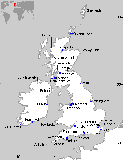
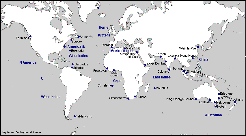
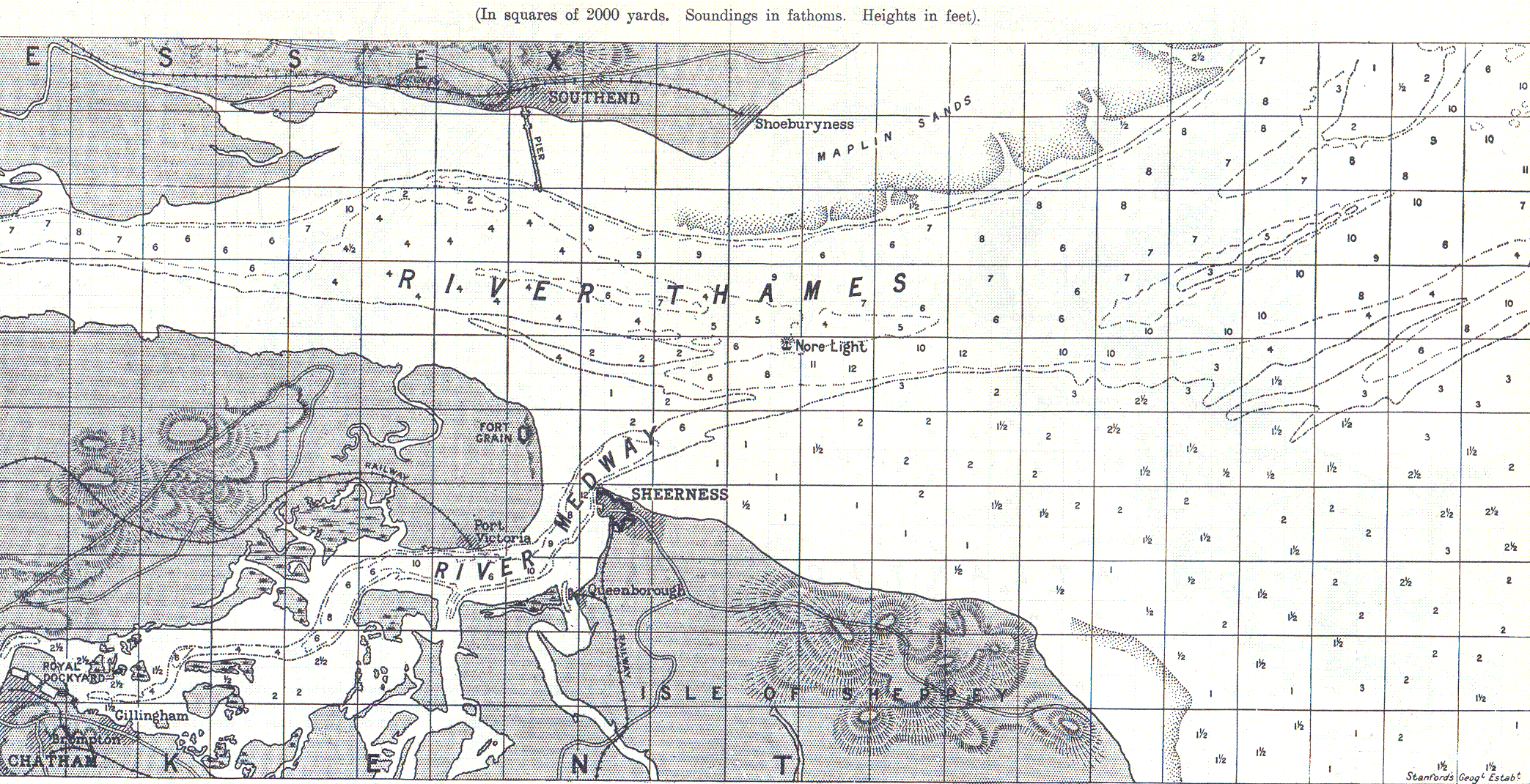
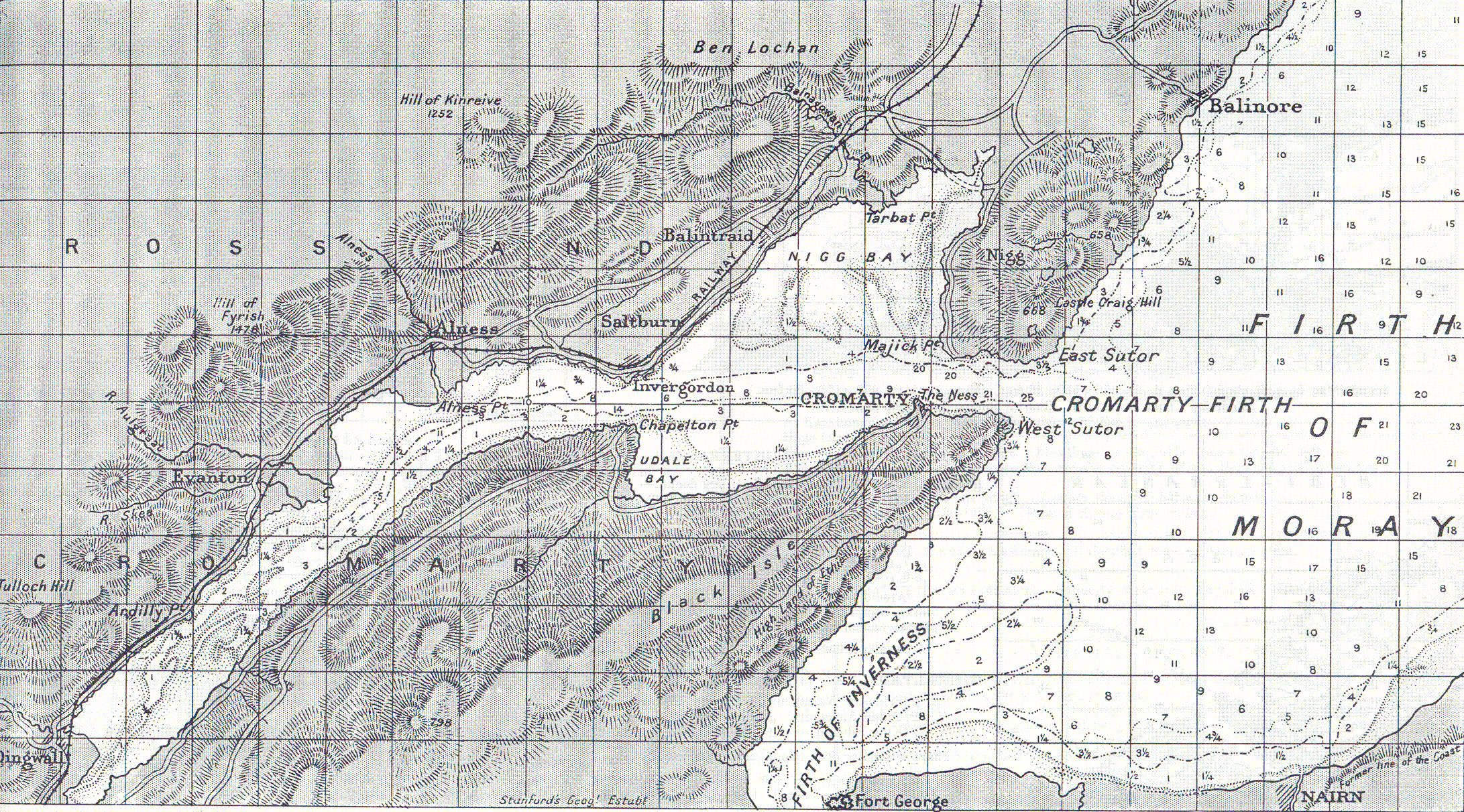
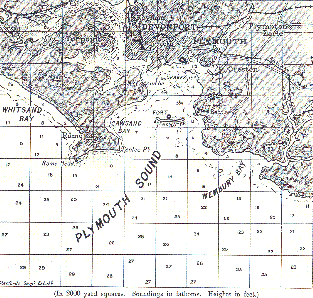
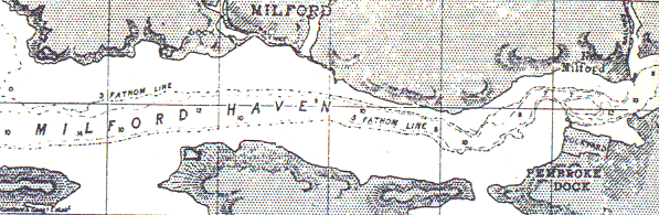
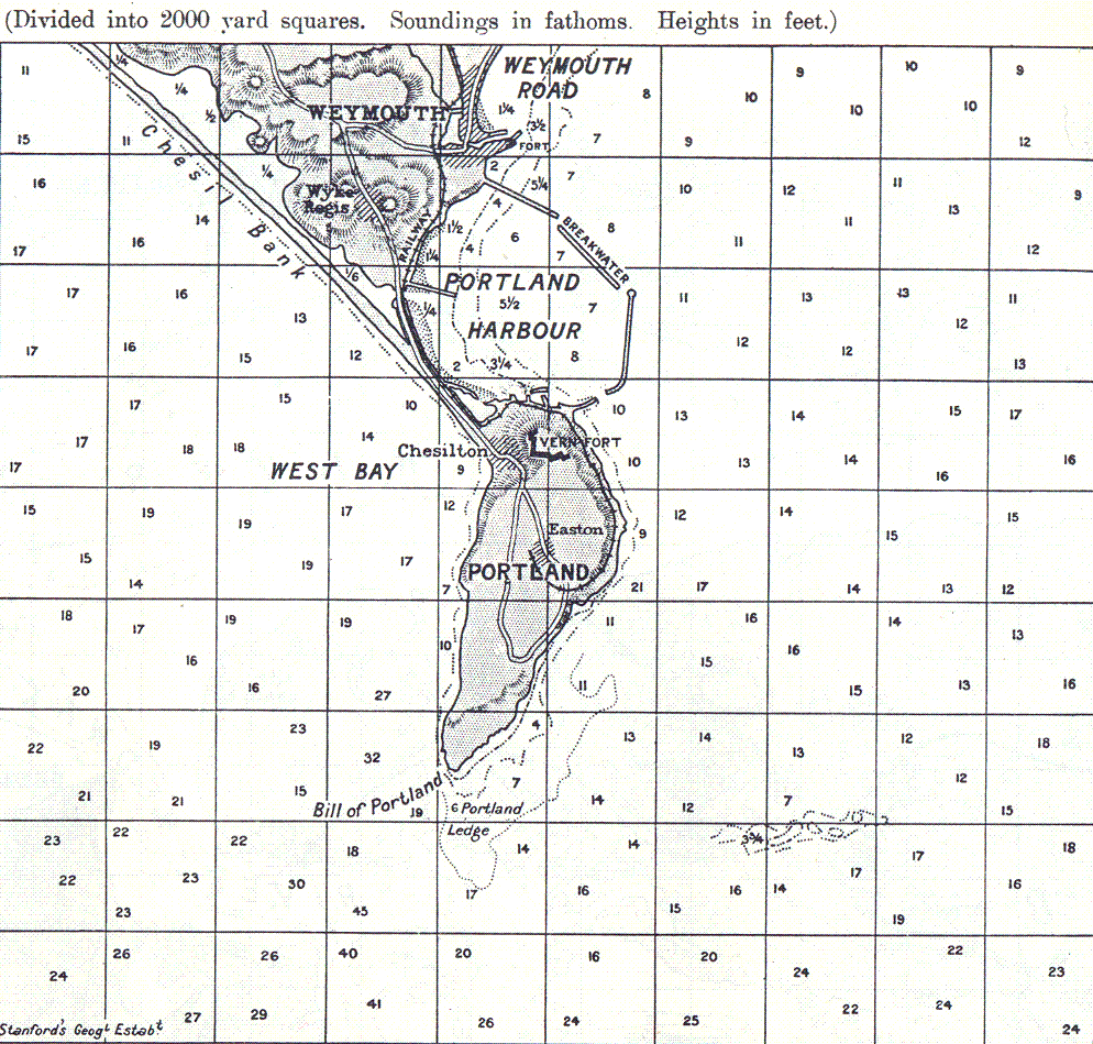
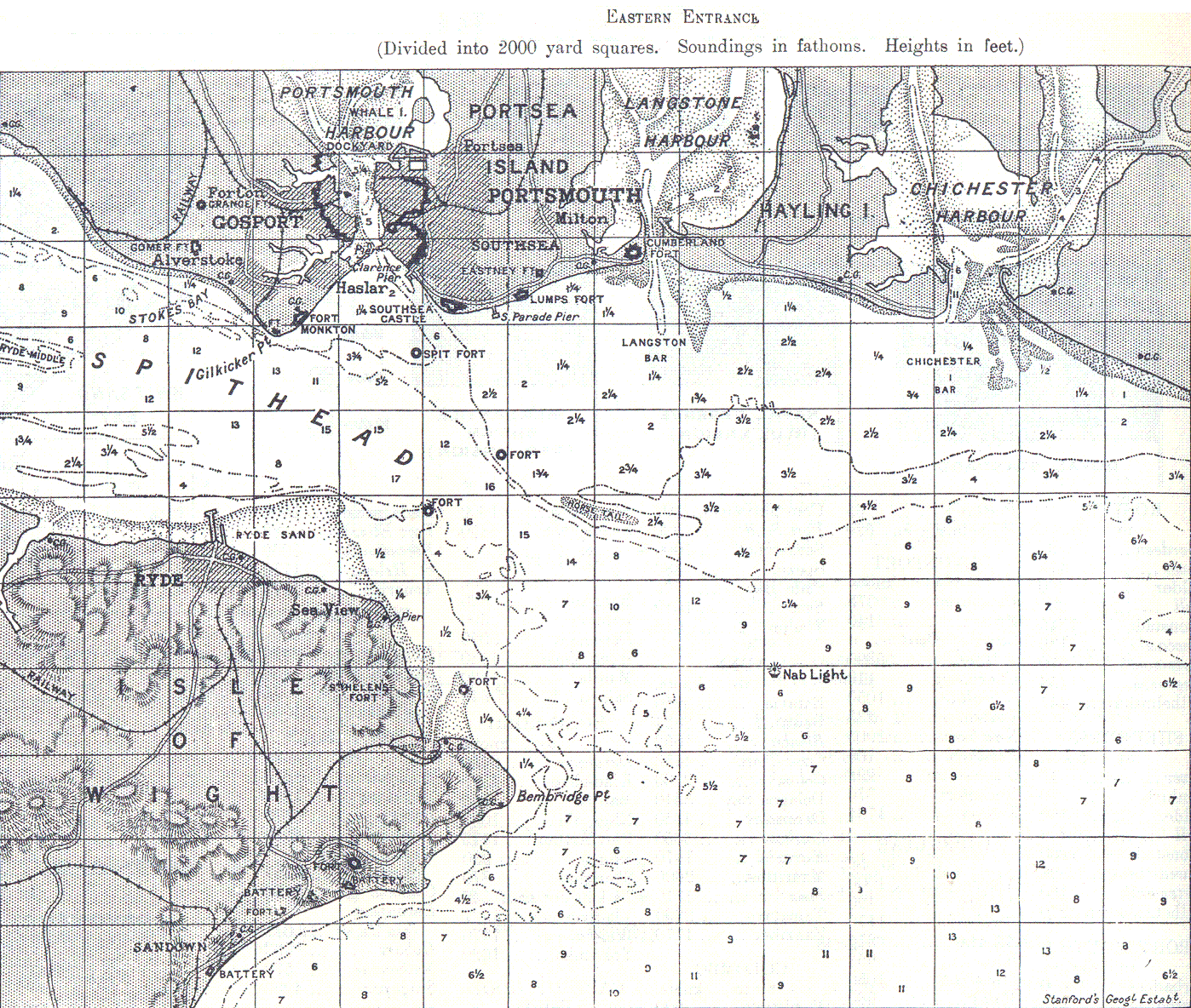
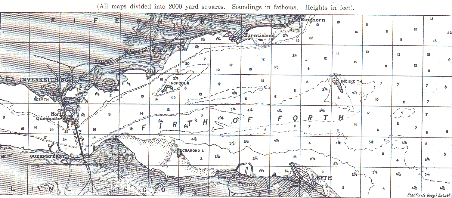
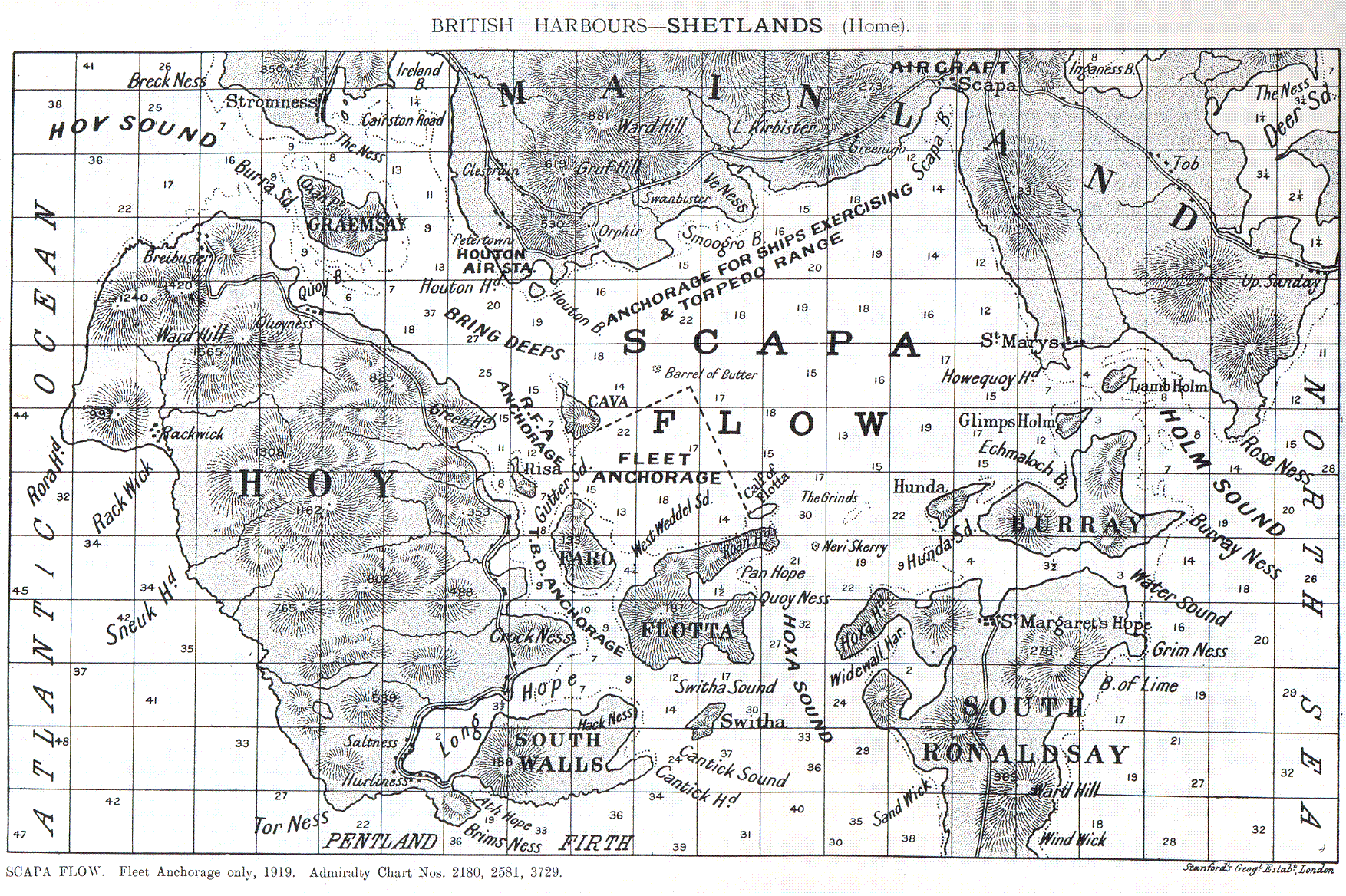
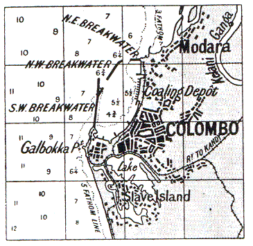
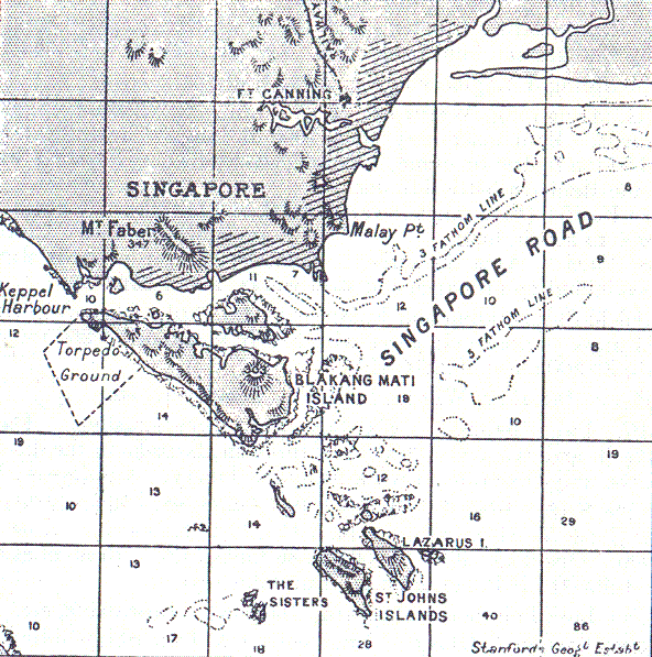
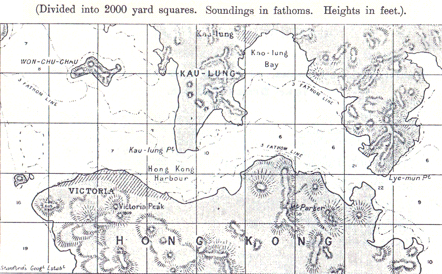
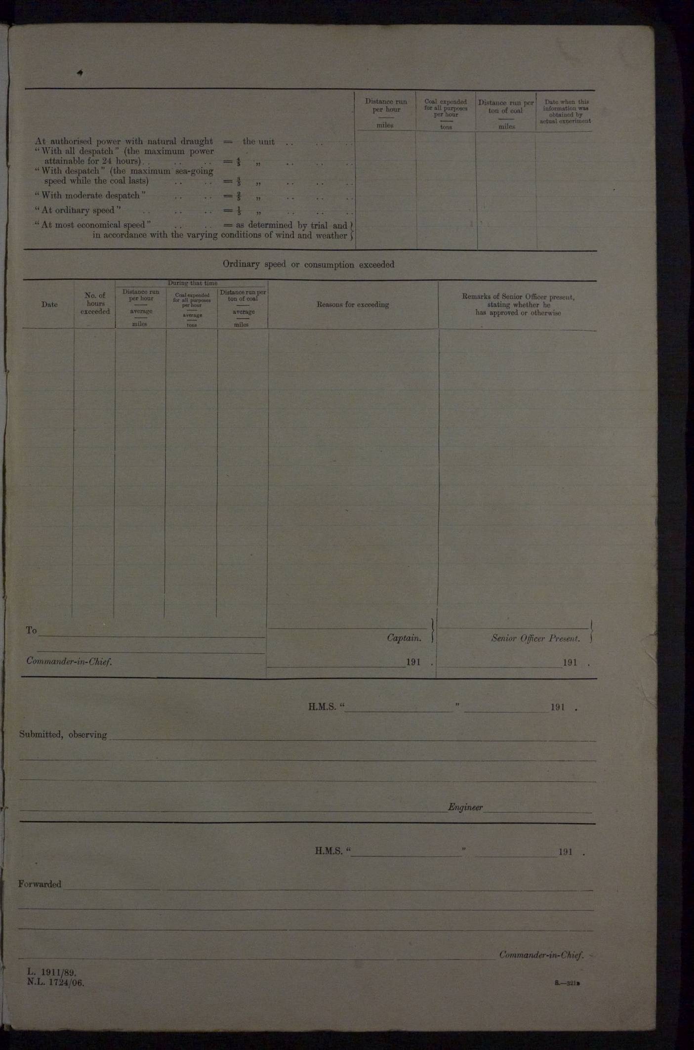
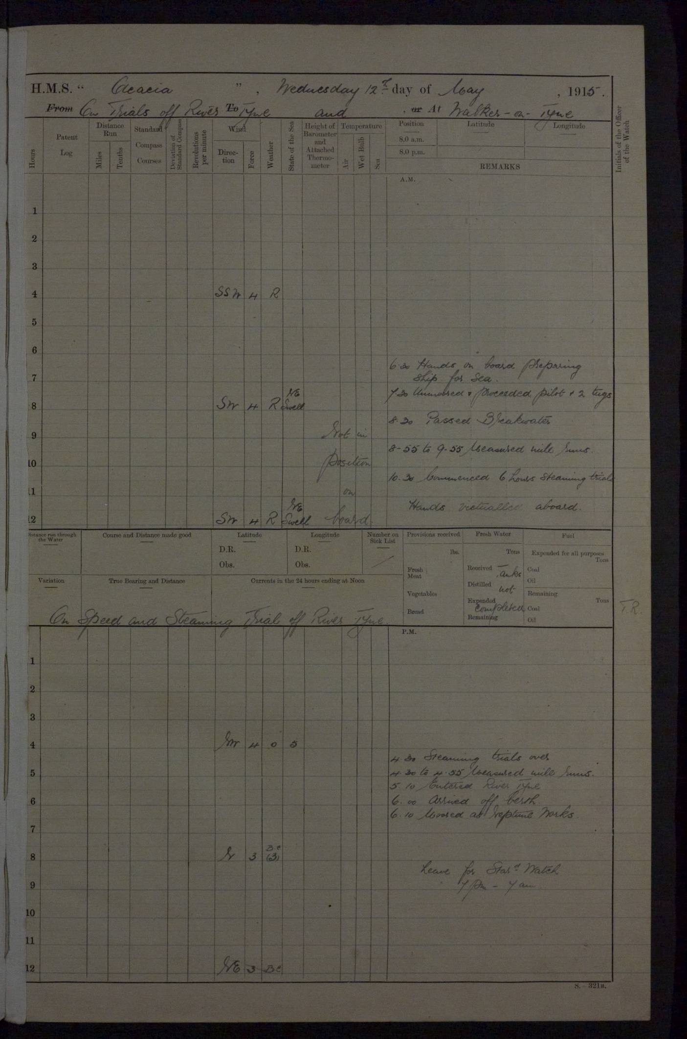
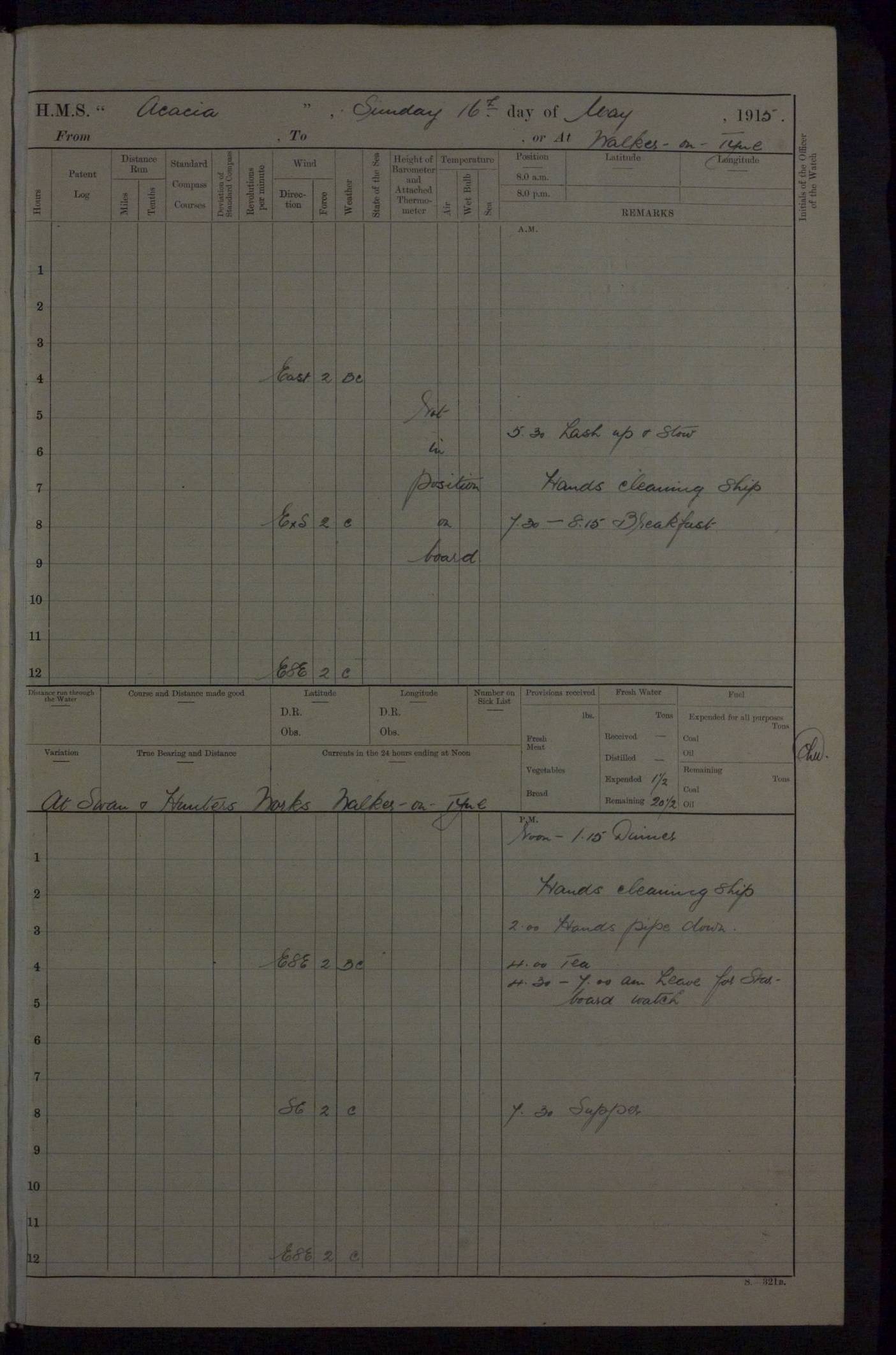
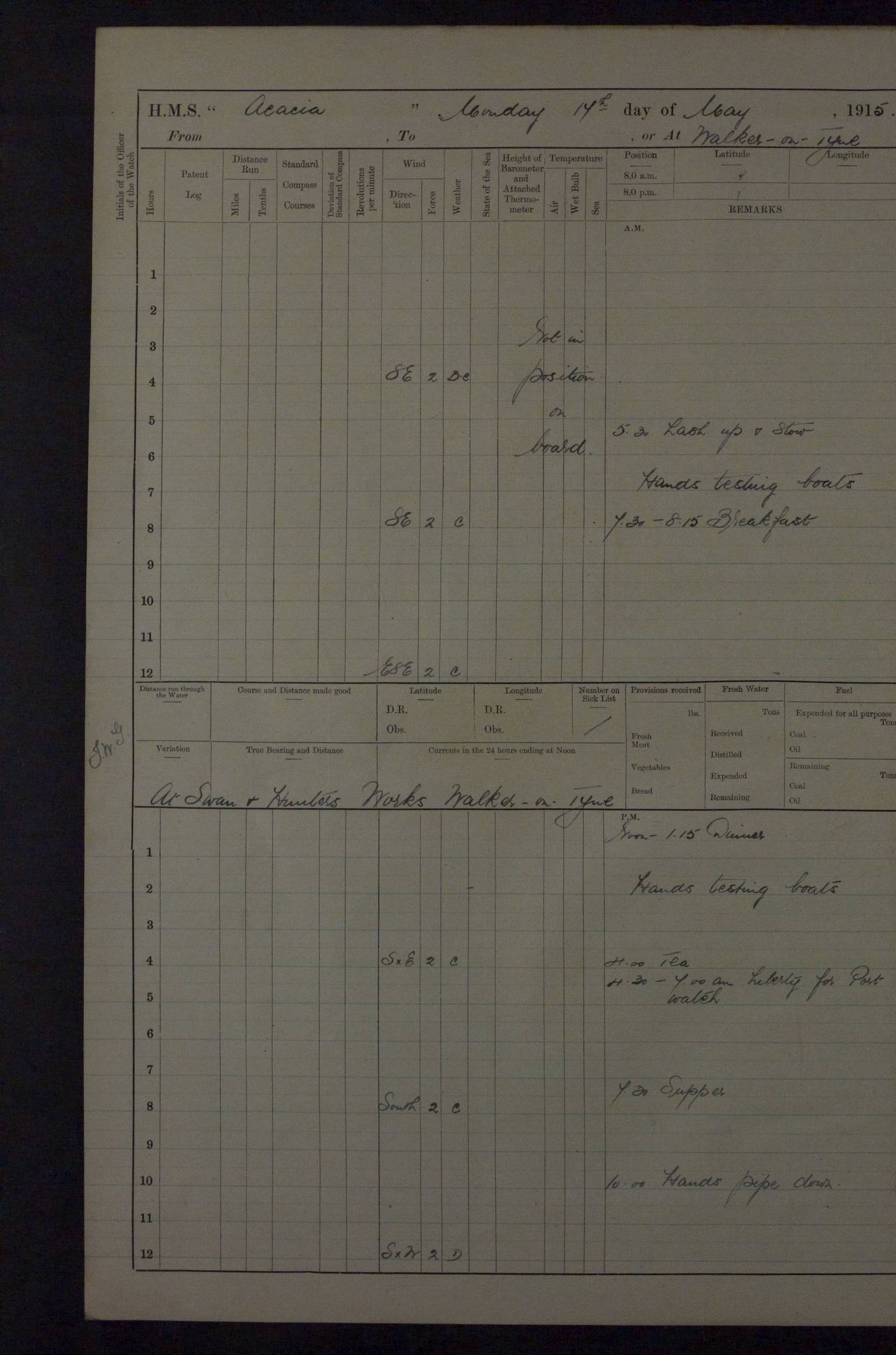
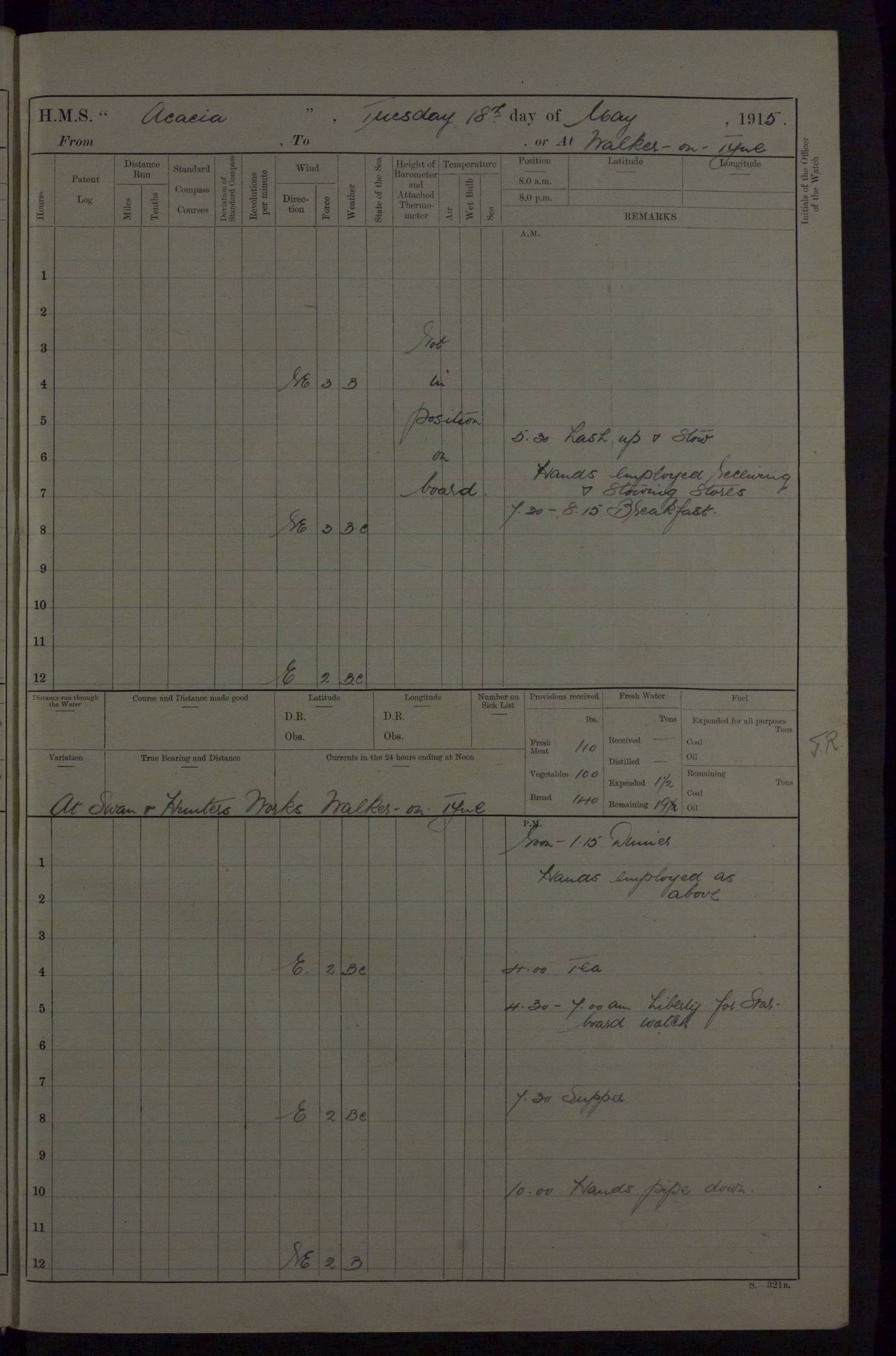
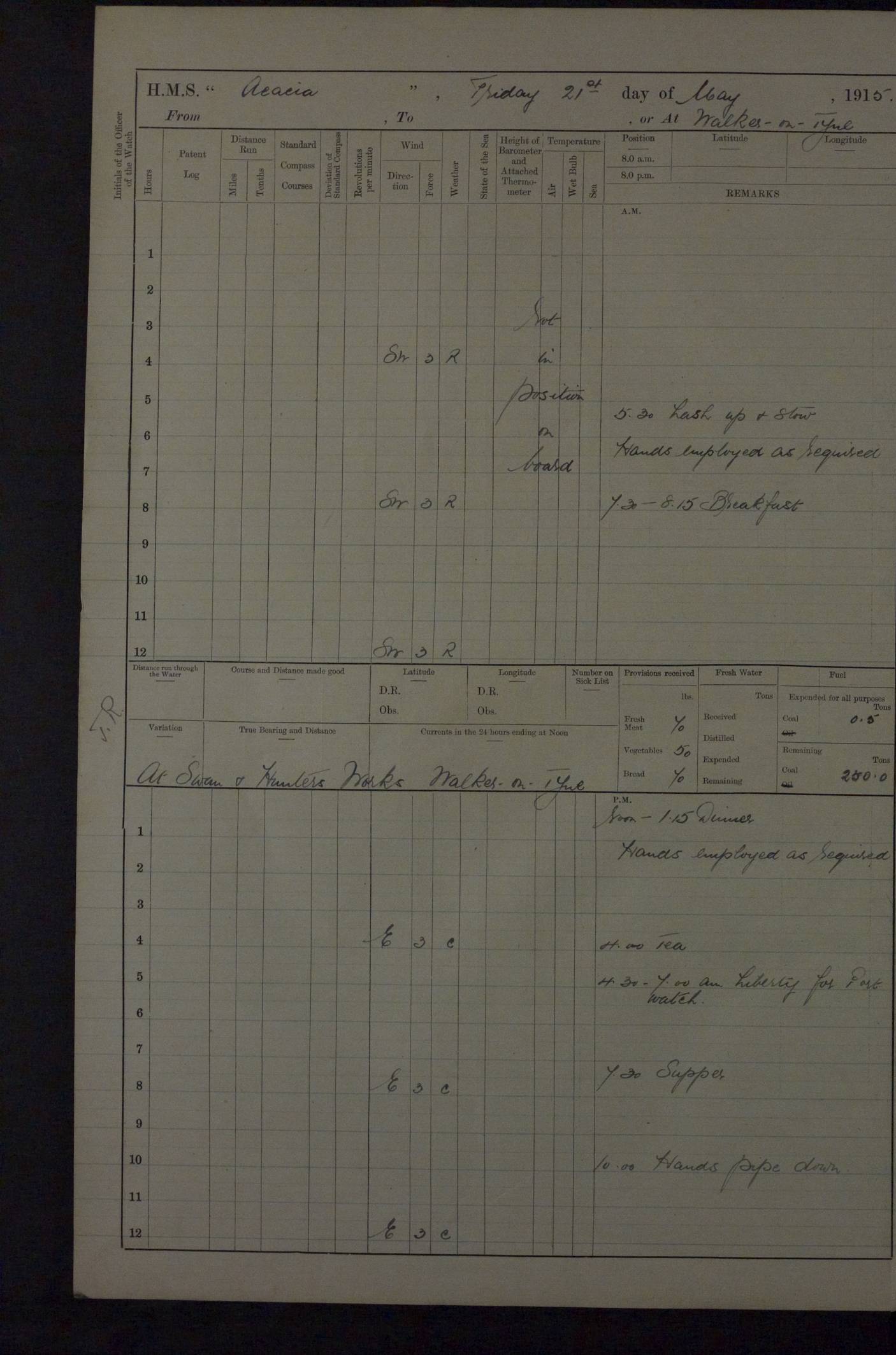
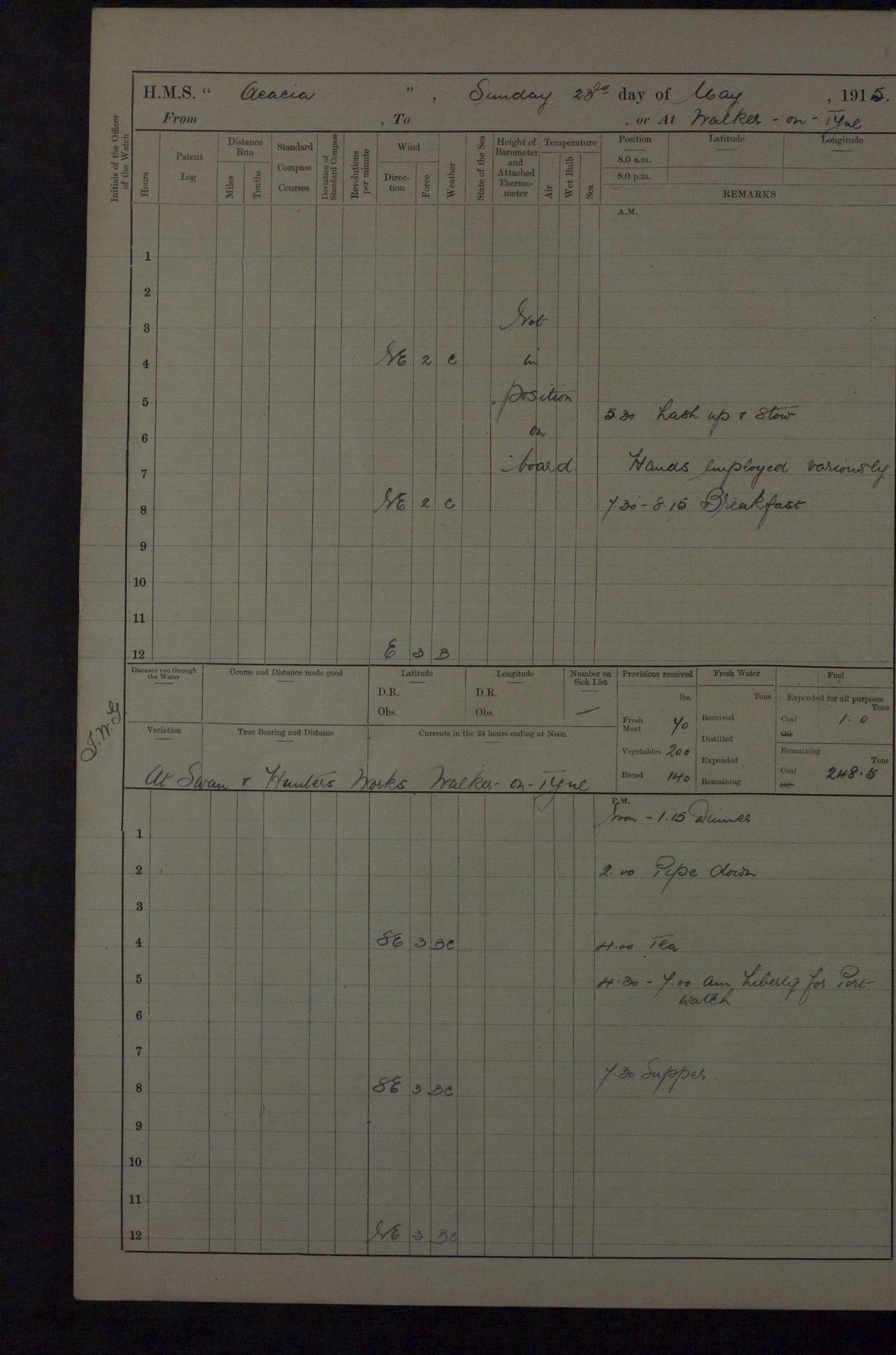
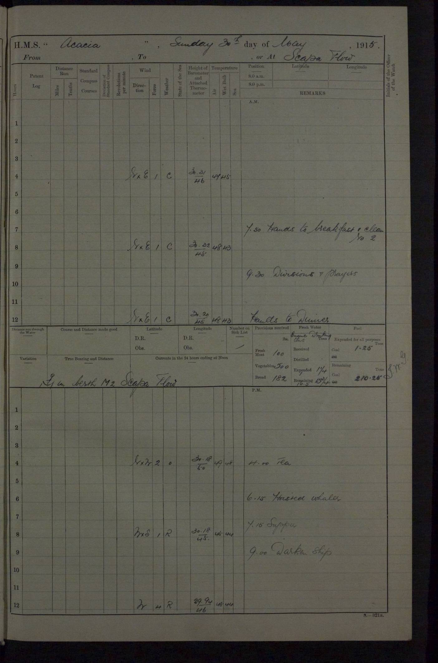
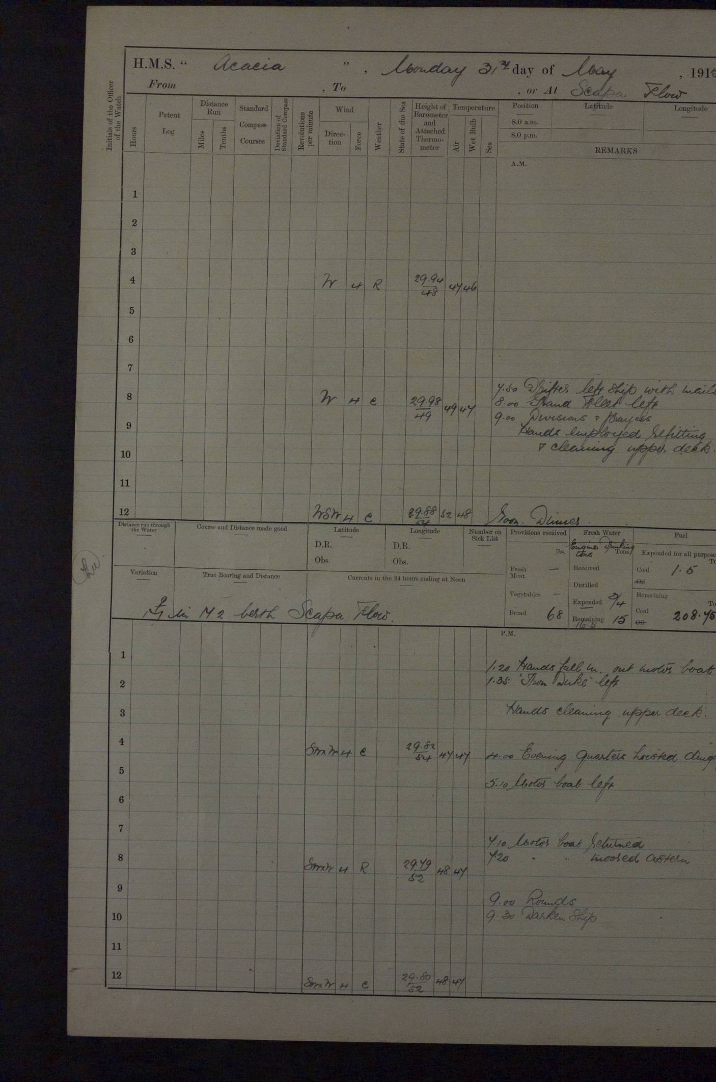
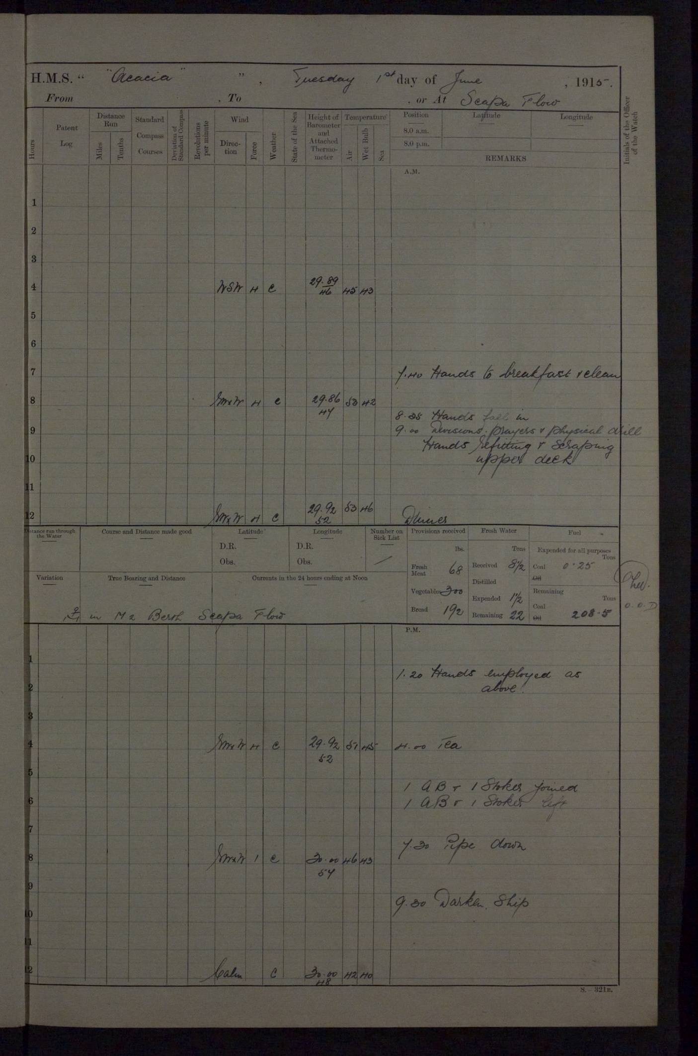
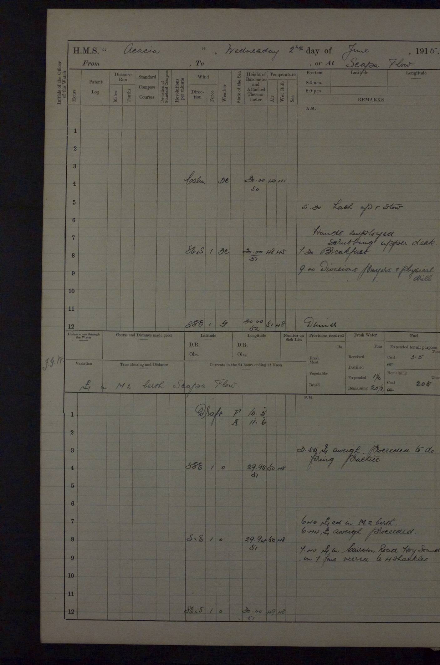
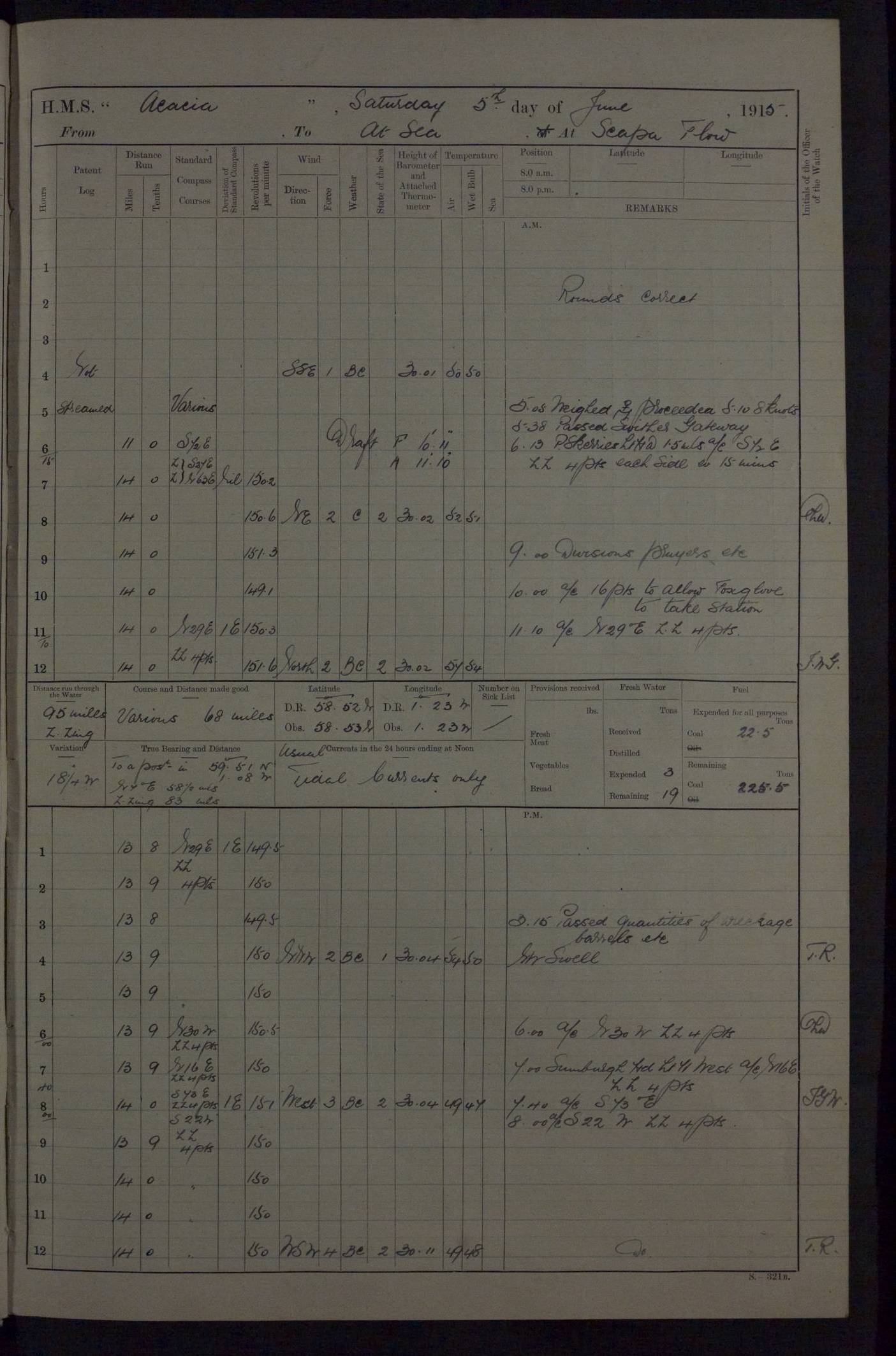
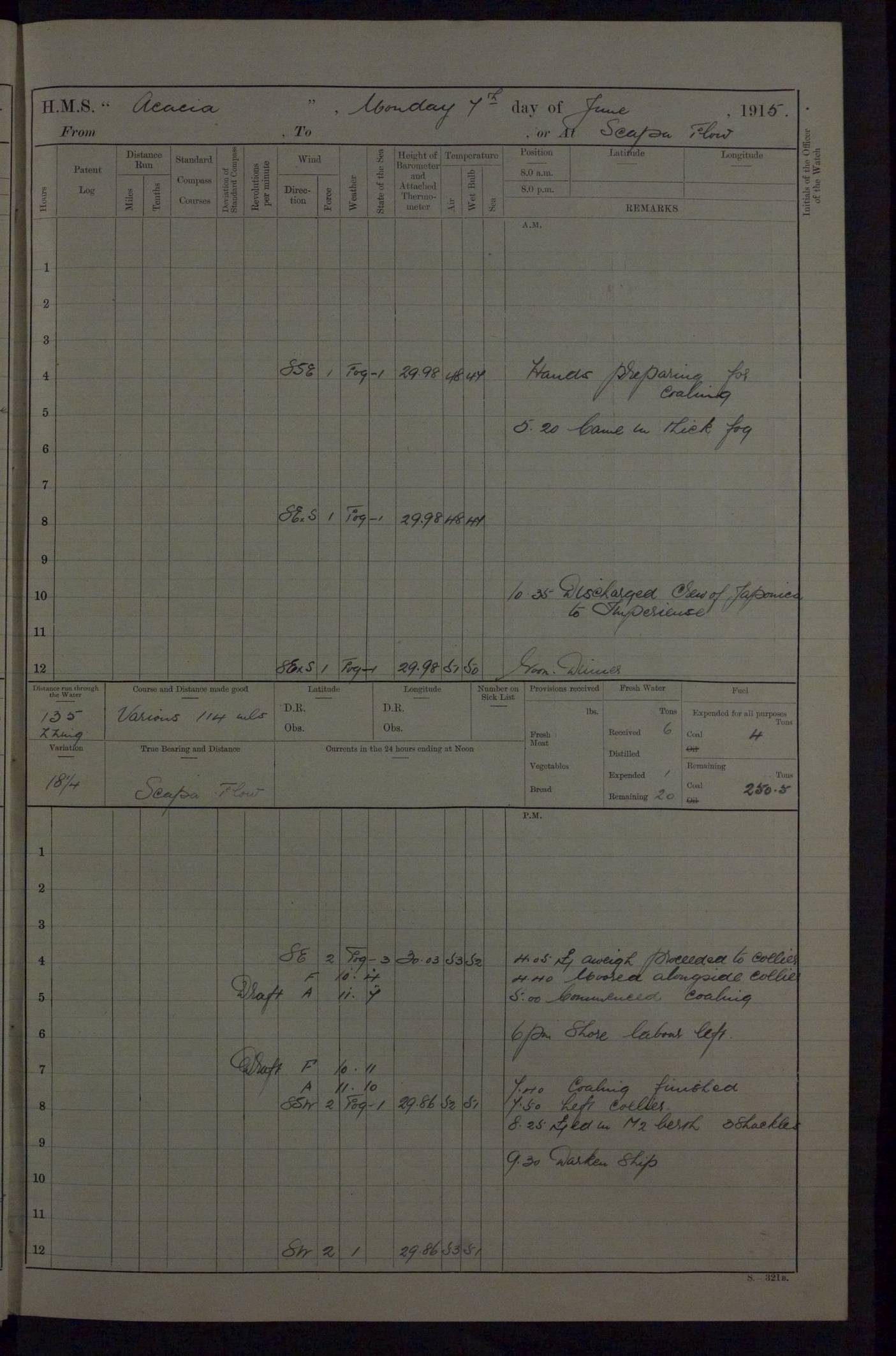
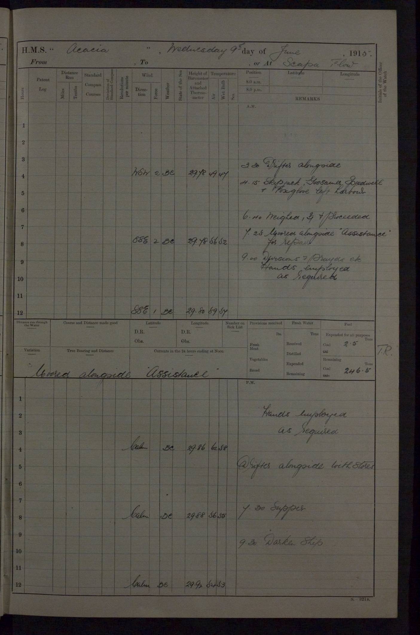
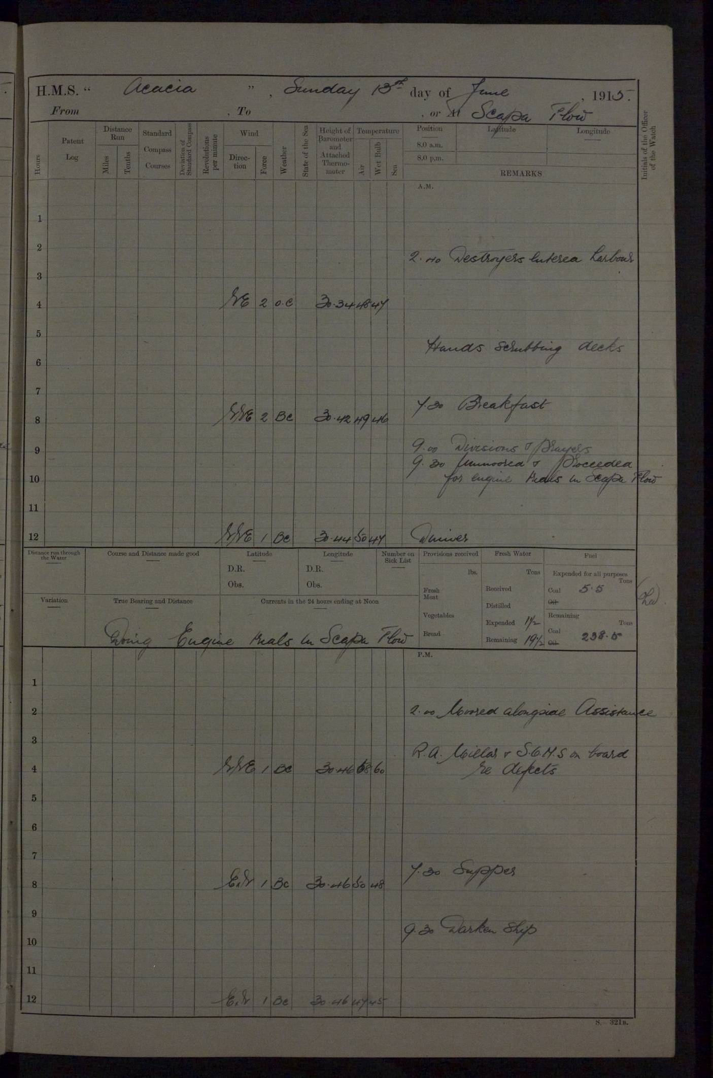
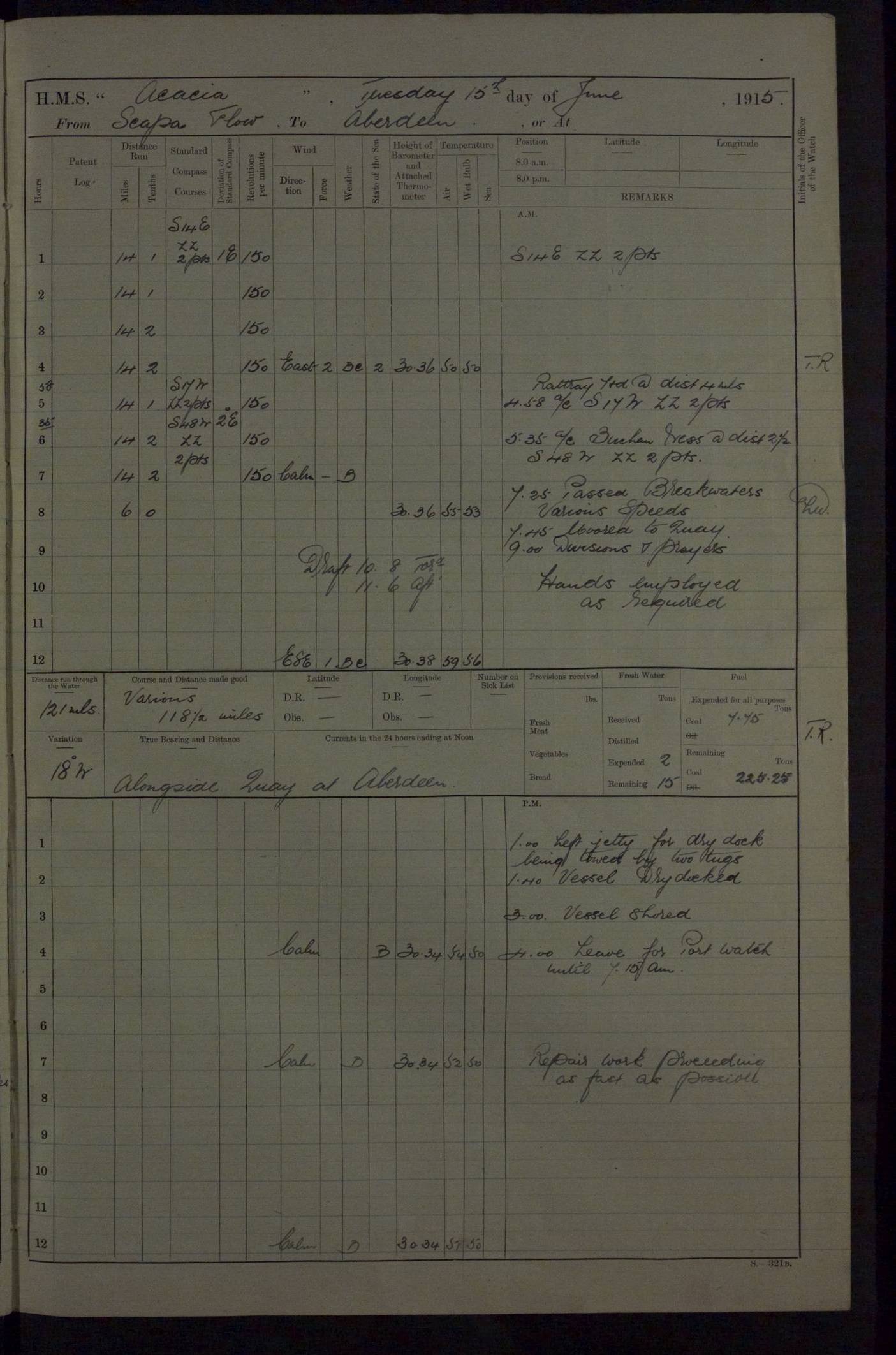
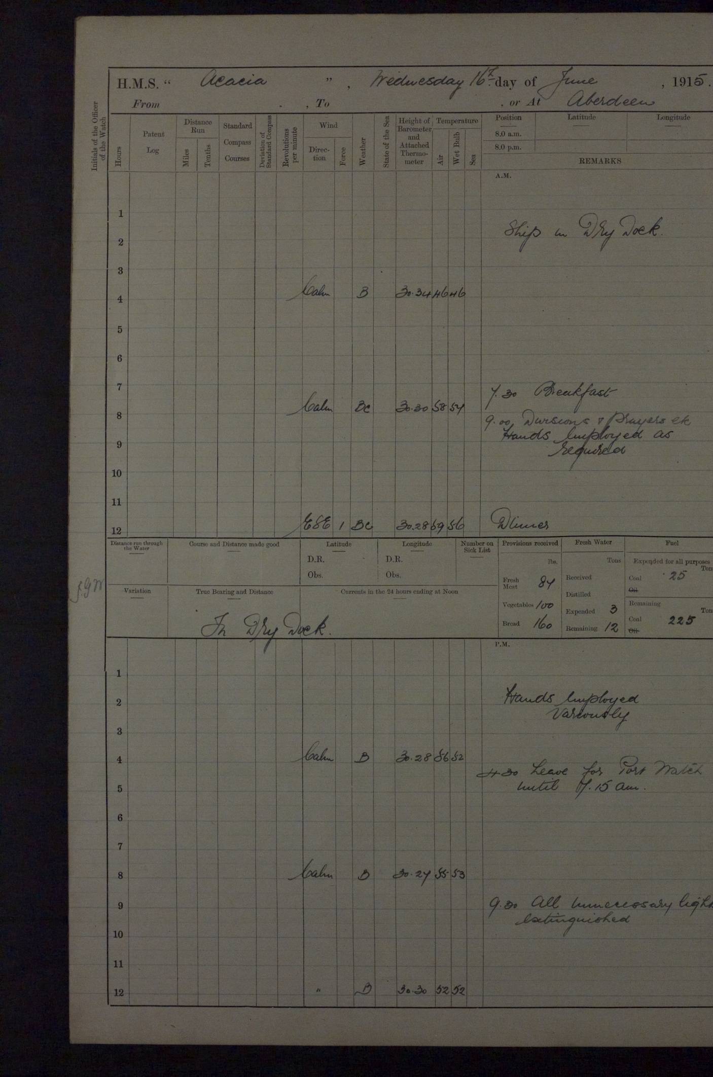
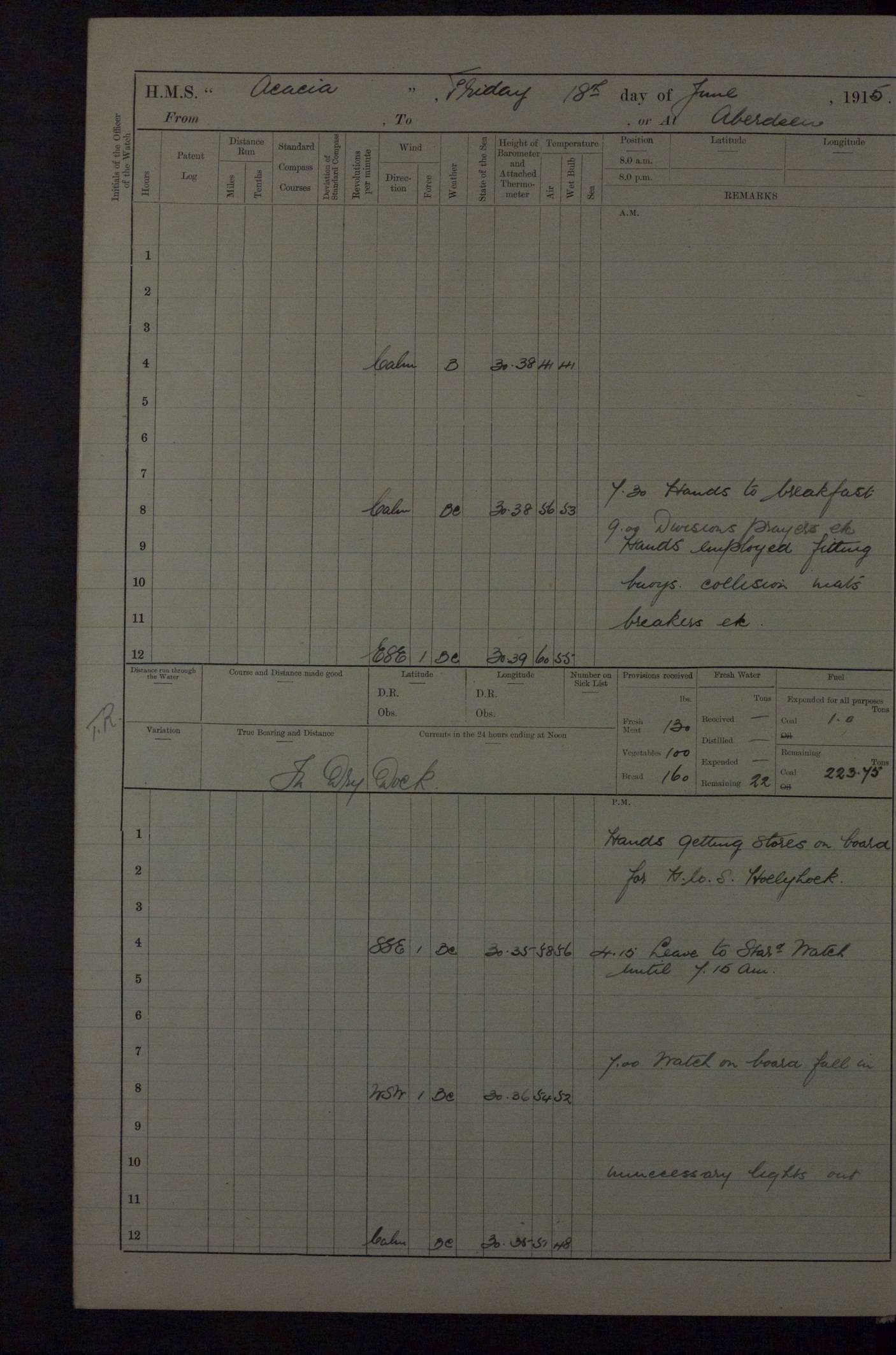
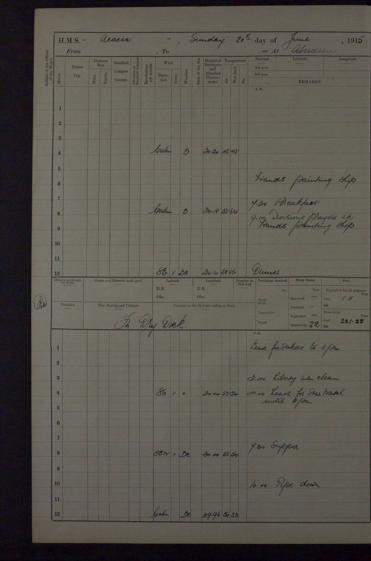
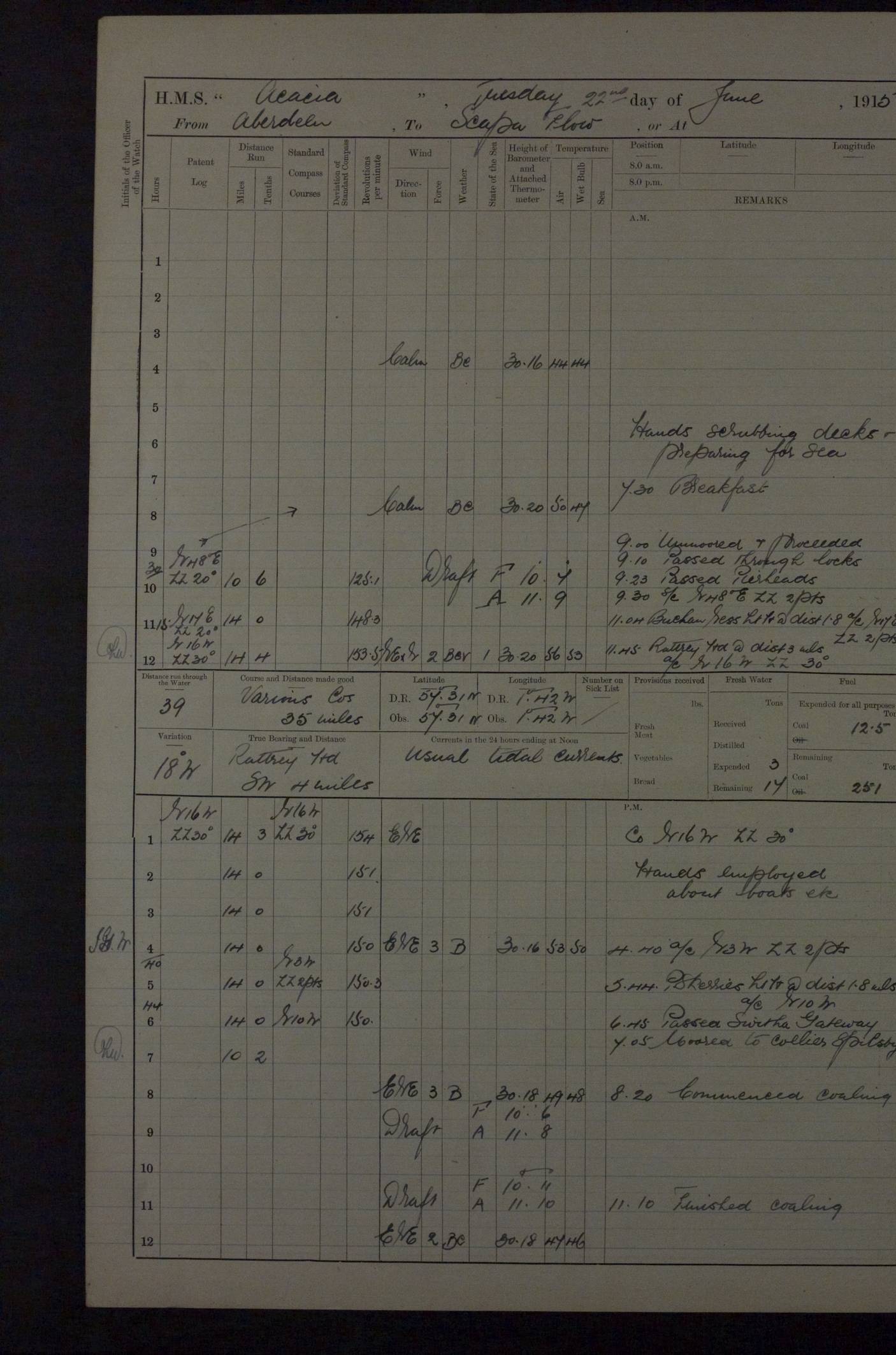
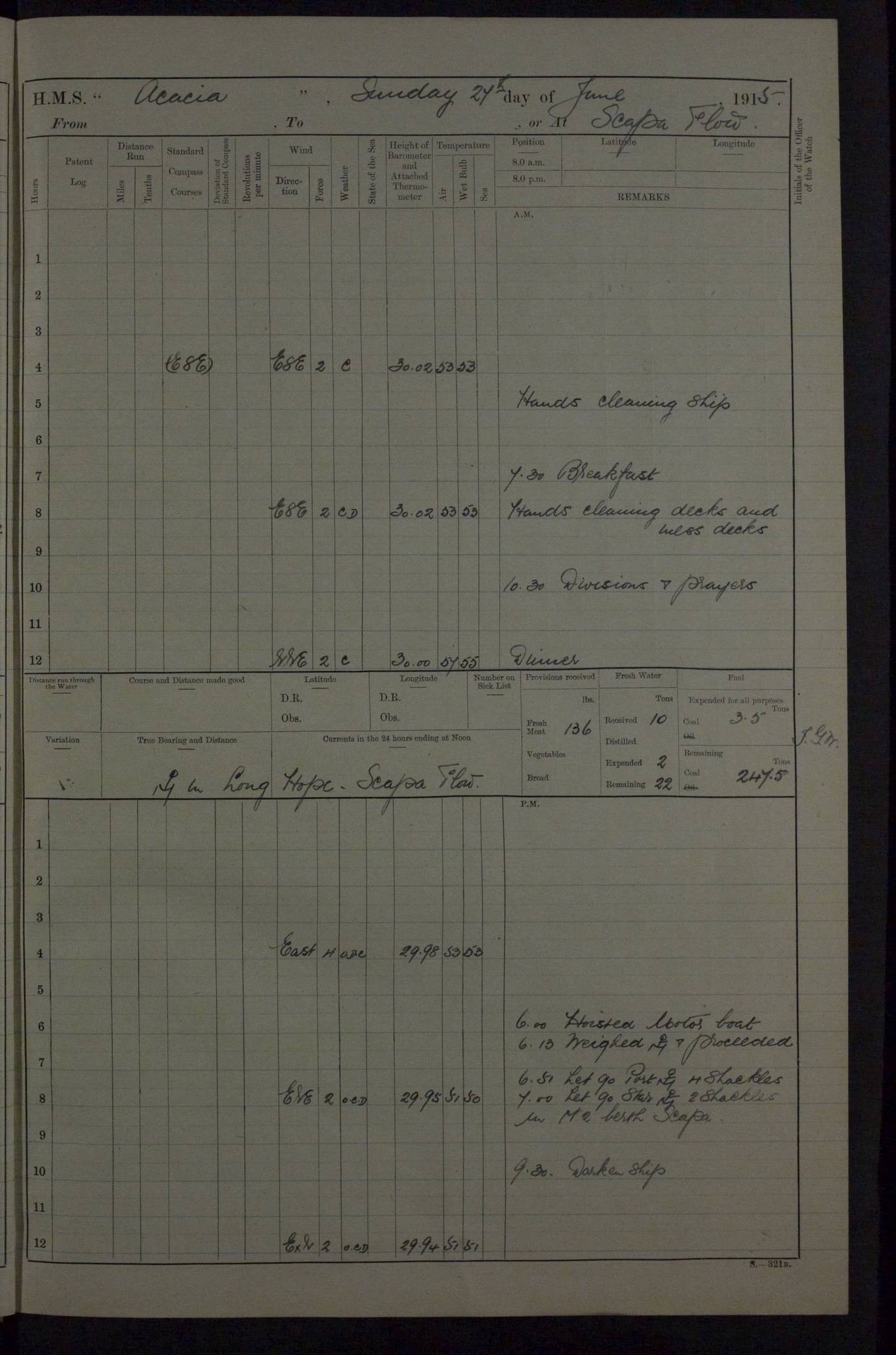
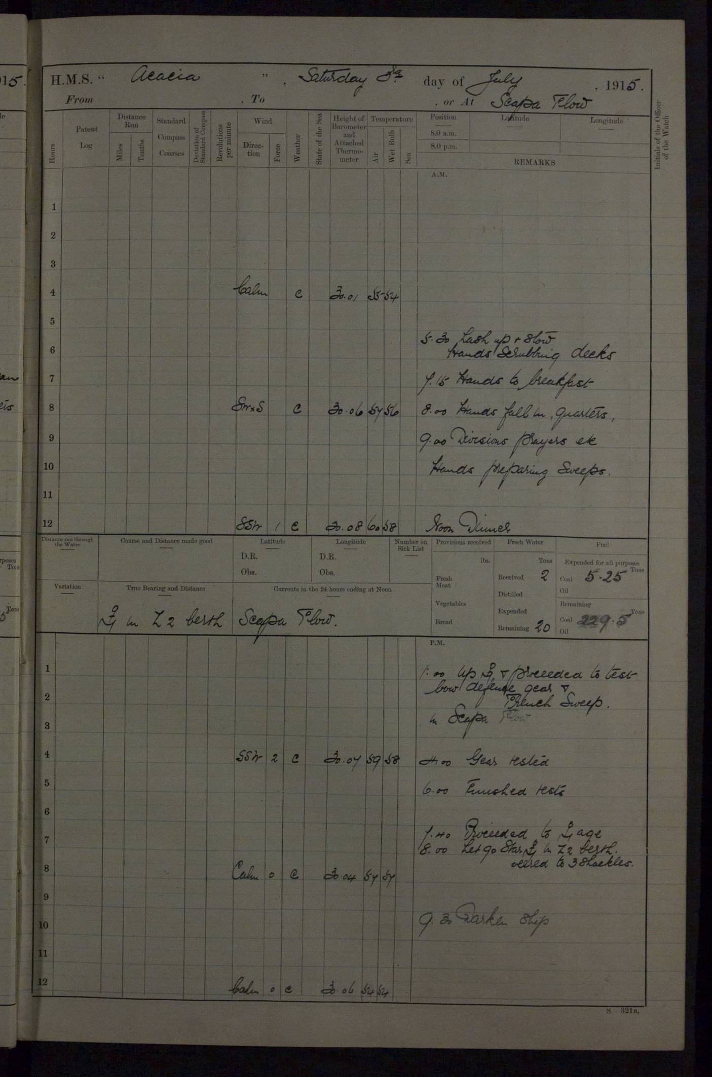
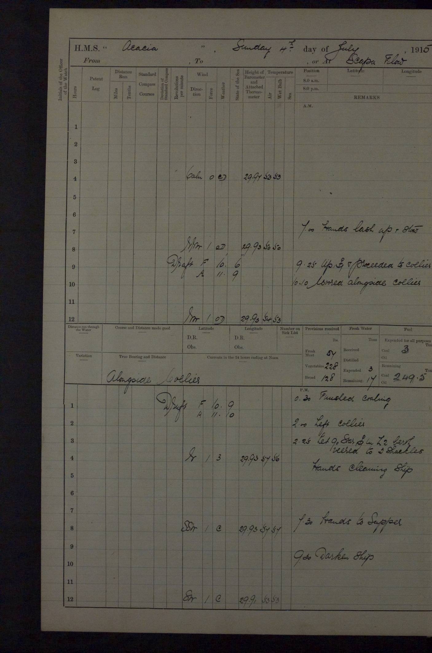
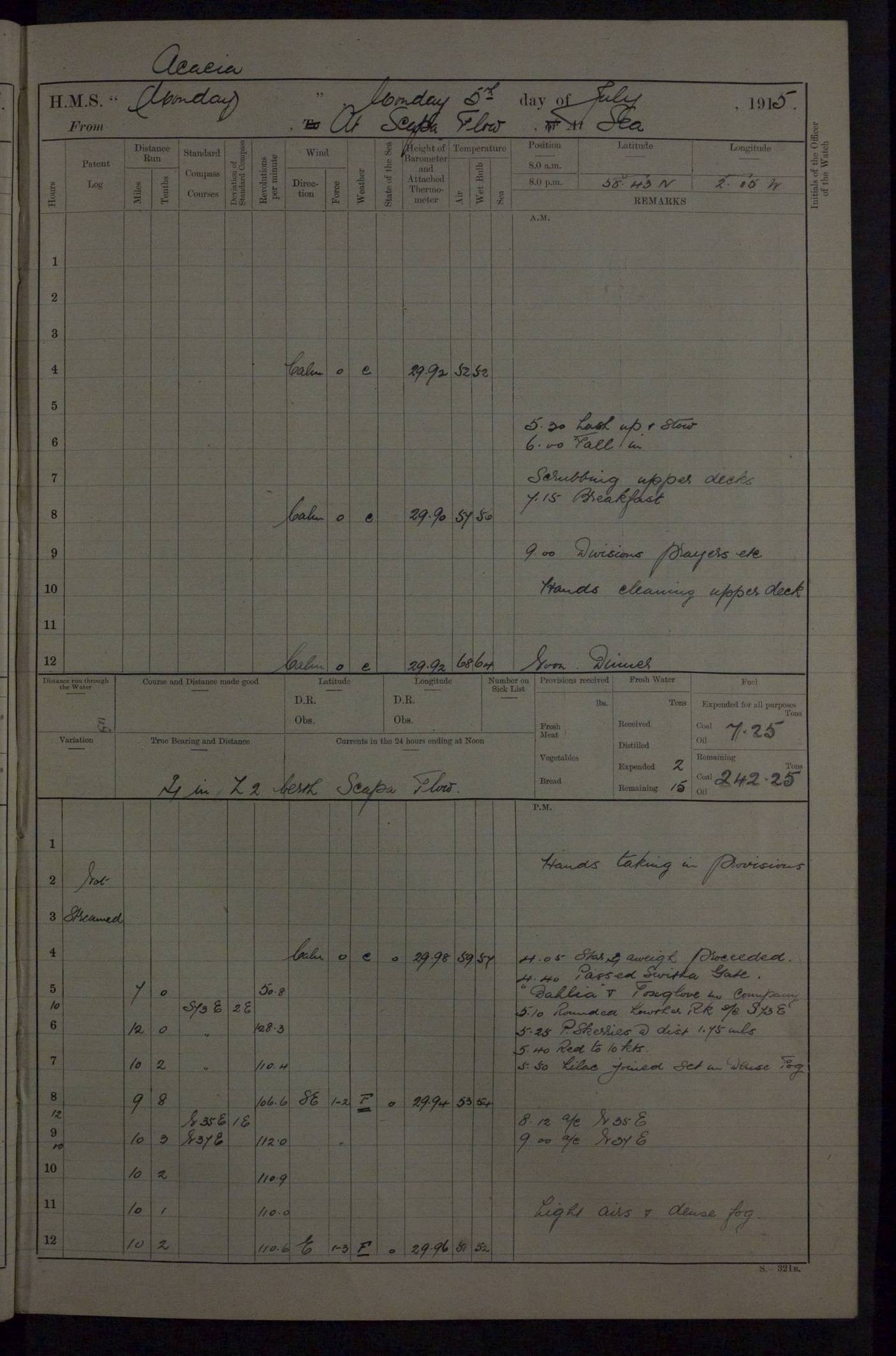
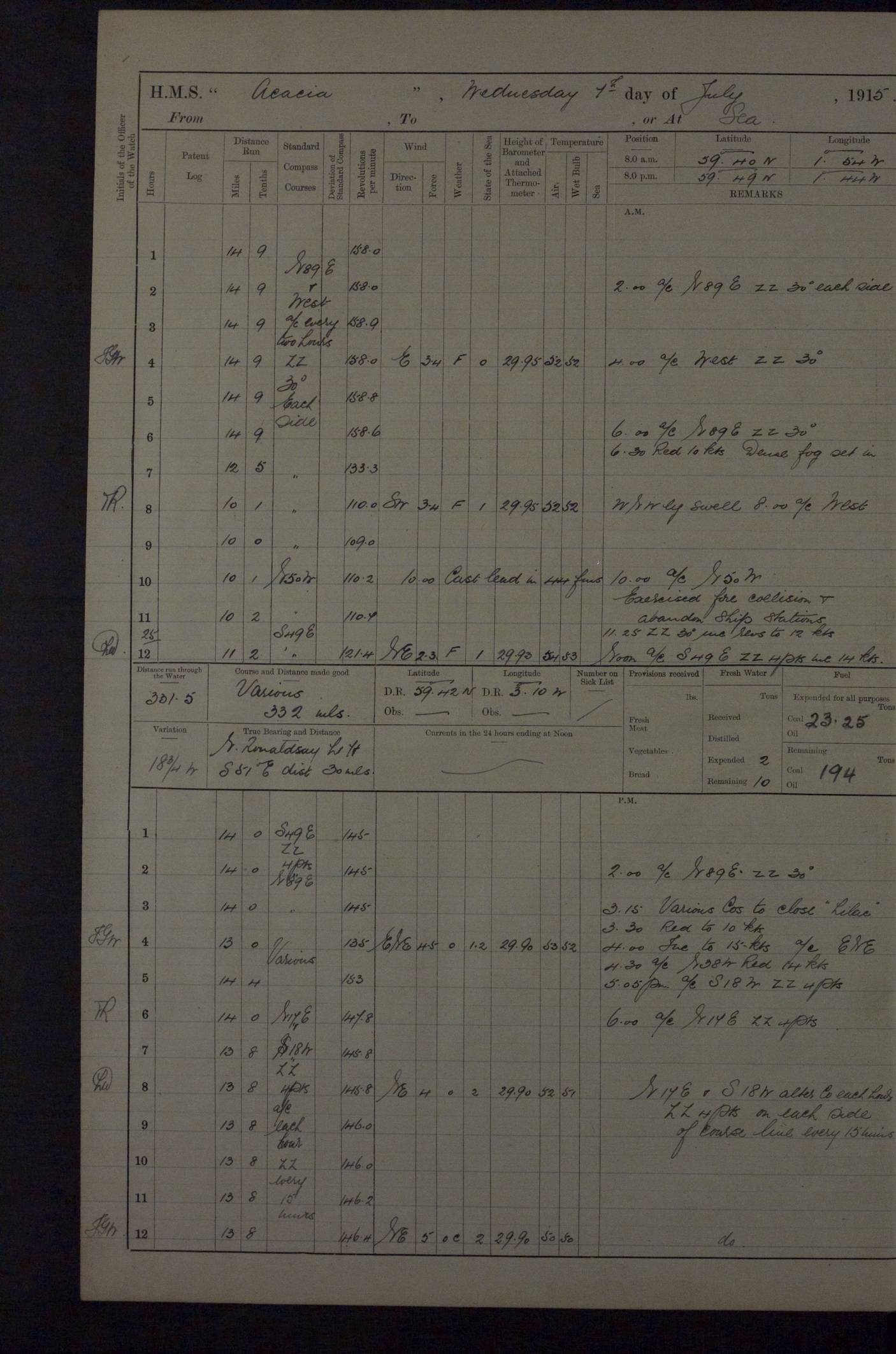
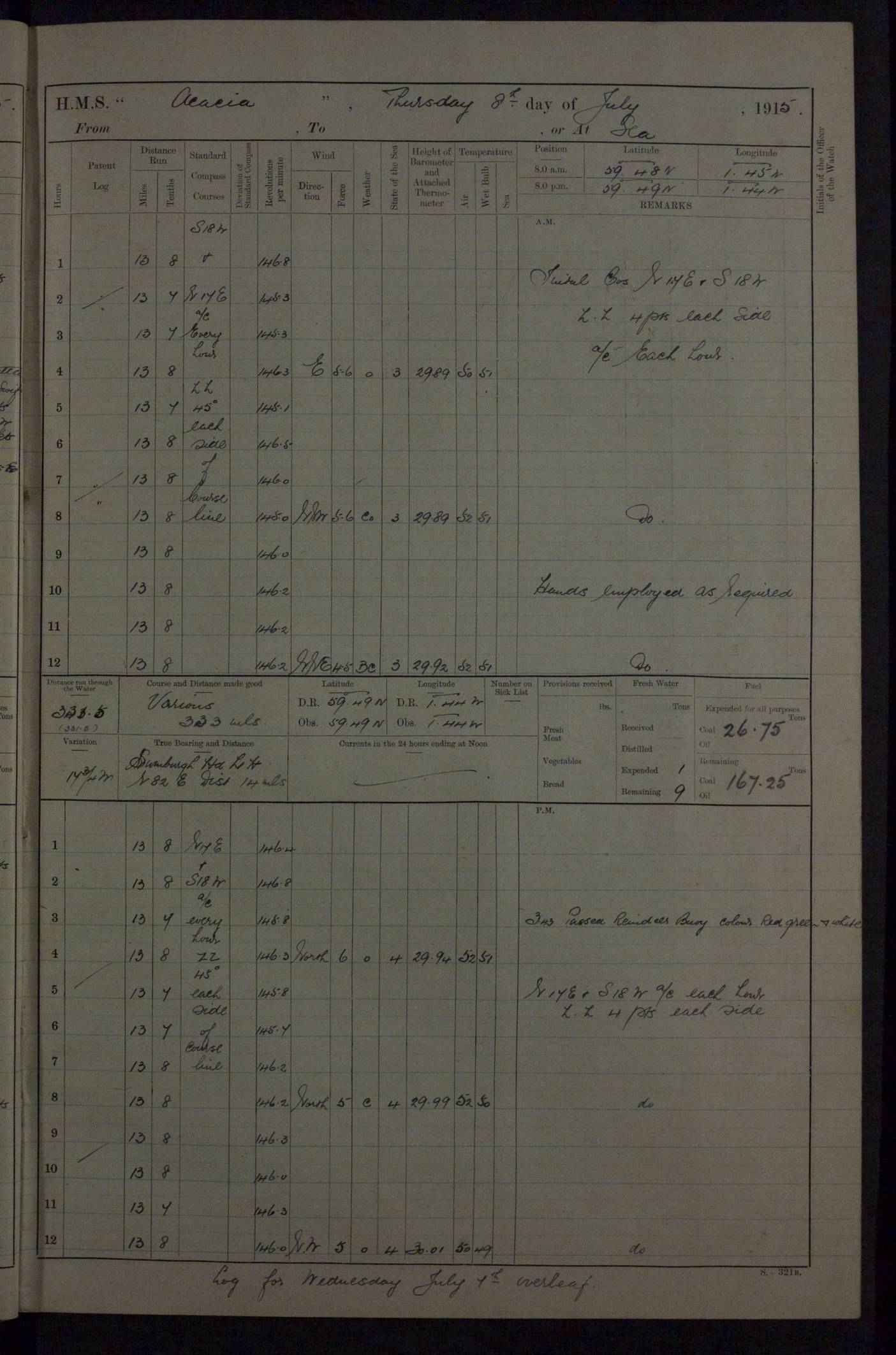
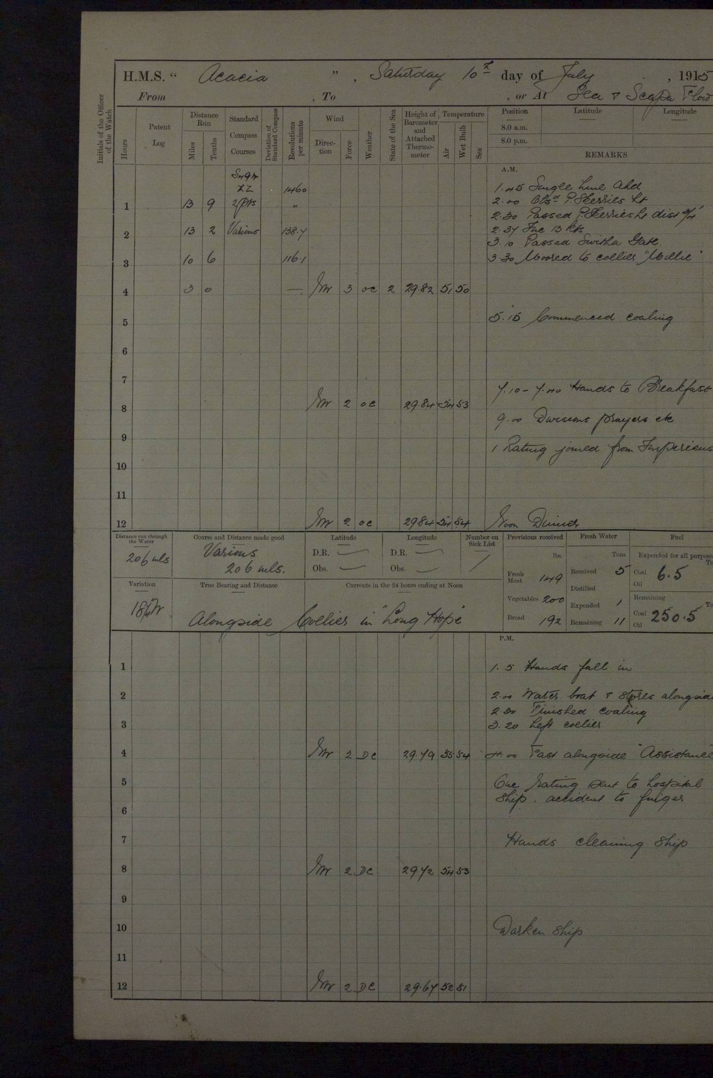
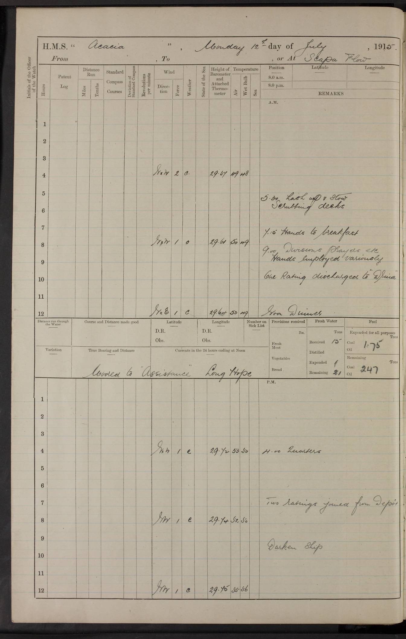
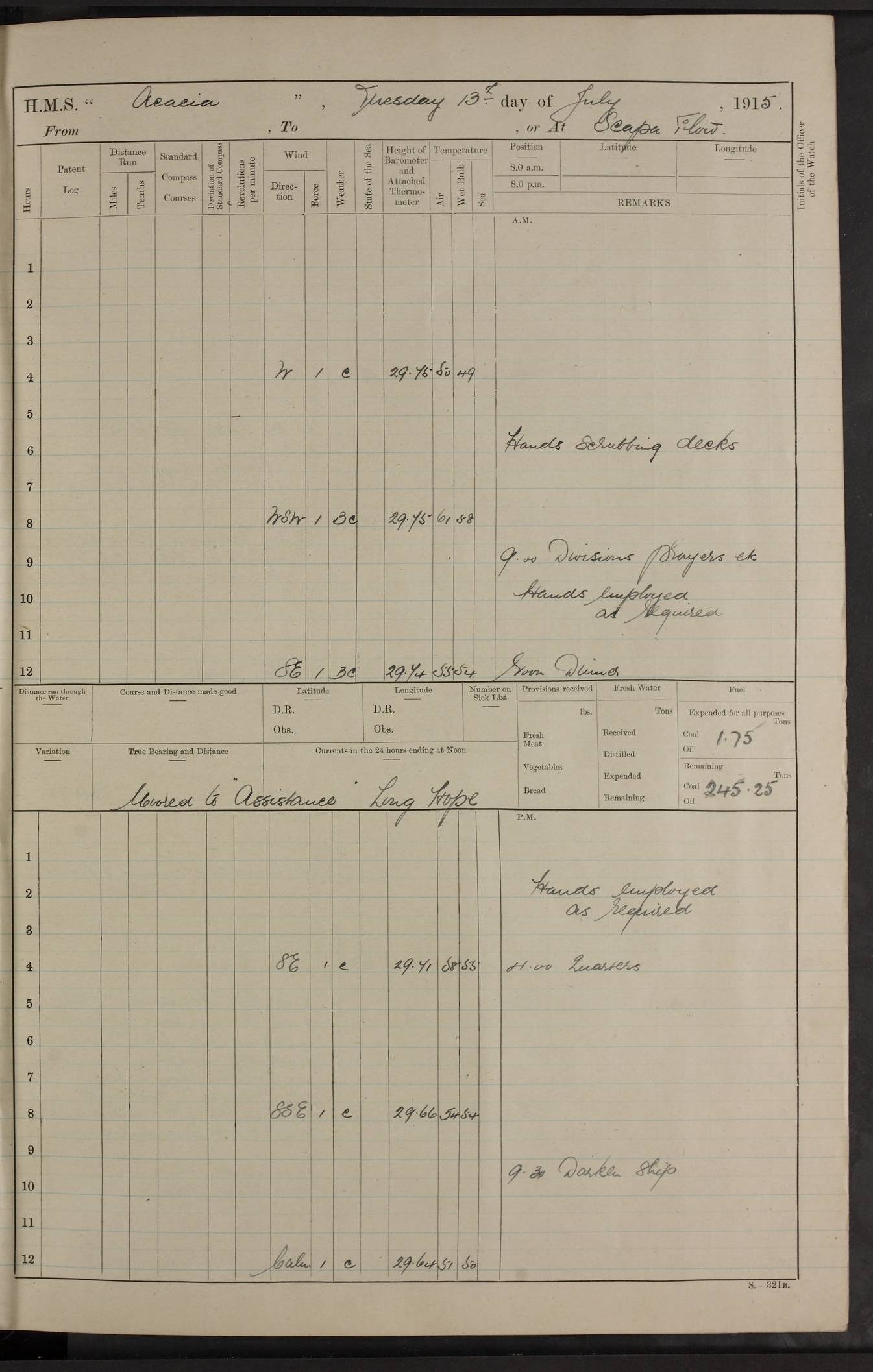
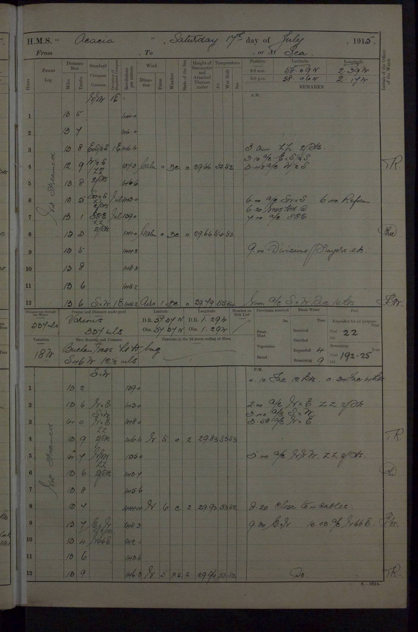
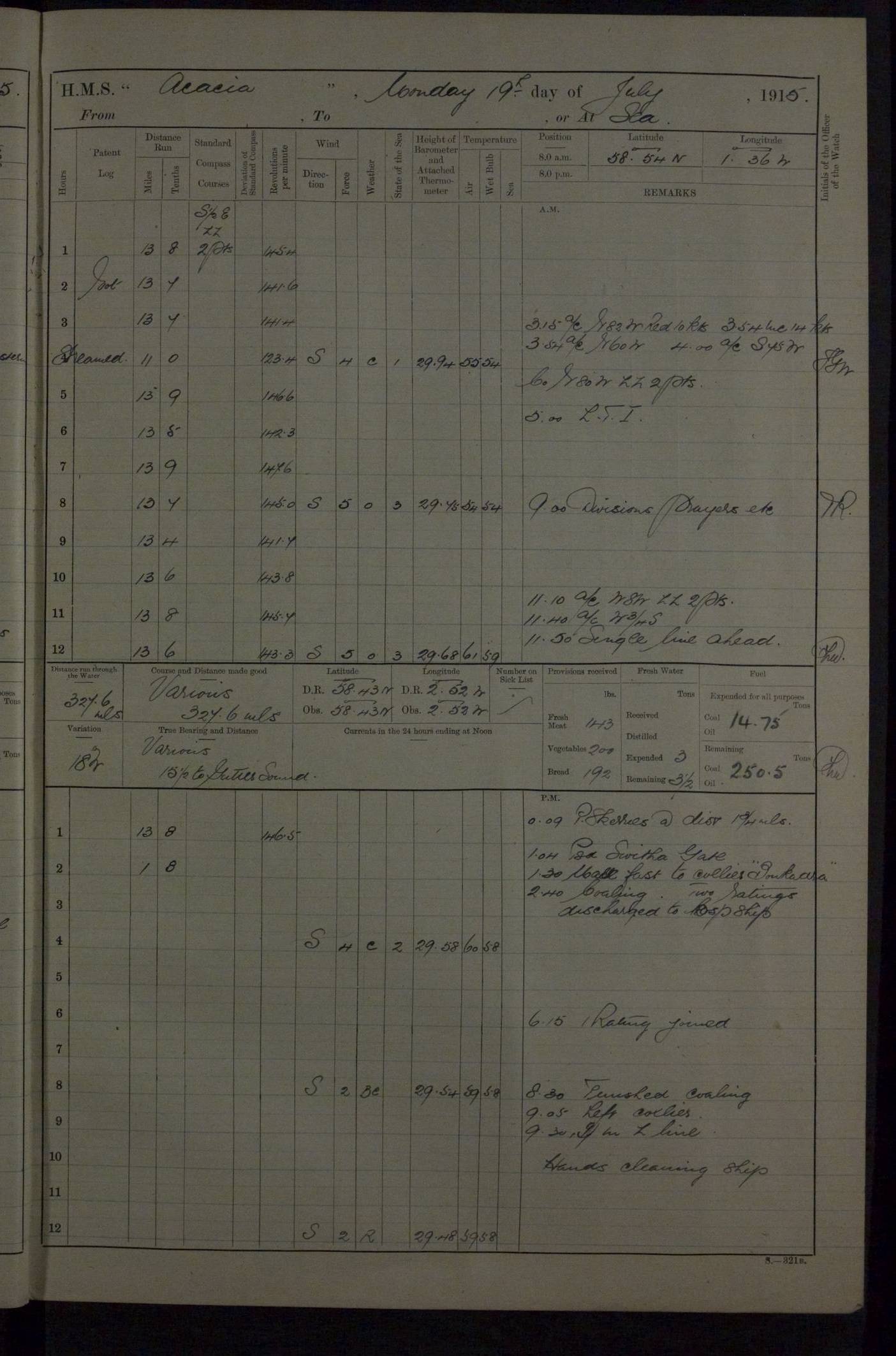
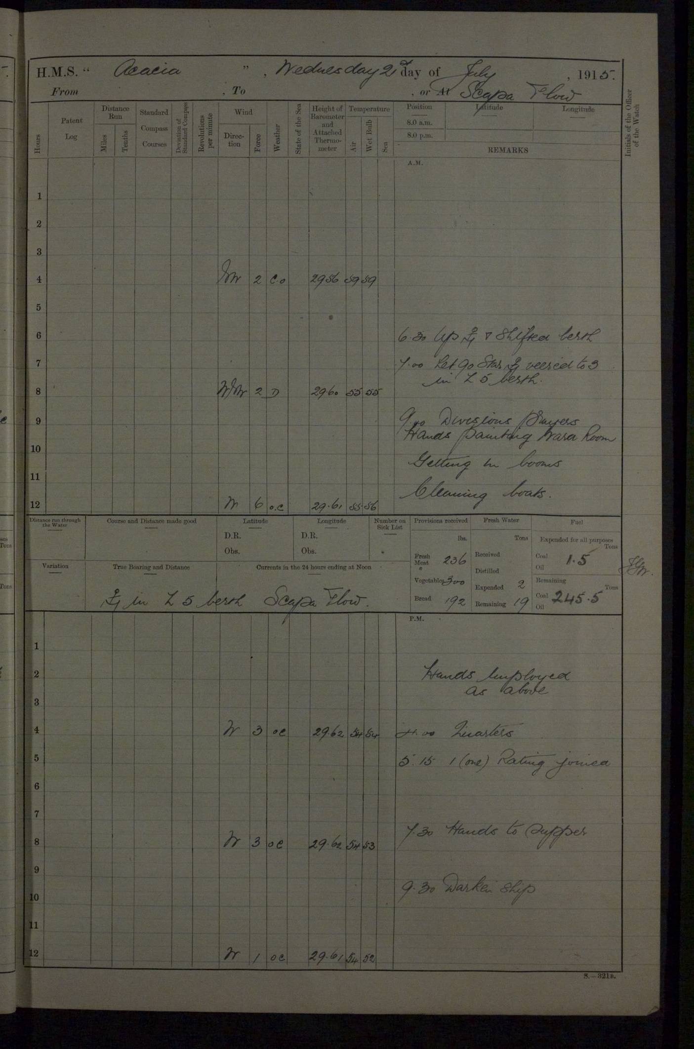
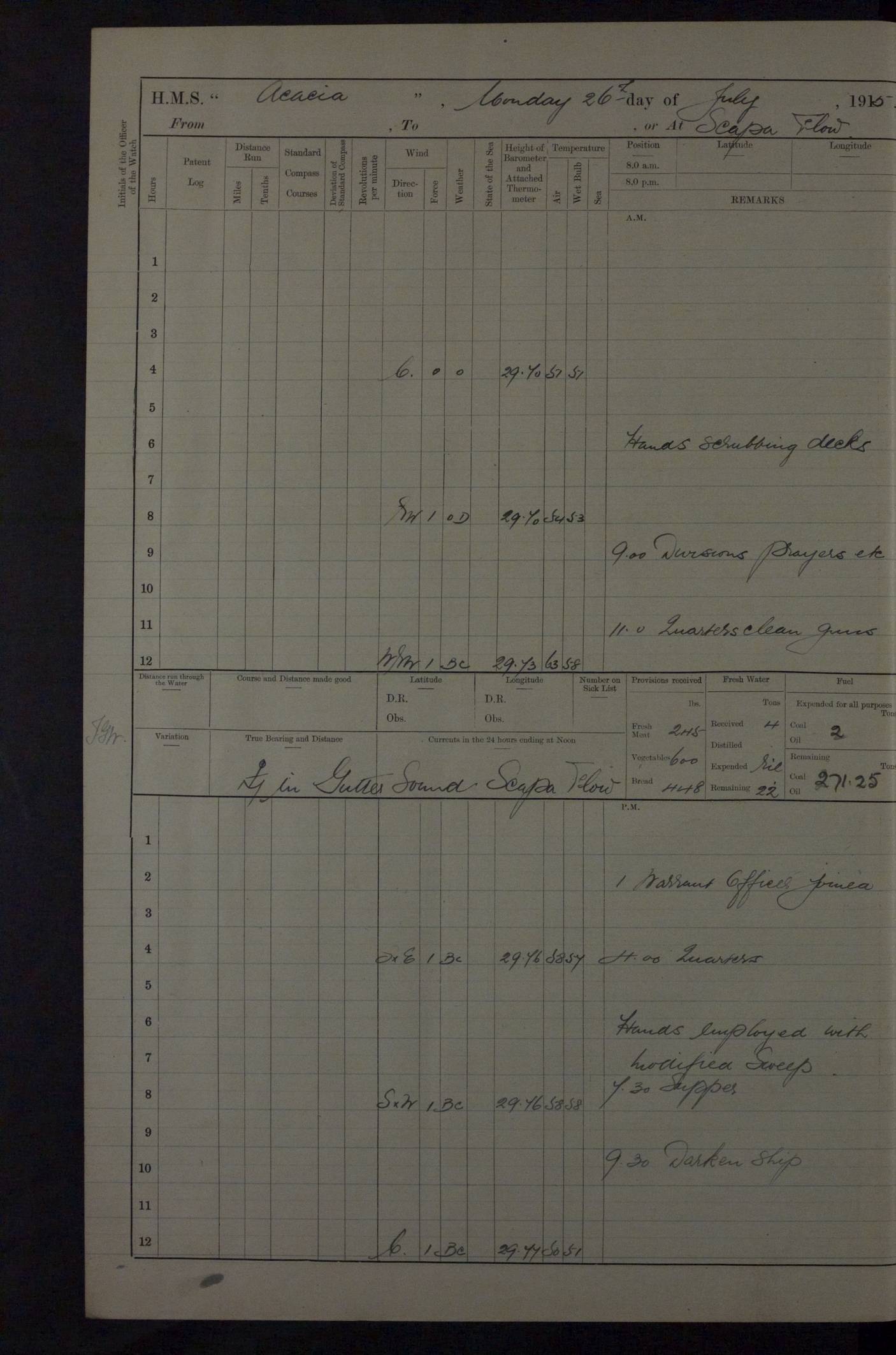
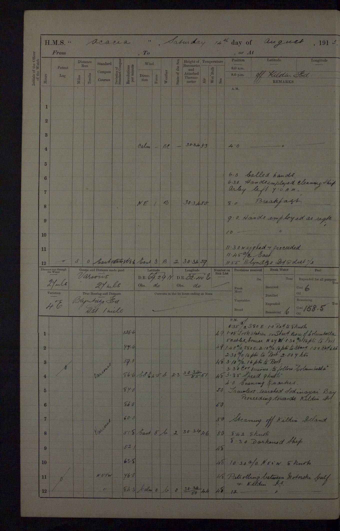
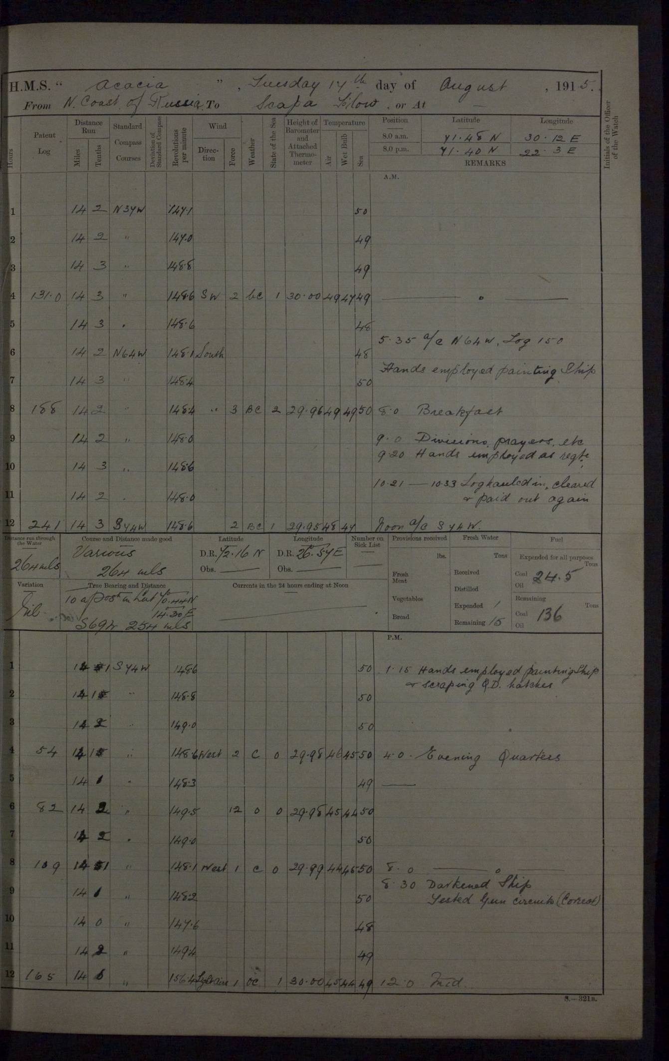
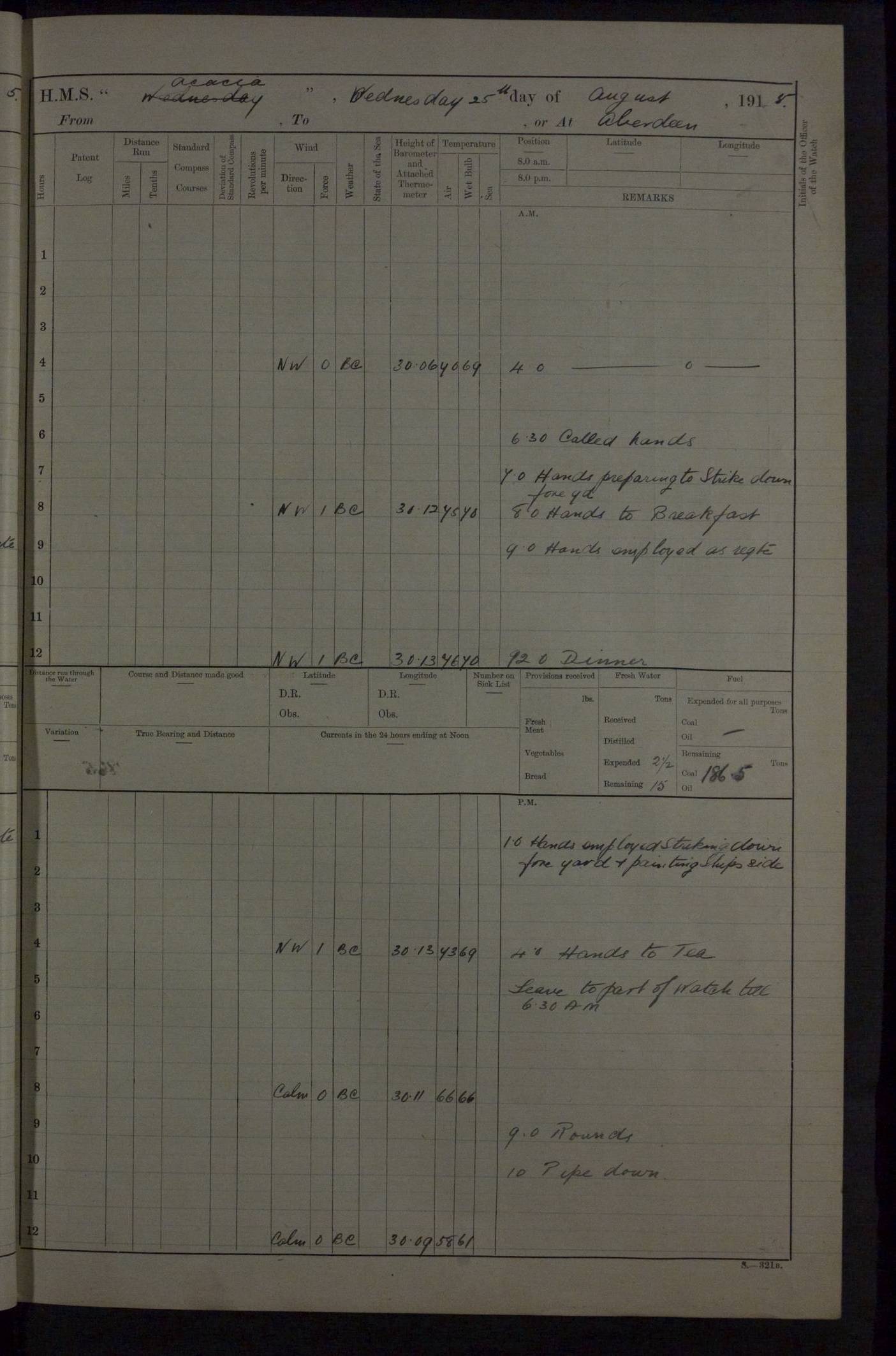
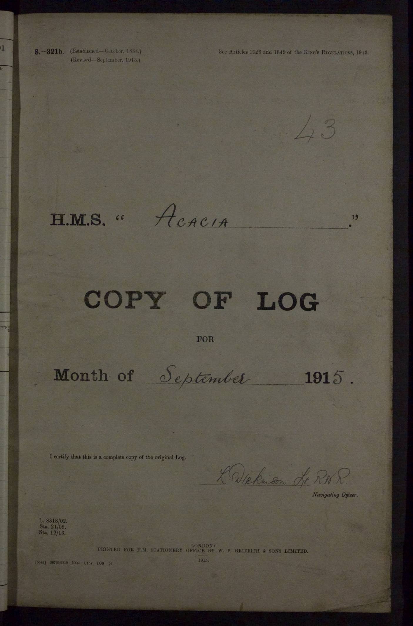
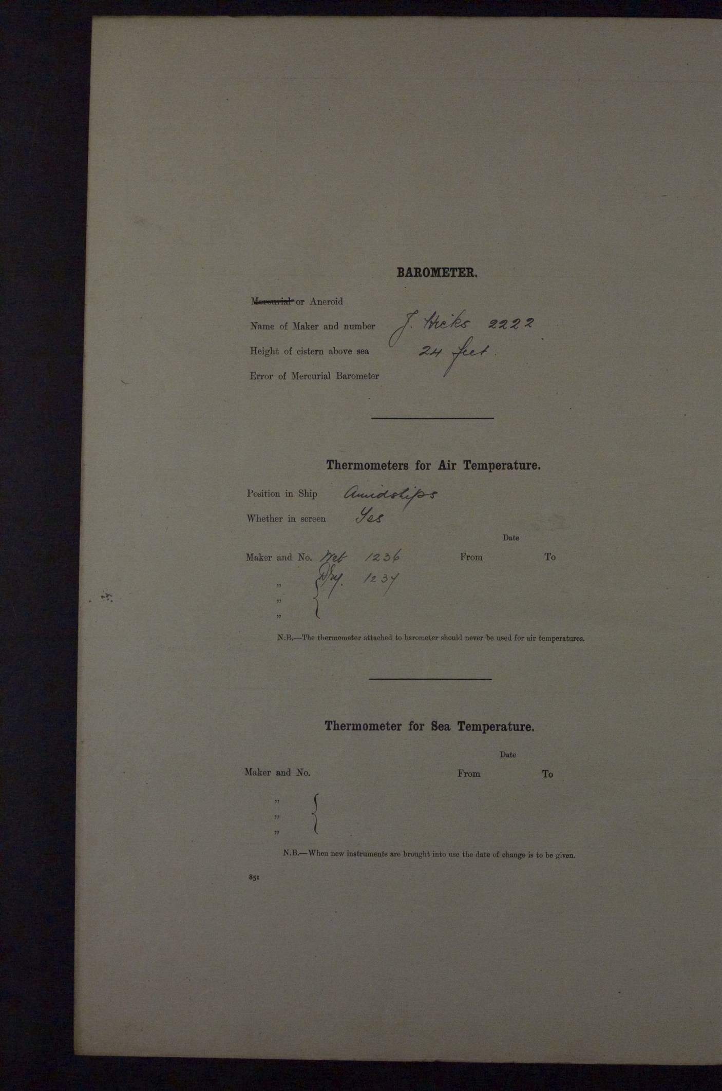
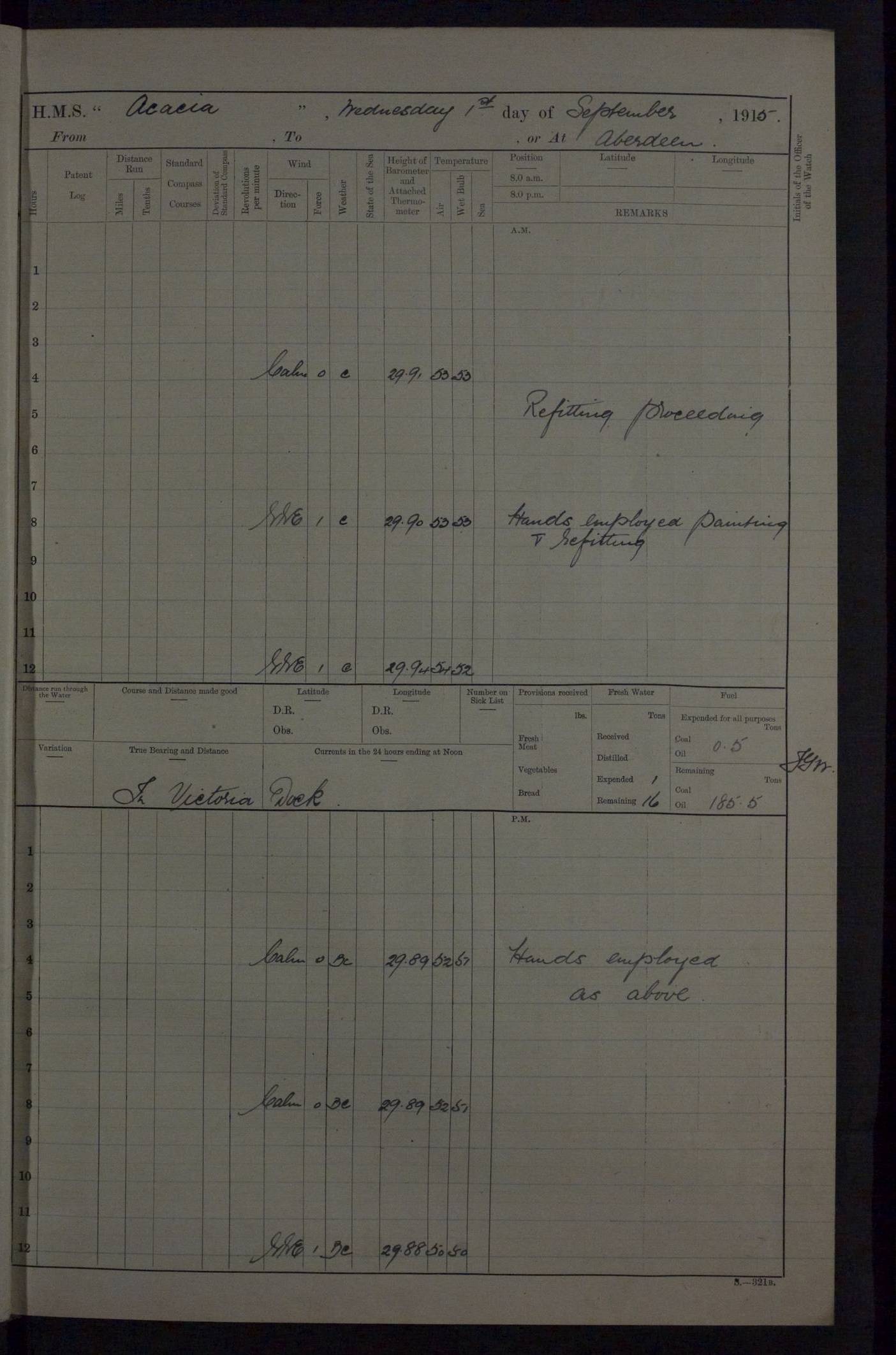
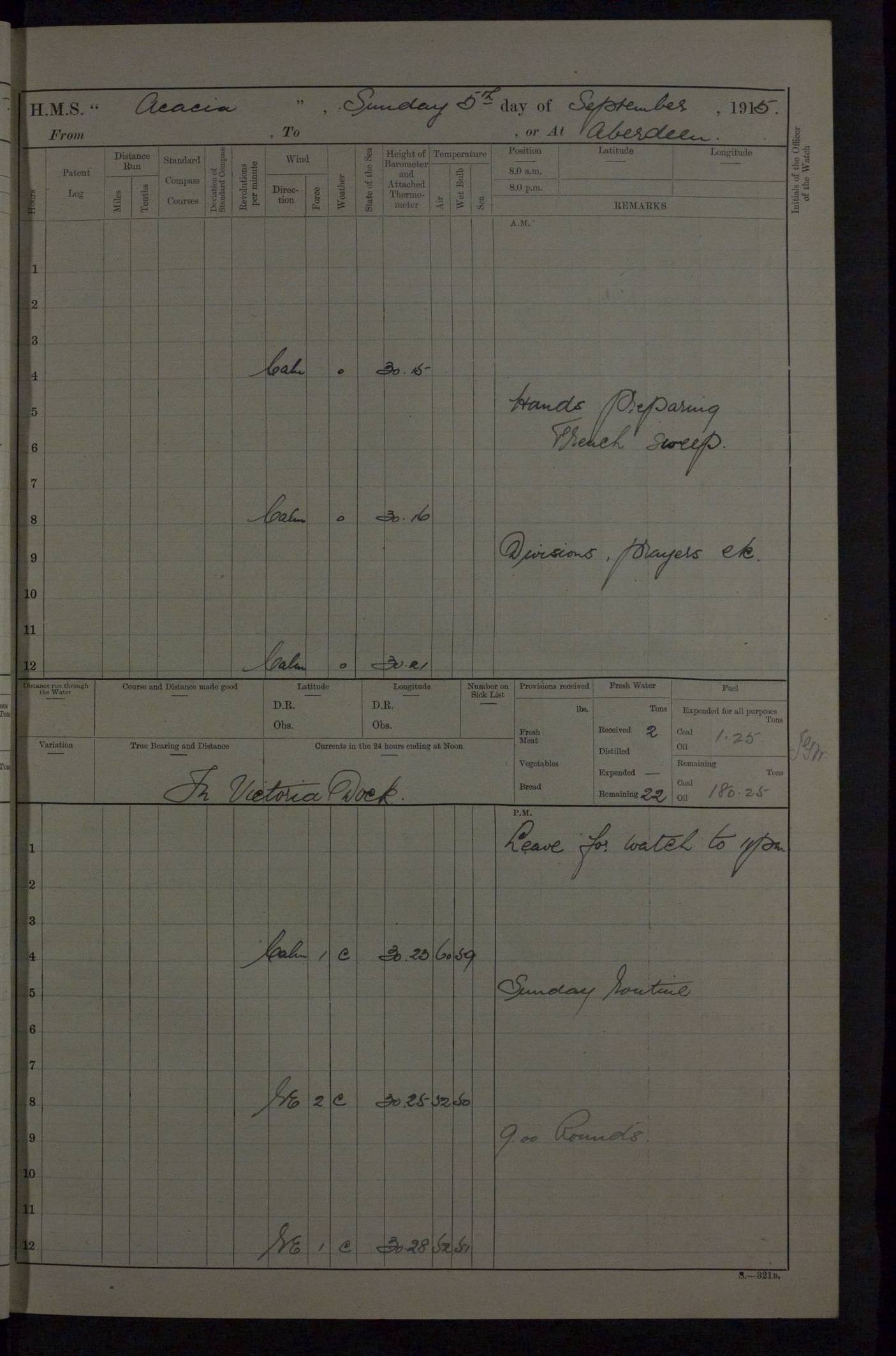
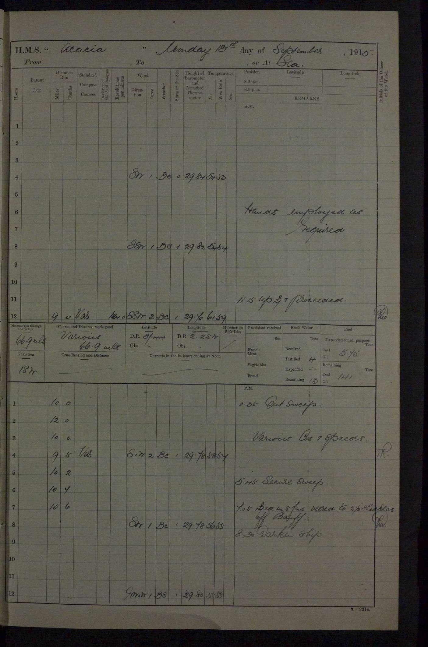
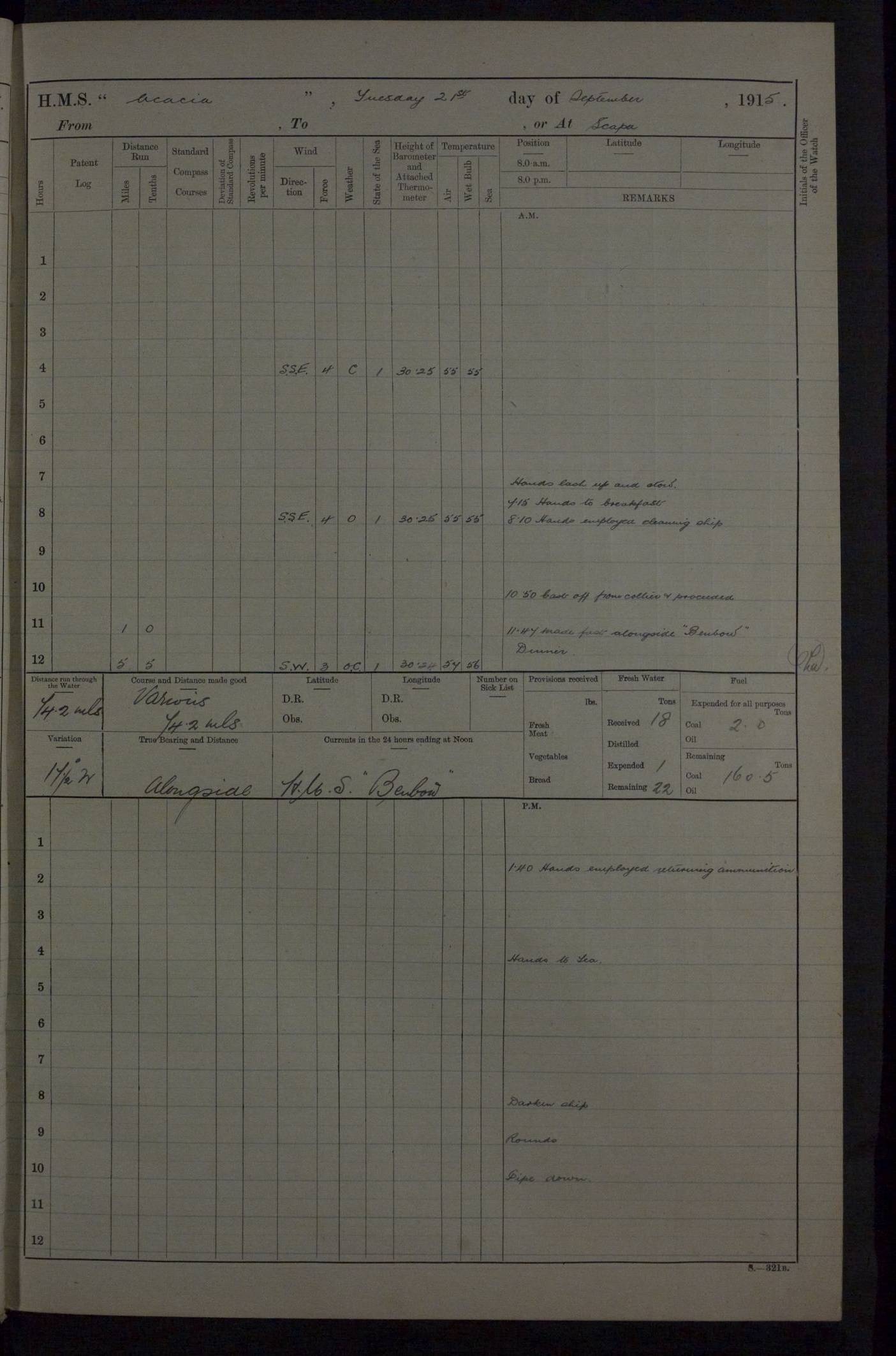
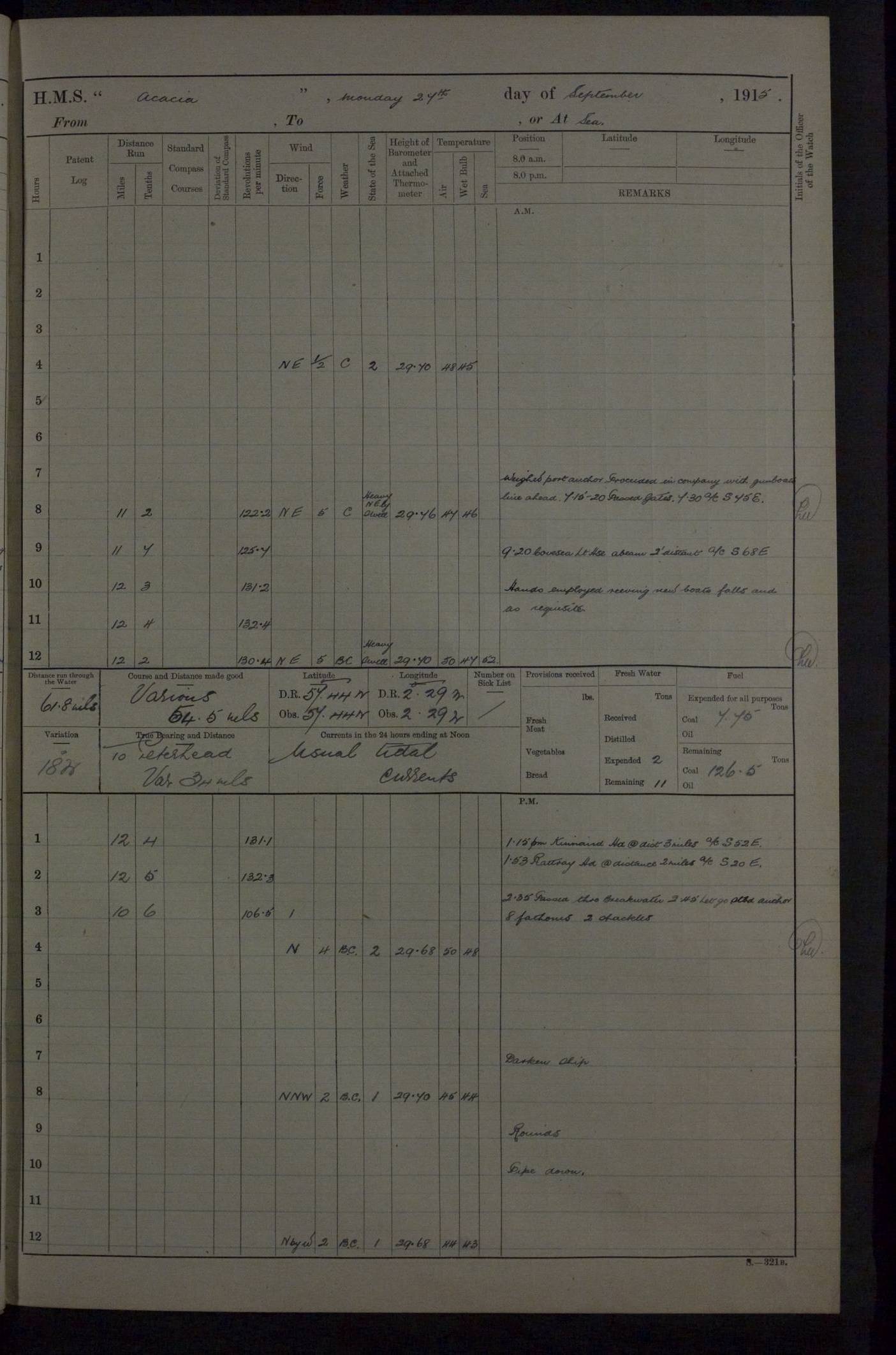
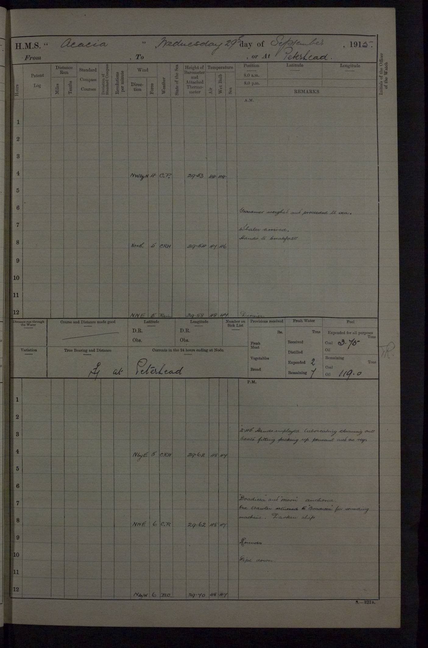
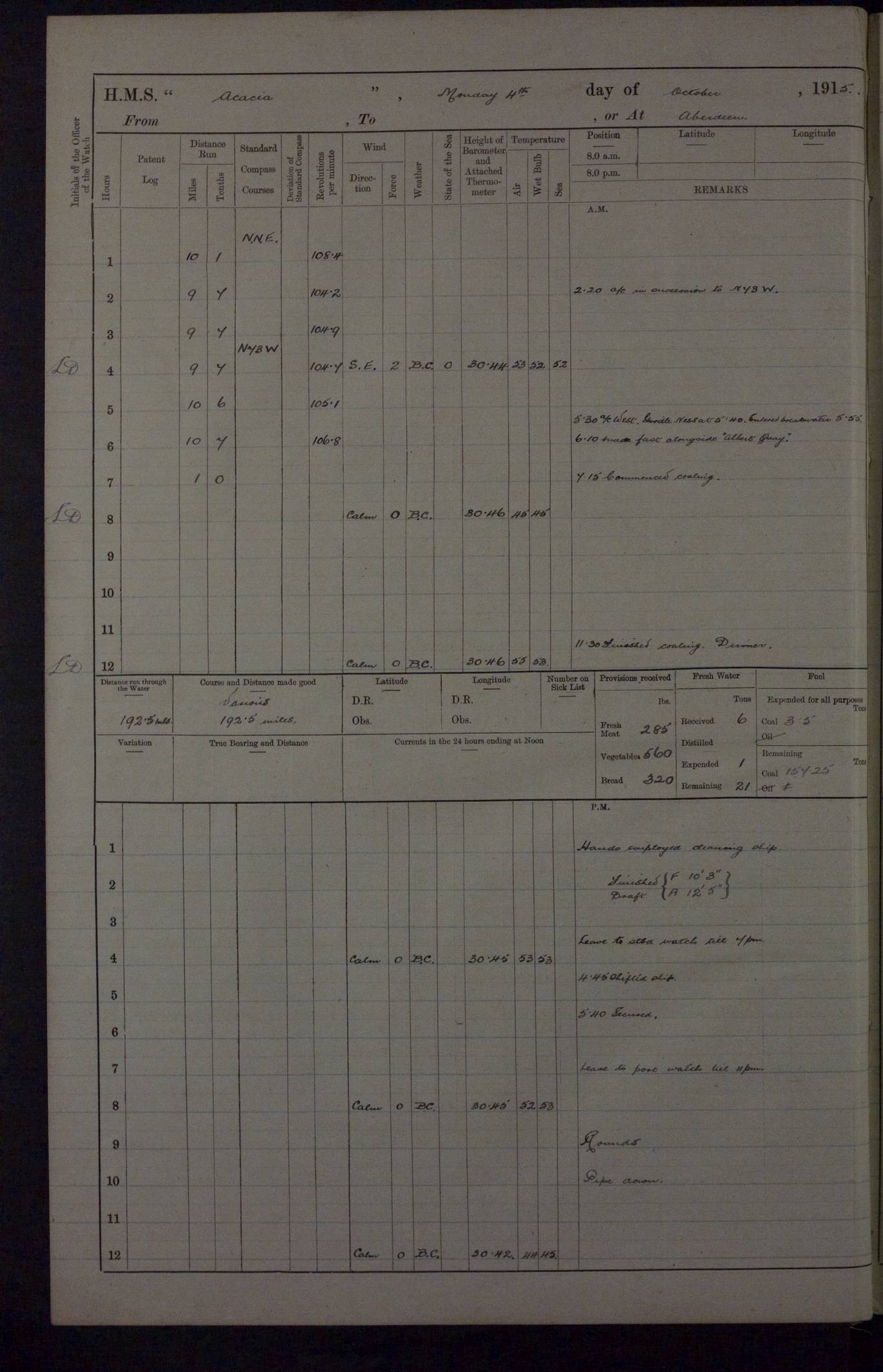
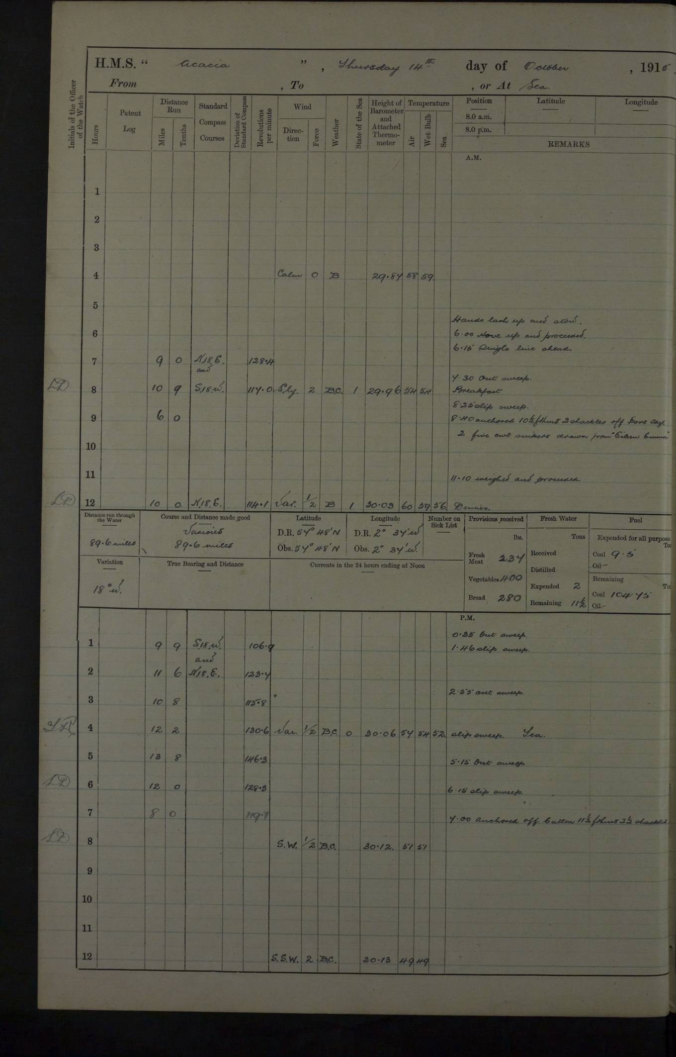
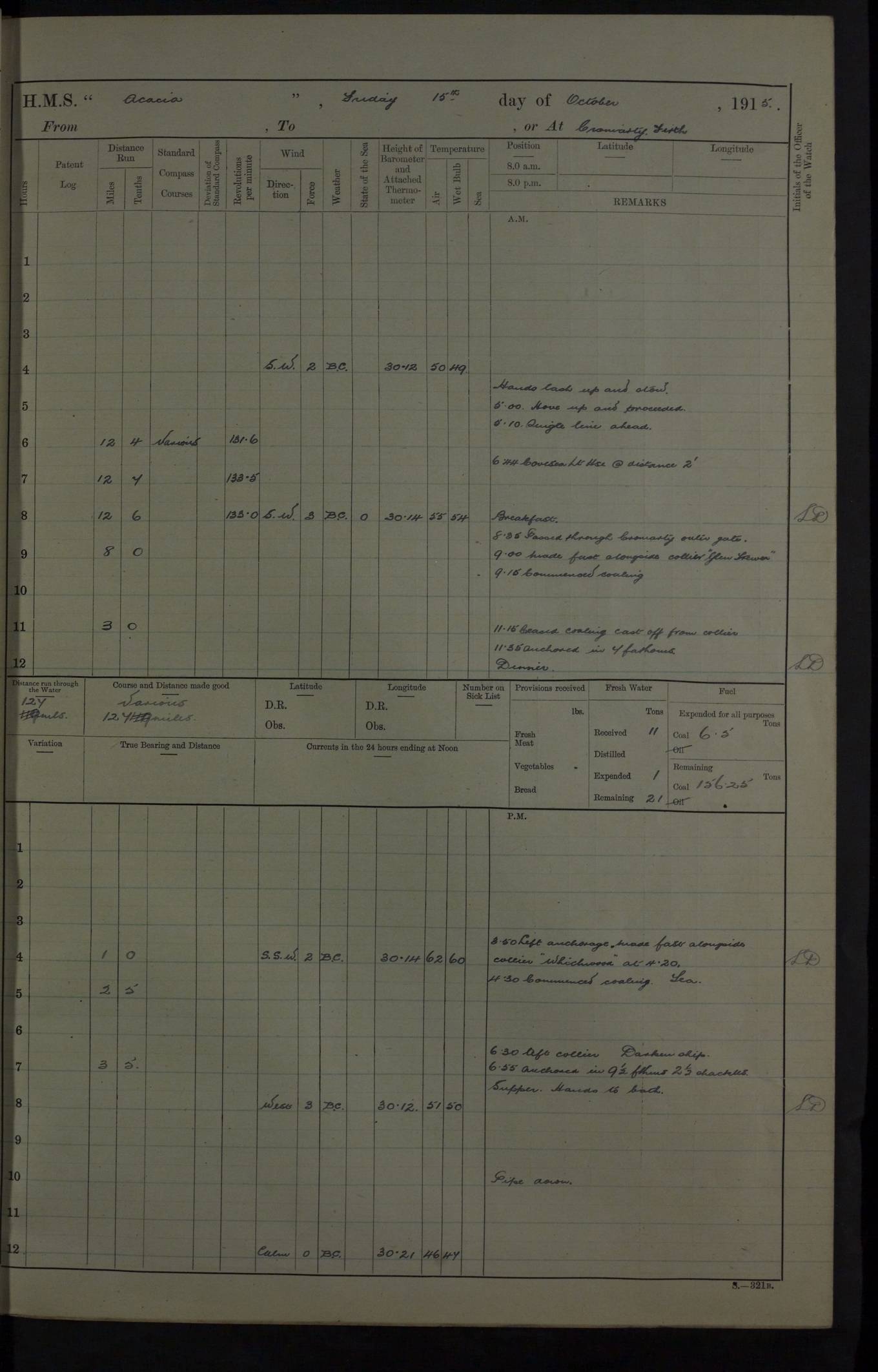
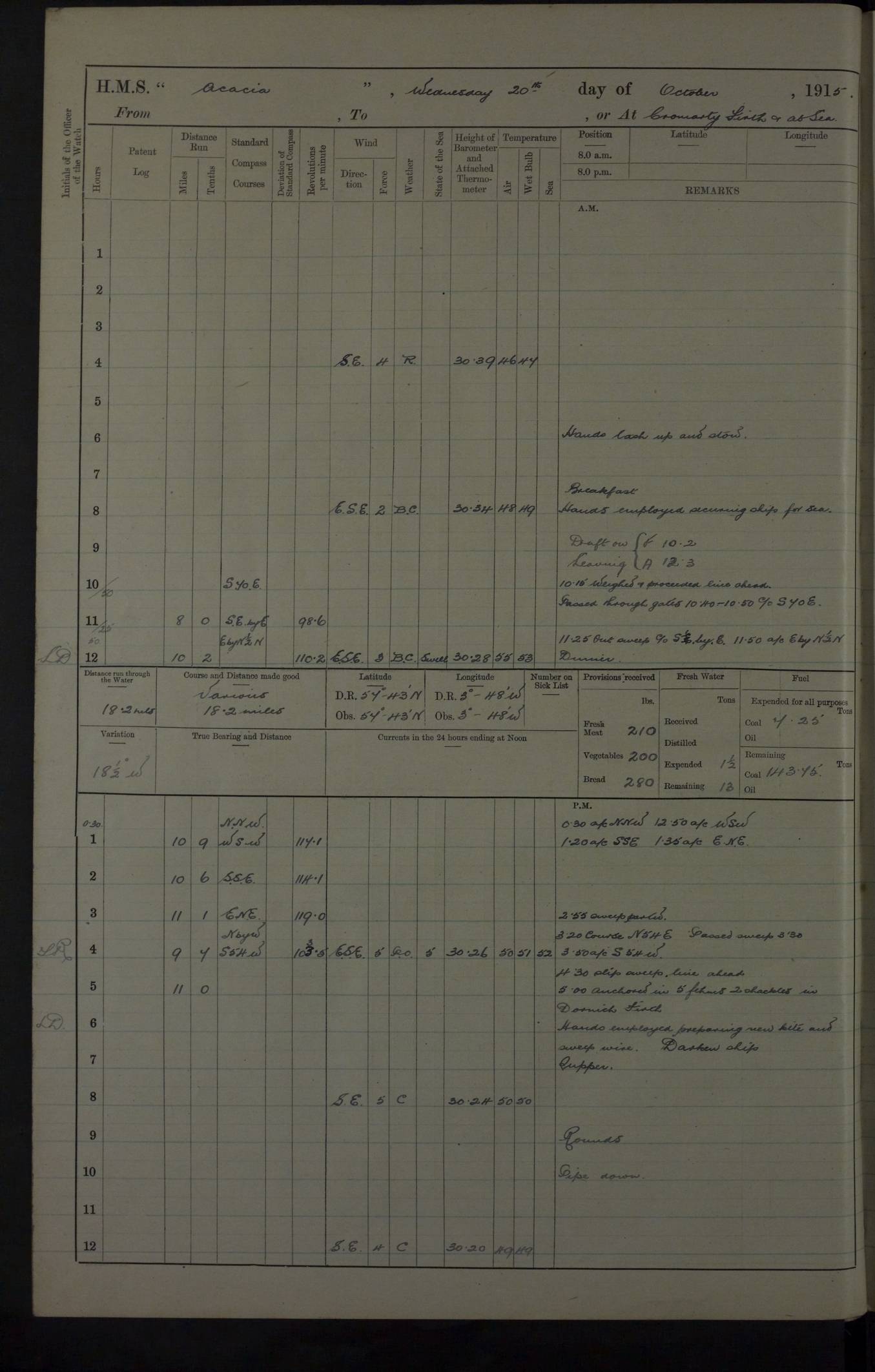
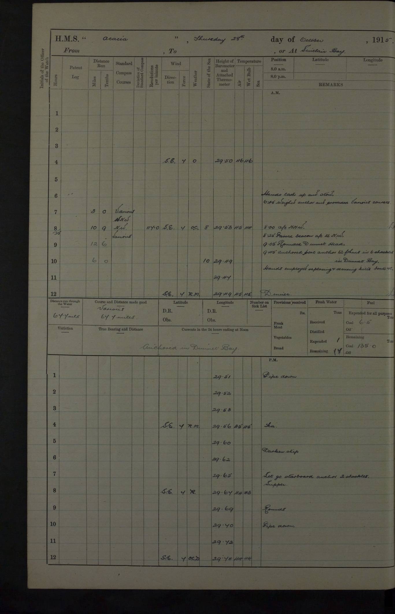
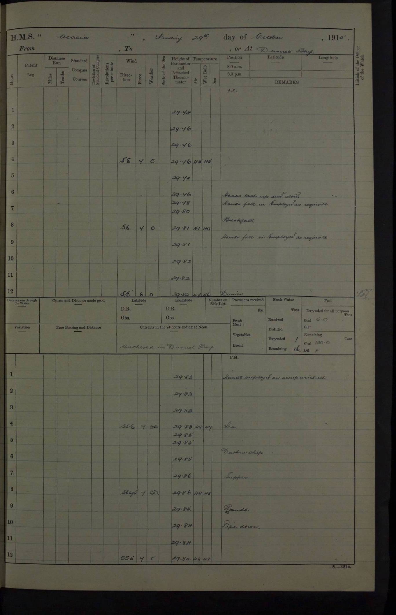
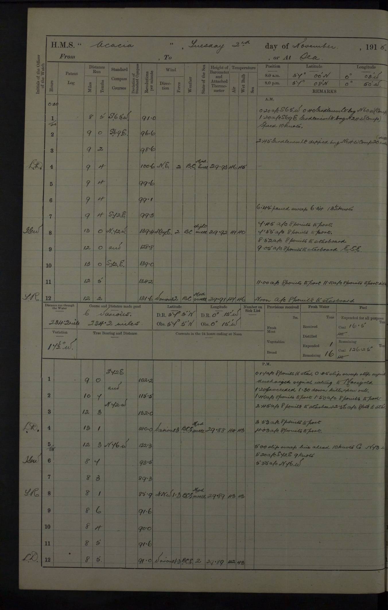
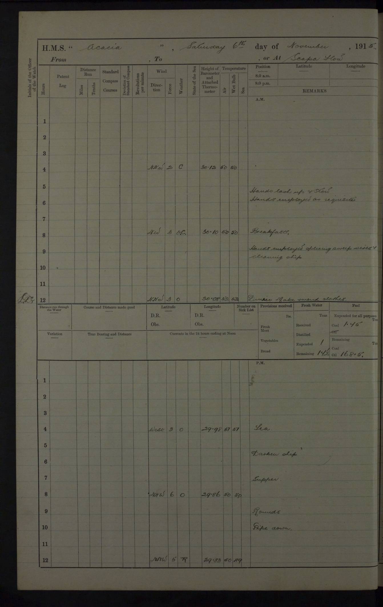
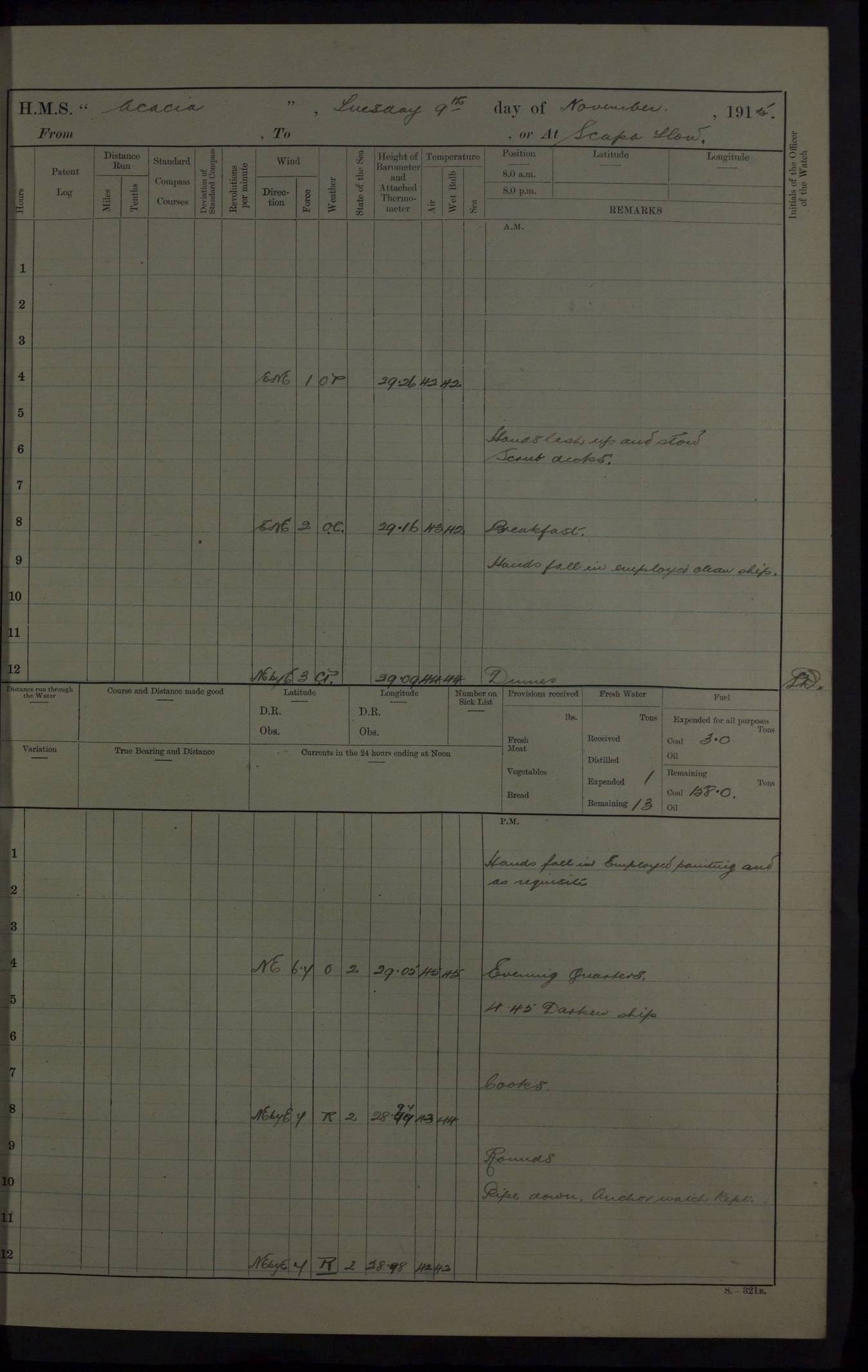
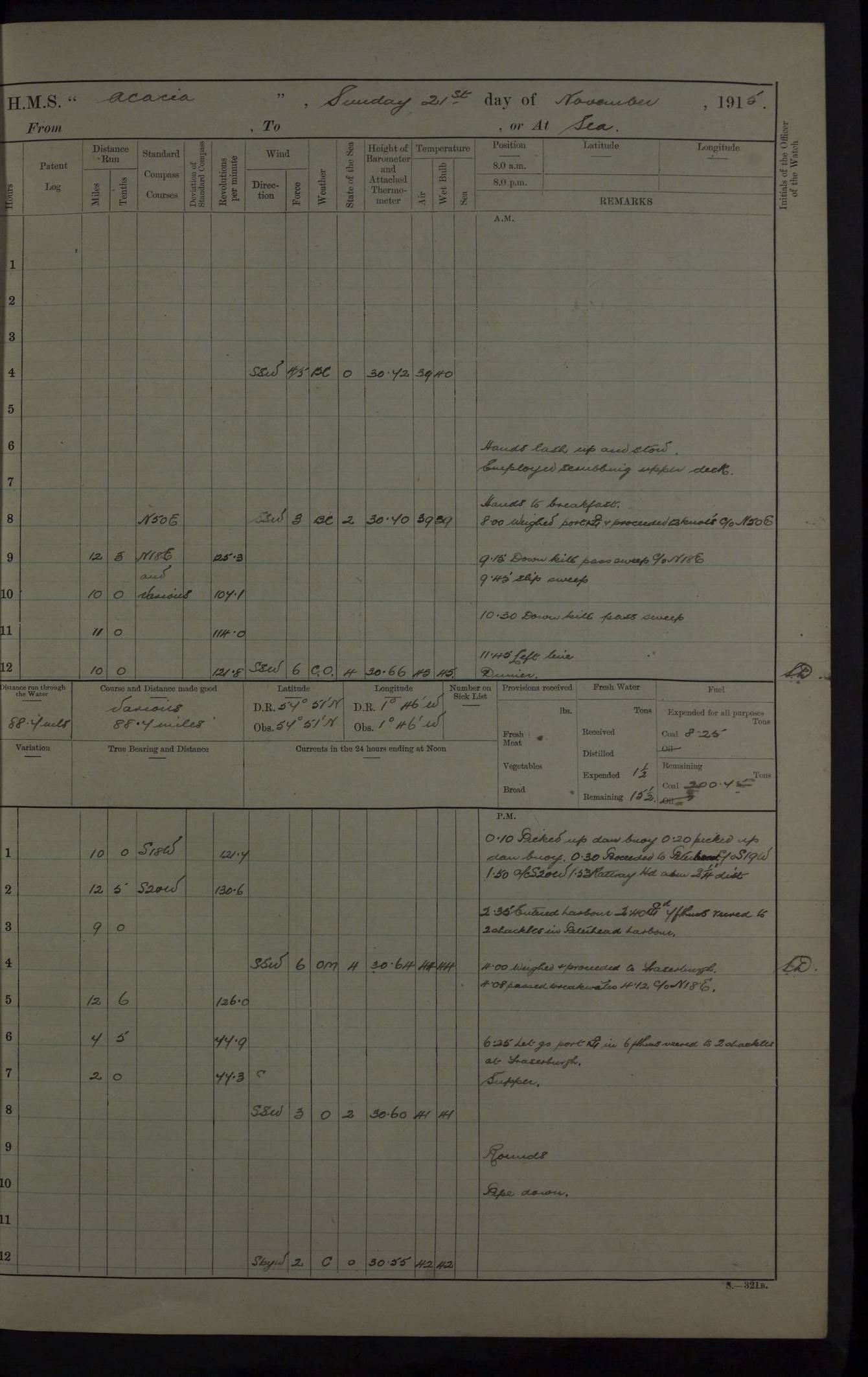
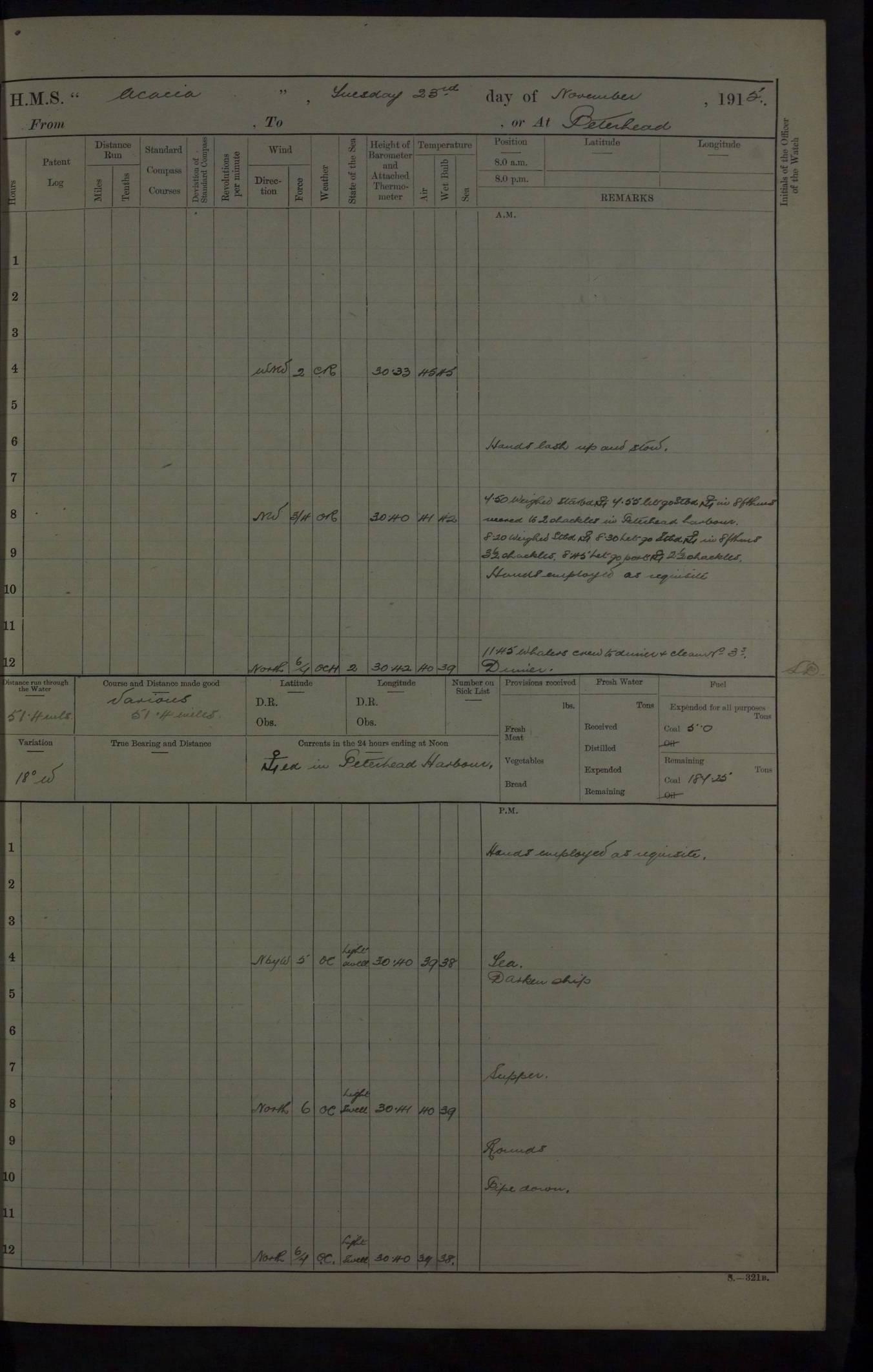
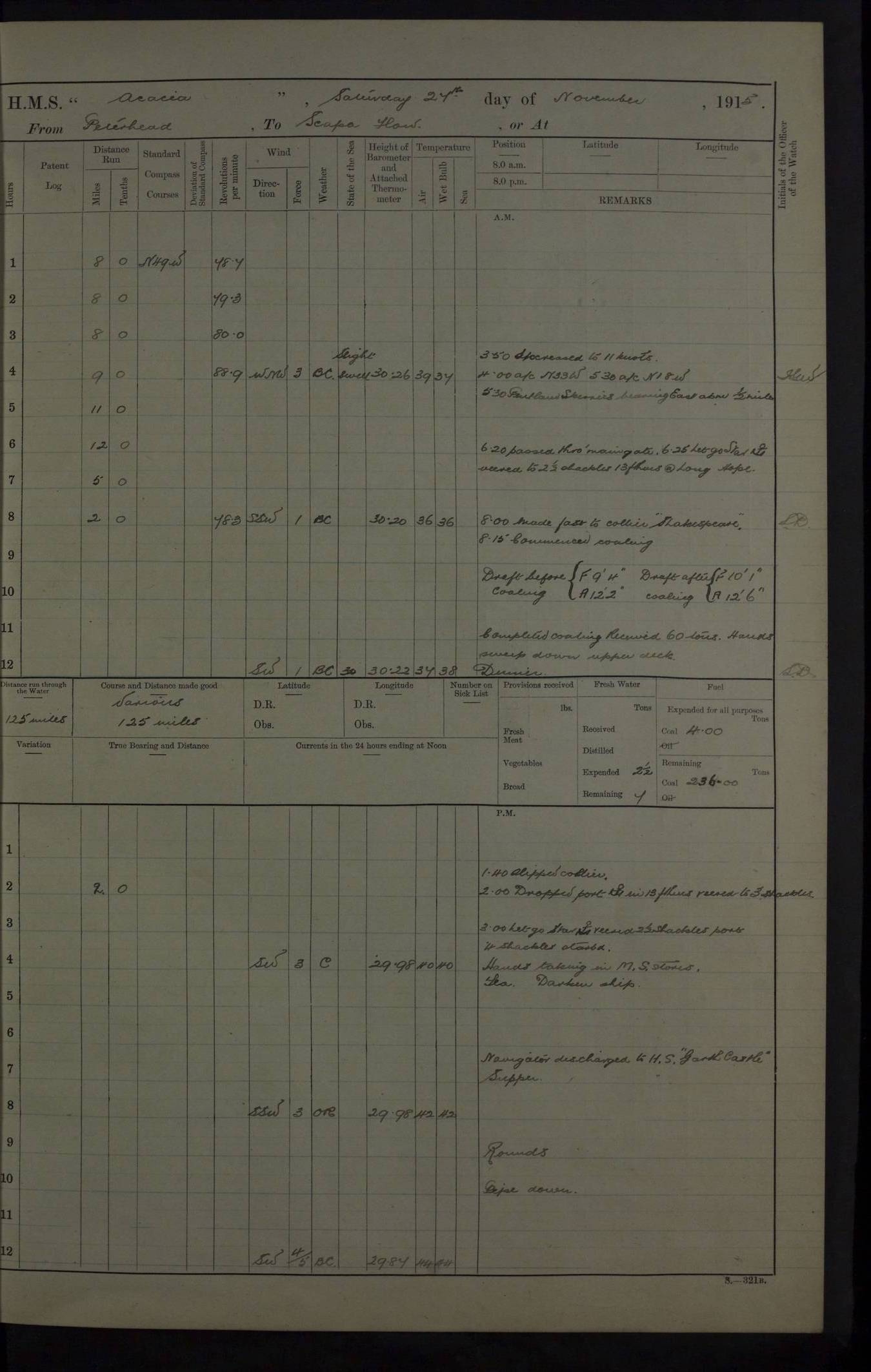
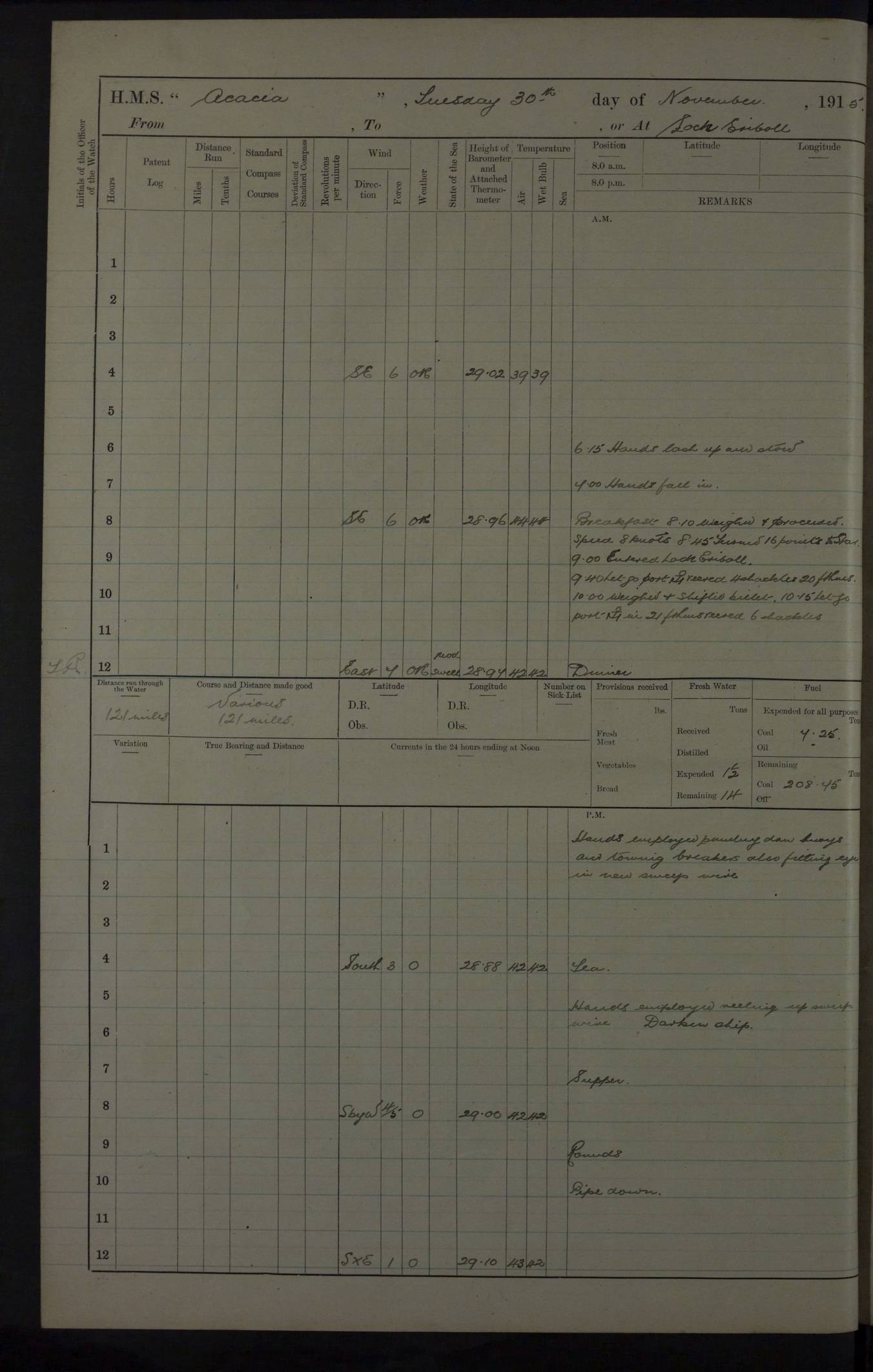
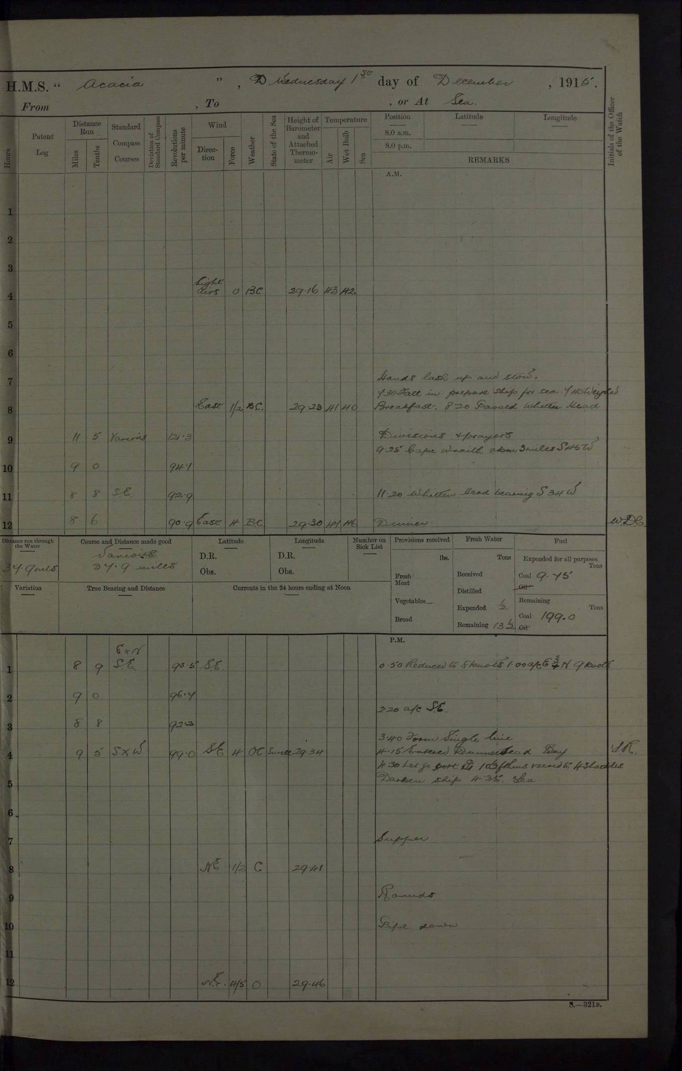
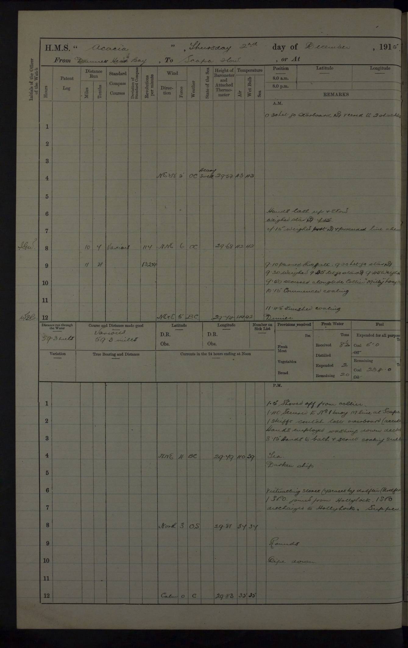
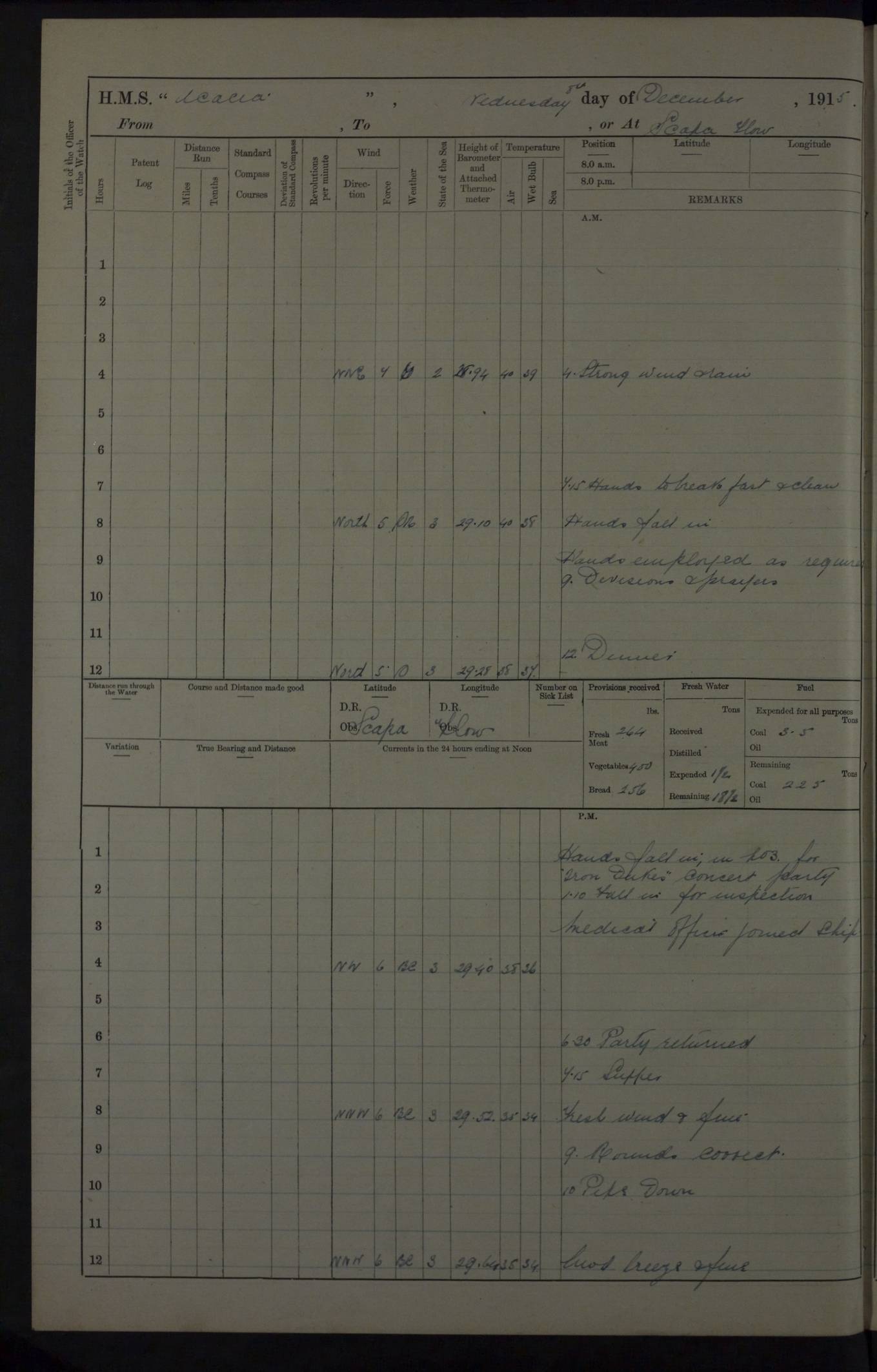
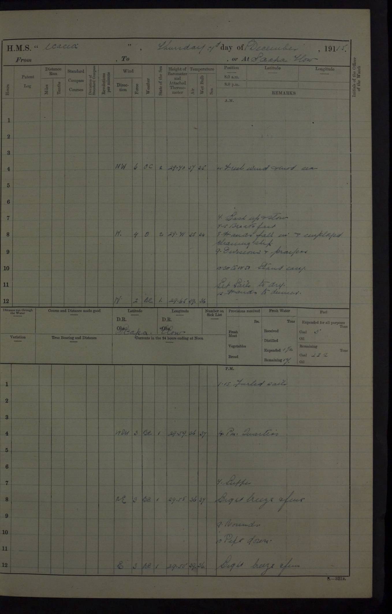
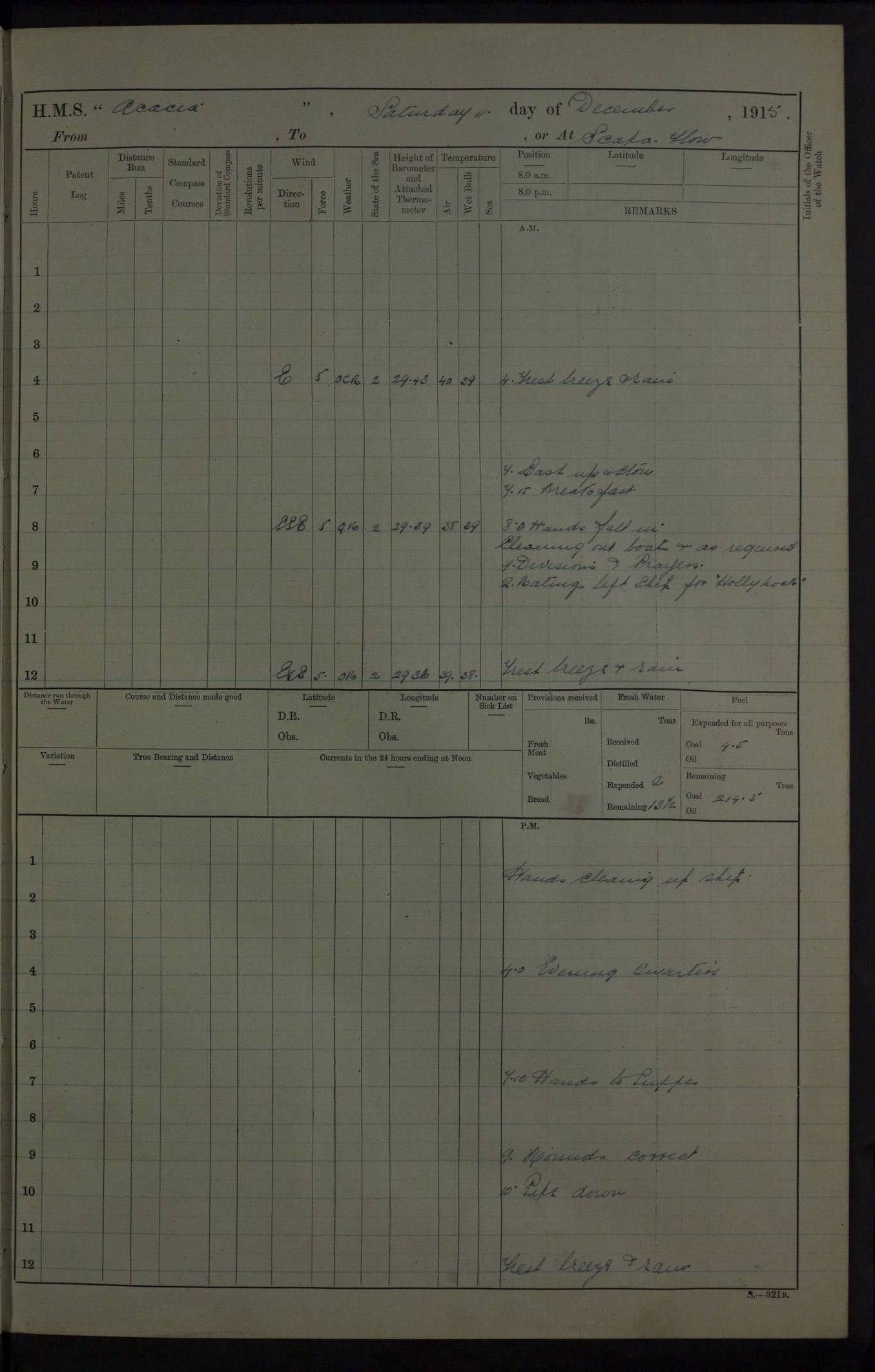
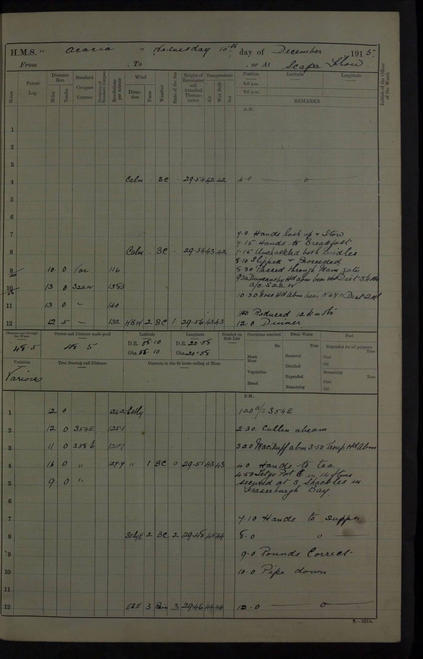
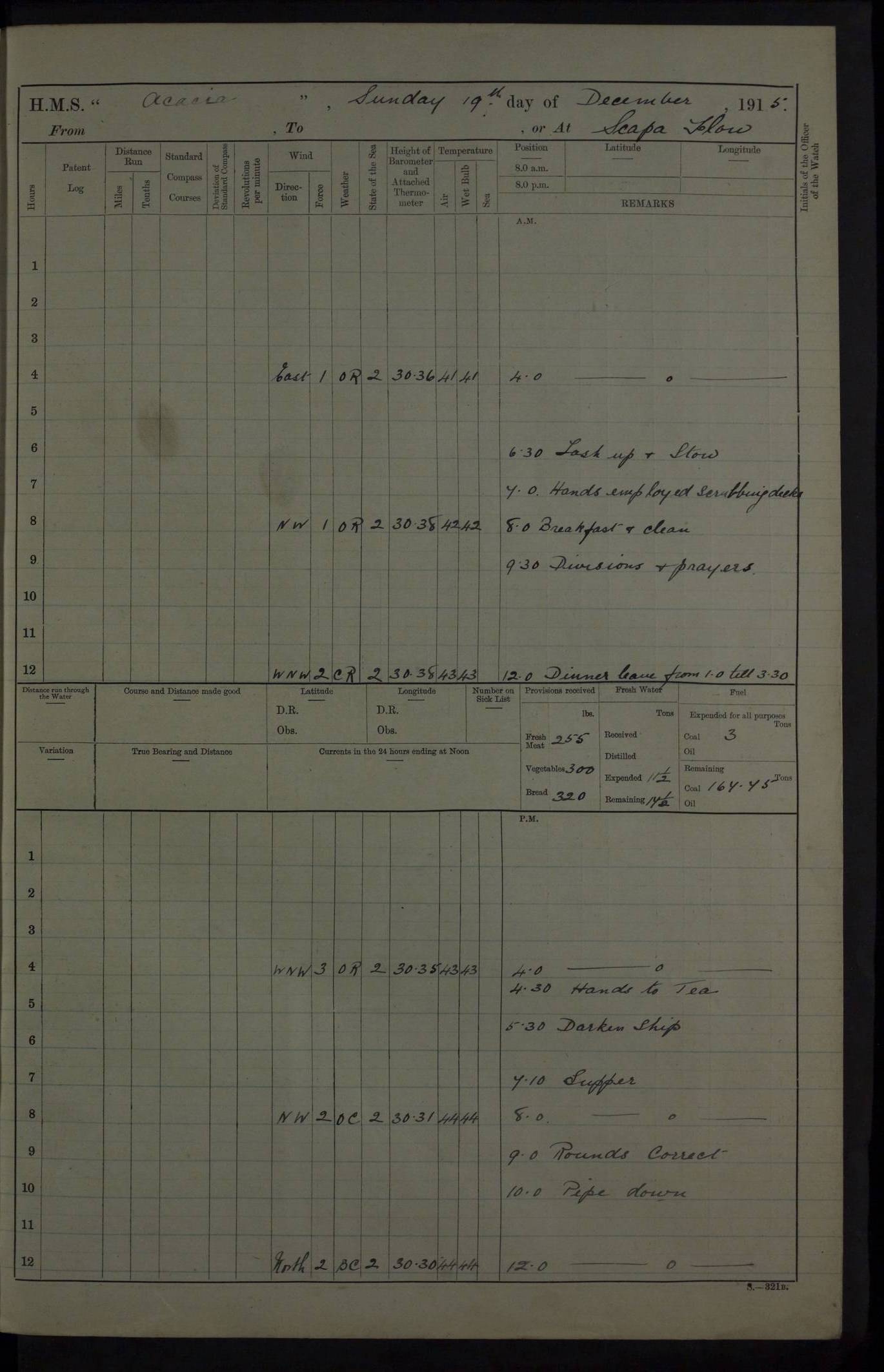
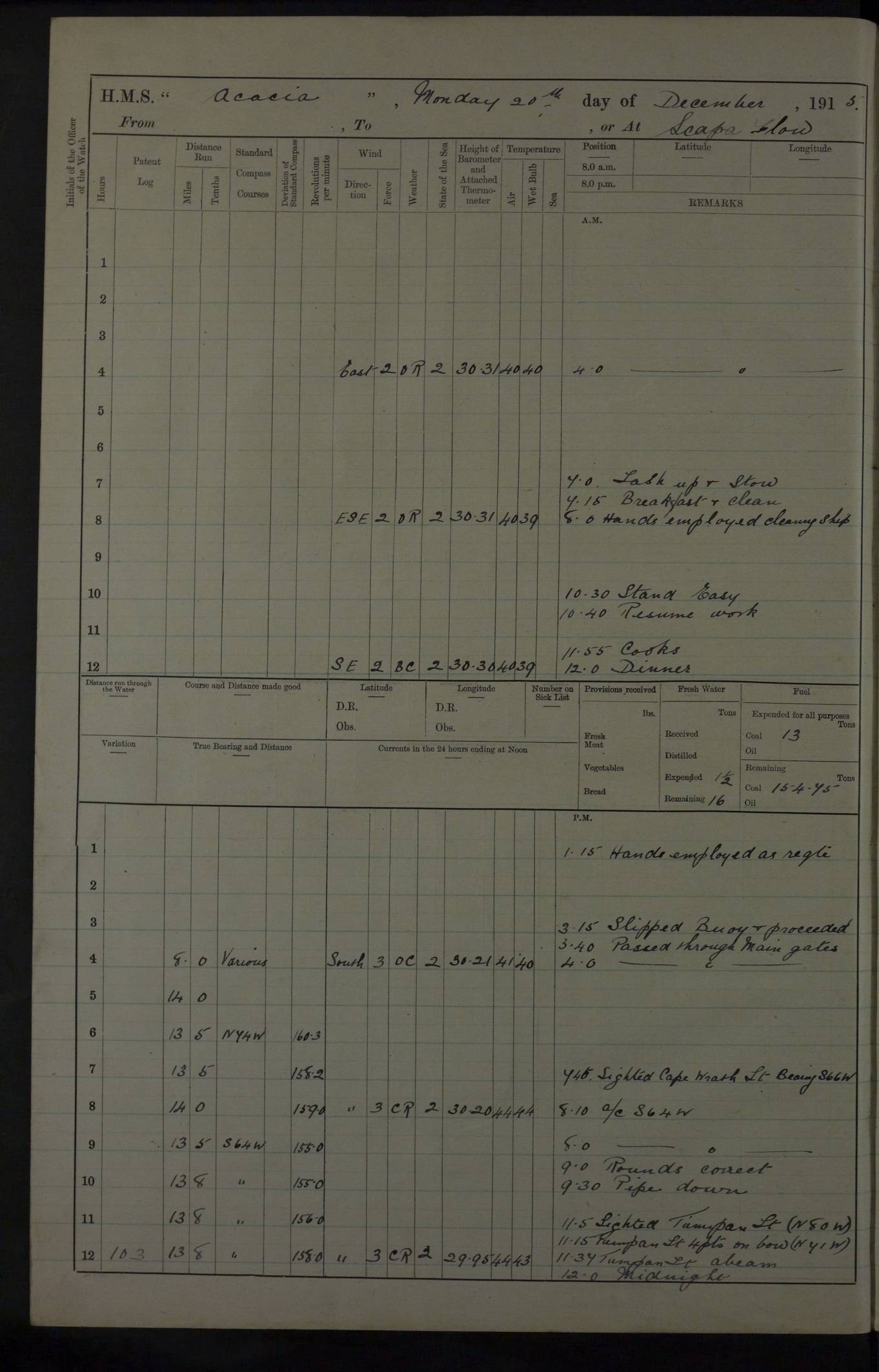
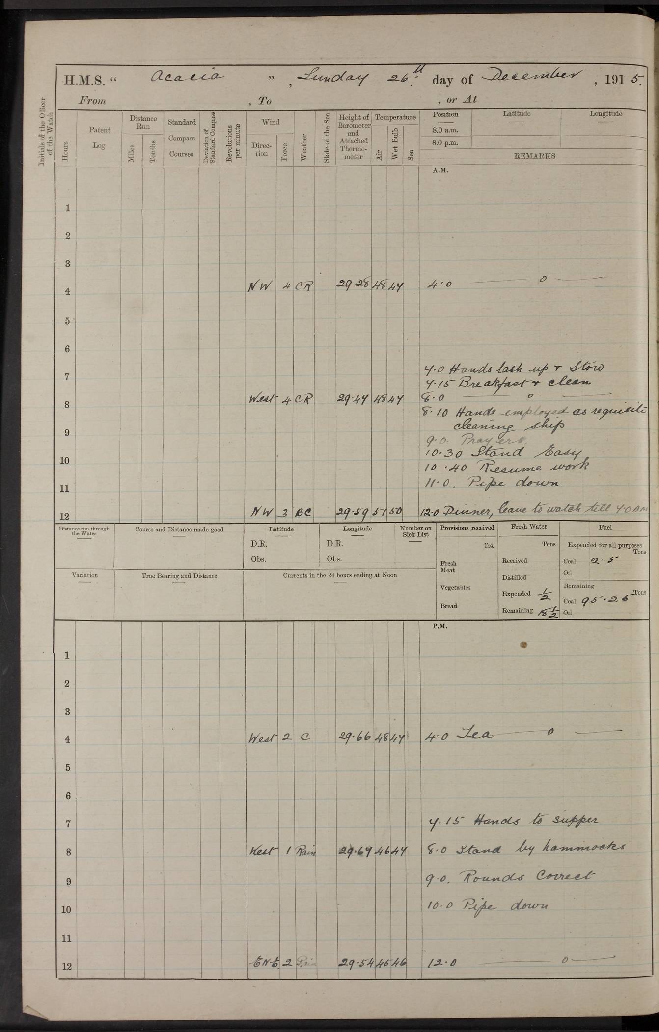
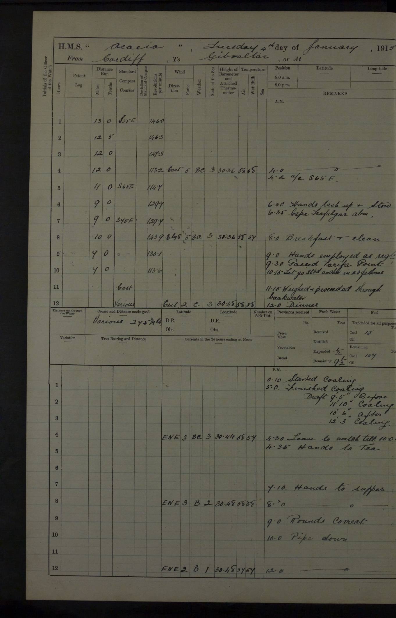
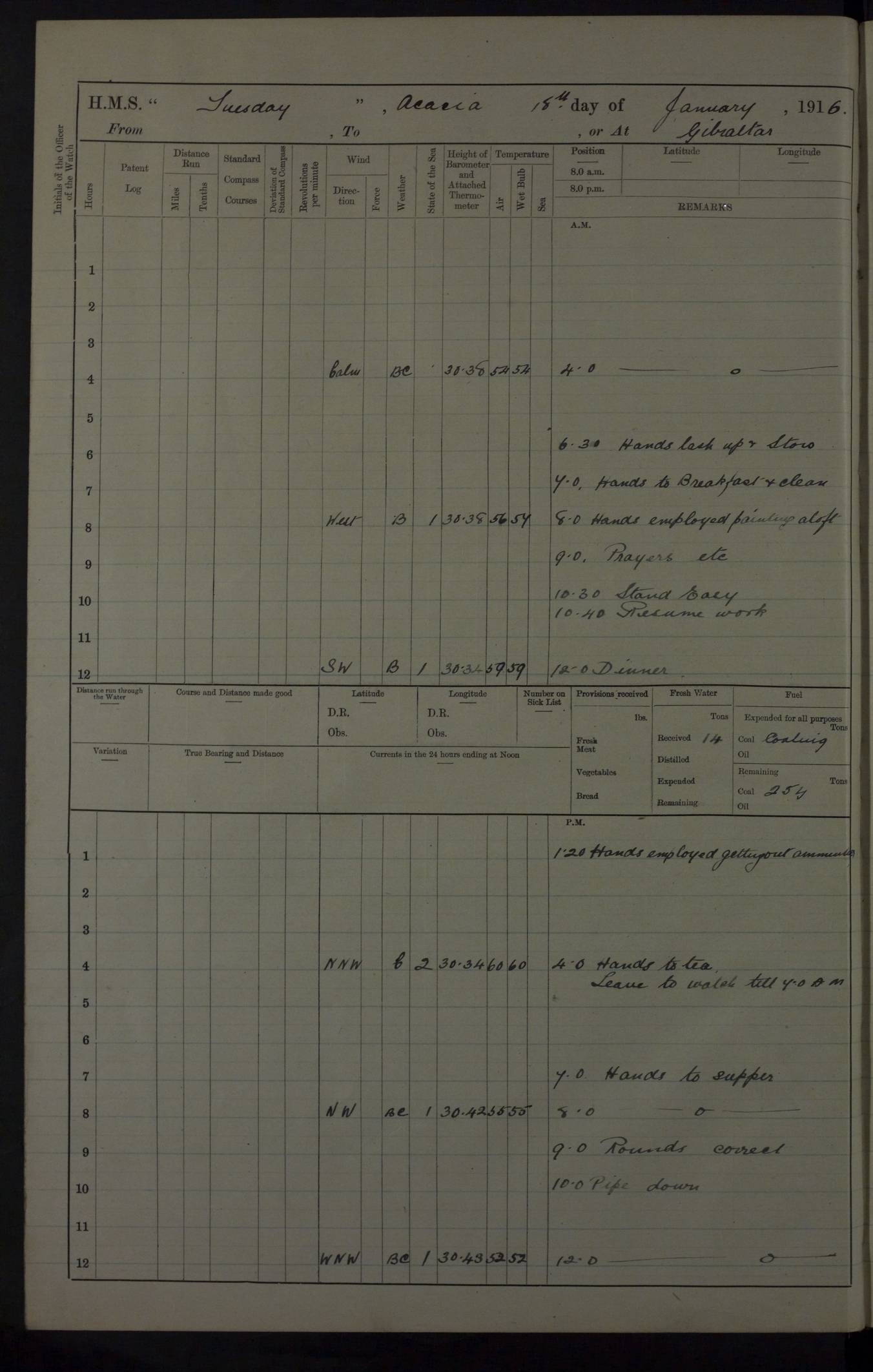
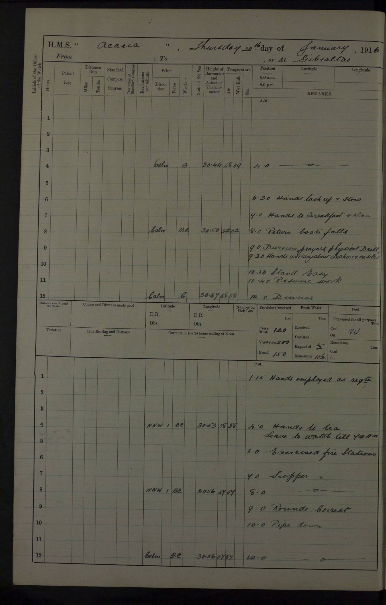
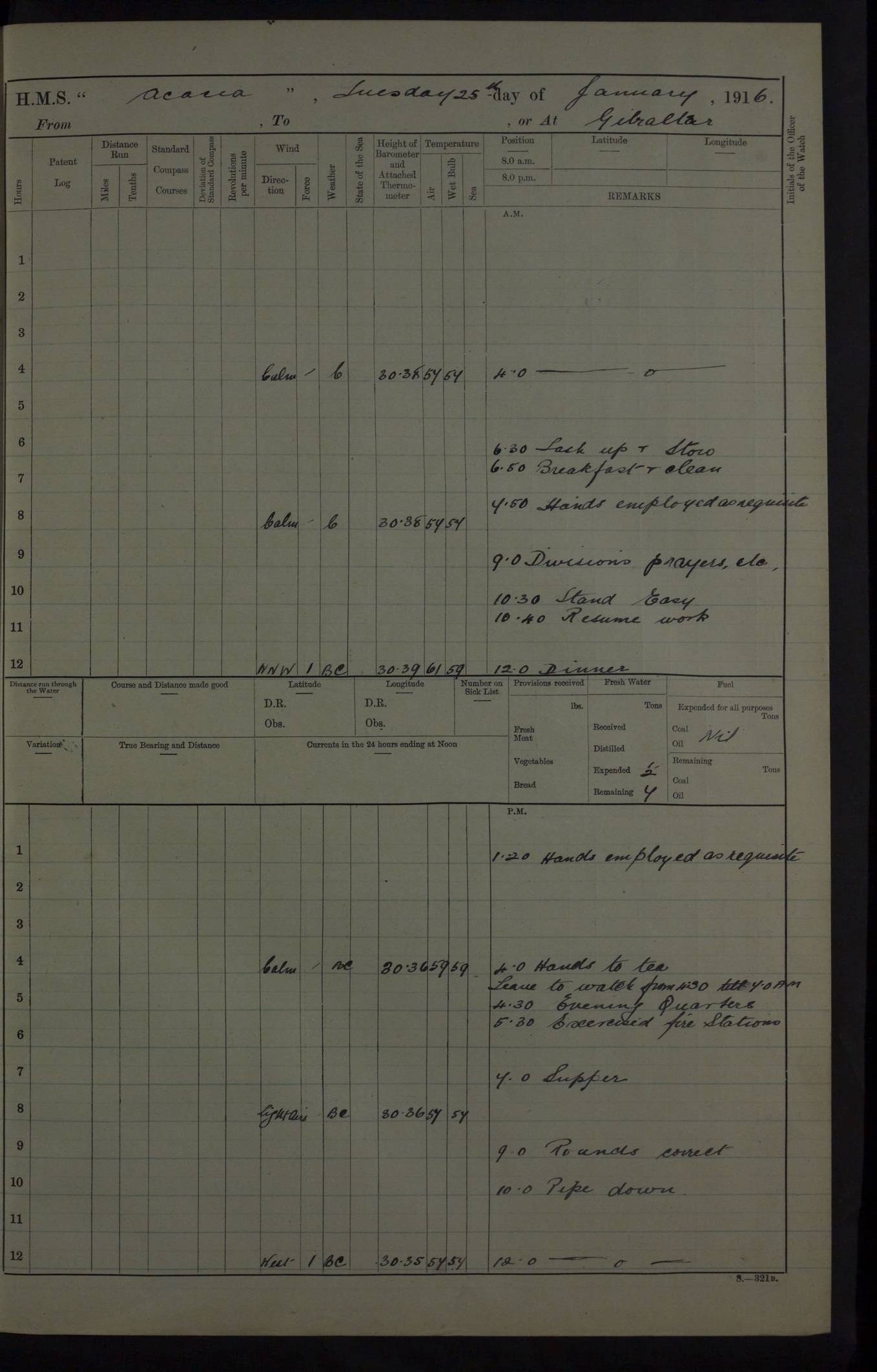
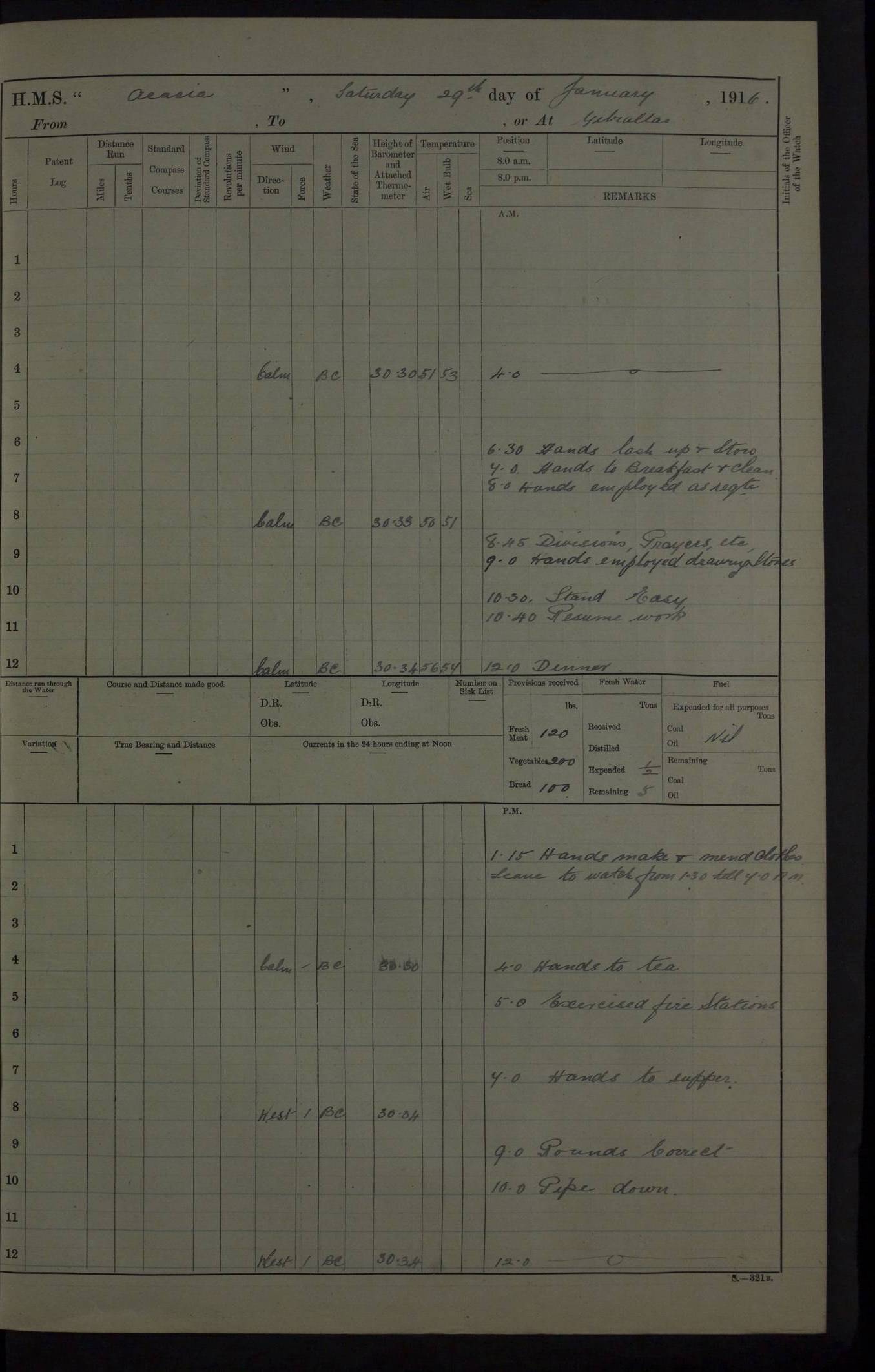
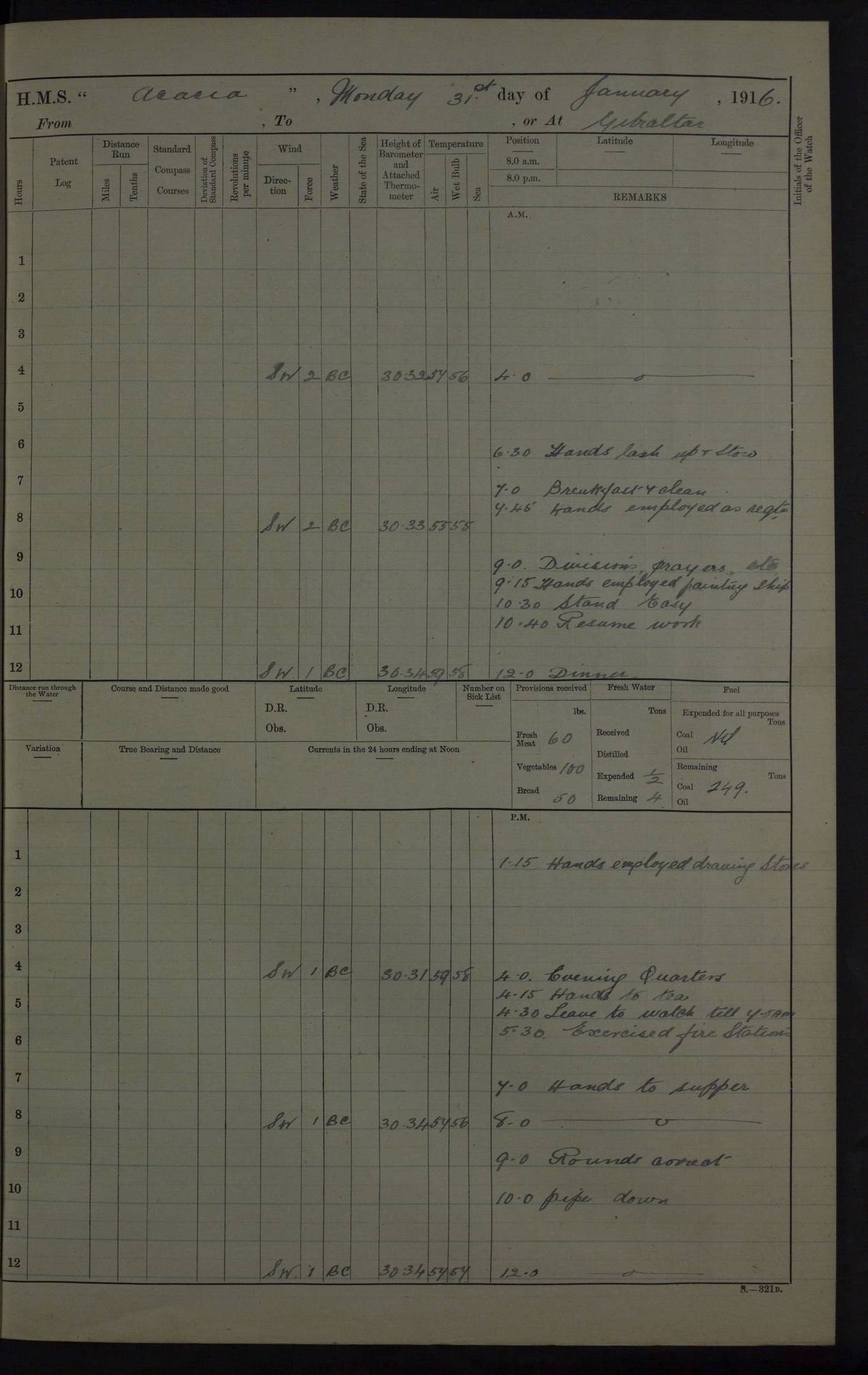
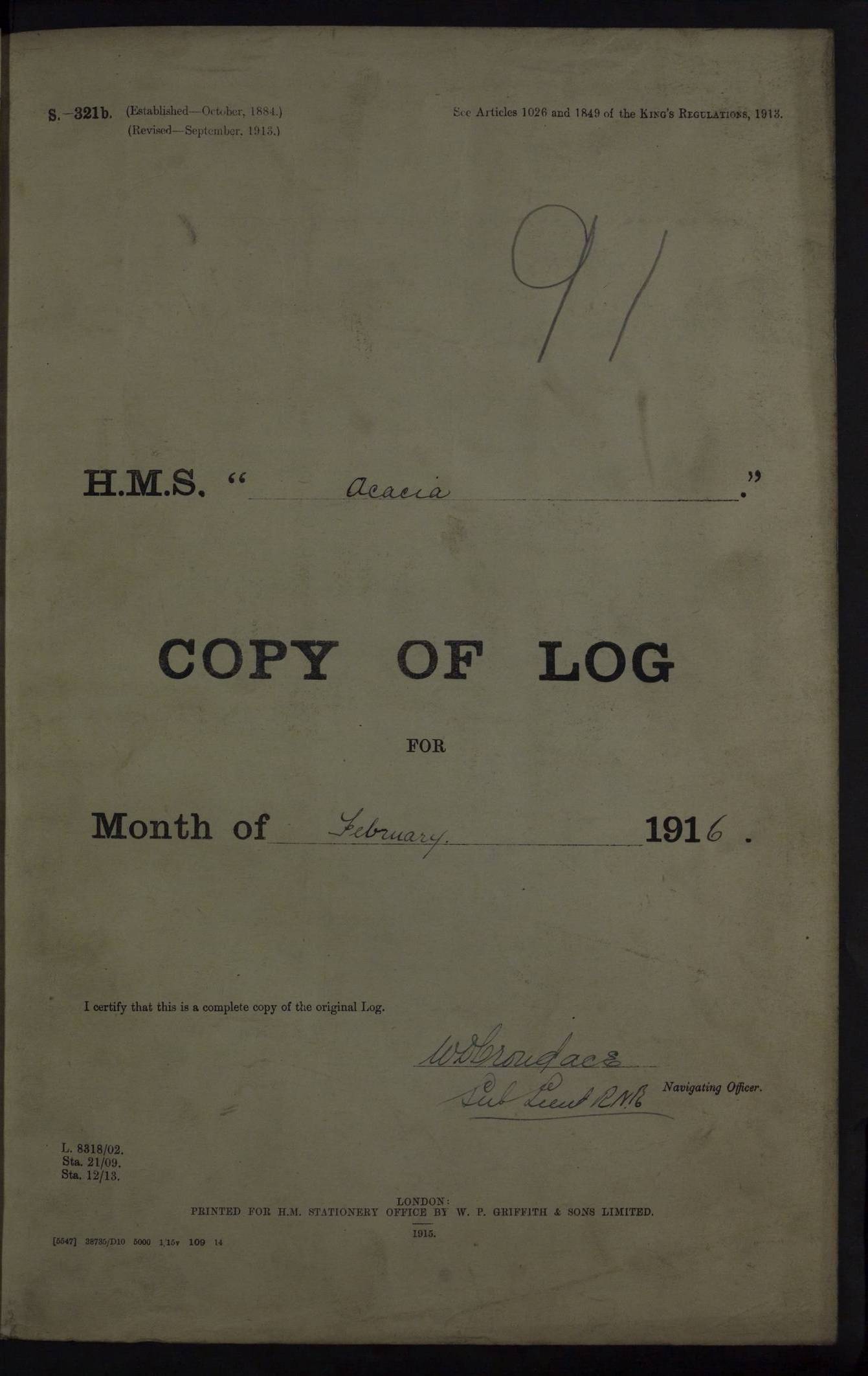
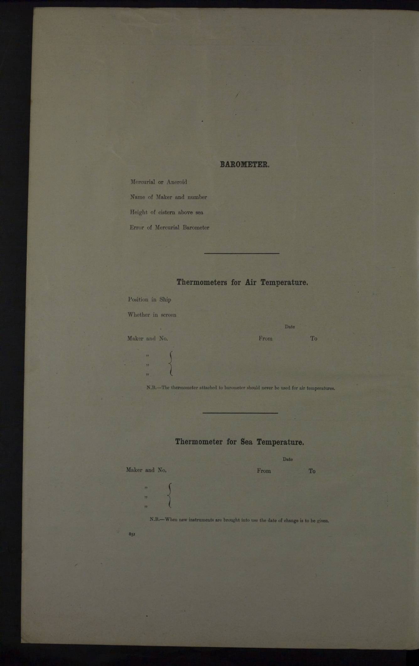
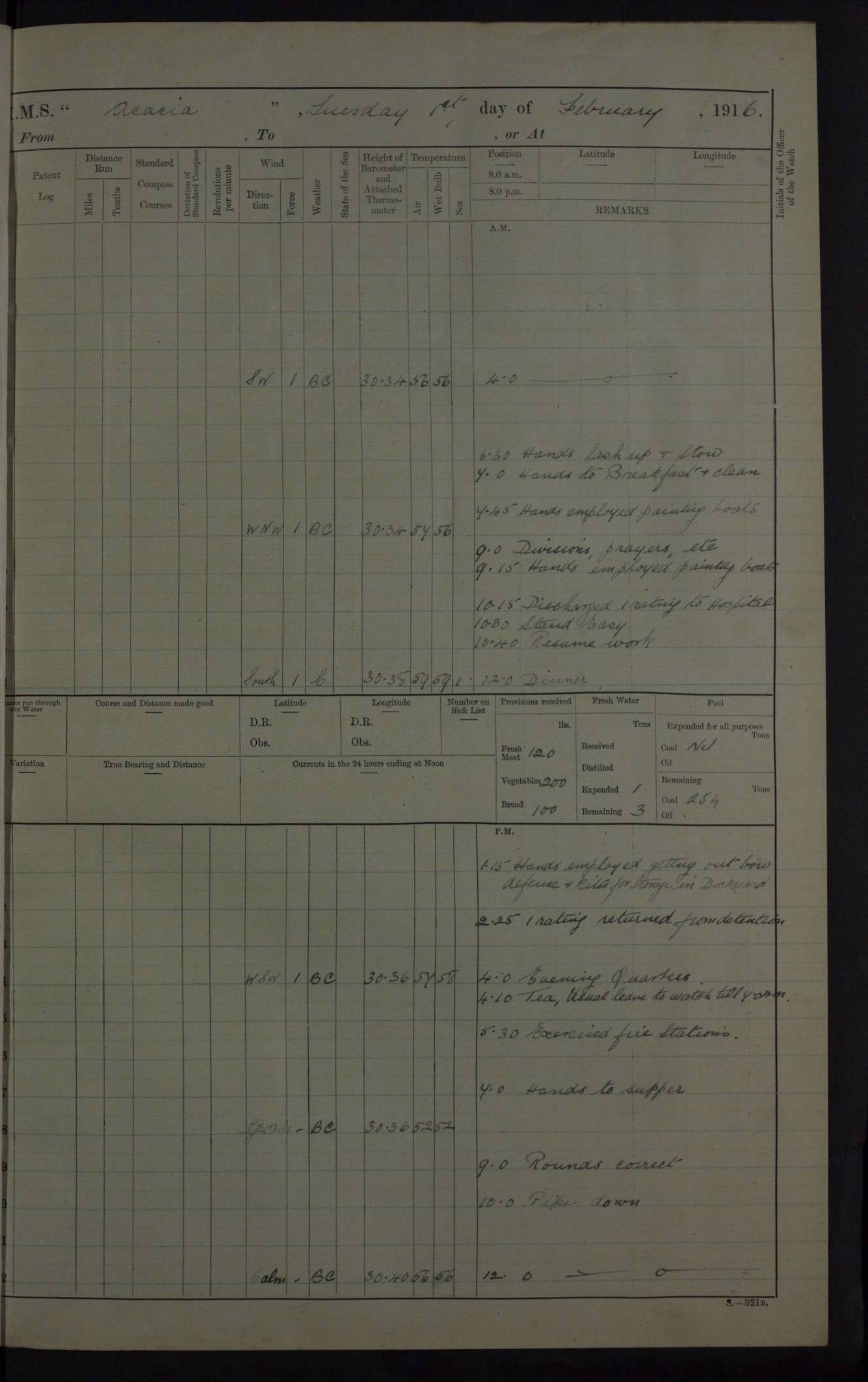
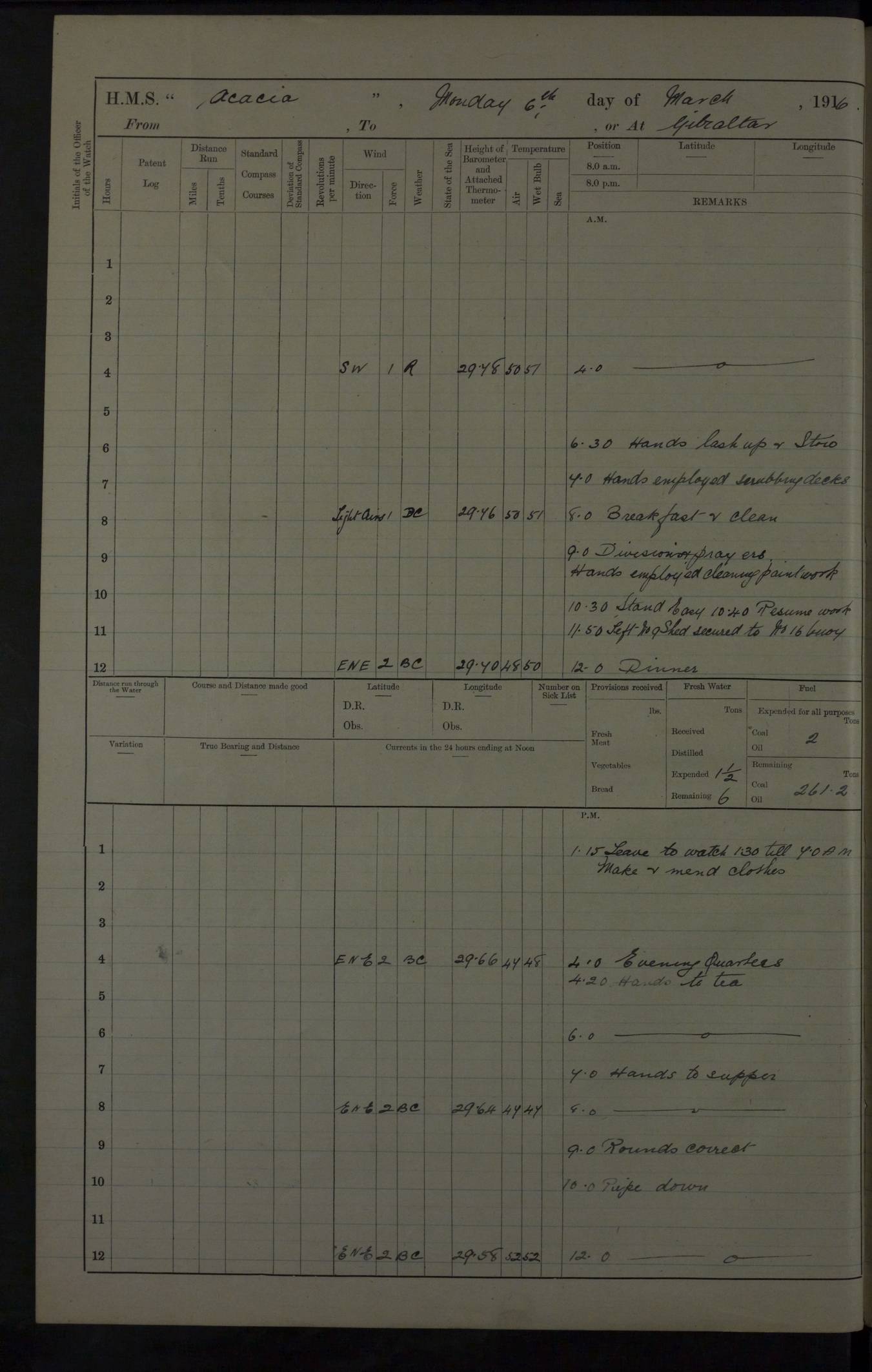
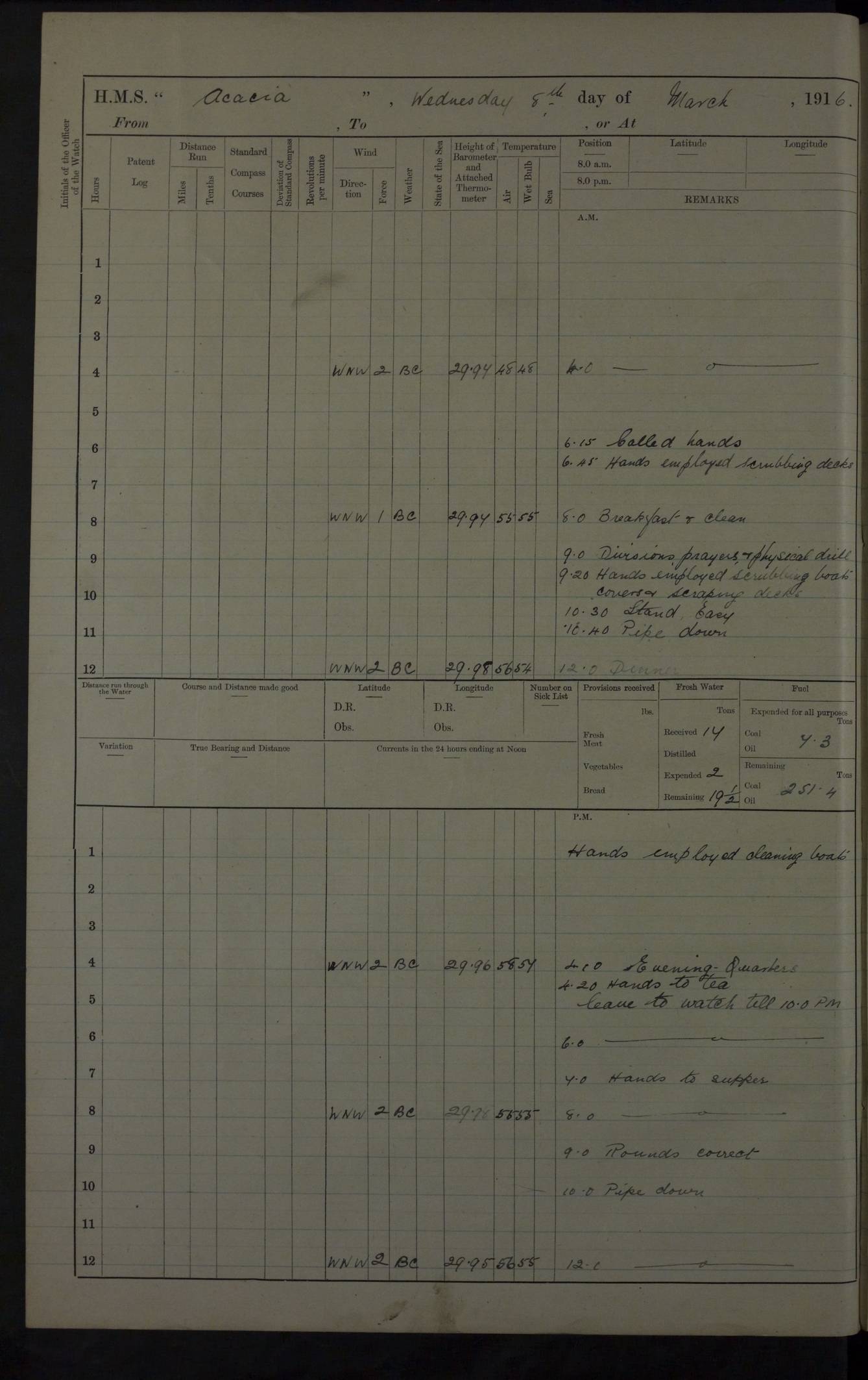
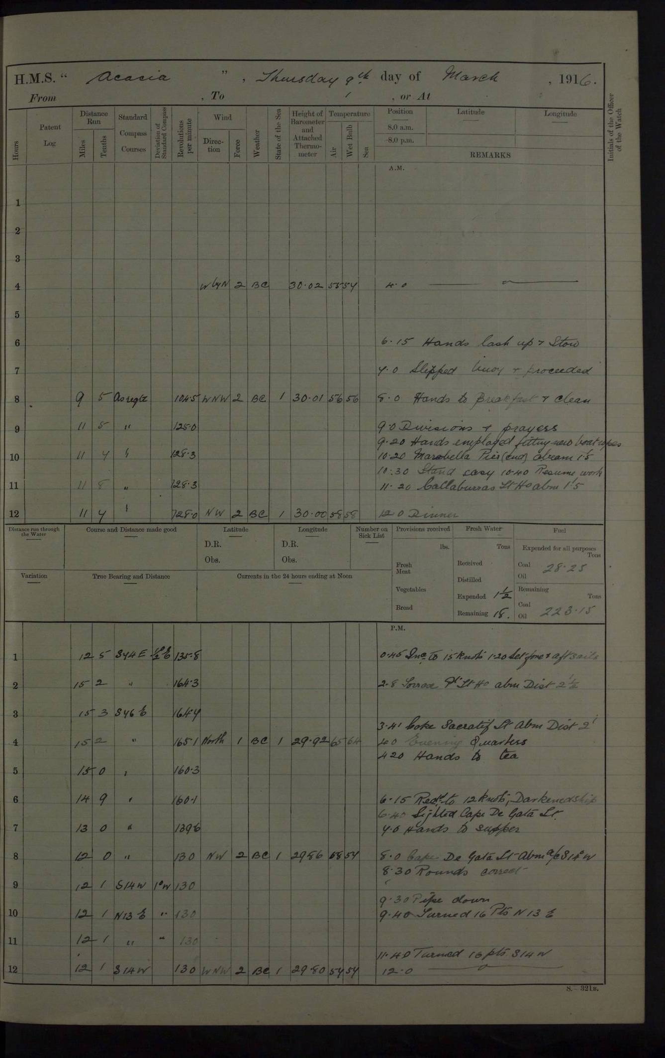
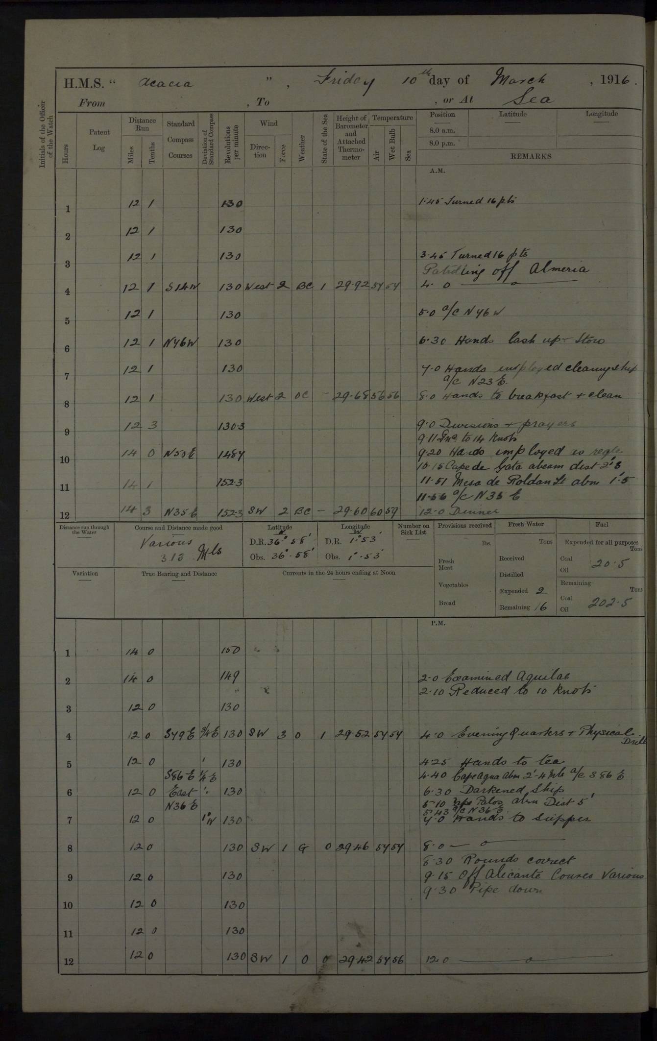
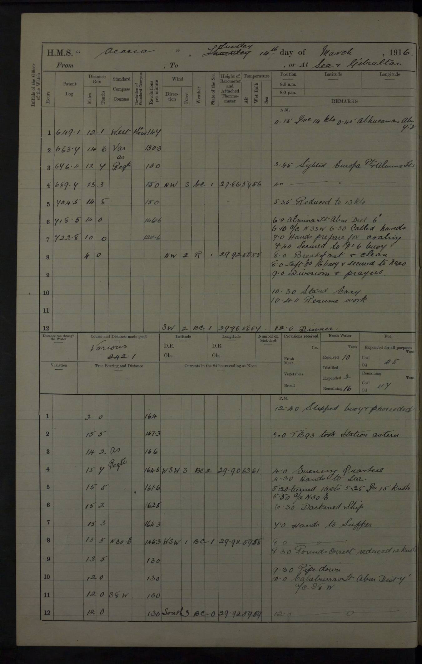
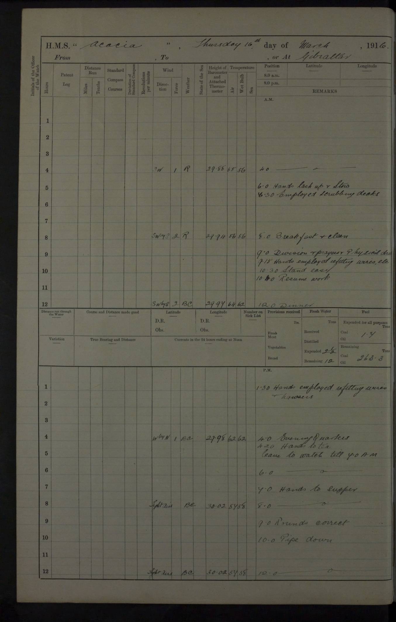
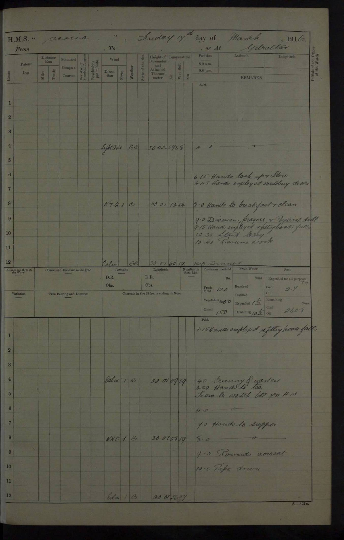
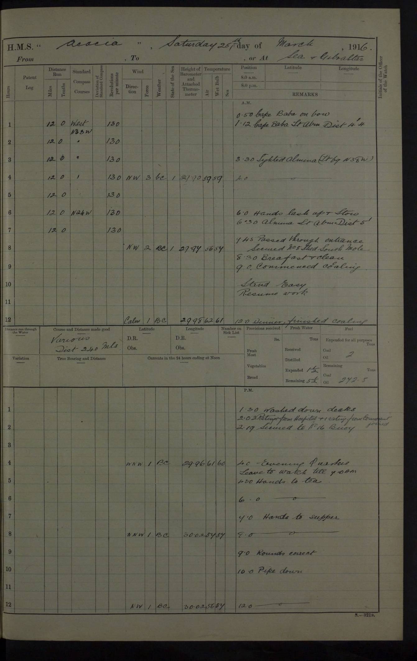
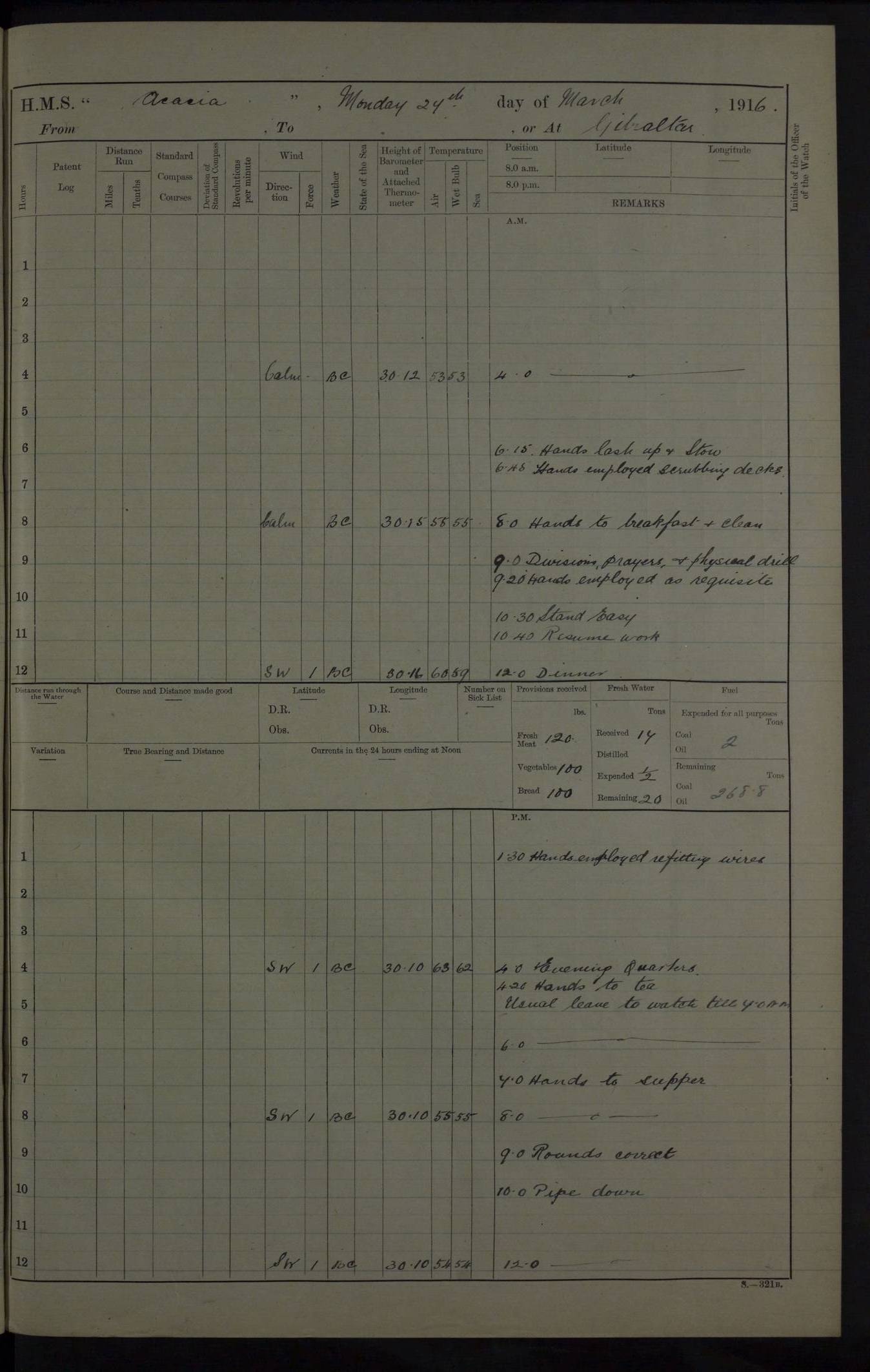
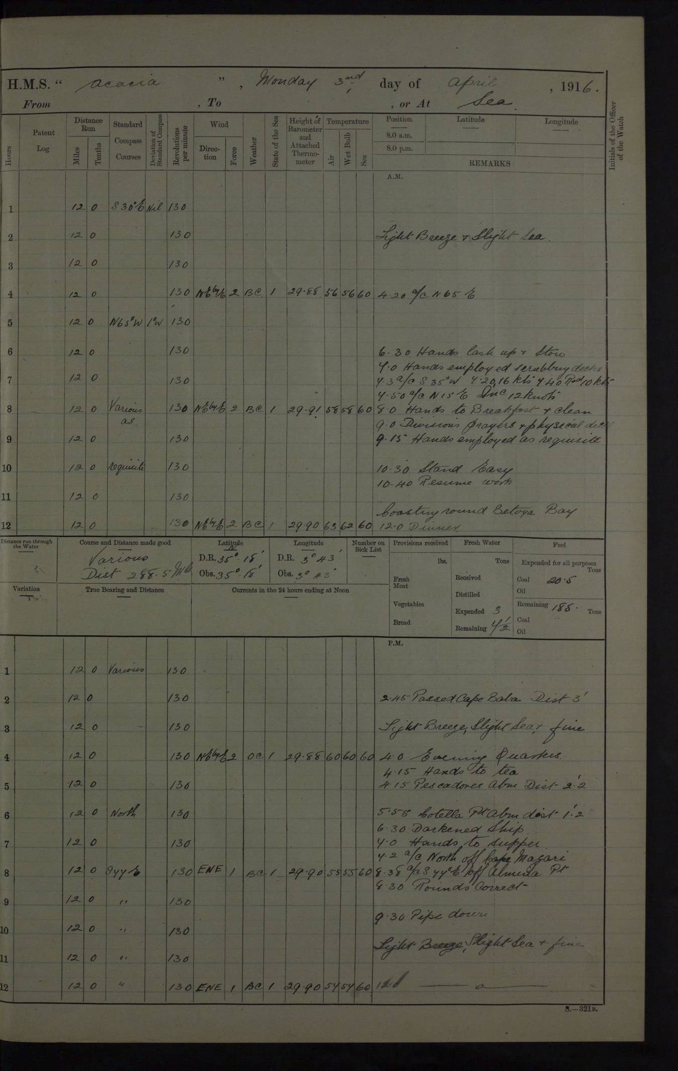
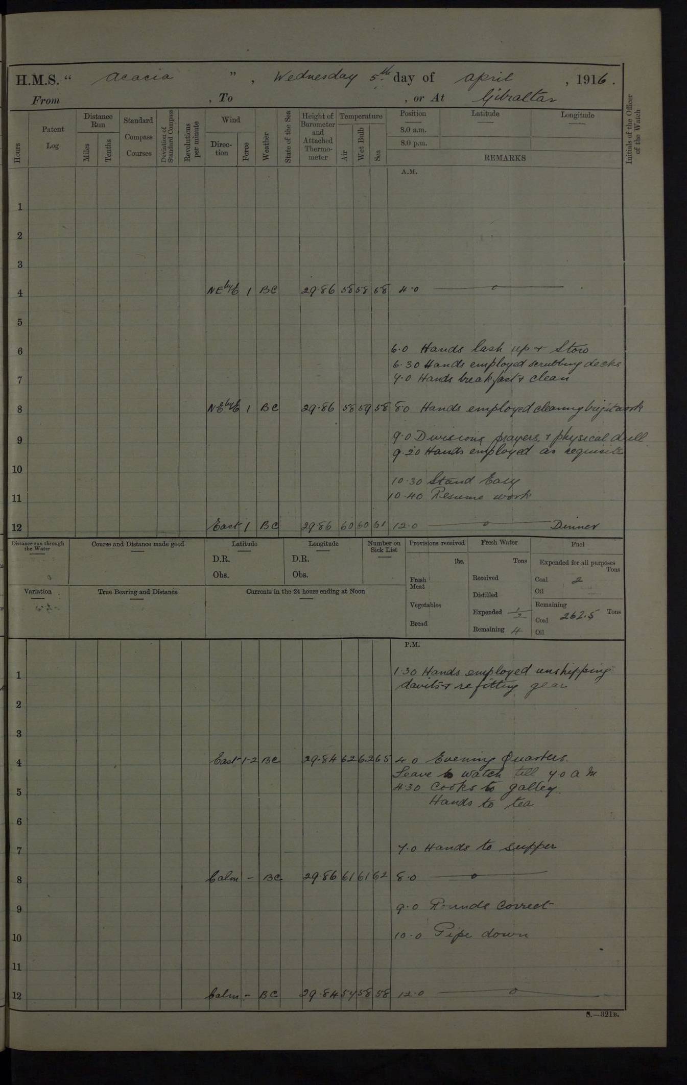
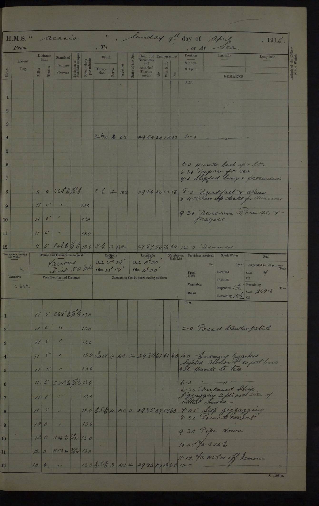
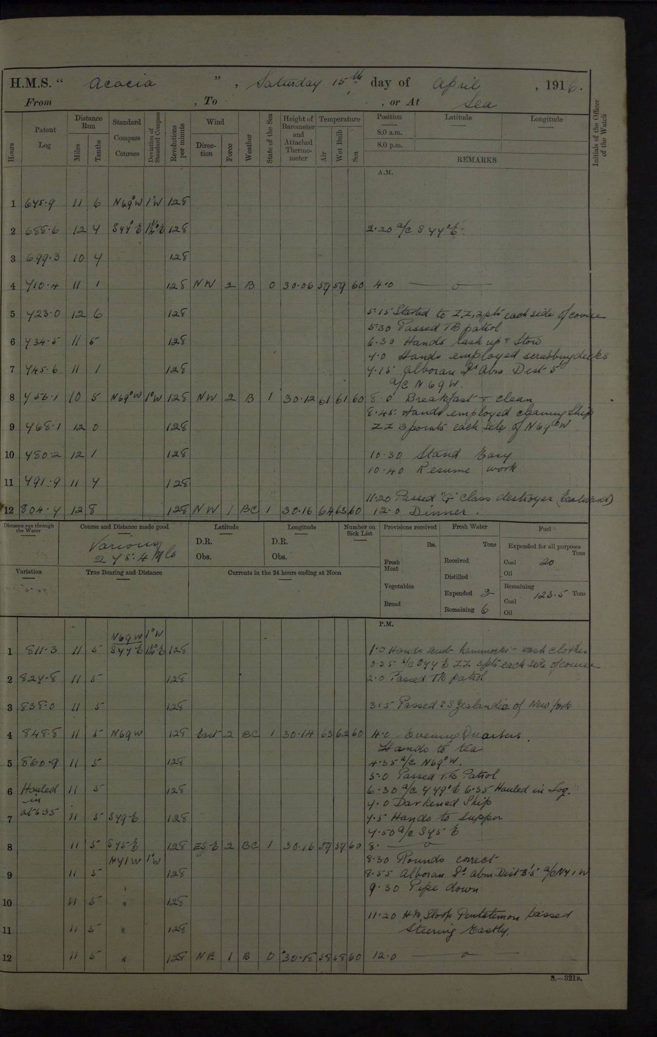
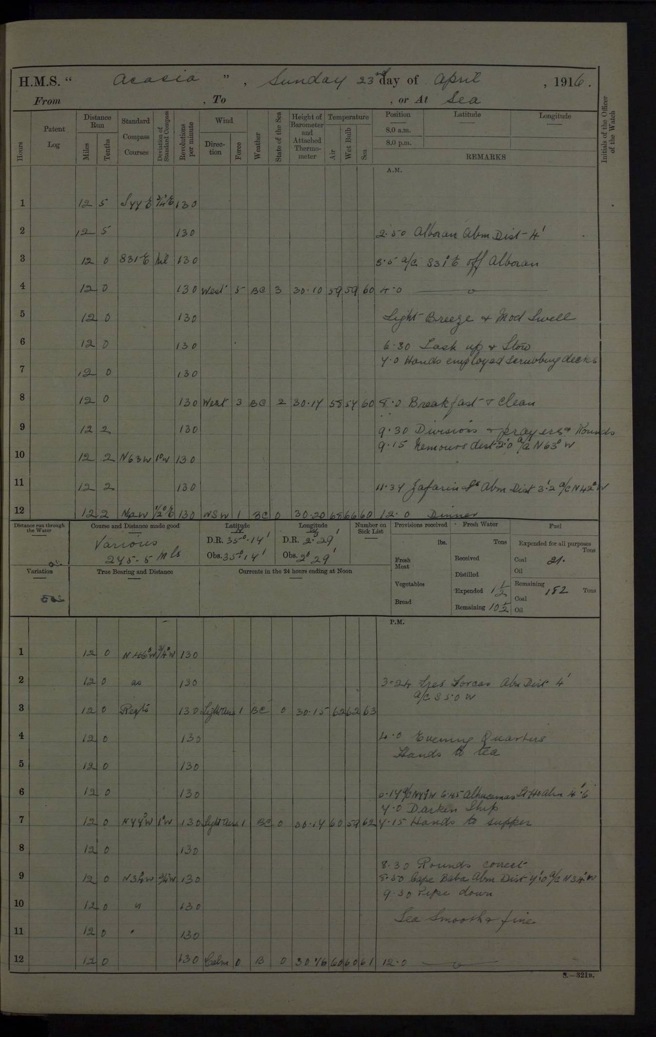
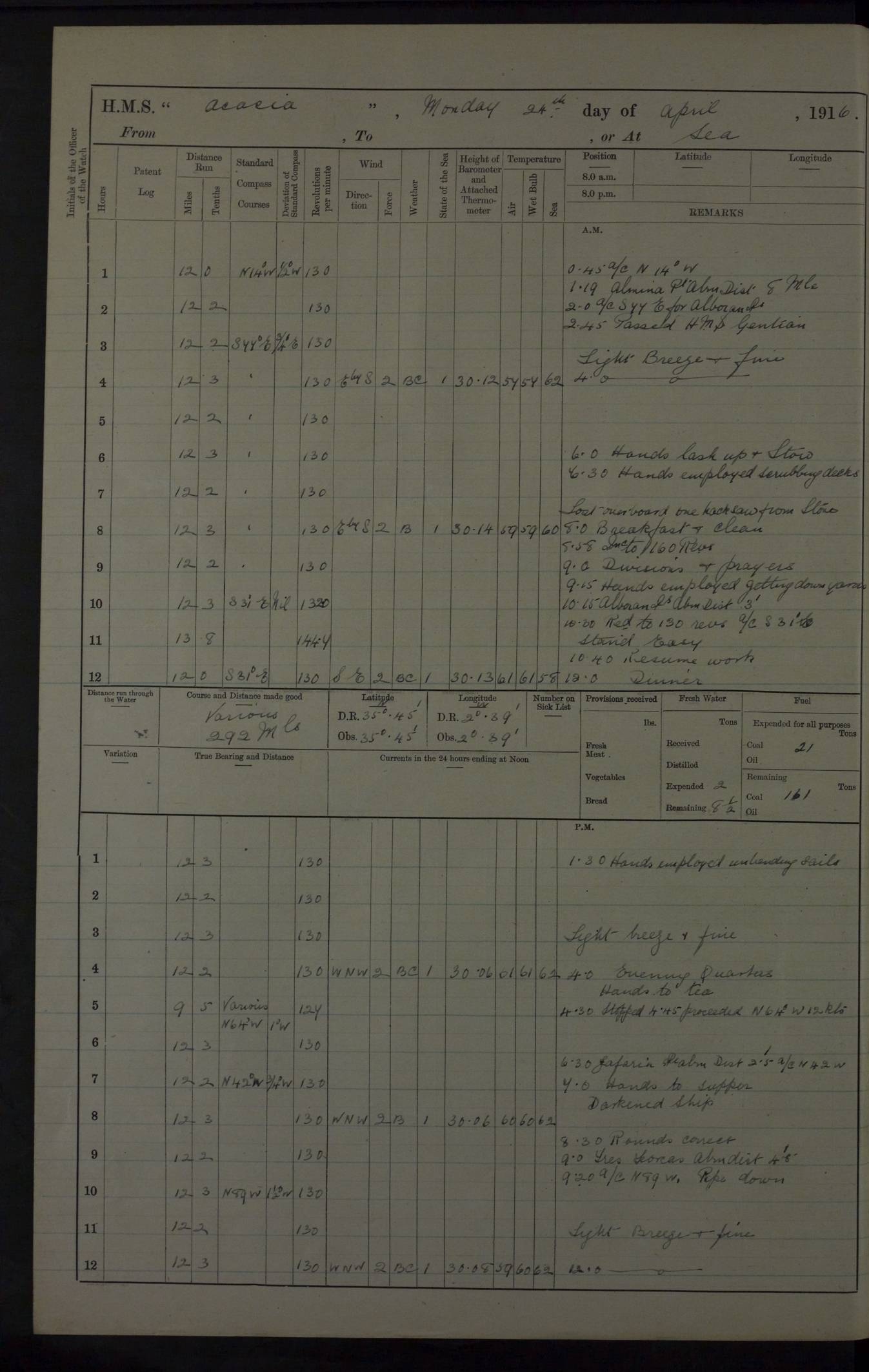
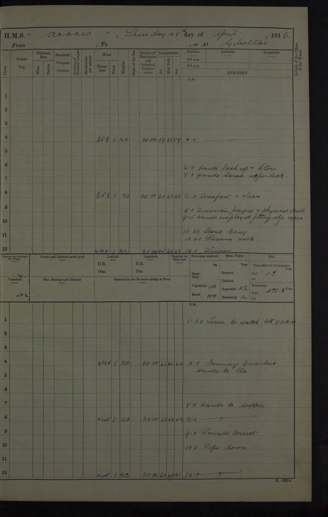
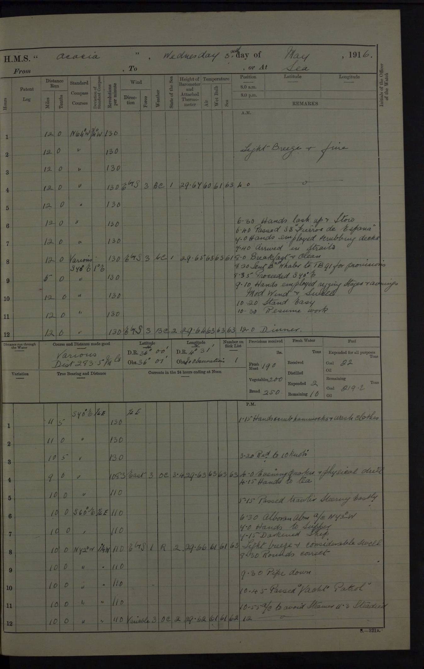
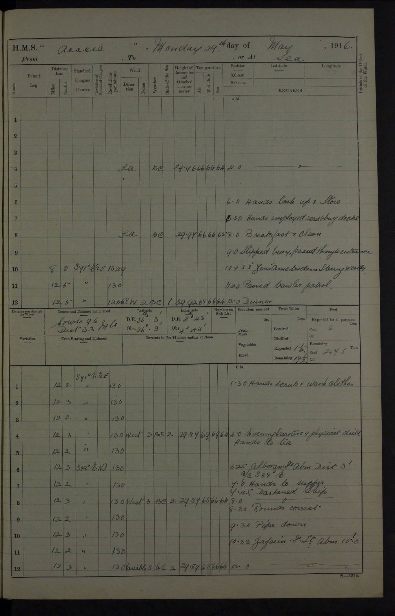
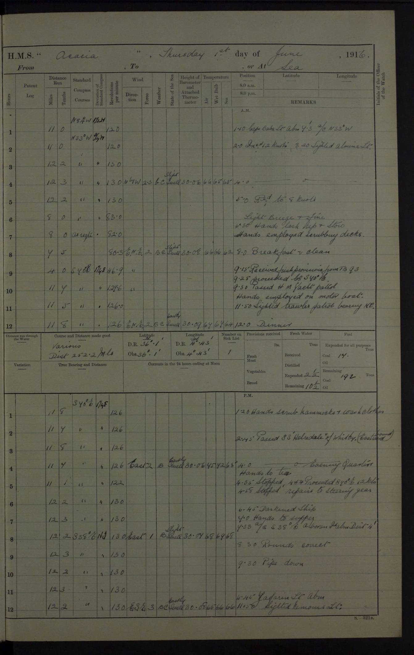
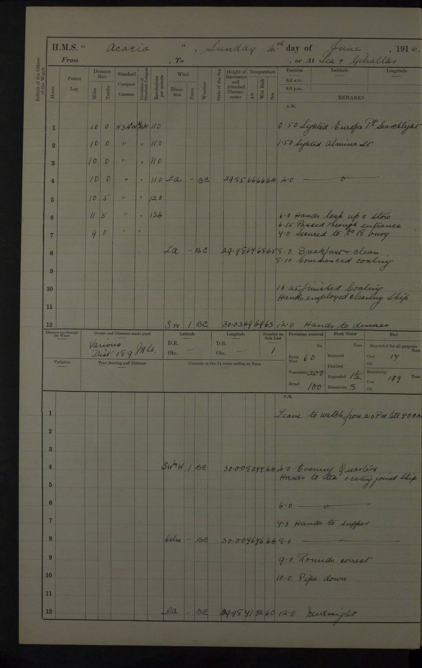
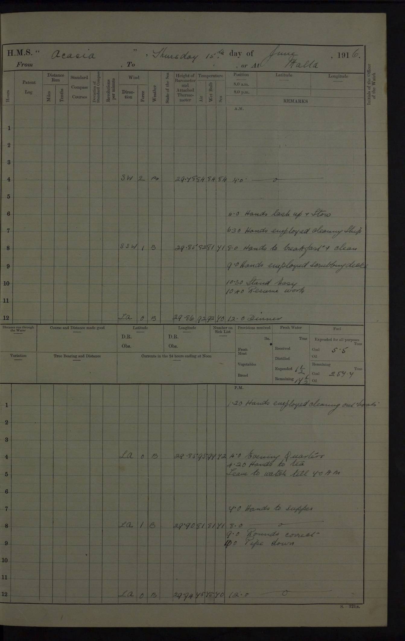
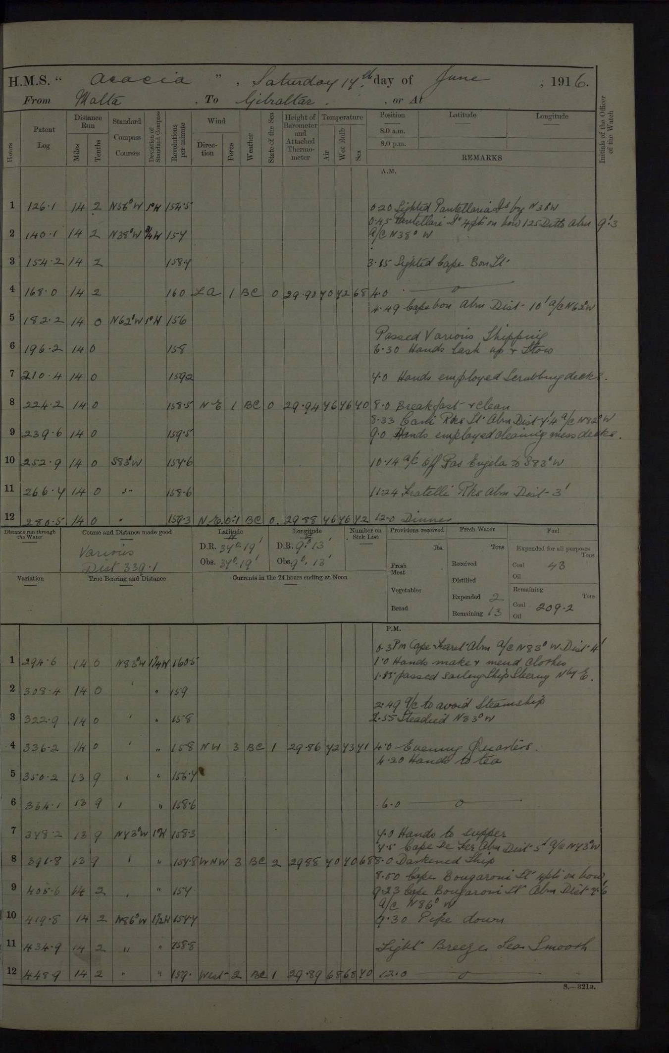
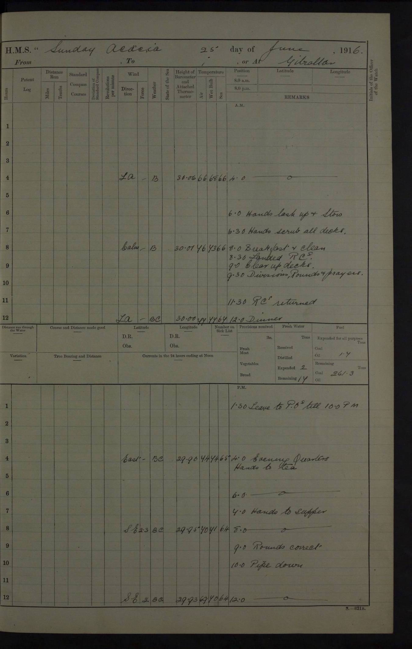
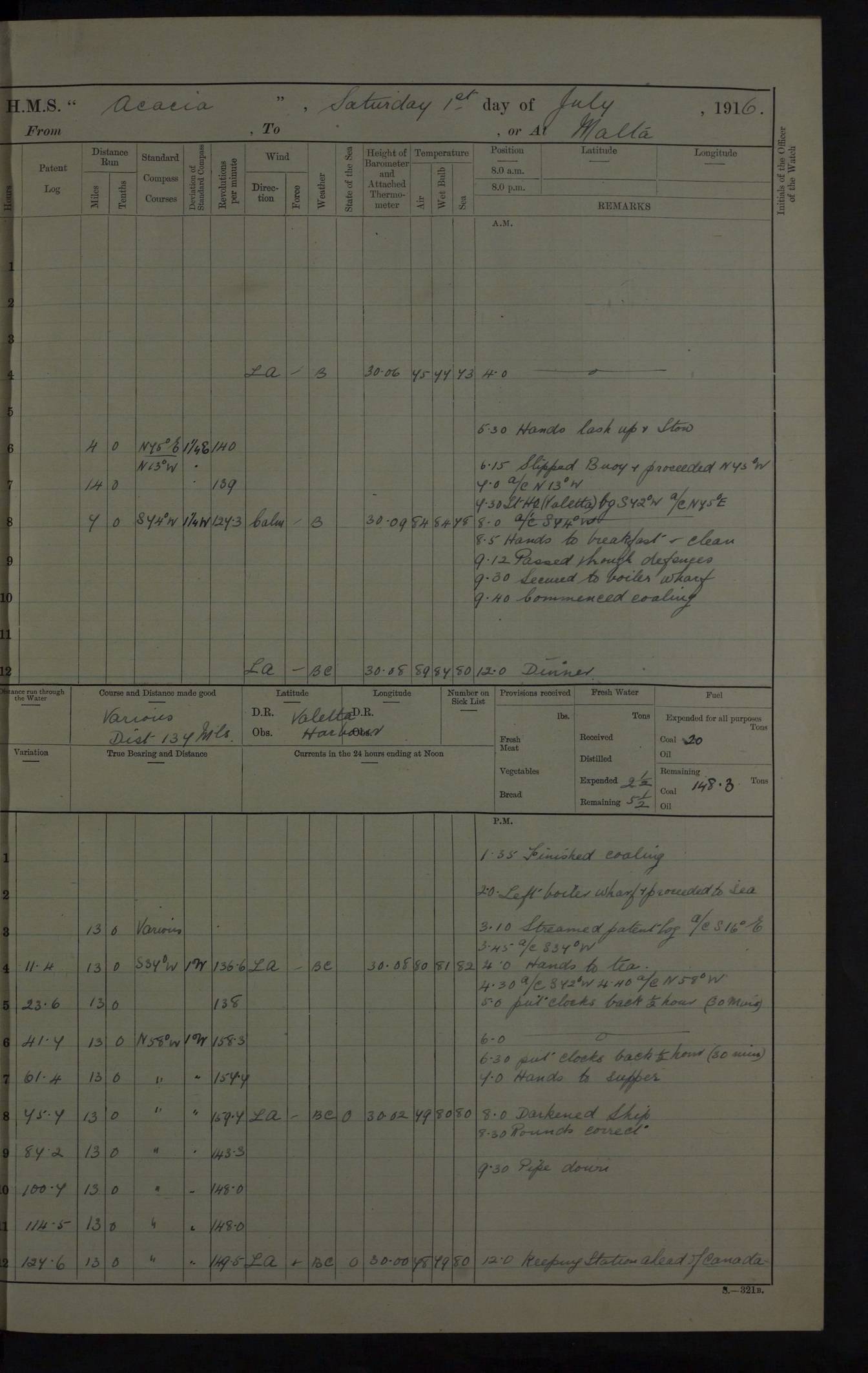
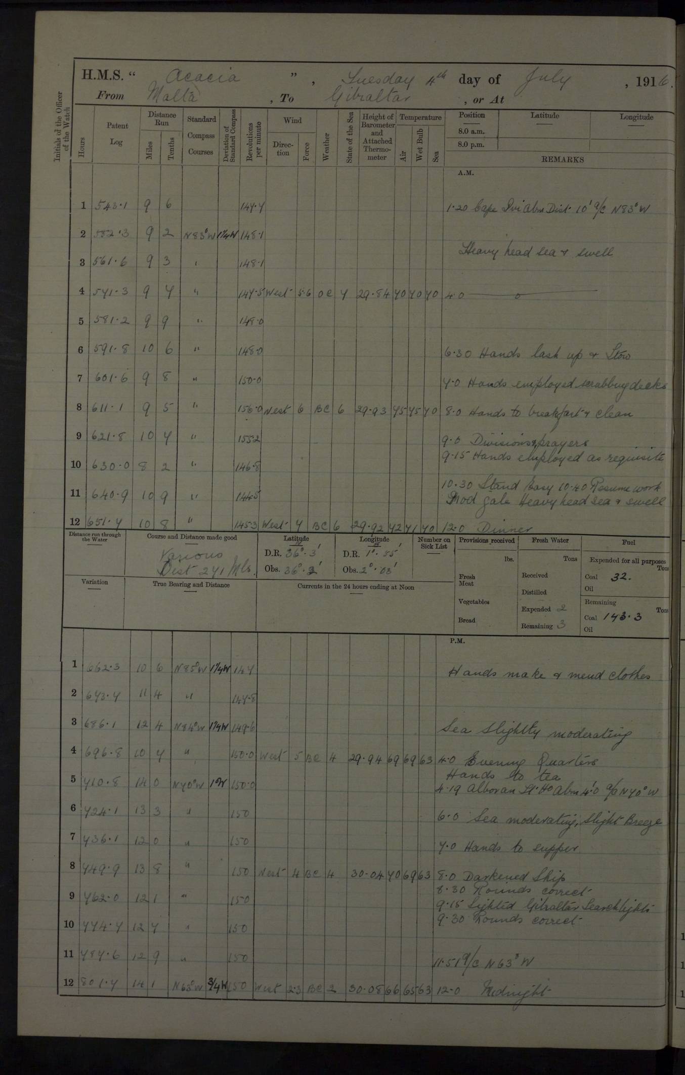
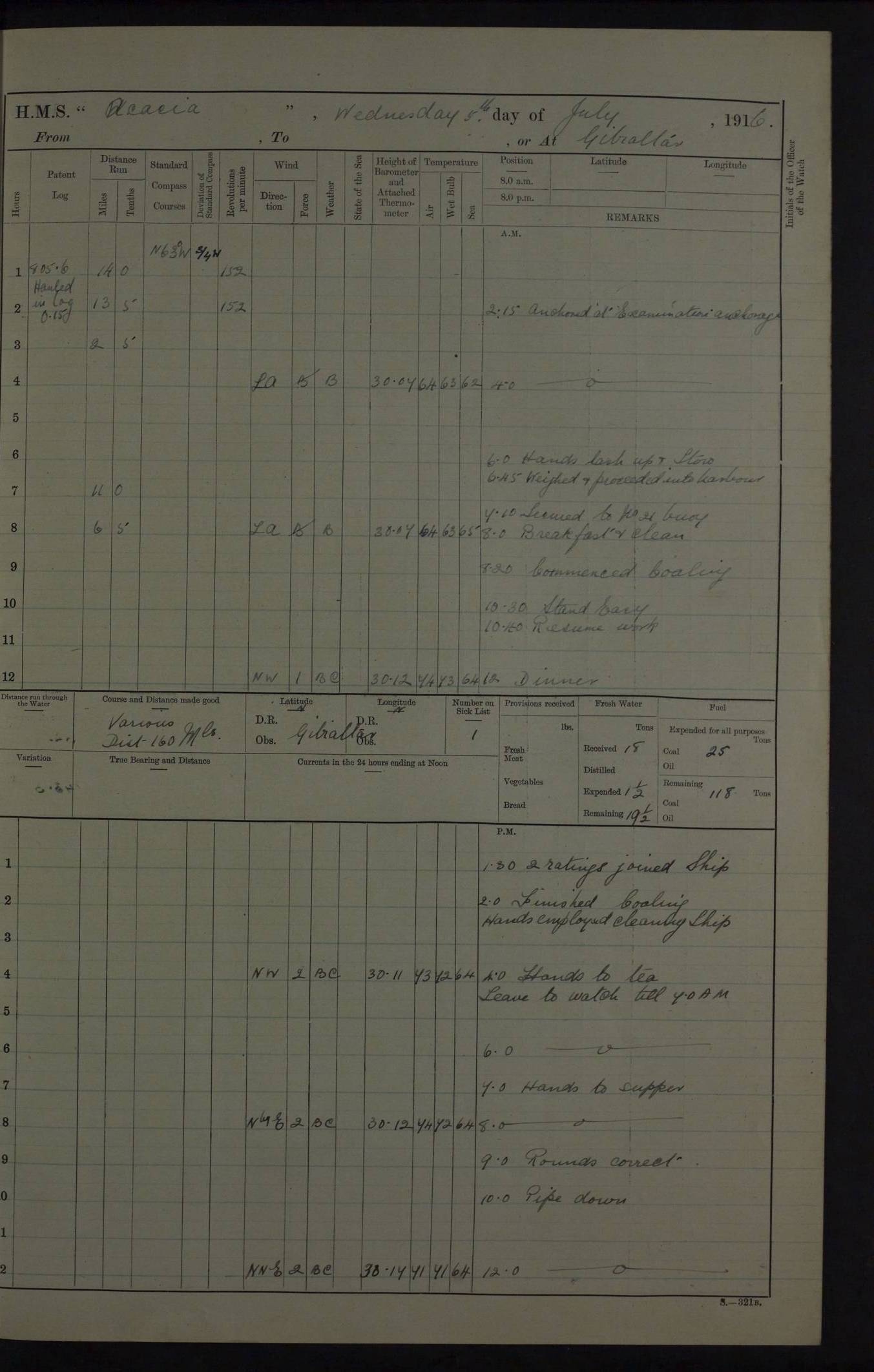
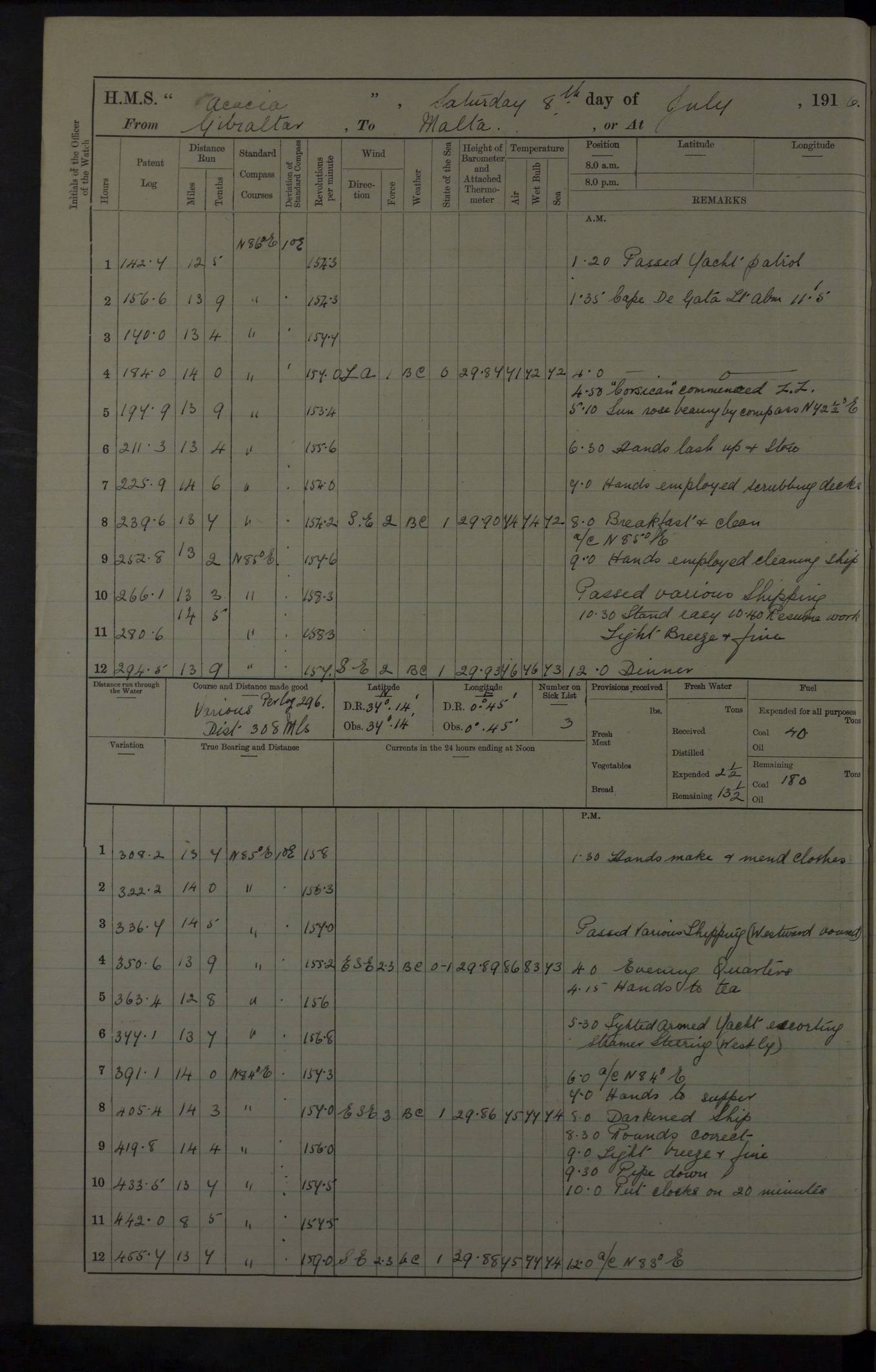
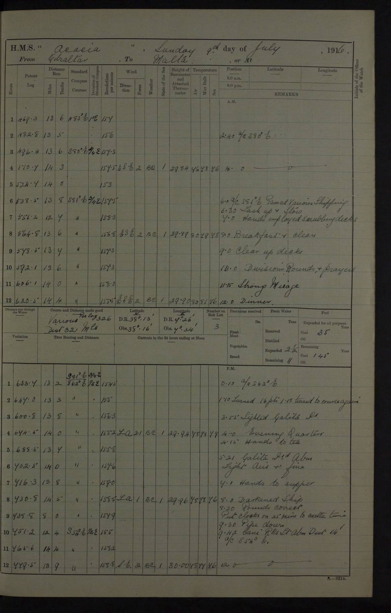
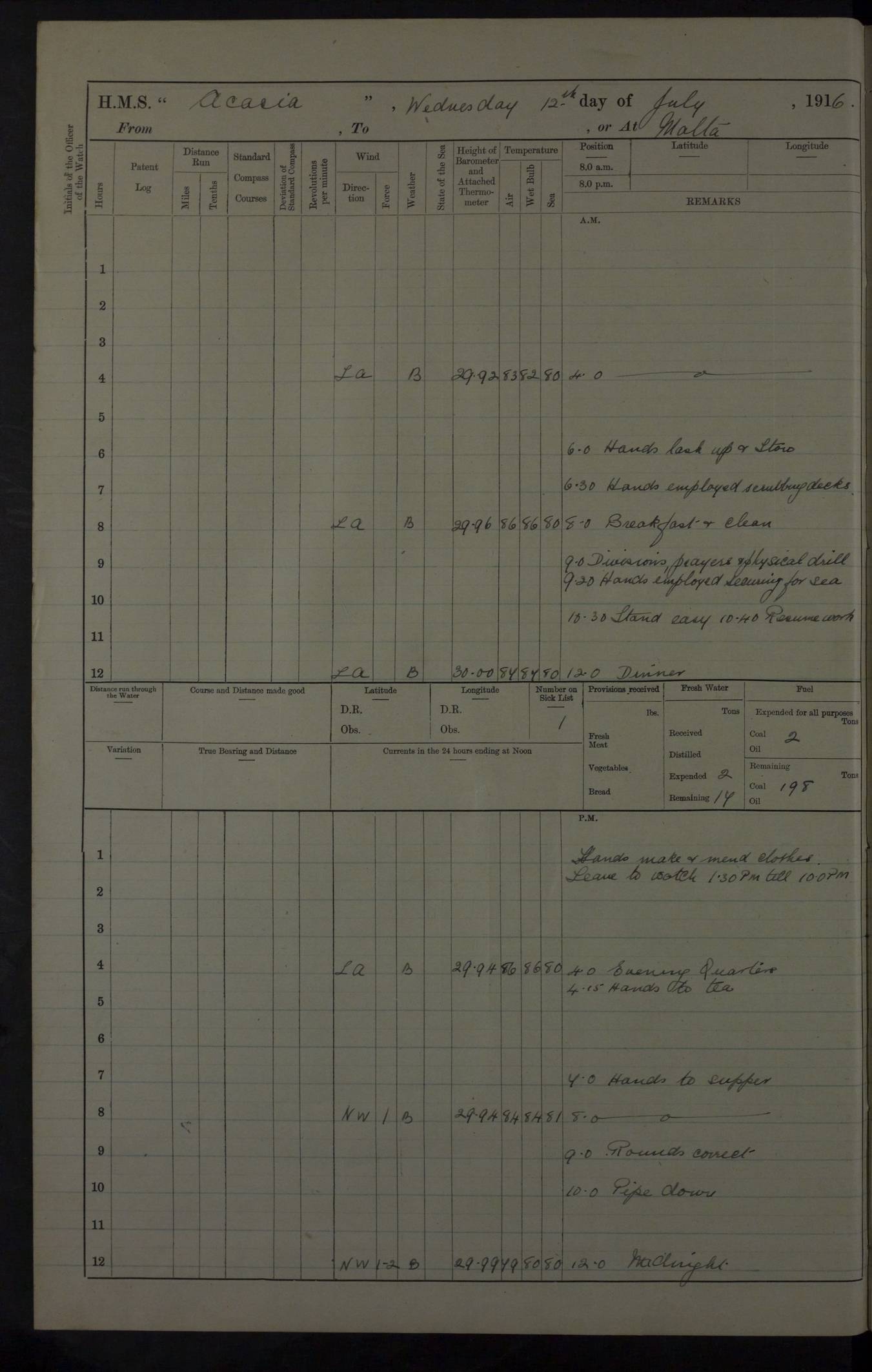
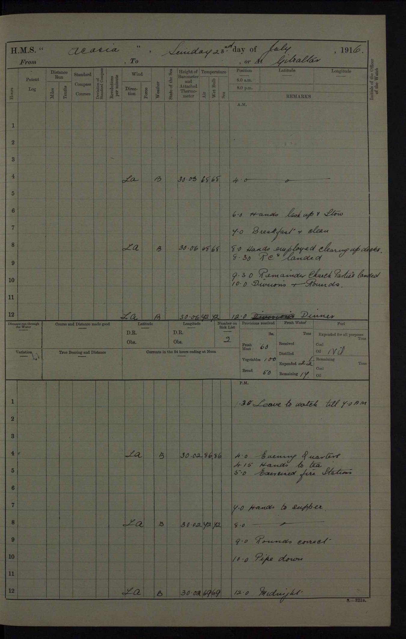
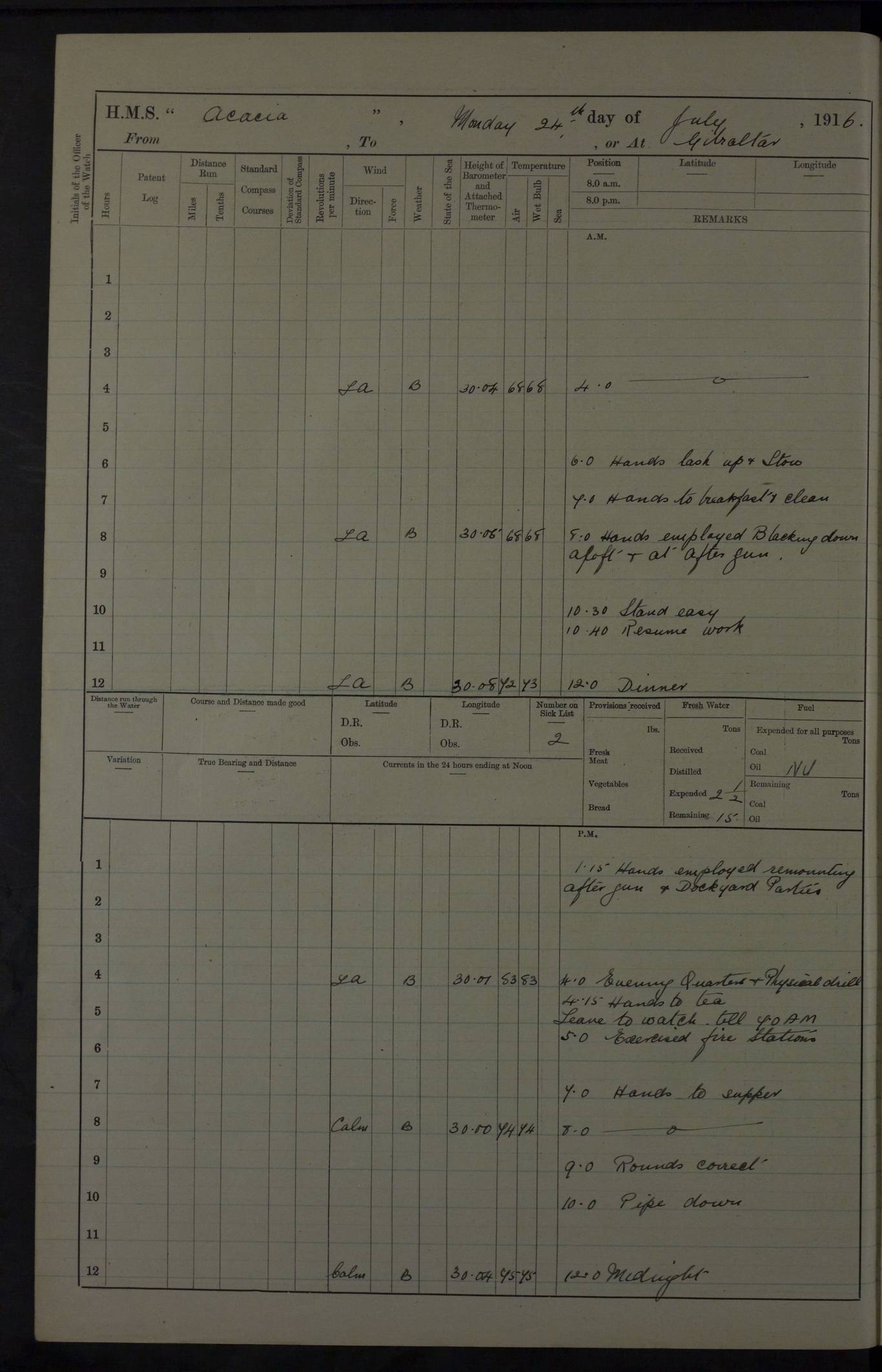
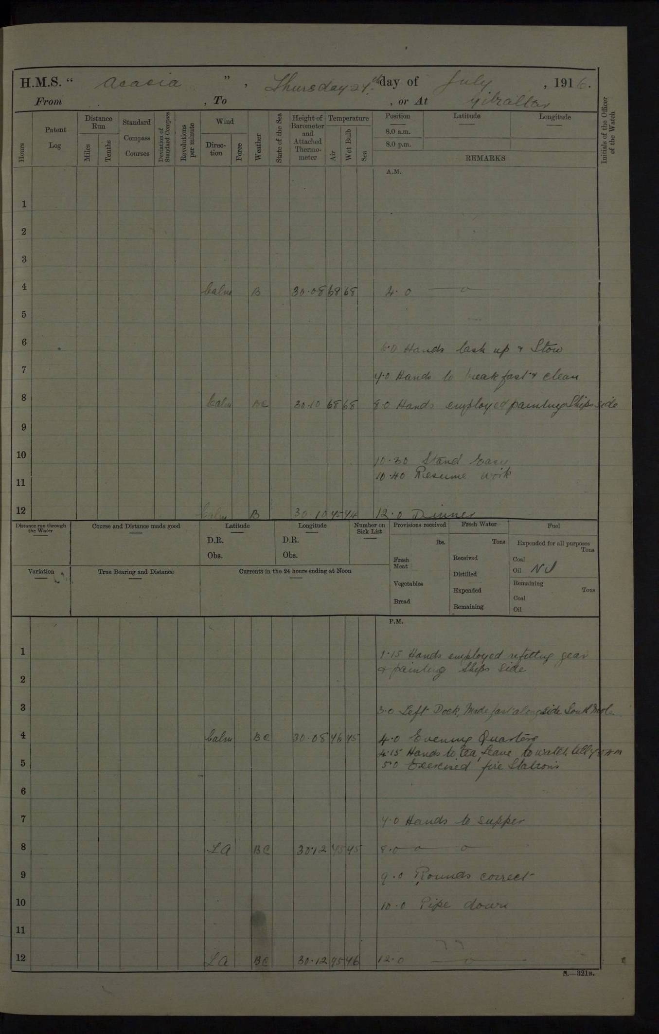
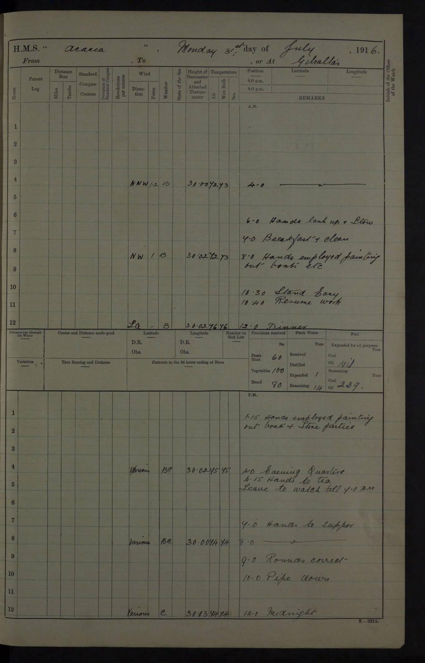